Category:United Kingdom photographs taken on 2008-08-24
Jump to navigation
Jump to search
Countries of Europe: Austria · Belarus · Belgium · Bulgaria · Croatia · Czech Republic · Denmark · Estonia · Finland · France‡ · Georgia‡ · Germany · Greece · Hungary · Republic of Ireland · Italy · Latvia · Liechtenstein · Malta · Montenegro · Netherlands‡ · North Macedonia · Norway · Poland · Portugal‡ · Romania · Russia‡ · Slovakia · Slovenia · Spain‡ · Sweden · Switzerland · Turkey‡ · Ukraine · United Kingdom
‡: partly located in Europe
‡: partly located in Europe
| ← | 24 August 2008 | → | ||
| ← | August 2008 | → | ||

United Kingdom photographs taken on 24 August 2008.
Image files should be categorized here automatically using {{taken on}} template. Direct categorisation is also possible, if automatic is impossible.
Subcategories
This category has the following 3 subcategories, out of 3 total.
Media in category "United Kingdom photographs taken on 2008-08-24"
The following 200 files are in this category, out of 1,258 total.
(previous page) (next page)-
 "ParcLife" at Niddrie Mains - geograph.org.uk - 959625.jpg 640 × 480; 80 KB
-
 'Tank traps' on Dumbarnie Links - geograph.org.uk - 945577.jpg 640 × 480; 57 KB
-
 A fine pony - geograph.org.uk - 935115.jpg 640 × 480; 169 KB
-
 A lonely traffic cone - geograph.org.uk - 935137.jpg 480 × 640; 157 KB
-
 A Pair of John Deere's - geograph.org.uk - 946415.jpg 640 × 480; 112 KB
-
 A parting of the ways - geograph.org.uk - 953024.jpg 640 × 427; 78 KB
-
 A Road and a Petrol Station - geograph.org.uk - 944267.jpg 639 × 426; 130 KB
-
 A rock with sea life on it - panoramio.jpg 2,402 × 3,208; 3.39 MB
-
 A shaded ride - geograph.org.uk - 935088.jpg 480 × 640; 190 KB
-

-

-
 A well built Dry stone wall - geograph.org.uk - 934487.jpg 640 × 480; 154 KB
-
 A40 heading to Halfway - geograph.org.uk - 937789.jpg 640 × 480; 94 KB
-
 A40 nearing Verde Villa - geograph.org.uk - 937866.jpg 640 × 480; 82 KB
-
 A489 Railway Bridge - geograph.org.uk - 935905.jpg 640 × 427; 69 KB
-
 A69 at Thornbrough - geograph.org.uk - 935614.jpg 640 × 480; 91 KB
-
 Aberdour Harbour - geograph.org.uk - 935720.jpg 640 × 480; 185 KB
-
-

-
 Able Seaman Morgan - geograph.org.uk - 940907.jpg 480 × 640; 82 KB
-
 Across a paddock at Harts Farm - geograph.org.uk - 936630.jpg 640 × 480; 146 KB
-
 Afon Dwyfach - geograph.org.uk - 1010841.jpg 640 × 478; 135 KB
-
 Afon Sawddle - geograph.org.uk - 939067.jpg 640 × 480; 95 KB
-
 Afon Sawddle - geograph.org.uk - 939195.jpg 640 × 480; 103 KB
-
 All Saints Church, Woodchurch - geograph.org.uk - 935724.jpg 640 × 480; 60 KB
-
 Allt Neuadd-fach - geograph.org.uk - 937895.jpg 640 × 480; 108 KB
-
 Allt-wen - geograph.org.uk - 935113.jpg 640 × 480; 166 KB
-
 Almshouse date stone - geograph.org.uk - 937621.jpg 480 × 640; 64 KB
-
 Along the roadline - geograph.org.uk - 955689.jpg 640 × 426; 63 KB
-
-

-
 Alvecote Marina - geograph.org.uk - 935285.jpg 480 × 640; 78 KB
-
 An ancient oak - geograph.org.uk - 935173.jpg 480 × 640; 167 KB
-
 Ancient Ash Tree - geograph.org.uk - 946392.jpg 640 × 440; 82 KB
-
 Anick village - geograph.org.uk - 935587.jpg 640 × 480; 94 KB
-
 Apples at The Vyne - geograph.org.uk - 943885.jpg 428 × 640; 81 KB
-
 Appletree Eyot - geograph.org.uk - 951375.jpg 640 × 480; 82 KB
-
 Approaching Boveney Lock - geograph.org.uk - 948452.jpg 640 × 427; 142 KB
-
 Approaching Tarbet from the north - geograph.org.uk - 937942.jpg 640 × 480; 115 KB
-
 Approaching the church at Pauntley - geograph.org.uk - 938464.jpg 640 × 439; 152 KB
-
-
-
 Arch at entrance to walled kitchen garden - geograph.org.uk - 935467.jpg 480 × 640; 207 KB
-
 Archway Sutton Harbour. - geograph.org.uk - 935976.jpg 640 × 428; 89 KB
-
 Ardsley Reservoir - geograph.org.uk - 939439.jpg 412 × 640; 169 KB
-
 Artichoke (Cynara scolymus) - detail - geograph.org.uk - 935427.jpg 480 × 640; 192 KB
-
 Artichoke (Cynara scolymus) - flower - geograph.org.uk - 935424.jpg 480 × 640; 164 KB
-
 Ascending The Edge to Ullock Pike - geograph.org.uk - 958071.jpg 640 × 426; 78 KB
-
 Ash tree near the Long Drag - geograph.org.uk - 937850.jpg 480 × 640; 112 KB
-
 Atlantic seals on The Carracks - geograph.org.uk - 964394.jpg 640 × 482; 80 KB
-
 Avast ye swabs - geograph.org.uk - 935121.jpg 485 × 640; 44 KB
-
 Ayr Harbour Entrance - geograph.org.uk - 935305.jpg 640 × 480; 62 KB
-
 Babel Village Hall - geograph.org.uk - 946402.jpg 640 × 480; 100 KB
-
 Back towards Breach house - geograph.org.uk - 955704.jpg 640 × 426; 51 KB
-
 Bakestall and Dead Crags - geograph.org.uk - 945449.jpg 640 × 426; 84 KB
-
 Bank and Sports bar - geograph.org.uk - 934524.jpg 640 × 427; 92 KB
-
 Bank holiday weekend at Cwm-yr-Eglwys - geograph.org.uk - 935841.jpg 640 × 480; 70 KB
-
 Barbed wire (plain wood).jpg 800 × 600; 84 KB
-
 Barges at Old Windsor - geograph.org.uk - 948621.jpg 640 × 427; 180 KB
-
 Barns at Throope Manor - geograph.org.uk - 940309.jpg 640 × 480; 127 KB
-
 Baron's Cleuch - geograph.org.uk - 946495.jpg 640 × 359; 64 KB
-
 Humber Estuary and Chowder Ness - geograph.org.uk - 945561.jpg 640 × 393; 45 KB
-

-
 Bassenthwaite Lakeside Lodges - geograph.org.uk - 943090.jpg 640 × 426; 121 KB
-
 Bat Tower at Mere Sands - geograph.org.uk - 935147.jpg 640 × 425; 175 KB
-
 Bavelaw Burn - geograph.org.uk - 945961.jpg 640 × 359; 87 KB
-
 Bavelaw Burn - geograph.org.uk - 946462.jpg 640 × 359; 89 KB
-
 Beach and houses at Lower Largo - geograph.org.uk - 945569.jpg 640 × 480; 65 KB
-

-
 Beinn Ghlas - geograph.org.uk - 936413.jpg 640 × 480; 109 KB
-

-
 Bell Weir Lock - geograph.org.uk - 948702.jpg 640 × 422; 194 KB
-
 Bell Weir Lock - geograph.org.uk - 948706.jpg 640 × 427; 184 KB
-

-
 Belmont Avenue. - geograph.org.uk - 935761.jpg 640 × 480; 97 KB
-

-

-

-
 Ben Lawers Nature Trail - geograph.org.uk - 936150.jpg 640 × 480; 121 KB
-
 Ben Lawers Nature Trail - geograph.org.uk - 936490.jpg 640 × 480; 129 KB
-
 Ben Lawers summit - geograph.org.uk - 936384.jpg 640 × 480; 96 KB
-
 Ben Lawers Visitor Centre - geograph.org.uk - 936129.jpg 640 × 480; 111 KB
-
 Bend in the Bridleway - geograph.org.uk - 954457.jpg 640 × 426; 120 KB
-
 Bend in the path - geograph.org.uk - 954376.jpg 640 × 426; 111 KB
-
 Bend on Stoke Ferry Lane - geograph.org.uk - 936789.jpg 640 × 480; 81 KB
-
 Beside Babbacombe Road, Wellswood - geograph.org.uk - 938990.jpg 640 × 485; 145 KB
-
 Between the summits, East Cairn Hill - geograph.org.uk - 946784.jpg 640 × 359; 63 KB
-
 Birch Spring view - geograph.org.uk - 1005207.jpg 640 × 427; 77 KB
-
 Birdsmoorgate, cow and calf - geograph.org.uk - 935808.jpg 640 × 480; 118 KB
-
 Birdsmoorgate, postbox № DT6 68 - geograph.org.uk - 935807.jpg 640 × 480; 96 KB
-
 Birkett Edge, Bakestall - geograph.org.uk - 945438.jpg 426 × 640; 77 KB
-
 Blackdown, postbox № DT8 104 - geograph.org.uk - 935811.jpg 640 × 480; 126 KB
-
 Blackney, postbox № DT8 20 - geograph.org.uk - 935797.jpg 480 × 640; 85 KB
-
 Blackney, Venn Farm - geograph.org.uk - 935802.jpg 640 × 470; 102 KB
-
 Bliss Gate Inn, Heightington Road - geograph.org.uk - 935468.jpg 640 × 409; 66 KB
-

-
 Blockhouse on the coast - geograph.org.uk - 945572.jpg 640 × 480; 65 KB
-
 Blyth Bridge View - geograph.org.uk - 937371.jpg 640 × 393; 67 KB
-
 BMW Group Academy UK - geograph.org.uk - 940330.jpg 640 × 428; 88 KB
-
 Boat at Runnymede - geograph.org.uk - 948625.jpg 640 × 427; 182 KB
-
 Boat Trips, Loch Ness - geograph.org.uk - 944110.jpg 640 × 480; 92 KB
-
 Boats and planes - geograph.org.uk - 948628.jpg 427 × 640; 174 KB
-
 Boats at Morston Greens - geograph.org.uk - 952657.jpg 640 × 480; 94 KB
-
 Boatyard at Wells - geograph.org.uk - 950201.jpg 640 × 480; 107 KB
-
 Bore Stane - geograph.org.uk - 946751.jpg 640 × 480; 99 KB
-
 Bore Stane track - geograph.org.uk - 935398.jpg 640 × 480; 77 KB
-
 Bore Stane track - geograph.org.uk - 935426.jpg 640 × 359; 80 KB
-
 Bore Stane track - geograph.org.uk - 946479.jpg 640 × 359; 94 KB
-
 Bore Stane track - geograph.org.uk - 946488.jpg 640 × 359; 66 KB
-
 Bowness Farm and Bassenthwaite Lake - geograph.org.uk - 945568.jpg 426 × 640; 64 KB
-
 Box pews - geograph.org.uk - 936298.jpg 480 × 640; 58 KB
-
 Box pews - geograph.org.uk - 936303.jpg 640 × 480; 65 KB
-
 BP North Sea Headquarters - geograph.org.uk - 937691.jpg 640 × 426; 65 KB
-
 BP North Sea offices - geograph.org.uk - 937699.jpg 640 × 426; 56 KB
-
 Bracknell mill pond - geograph.org.uk - 938058.jpg 426 × 640; 117 KB
-
 Bray Lock - geograph.org.uk - 948411.jpg 640 × 427; 204 KB
-
 Breach house in the distance - geograph.org.uk - 954434.jpg 640 × 426; 56 KB
-
 Breaking storm over Felindre Farchog - geograph.org.uk - 935974.jpg 640 × 366; 29 KB
-
 Bridge near Magdalen.jpg 2,092 × 1,340; 1.61 MB
-

-
 Bridge Over Quy Water - geograph.org.uk - 935163.jpg 640 × 480; 130 KB
-
 Bridge, Afon Derfyn - geograph.org.uk - 936774.jpg 640 × 480; 98 KB
-
 Bridging the gap^ - geograph.org.uk - 946381.jpg 480 × 640; 112 KB
-
 Bridleway by Breach house. - geograph.org.uk - 954443.jpg 640 × 426; 116 KB
-
 Bridleway heading for Cistfaen - geograph.org.uk - 934760.jpg 640 × 480; 158 KB
-
 Broad End - geograph.org.uk - 958093.jpg 640 × 426; 92 KB
-
-

-
 Broad Park Avenue. - geograph.org.uk - 937056.jpg 640 × 480; 77 KB
-
 Brown water, Omagh - geograph.org.uk - 934434.jpg 640 × 480; 66 KB
-
 Bryn Blaen-Wysg - geograph.org.uk - 939175.jpg 640 × 480; 86 KB
-

-
 Buildings Along Littlestone Sea Front - geograph.org.uk - 935722.jpg 640 × 527; 50 KB
-
 Burlough Castle - geograph.org.uk - 936148.jpg 443 × 640; 105 KB
-
 Burn of Edramucky - geograph.org.uk - 936459.jpg 640 × 480; 117 KB
-
 Burn of Edramucky - geograph.org.uk - 936472.jpg 640 × 480; 117 KB
-
 Burn of Erdamucky - geograph.org.uk - 936172.jpg 640 × 480; 148 KB
-
 Burn of Erdamucky - geograph.org.uk - 936182.jpg 640 × 480; 138 KB
-
 Burntridge Moor with heather in bloom - geograph.org.uk - 936880.jpg 640 × 480; 104 KB
-
 Burntridge Moor with heather in bloom - geograph.org.uk - 936956.jpg 640 × 480; 104 KB
-
 Bus Garage - geograph.org.uk - 937209.jpg 640 × 379; 53 KB
-
 Bus Garage - geograph.org.uk - 937212.jpg 640 × 390; 55 KB
-
 Bus Garage - geograph.org.uk - 937213.jpg 640 × 391; 61 KB
-
 Bus Garage - geograph.org.uk - 937232.jpg 640 × 480; 76 KB
-
 Bus Garage - geograph.org.uk - 937237.jpg 640 × 377; 43 KB
-
 Bus in Tower Bridge - panoramio.jpg 2,816 × 2,112; 2.18 MB
-
 Butterfly trowel - geograph.org.uk - 935143.jpg 480 × 640; 158 KB
-
 Buttress, St Mary's - geograph.org.uk - 943095.jpg 427 × 640; 229 KB
-
 Bwlch y Garreg-Wen forest - geograph.org.uk - 936034.jpg 640 × 427; 90 KB
-
 By the Barns - geograph.org.uk - 955759.jpg 640 × 426; 63 KB
-
 Caersws Station - geograph.org.uk - 935920.jpg 640 × 427; 64 KB
-
 Cafartha mine wheelpit - geograph.org.uk - 936073.jpg 640 × 427; 77 KB
-
 Cafartha mine winding shaft - geograph.org.uk - 936086.jpg 640 × 427; 83 KB
-
 Cafés on the Barbican - geograph.org.uk - 934656.jpg 640 × 428; 76 KB
-
 Cairn on Bakestall - geograph.org.uk - 945426.jpg 426 × 640; 69 KB
-
 Cairn on Druim na Cluain-airighe - geograph.org.uk - 940769.jpg 640 × 404; 70 KB
-
 Cairn on the Beinn Ghlas ridge - geograph.org.uk - 936199.jpg 640 × 480; 106 KB
-
 Cannon Hall - geograph.org.uk - 934725.jpg 640 × 480; 66 KB
-
 Car Boot Sale, Dinnington - geograph.org.uk - 945557.jpg 640 × 426; 74 KB
-
 Car park and campsite - geograph.org.uk - 952425.jpg 640 × 480; 107 KB
-
 Car park at Ben Lawers - geograph.org.uk - 936130.jpg 640 × 480; 115 KB
-
 Cardiff Bay, Cardiff.jpg 640 × 480; 92 KB
-
 Cardigan Bay viewed from Allt-wen - geograph.org.uk - 935732.jpg 640 × 480; 113 KB
-

-
 Care home, Kirk Park - geograph.org.uk - 971193.jpg 640 × 480; 68 KB
-
 Carl Side Col - geograph.org.uk - 945417.jpg 640 × 426; 37 KB
-
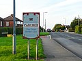 Carlisle welcome sign - geograph.org.uk - 938308.jpg 640 × 479; 288 KB
-
 Carn na h-Aire and river Gruinard - geograph.org.uk - 938101.jpg 426 × 640; 108 KB
-
 Casino and Tamebridge Tower - geograph.org.uk - 934572.jpg 640 × 427; 54 KB
-
 Castle and cannon - geograph.org.uk - 934882.jpg 480 × 640; 69 KB
-
 Castle Cafe, Scalloway - geograph.org.uk - 972830.jpg 640 × 480; 53 KB
-
 Castle Rock - geograph.org.uk - 935959.jpg 640 × 427; 79 KB
-
 Castle Street, Scalloway - geograph.org.uk - 971121.jpg 640 × 480; 83 KB
-
 Cattle grazing in the Leadon Valley - geograph.org.uk - 937566.jpg 640 × 480; 143 KB
-
 Cattle in Dash valley - geograph.org.uk - 945473.jpg 640 × 426; 92 KB
-
 Cattle in rough grazing - geograph.org.uk - 935758.jpg 640 × 480; 169 KB
-
 Cattle, Cock Burn - geograph.org.uk - 946928.jpg 640 × 359; 78 KB
-
 Caution - mud on road - geograph.org.uk - 941235.jpg 640 × 480; 80 KB
-
 Caversham Bridge on the Thames - geograph.org.uk - 951896.jpg 640 × 480; 65 KB
-
 Cefn Farm - geograph.org.uk - 937938.jpg 640 × 480; 73 KB
-
 Cepholonia - geograph.org.uk - 935125.jpg 640 × 480; 79 KB
-
 Chalmore House - geograph.org.uk - 954340.jpg 640 × 426; 76 KB
-
 Chapel Farm perched on a hillside - geograph.org.uk - 936589.jpg 640 × 480; 161 KB
-
 Chapel House, Bassenthwaite - geograph.org.uk - 946513.jpg 640 × 426; 72 KB
-
 Chapel in Bassenthwaite - geograph.org.uk - 946548.jpg 640 × 426; 73 KB
-
 Cheltenham and Gloucester - geograph.org.uk - 934527.jpg 427 × 640; 73 KB
-
 Chertsey Bridge - geograph.org.uk - 948812.jpg 640 × 427; 181 KB
-
 Chertsey Lock - geograph.org.uk - 948803.jpg 640 × 427; 165 KB
-
 Chertsey Lock House - geograph.org.uk - 948807.jpg 640 × 427; 170 KB
-
 Chewing the cud - geograph.org.uk - 943625.jpg 640 × 480; 111 KB
-
 Christadelphian Hall - geograph.org.uk - 944139.jpg 639 × 425; 175 KB
-
 Church and graveyard - geograph.org.uk - 936742.jpg 640 × 480; 99 KB
-
 Church at Lelant from Riviere Towans - geograph.org.uk - 958146.jpg 640 × 480; 77 KB
-
 Church Hill - geograph.org.uk - 935752.jpg 640 × 480; 107 KB
-

-

-

-

-
 Cinema Conversion - geograph.org.uk - 937215.jpg 640 × 480; 87 KB
-
 Clatteringshaws Dam - geograph.org.uk - 935334.jpg 640 × 480; 60 KB


_-_detail_-_geograph.org.uk_-_935427.jpg)
_-_flower_-_geograph.org.uk_-_935424.jpg)


.jpg)


