Category:United Kingdom photographs taken on 2008-08-11
Jump to navigation
Jump to search
Countries of Europe: Albania · Austria · Belgium · Croatia · Czech Republic · Finland · France‡ · Georgia‡ · Germany · Greece · Hungary · Iceland · Italy · Latvia · Netherlands‡ · Norway · Poland · Portugal‡ · Russia‡ · Serbia · Slovakia · Slovenia · Spain‡ · Sweden · Switzerland · Turkey‡ · Ukraine · United Kingdom
‡: partly located in Europe
‡: partly located in Europe
| ← | 11 August 2008 | → | ||
| ← | August 2008 | → | ||

United Kingdom photographs taken on 11 August 2008.
Image files should be categorized here automatically using {{taken on}} template. Direct categorisation is also possible, if automatic is impossible.
Subcategories
This category has the following 3 subcategories, out of 3 total.
Media in category "United Kingdom photographs taken on 2008-08-11"
The following 200 files are in this category, out of 697 total.
(previous page) (next page)-
 'Amy's Side', Portreath Beach - geograph.org.uk - 928746.jpg 640 × 457; 179 KB
-

-
 'The Cock Inn', Callis Street, Clare - geograph.org.uk - 935527.jpg 640 × 480; 58 KB
-
 'The Globe' inn at Clare - geograph.org.uk - 944150.jpg 640 × 480; 72 KB
-
 09002 Buckfastleigh.jpg 3,456 × 2,304; 4.43 MB
-
 2 Signposts - geograph.org.uk - 930972.jpg 640 × 480; 90 KB
-
 20110 Buckfastleigh (1).jpg 3,456 × 2,304; 4.53 MB
-
 20110 Buckfastleigh.jpg 1,560 × 1,671; 1.78 MB
-
 20118 Buckfastleigh.jpg 2,232 × 2,235; 3.3 MB
-
 33002 at Buckfastleigh.jpg 2,862 × 1,932; 3.47 MB
-
 3803 South Devon Railway (1).jpg 1,812 × 3,068; 3.95 MB
-
 3803 South Devon Railway (2).jpg 2,583 × 2,013; 4.18 MB
-
 3803 South Devon Railway (3).jpg 2,619 × 2,202; 4.24 MB
-
 3803 South Devon Railway (4).jpg 2,300 × 3,184; 4.66 MB
-
 3803 South Devon Railway (5).jpg 3,105 × 2,025; 4.74 MB
-
 3803 South Devon Railway.jpg 2,295 × 2,097; 4.26 MB
-
 4920 Dumbleton Hall South Devon Railway (1).jpg 2,856 × 2,097; 3.41 MB
-
 4920 Dumbleton Hall South Devon Railway.jpg 2,215 × 2,475; 3.31 MB
-
 5786 South Devon Railway (1).jpg 2,760 × 1,980; 4.69 MB
-
 5786 South Devon Railway (2).jpg 2,124 × 1,797; 3.23 MB
-
 5786 South Devon Railway (3).jpg 2,544 × 1,848; 3.57 MB
-
 5786 South Devon Railway (4).jpg 2,217 × 1,584; 2.7 MB
-
 5786 South Devon Railway.jpg 2,505 × 1,833; 2.6 MB
-
 68011 at Buckfastleigh.jpg 2,835 × 1,620; 3.45 MB
-
 A family of swans on the River Sence - geograph.org.uk - 925996.jpg 640 × 420; 103 KB
-
 A mile marker along the Ashby Canal - geograph.org.uk - 924992.jpg 506 × 640; 131 KB
-
 A mile marker along the Ashby Canal - geograph.org.uk - 926547.jpg 495 × 640; 114 KB
-
 A mile marker along the Ashby Canal - geograph.org.uk - 928892.jpg 500 × 640; 126 KB
-
 A mile marker along the Ashby Canal - geograph.org.uk - 931469.jpg 494 × 640; 132 KB
-
 A mile marker along the Ashby Canal - geograph.org.uk - 931500.jpg 491 × 640; 119 KB
-
 A playing field at Clare - geograph.org.uk - 919770.jpg 640 × 480; 65 KB
-
 A road junction by Clare church - geograph.org.uk - 944160.jpg 640 × 437; 64 KB
-
 A tractor traverses Town Bridge - geograph.org.uk - 926474.jpg 640 × 510; 100 KB
-
 A wooded stretch of the Ashby Canal - geograph.org.uk - 926538.jpg 640 × 429; 125 KB
-
 A34 near Chieveley services - geograph.org.uk - 927819.jpg 640 × 427; 188 KB
-
 A444 Burton Road enters Twycross - geograph.org.uk - 926104.jpg 640 × 390; 65 KB
-
 A444 Burton Road near Twycross - geograph.org.uk - 926045.jpg 640 × 448; 66 KB
-
 A444 Burton Road near Twycross - geograph.org.uk - 926063.jpg 640 × 377; 58 KB
-
 A444 Burton Road towards Twycross - geograph.org.uk - 926033.jpg 640 × 404; 64 KB
-
 A444 Burton Road towards Twycross - geograph.org.uk - 926054.jpg 640 × 484; 75 KB
-
 Abandoned Croft house at Aird Mhighe - geograph.org.uk - 922881.jpg 640 × 480; 66 KB
-
 Abandoned lookout at Black Head - geograph.org.uk - 926718.jpg 640 × 480; 50 KB
-
 ABC Computer Sales - geograph.org.uk - 917696.jpg 640 × 480; 43 KB
-

-
 Acorns at Kiltonga - geograph.org.uk - 917933.jpg 640 × 480; 73 KB
-
 Across the river from Gairnshiel Lodge - geograph.org.uk - 919477.jpg 640 × 429; 119 KB
-
 All Saints' Church, Morston - geograph.org.uk - 1054642.jpg 640 × 440; 87 KB
-
 Along Tamworth Road towards Measham - geograph.org.uk - 928978.jpg 640 × 447; 69 KB
-
 Angle Park, Penicuik - geograph.org.uk - 952795.jpg 640 × 427; 78 KB
-
 Angley Wood, Cranbrook, Kent - geograph.org.uk - 917820.jpg 480 × 640; 146 KB
-
 Appleby Road in Snarestone - geograph.org.uk - 928937.jpg 640 × 446; 119 KB
-
 Appleby Road towards Snarestone - geograph.org.uk - 928942.jpg 640 × 421; 62 KB
-

-
 Approaching Stonehaven station - geograph.org.uk - 919417.jpg 640 × 429; 99 KB
-
 Aqueduct across the River Sence - geograph.org.uk - 931464.jpg 640 × 499; 111 KB
-
 Arable land, Newton Hall - geograph.org.uk - 917979.jpg 640 × 359; 50 KB
-
 Archway - geograph.org.uk - 917432.jpg 640 × 480; 88 KB
-
 Archway Tavern - geograph.org.uk - 917434.jpg 640 × 480; 72 KB
-
 Arctic Spas - geograph.org.uk - 918014.jpg 640 × 427; 61 KB
-
 Argynnis paphia - geograph.org.uk - 920272.jpg 640 × 425; 102 KB
-
 Arlington Grange Farm - geograph.org.uk - 927824.jpg 640 × 427; 192 KB
-
 Ash Cottage - geograph.org.uk - 921563.jpg 640 × 479; 126 KB
-
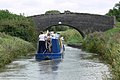
 Ashby Canal and Bates Wharf Bridge - geograph.org.uk - 931492.jpg 640 × 499; 105 KB
-
 Ashby Canal and farmland - geograph.org.uk - 931504.jpg 493 × 640; 77 KB
-
 Ashby Canal and towpath - geograph.org.uk - 926600.jpg 640 × 472; 135 KB
-
 Ashby Canal and towpath - geograph.org.uk - 926620.jpg 640 × 423; 119 KB
-
 Ashby Canal and towpath - geograph.org.uk - 931498.jpg 640 × 451; 110 KB
-
 Ashby Canal aqueduct - geograph.org.uk - 931466.jpg 640 × 410; 94 KB
-

-

-
 Ashby Canal from Congerstone Bridge - geograph.org.uk - 925027.jpg 543 × 640; 98 KB
-
 Ashby Canal near Carlton Bridge - geograph.org.uk - 924984.jpg 640 × 384; 79 KB
-
 Ashby Canal near Congerstone Bridge - geograph.org.uk - 925021.jpg 640 × 469; 102 KB
-
 Ashby Canal near Green Lane Bridge - geograph.org.uk - 926625.jpg 640 × 463; 138 KB
-
 Ashby Canal near Hill's Bridge - geograph.org.uk - 926566.jpg 640 × 474; 127 KB
-
 Ashby Canal near Pare's Bridge - geograph.org.uk - 928885.jpg 640 × 453; 124 KB
-
 Ashby Canal near Snarestone - geograph.org.uk - 928924.jpg 640 × 420; 69 KB
-
 Ashby Canal toward Pare's Bridge - geograph.org.uk - 926666.jpg 640 × 428; 97 KB
-

-
-
 Ashby Road atTwycross - geograph.org.uk - 926120.jpg 640 × 436; 87 KB
-
 Ashby Road towards Snarestone - geograph.org.uk - 926647.jpg 640 × 416; 76 KB
-

-
 Atherstone Road - geograph.org.uk - 931353.jpg 640 × 434; 54 KB
-
 Auto Components - geograph.org.uk - 917686.jpg 640 × 480; 65 KB
-
 Bales next to Sharp's Covert - geograph.org.uk - 926202.jpg 640 × 495; 116 KB
-
 Bark path entering Hermitage - geograph.org.uk - 927932.jpg 640 × 427; 175 KB
-
 Barley field on airfield perimeter - geograph.org.uk - 929831.jpg 640 × 480; 55 KB
-
 Barrett Electrical - geograph.org.uk - 917644.jpg 640 × 480; 50 KB
-
 Baxter's Joinery - geograph.org.uk - 917619.jpg 640 × 480; 77 KB
-
 Bay window tower - geograph.org.uk - 918622.jpg 510 × 640; 69 KB
-
 Bays Community centre - geograph.org.uk - 924701.jpg 614 × 480; 71 KB
-
 Belted Galloway - geograph.org.uk - 921654.jpg 640 × 480; 92 KB
-
 Between the woods - geograph.org.uk - 920088.jpg 640 × 480; 69 KB
-
 Beyond the garden wall - geograph.org.uk - 922727.jpg 640 × 480; 43 KB
-
 Bilstone Road at Little Twycross - geograph.org.uk - 926125.jpg 640 × 387; 66 KB
-
 Bilstone Road at Little Twycross - geograph.org.uk - 926164.jpg 640 × 428; 85 KB
-
 Bilstone Road near Congerstone - geograph.org.uk - 925033.jpg 640 × 406; 89 KB
-
 Bilstone Road towards Bilstone - geograph.org.uk - 926169.jpg 640 × 455; 98 KB
-
 Bindweed at Kiltonga - geograph.org.uk - 917834.jpg 640 × 438; 104 KB
-
 Black Swallowtail Butterfly 1.jpg 1,947 × 1,431; 1.85 MB
-
 Black Swallowtail Butterfly 2 (2764963433).jpg 2,058 × 1,683; 2.39 MB
-
 Blakeney Quay - geograph.org.uk - 1054660.jpg 640 × 426; 86 KB
-
 Blakeney Quay - geograph.org.uk - 1054661.jpg 640 × 434; 100 KB
-
 Blenheim Industrial Estate - geograph.org.uk - 917864.jpg 640 × 480; 68 KB
-

-
 Blenheim New Site Allotments - geograph.org.uk - 917854.jpg 640 × 480; 81 KB
-

-
 BOC Industrial Gas - geograph.org.uk - 917646.jpg 640 × 480; 53 KB
-
 Boiler (2764815491).jpg 3,456 × 2,304; 4.67 MB
-
 Bosworth Road towards Congerstone - geograph.org.uk - 925029.jpg 640 × 386; 69 KB
-
 Bowness - panoramio (2).jpg 3,264 × 2,448; 1.94 MB
-
 Bowness - panoramio (3).jpg 3,264 × 2,448; 1.94 MB
-
 Bradley's Pharmacy - geograph.org.uk - 917690.jpg 640 × 480; 39 KB
-
 Bramble flower at Kiltonga - geograph.org.uk - 917844.jpg 640 × 407; 87 KB
-
 Brent Mill Industrial Estate - geograph.org.uk - 1112469.jpg 640 × 427; 64 KB
-
 Brent Mill Industrial Estate - geograph.org.uk - 1112482.jpg 640 × 427; 63 KB
-
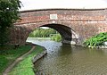
 Bridge 44, Carlton Bridge - geograph.org.uk - 924985.jpg 640 × 429; 83 KB
-
 Bridge 45, Iliffe Bridge - geograph.org.uk - 931505.jpg 640 × 406; 67 KB
-
 Bridge 46, Fairfield Bridge - geograph.org.uk - 925002.jpg 640 × 474; 99 KB
-
 Bridge 47, Congerstone Bridge - geograph.org.uk - 925026.jpg 640 × 471; 93 KB
-
 Bridge 50, Bates Bridge - geograph.org.uk - 931497.jpg 640 × 462; 87 KB
-
 Bridge 52, Turn Bridge - geograph.org.uk - 931459.jpg 640 × 447; 93 KB
-
 Bridge 53, Town Bridge - geograph.org.uk - 926519.jpg 640 × 375; 88 KB
-
 Bridge 54, Hill's Bridge - geograph.org.uk - 926570.jpg 640 × 409; 97 KB
-
 Bridge 56, Timms Bridge - geograph.org.uk - 926610.jpg 640 × 414; 96 KB
-
 Bridge 57, Green Lane Bridge - geograph.org.uk - 926630.jpg 640 × 389; 86 KB
-
 Bridge 58, Gopsall Wharf Bridge - geograph.org.uk - 926639.jpg 640 × 411; 92 KB
-
 Bridge 59, Pare's Bridge - geograph.org.uk - 928890.jpg 640 × 432; 83 KB
-
 Bridge across the River Sence - geograph.org.uk - 925918.jpg 640 × 421; 94 KB
-
 Bridge across the River Sence - geograph.org.uk - 926011.jpg 640 × 433; 122 KB
-
 Bridge and Toll House at Brent Mill - geograph.org.uk - 1112425.jpg 640 × 427; 81 KB
-
 Bridge arches - geograph.org.uk - 931063.jpg 640 × 480; 131 KB
-
 Bridge at the head of Loch Stocinis - geograph.org.uk - 925603.jpg 640 × 480; 79 KB
-
 Bridge over dismantled railway line - geograph.org.uk - 927986.jpg 640 × 480; 102 KB
-
 Bridge over disused railway line - geograph.org.uk - 927978.jpg 640 × 480; 101 KB
-
 Bridge over the River Chilt - geograph.org.uk - 1073698.jpg 640 × 360; 118 KB
-
 Bridge over the River Gairn at Gairnshiel - geograph.org.uk - 919448.jpg 640 × 429; 119 KB
-
 Bridleway by the motorway - geograph.org.uk - 927948.jpg 640 × 427; 193 KB
-
 Bridleway by the motorway - geograph.org.uk - 927951.jpg 640 × 427; 194 KB
-
 Bridleway up Cwm Ceirig - geograph.org.uk - 918285.jpg 640 × 428; 152 KB
-
 British Red Cross - County Photos - geograph.org.uk - 917677.jpg 640 × 480; 49 KB
-
 Britvic, Northern Ireland - geograph.org.uk - 917651.jpg 640 × 480; 45 KB
-
 Bromsash Crossroads - geograph.org.uk - 919919.jpg 640 × 480; 66 KB
-
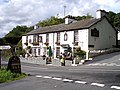 Brown Horse public house at Winster - geograph.org.uk - 920298.jpg 640 × 479; 88 KB
-
 BT satellite station - geograph.org.uk - 958085.jpg 640 × 480; 77 KB
-
 Buchanan Fuels - geograph.org.uk - 917621.jpg 640 × 480; 41 KB
-
 Buddleja davidii not Lads Club - geograph.org.uk - 923713.jpg 427 × 640; 307 KB
-
 Building on Low Auchenree Farm - geograph.org.uk - 931998.jpg 640 × 480; 66 KB
-
 Burnt area, Blinkbonny Burn - geograph.org.uk - 927202.jpg 640 × 359; 75 KB
-
 Bus along Carlton Road - geograph.org.uk - 924788.jpg 640 × 379; 52 KB
-
 Butterfly Blue Morpho (2764932527).jpg 2,475 × 1,809; 3.03 MB
-
 Butterfly Blue Morpho Closed (2765780998).jpg 1,392 × 1,500; 1.49 MB
-
 Butterfly Blue Morpho just emerged (2764936097).jpg 2,004 × 1,803; 2.57 MB
-
 Butterfly Cyane 1 (2765784078).jpg 1,269 × 930; 897 KB
-
 Butterfly Cyane 3 (2764937703).jpg 1,203 × 1,194; 955 KB
-
 Butterfly IMG 0037a (2765790146).jpg 1,623 × 1,422; 1.43 MB
-
 Butterfly IMG 0051a (2765788890).jpg 2,418 × 1,797; 3.01 MB
-
 Butterfly IMG 0055a (2765791364).jpg 1,422 × 1,332; 1.35 MB
-
 Butterfly IMG 0061a (2764945279).jpg 1,422 × 969; 1,005 KB
-
 Butterfly IMG 0066 (2765793222).jpg 1,389 × 1,053; 1.07 MB
-
 Butterfly IMG 0070a (2765794502).jpg 1,704 × 1,194; 1.38 MB
-
 Butterfly IMG 0073a (2765797744).jpg 1,065 × 1,128; 968 KB
-
 Butterfly IMG 0078 (2765796904).jpg 1,728 × 1,617; 2.05 MB
-
 Butterfly IMG 0082a (2764956687).jpg 1,416 × 1,086; 1.09 MB
-
 Butterfly IMG 0096a (2765801640).jpg 1,446 × 1,170; 1.1 MB
-
 Butterfly IMG 0100 (2764955703).jpg 1,476 × 1,119; 1.01 MB
-
 Butterfly IMG 0103 (2765805186).jpg 1,827 × 1,578; 1.6 MB
-
 Butterfly IMG 0119 (2764959325).jpg 1,281 × 1,452; 1.28 MB
-
 Butterfly IMG 0143 (2765807220).jpg 1,128 × 1,056; 1.04 MB
-
 Butterfly IMG 0158 (2764961293).jpg 1,485 × 1,167; 1.27 MB
-
 Butterfly IMG 0180 (2764965303).jpg 1,353 × 1,101; 1.01 MB
-
 Butterfly IMG 0196 (2765798572).jpg 1,314 × 1,143; 941 KB
-
 Butterfly Zebra Longwing (2765786254).jpg 1,680 × 1,254; 1.63 MB
-
 By the Side of Pet Mart - geograph.org.uk - 923723.jpg 640 × 427; 259 KB
-
 Byway north of Rookery Farm - geograph.org.uk - 927890.jpg 640 × 427; 221 KB
-
 C and C, Omagh - geograph.org.uk - 917668.jpg 640 × 480; 45 KB
-
 Cafe and shop at Kennack Sands - geograph.org.uk - 926699.jpg 640 × 480; 76 KB
-
 Cairn above Gairnshiel Lodge - geograph.org.uk - 919510.jpg 640 × 429; 126 KB
-
 Cairn on Mulloch Hill - geograph.org.uk - 921623.jpg 640 × 480; 75 KB
-
 Canal bridge. - geograph.org.uk - 1730754.jpg 640 × 589; 159 KB
-
 Car park, Balmaha - geograph.org.uk - 954882.jpg 640 × 426; 63 KB
-
 Car park, Balmaha - geograph.org.uk - 954883.jpg 640 × 413; 119 KB
-
 Carlton Bridge - geograph.org.uk - 924741.jpg 640 × 472; 77 KB
-
 Carlton in Leicestershire - geograph.org.uk - 924928.jpg 640 × 358; 68 KB
-

-
 Carlton Road near Market Bosworth - geograph.org.uk - 931507.jpg 640 × 348; 51 KB
-
 Carlton Road towards Market Bosworth - geograph.org.uk - 924934.jpg 640 × 593; 96 KB
-
 Carlton, Barn along the Main Street - geograph.org.uk - 924976.jpg 640 × 458; 92 KB
-
 Carlton, Congerstone Lane - geograph.org.uk - 924978.jpg 640 × 361; 79 KB
-
 Carlton, Main Street - geograph.org.uk - 924961.jpg 640 × 360; 64 KB
-
 Carlton, Main Street - geograph.org.uk - 924970.jpg 640 × 452; 68 KB
-
 Carlton, Phone box along Main Street - geograph.org.uk - 924977.jpg 476 × 640; 81 KB
-
 Carrick Luz - geograph.org.uk - 926706.jpg 606 × 440; 257 KB
-
 Castle Farm near Congerstone - geograph.org.uk - 926422.jpg 640 × 341; 51 KB
-
 Castle Lighting - geograph.org.uk - 917635.jpg 640 × 480; 39 KB
-
 Cattle in field - geograph.org.uk - 921577.jpg 640 × 480; 79 KB
-
 Cattle pen at Losgaintir - geograph.org.uk - 925834.jpg 640 × 480; 84 KB
-
 CBS (Complete Beverage Services) - geograph.org.uk - 917721.jpg 640 × 480; 40 KB
-
 Chalky Lane - geograph.org.uk - 927811.jpg 640 × 427; 239 KB


.jpg)


.jpg)
.jpg)
.jpg)
.jpg)
.jpg)

.jpg)

.jpg)
.jpg)
.jpg)
.jpg)


.jpg)


.jpg)

.jpg)
.jpg)


.jpg)
.jpg)
.jpg)
.jpg)
.jpg)
.jpg)
.jpg)
.jpg)
.jpg)
.jpg)
.jpg)
.jpg)
.jpg)
.jpg)
.jpg)
.jpg)
.jpg)
.jpg)
.jpg)
.jpg)
.jpg)
.jpg)
.jpg)


_-_geograph.org.uk_-_917721.jpg)
