Category:United Kingdom photographs taken on 2008-07-10
Jump to navigation
Jump to search
Countries of Europe: Austria · Belarus · Belgium · Bulgaria · Croatia · Czech Republic · Estonia · Finland · France‡ · Germany · Greece · Hungary · Iceland · Republic of Ireland · Italy · Lithuania · Malta · Netherlands‡ · Norway · Poland · Portugal‡ · Russia‡ · Serbia · Slovakia · Spain‡ · Sweden · Switzerland · Turkey‡ · Ukraine · United Kingdom
‡: partly located in Europe
‡: partly located in Europe
| ← | 10 July 2008 | → | ||
| ← | July 2008 | → | ||

United Kingdom photographs taken on 10 July 2008.
Image files should be categorized here automatically using {{taken on}} template. Direct categorisation is also possible, if automatic is impossible.
Subcategories
This category has only the following subcategory.
L
Media in category "United Kingdom photographs taken on 2008-07-10"
The following 200 files are in this category, out of 817 total.
(previous page) (next page)-
 "The Port in Green Fields" - geograph.org.uk - 878238.jpg 640 × 433; 59 KB
-
 'Lagan Viking' in dry dock, Belfast - geograph.org.uk - 878541.jpg 640 × 569; 285 KB
-

-
 A dry time on Bealach a' Mhaim - geograph.org.uk - 878743.jpg 640 × 480; 178 KB
-
 A field margin - geograph.org.uk - 879016.jpg 640 × 480; 183 KB
-
 A Hedon drainage channel - geograph.org.uk - 878452.jpg 480 × 640; 163 KB
-
 A quiet corner of Yorkshire - geograph.org.uk - 878702.jpg 640 × 382; 52 KB
-
 A ruined barn - geograph.org.uk - 878421.jpg 640 × 480; 171 KB
-
 A sea of barley - geograph.org.uk - 878419.jpg 480 × 640; 180 KB
-
 A small island - geograph.org.uk - 878490.jpg 640 × 427; 68 KB
-
 A view of Four Wents House from the N - geograph.org.uk - 884867.jpg 640 × 480; 229 KB
-
 A view SW from Water Lane - geograph.org.uk - 884872.jpg 640 × 480; 213 KB
-
 A winter crop emerging from the soil - geograph.org.uk - 879021.jpg 640 × 480; 203 KB
-
 A62, Manchester Road, Slaithwaite - geograph.org.uk - 883604.jpg 640 × 480; 77 KB
-
 Access Ramp to Bridge - geograph.org.uk - 879680.jpg 427 × 640; 197 KB
-
 Access Ramp to Bridge - geograph.org.uk - 879687.jpg 640 × 427; 247 KB
-
 Achmelvich Campsite - geograph.org.uk - 1094273.jpg 640 × 480; 97 KB
-
 Across the fields - geograph.org.uk - 878957.jpg 640 × 426; 53 KB
-
 All aboard for Elgol - geograph.org.uk - 878506.jpg 427 × 640; 64 KB
-
 All Saints Church, Wing - geograph.org.uk - 1480810.jpg 640 × 426; 316 KB
-
 Allt Coir' a' Mhadaidh - geograph.org.uk - 878759.jpg 640 × 480; 152 KB
-
 Allt Coir' a' Tairneilear - geograph.org.uk - 878750.jpg 480 × 640; 171 KB
-
 Allt na Cuinneige Bige - geograph.org.uk - 912300.jpg 640 × 480; 71 KB
-
 Anglian Water site on St Neots Road - geograph.org.uk - 879101.jpg 640 × 480; 76 KB
-
 Anlaby Park Rd North, Hull - geograph.org.uk - 878569.jpg 640 × 448; 191 KB
-
 Anlaby Park Rd South, Hull - geograph.org.uk - 878571.jpg 640 × 498; 208 KB
-
 Approach to Bridge Over Railway - geograph.org.uk - 879666.jpg 640 × 427; 246 KB
-
 Approach to Lovesgrove roundabout - geograph.org.uk - 878135.jpg 640 × 480; 192 KB
-
 Approach to the Morris Dancers - geograph.org.uk - 878980.jpg 640 × 426; 62 KB
-
 Architectural gems - geograph.org.uk - 878661.jpg 640 × 426; 70 KB
-
 Architectural gems - geograph.org.uk - 878667.jpg 640 × 426; 72 KB
-
 Arriva Bus Depot - geograph.org.uk - 878540.jpg 640 × 426; 51 KB
-
 Arriva Bus Garage - geograph.org.uk - 878535.jpg 640 × 426; 55 KB
-

-

-
 Asiana B777 (2656666400).jpg 3,300 × 2,400; 4.09 MB
-
 Attwater Cottage on Attwaters Lane - geograph.org.uk - 886091.jpg 640 × 480; 173 KB
-

-
 Barley field - geograph.org.uk - 881055.jpg 640 × 427; 100 KB
-
 Barley, Unhill Bottom - geograph.org.uk - 884789.jpg 640 × 480; 147 KB
-
 Barley, Unhill Bottom - geograph.org.uk - 884803.jpg 640 × 480; 122 KB
-
 Barley, Unhill Bottom - geograph.org.uk - 884814.jpg 640 × 480; 126 KB
-
 Barley, Unhill Bottom - geograph.org.uk - 884820.jpg 640 × 480; 103 KB
-
 Barley, Unhill Bottom - geograph.org.uk - 884834.jpg 640 × 480; 138 KB
-
 Barley, Unhill Bottom - geograph.org.uk - 884881.jpg 640 × 480; 180 KB
-
 Barley, Unhill Bottom - geograph.org.uk - 884883.jpg 640 × 480; 135 KB
-
 Barleyfield beside Keeper's Lane - geograph.org.uk - 878418.jpg 480 × 640; 179 KB
-
 Barn south of Barton Road - geograph.org.uk - 878240.jpg 640 × 480; 94 KB
-
 Barrow Haven with a Gaggle of Swans - geograph.org.uk - 878257.jpg 640 × 427; 59 KB
-
 Barton Road, Comberton - geograph.org.uk - 878252.jpg 640 × 480; 84 KB
-
 Barton Stacey - Wheat Field - geograph.org.uk - 942691.jpg 640 × 404; 69 KB
-
 Barton Stacy - New Village Sign - geograph.org.uk - 942743.jpg 640 × 480; 180 KB
-
 Baxter's Visitor Centre - geograph.org.uk - 885610.jpg 640 × 480; 83 KB
-
 Beech 1900D (3870330353).jpg 1,200 × 800; 165 KB
-
 Beech 1900d - RIAT 2008 (2743934414).jpg 1,024 × 683; 172 KB
-
 Beechcraft 1900d d-cbig fairford arp.jpg 2,132 × 1,479; 2.69 MB
-
 Beechwood Shopping Centre, Cheltenham - geograph.org.uk - 888091.jpg 640 × 480; 96 KB
-
 Berkeley Chapel from Cemetery Garden - geograph.org.uk - 880766.jpg 480 × 640; 94 KB
-
 Berkeley Square - geograph.org.uk - 925391.jpg 640 × 480; 118 KB
-
 Beverley Road, Hessle - geograph.org.uk - 878879.jpg 640 × 480; 233 KB
-
 Biblical Gardens, Elgin - geograph.org.uk - 885668.jpg 640 × 480; 158 KB
-
 Big Point Rock and Little Point Rock - geograph.org.uk - 879177.jpg 640 × 480; 85 KB
-

-
 Birdlip and Brimsfield cricket pitch - geograph.org.uk - 878482.jpg 640 × 426; 73 KB
-
 Bishop's Lodge - geograph.org.uk - 885744.jpg 640 × 480; 90 KB
-
 Blacked bottoms - geograph.org.uk - 878402.jpg 640 × 426; 74 KB
-
 Blooming heather - geograph.org.uk - 878961.jpg 640 × 480; 125 KB
-
 Blue clematis flower - geograph.org.uk - 878992.jpg 640 × 480; 145 KB
-
 Boars Head - geograph.org.uk - 878592.jpg 640 × 480; 67 KB
-
 Boer War Memorial, Cheltenham - geograph.org.uk - 884729.jpg 480 × 640; 109 KB
-
 Boggy col, Carn Chuinneag - geograph.org.uk - 912275.jpg 640 × 480; 54 KB
-
 Bogs on Mullach Coire na Gaoitheag - geograph.org.uk - 911914.jpg 640 × 480; 86 KB
-
 Boothferry Road, Hessle - geograph.org.uk - 878878.jpg 640 × 440; 194 KB
-
 Boothferry Road, Hull - geograph.org.uk - 878555.jpg 640 × 489; 192 KB
-
 Boothferry Road, Hull - geograph.org.uk - 878562.jpg 480 × 640; 177 KB
-
 Boothferry Road, Hull - geograph.org.uk - 878565.jpg 640 × 471; 197 KB
-
 Boundary Stone - geograph.org.uk - 879740.jpg 640 × 427; 277 KB
-

-

-

-

-
 Bramhall Road, Bilborough - geograph.org.uk - 877948.jpg 640 × 480; 72 KB
-
 Brick Foundations, Beacon Hill - geograph.org.uk - 879736.jpg 640 × 427; 223 KB
-
 Bridge Street, Slaithwaite - geograph.org.uk - 882544.jpg 640 × 480; 95 KB
-
 Brimpsfield Castle - geograph.org.uk - 878492.jpg 640 × 480; 118 KB
-
 Brimpsfield War Memorial - geograph.org.uk - 878499.jpg 640 × 426; 162 KB
-
 Bristol Cathedral - geograph.org.uk - 880598.jpg 640 × 480; 83 KB
-
 Broken and overgrown gates - geograph.org.uk - 878521.jpg 640 × 480; 64 KB
-
 Bronze profile, Bristol cathedral - geograph.org.uk - 880808.jpg 480 × 640; 58 KB
-
 Brook Cottage - geograph.org.uk - 878394.jpg 480 × 640; 90 KB
-
 Brook Mill, Carr Lane, Crimble - geograph.org.uk - 880323.jpg 640 × 480; 114 KB
-
 Brook Mill, Crimble - geograph.org.uk - 880318.jpg 640 × 480; 79 KB
-
 Brookside Terrace, Crimble Clough - geograph.org.uk - 880092.jpg 640 × 480; 123 KB
-
 Brookside,Crimble Clough. - geograph.org.uk - 880104.jpg 640 × 480; 104 KB
-

-
 Bullan Riabhach Mòr - geograph.org.uk - 911918.jpg 640 × 359; 59 KB
-
 Bullring beach - geograph.org.uk - 900772.jpg 640 × 480; 85 KB
-
 Bulwell Community Toy Library - geograph.org.uk - 877952.jpg 640 × 480; 78 KB
-
 Bus stop - geograph.org.uk - 879309.jpg 640 × 437; 92 KB
-
 Butchers Cottage, West Street - geograph.org.uk - 878473.jpg 640 × 480; 73 KB
-
 Byway to Long Road - geograph.org.uk - 878337.jpg 640 × 480; 78 KB
-
 Byway to nowhere in particular - geograph.org.uk - 878358.jpg 640 × 480; 80 KB
-
 Byway to south Comberton - geograph.org.uk - 878353.jpg 640 × 480; 76 KB
-
 Cambridge Observatory Annex (1892-3) - geograph.org.uk - 878176.jpg 640 × 480; 84 KB
-
 Campsie, Omagh - geograph.org.uk - 878230.jpg 640 × 286; 32 KB
-
 Canal at Slaithwaite - geograph.org.uk - 882606.jpg 640 × 480; 72 KB
-
 Car park bonfire, Belfast - geograph.org.uk - 877916.jpg 640 × 543; 357 KB
-
 Cargo ship 'Imi' at Belfast - geograph.org.uk - 878928.jpg 640 × 480; 244 KB
-
 Carn Chuinneag - geograph.org.uk - 912256.jpg 640 × 480; 58 KB
-
 Carr Lane, Slaithwaite - geograph.org.uk - 880337.jpg 480 × 640; 97 KB
-
 Carr Lane, Slaithwaite - geograph.org.uk - 880380.jpg 640 × 480; 80 KB
-

-
 Cathay A340 (2655895813).jpg 3,300 × 2,400; 2.84 MB
-
 Cattle grid on road to Tilden Farm - geograph.org.uk - 879868.jpg 640 × 480; 224 KB
-
 Cattle in field next to Nineveh Lane - geograph.org.uk - 888218.jpg 640 × 480; 157 KB
-

-
 Cavendish House, Cheltenham - geograph.org.uk - 884836.jpg 480 × 640; 76 KB
-
 Cemetery garden, Bristol Cathedral - geograph.org.uk - 880782.jpg 640 × 480; 119 KB
-
 Central retail park - geograph.org.uk - 878507.jpg 640 × 318; 43 KB
-
 St Mary's Church, Chalk, Kent - geograph.org.uk - 886163.jpg 640 × 513; 96 KB
-
 Cheltenham Town Hall - geograph.org.uk - 888047.jpg 640 × 480; 75 KB
-
 Childs way Milton Keynes - geograph.org.uk - 878487.jpg 640 × 480; 63 KB
-
 Chiselbury Bay - geograph.org.uk - 879193.jpg 640 × 480; 82 KB
-
 Choir' a Ghaill - geograph.org.uk - 911934.jpg 640 × 359; 48 KB
-

-

-

-
 Christ Church, Gravesend Kent - Font - geograph.org.uk - 886185.jpg 336 × 640; 35 KB
-
 Christ Church, Gravesend Kent - geograph.org.uk - 886178.jpg 640 × 428; 89 KB
-

-

-
 Church Cottage, Catfield - geograph.org.uk - 882987.jpg 640 × 480; 77 KB
-
 Church Farm cottages - geograph.org.uk - 878409.jpg 640 × 480; 92 KB
-
 Church Farm House - geograph.org.uk - 878325.jpg 640 × 480; 95 KB
-
 Church Lane - geograph.org.uk - 879022.jpg 640 × 480; 139 KB
-
 Clacton Beach towards Jaywick - geograph.org.uk - 886900.jpg 640 × 427; 54 KB
-
 Cliff - Kilt Rock - geograph.org.uk - 901484.jpg 640 × 427; 76 KB
-
 Clonlee Drive, Belfast - geograph.org.uk - 877894.jpg 640 × 453; 291 KB
-
 Coast Path at Brandy Head - geograph.org.uk - 879204.jpg 640 × 480; 69 KB
-
 Coastguard Cottage, Peppercombe - geograph.org.uk - 882751.jpg 640 × 480; 107 KB
-

-
 Coastline West Scarp - geograph.org.uk - 883740.jpg 640 × 428; 85 KB
-
 Cod Beck - geograph.org.uk - 879748.jpg 640 × 427; 237 KB
-
 Cod Beck Reservoir - geograph.org.uk - 879742.jpg 640 × 427; 225 KB
-
 Coire na Creiche - geograph.org.uk - 878732.jpg 640 × 480; 94 KB
-
 Coire na Gaoitheag - geograph.org.uk - 911912.jpg 640 × 480; 79 KB
-
 Combe Cottage, Peppercombe - geograph.org.uk - 882764.jpg 640 × 480; 142 KB
-
 Comberton Recycling Centre - geograph.org.uk - 878516.jpg 640 × 480; 88 KB
-

-

-

-

-

-

-
 Contractor's Site Cabins - geograph.org.uk - 879618.jpg 640 × 427; 224 KB
-
 Cottage adjoining Mannington Hall - geograph.org.uk - 878974.jpg 640 × 452; 161 KB
-
 Cottingham Cemetery - geograph.org.uk - 879353.jpg 640 × 471; 142 KB
-
 Cottingham Railway Station 1.jpg 640 × 455; 113 KB
-
 Cottingham War Memorial - geograph.org.uk - 879334.jpg 640 × 467; 175 KB
-
 Country road across the Fen - geograph.org.uk - 885829.jpg 640 × 427; 78 KB
-
 Country style - geograph.org.uk - 879029.jpg 640 × 426; 78 KB
-
 Court off Fletcher Gate - geograph.org.uk - 882147.jpg 454 × 640; 75 KB
-
 Cowesby from the south - geograph.org.uk - 878709.jpg 640 × 480; 70 KB
-

-
 Cramp Institute Club - geograph.org.uk - 878803.jpg 640 × 480; 220 KB
-
 Cranbrook Congregational Church - geograph.org.uk - 878828.jpg 480 × 640; 189 KB
-
 Cranbrook School - geograph.org.uk - 880855.jpg 640 × 480; 199 KB
-
 Cranbrook town sign - geograph.org.uk - 878244 (cropped).jpg 204 × 544; 63 KB
-
 Cranbrook town sign - geograph.org.uk - 878244.jpg 480 × 640; 191 KB
-
 Crimble, Slaithwaite - geograph.org.uk - 880176.jpg 640 × 480; 69 KB
-

-
 Crossing the 100 foot river - geograph.org.uk - 885908.jpg 640 × 427; 82 KB
-
 Crossing the hundred foot drain - geograph.org.uk - 884740.jpg 640 × 427; 72 KB
-
 Crossing the M58, looking East - geograph.org.uk - 879057.jpg 640 × 426; 55 KB
-
 Crossroads at Iden Green - geograph.org.uk - 889421.jpg 640 × 480; 198 KB
-
 Crossroads, Four Wents - geograph.org.uk - 884855.jpg 640 × 480; 243 KB
-
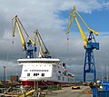
 Cruise ship 'Prinsendam' at Belfast - geograph.org.uk - 878537.jpg 640 × 439; 204 KB
-
 Cwm Rheidol Telephone Kiosk - geograph.org.uk - 878091.jpg 640 × 480; 349 KB
-
 Cyclepath on Old Railway Embankment - geograph.org.uk - 877962.jpg 640 × 480; 128 KB
-
 Cyprus Avenue, Belfast - geograph.org.uk - 877885.jpg 640 × 537; 554 KB
-
 Danger Point and Black Head - geograph.org.uk - 879208.jpg 640 × 480; 65 KB
-
 Darleys, Boothferry Road - geograph.org.uk - 878573.jpg 640 × 423; 190 KB
-
 Decking on display, Omagh - geograph.org.uk - 878226.jpg 640 × 284; 28 KB
-

-
 Dene Road, Cottingham - geograph.org.uk - 879341.jpg 640 × 461; 98 KB
-
 Derelict bothy at Sandaig - geograph.org.uk - 1261471.jpg 640 × 480; 88 KB
-
 Derelict Cottage at Marlow Farm - geograph.org.uk - 878318.jpg 640 × 480; 110 KB
-
 Detail on front of Cramp Institute Club - geograph.org.uk - 878808.jpg 640 × 480; 285 KB
-
 Devenden from the West - geograph.org.uk - 891929.jpg 640 × 480; 188 KB
-
 Devil's Bridge over the River Lune. - geograph.org.uk - 882484.jpg 640 × 426; 123 KB
-
 Dip in the ground - geograph.org.uk - 878934.jpg 480 × 640; 179 KB
-
 Disused house near Banbridge - geograph.org.uk - 878638.jpg 640 × 400; 84 KB
-
 Disused lodge - geograph.org.uk - 881672.jpg 640 × 427; 125 KB
-
 Disused mooring bollards - geograph.org.uk - 878234.jpg 640 × 512; 113 KB
-
 Dock Crane, Belfast (6) - geograph.org.uk - 878924.jpg 637 × 640; 317 KB
-
 Down Wallgate - geograph.org.uk - 878448.jpg 640 × 426; 67 KB
-
 Downland, Moulsford - geograph.org.uk - 884717.jpg 640 × 480; 135 KB
-
 Drain near Potter Heigham - geograph.org.uk - 882711.jpg 640 × 480; 110 KB
-
 Drain near South Somercotes Fen Houses - geograph.org.uk - 878636.jpg 640 × 457; 169 KB
-
 Driveway and gardens of Reynold's Farm - geograph.org.uk - 886086.jpg 640 × 480; 217 KB


.jpg)


.jpg)
.jpg)


_-_geograph.org.uk_-_878176.jpg)


.jpg)


_-_geograph.org.uk_-_878924.jpg)


.jpg)