Category:United Kingdom photographs taken on 2008-04-04
Jump to navigation
Jump to search
Countries of Europe: Austria · Belarus · Belgium · Bosnia and Herzegovina · Bulgaria · Croatia · Estonia · France‡ · Germany · Hungary · Republic of Ireland · Italy · Latvia · Netherlands‡ · Norway · Poland · Romania · Russia‡ · Serbia · Slovakia · Slovenia · Spain‡ · Sweden · Switzerland · Ukraine · United Kingdom
‡: partly located in Europe
‡: partly located in Europe
| ← | 4 April 2008 | → | ||
| ← | April 2008 | → | ||

United Kingdom photographs taken on 4 April 2008.
Image files should be categorized here automatically using {{taken on}} template. Direct categorisation is also possible, if automatic is impossible.
Subcategories
This category has only the following subcategory.
Media in category "United Kingdom photographs taken on 2008-04-04"
The following 200 files are in this category, out of 919 total.
(previous page) (next page)-
 'Down the Mill' - geograph.org.uk - 1112582.jpg 605 × 431; 64 KB
-
 'The Three Horseshoes' - geograph.org.uk - 750701.jpg 640 × 480; 62 KB
-
 165019 at Paddington 1.jpg 3,648 × 2,736; 4 MB
-
 165019 at Paddington 2.jpg 3,648 × 2,736; 4.03 MB
-
 67021 Castleton East Junction (1).jpg 1,024 × 768; 628 KB
-
 67021 Castleton East Junction (2).jpg 768 × 1,024; 553 KB
-
 754586 a96910f6.jpg 640 × 480; 140 KB
-
 A blind bend in the A5108 - geograph.org.uk - 753068.jpg 640 × 480; 62 KB
-

-
 A giant's mirror^ - geograph.org.uk - 750941.jpg 640 × 480; 111 KB
-
 A glimpse of two lochs - geograph.org.uk - 755356.jpg 640 × 480; 60 KB
-
 A local train enters Parsons Tunnel - geograph.org.uk - 1291516.jpg 640 × 480; 72 KB
-

-
 A peek through the hedge - geograph.org.uk - 750280.jpg 640 × 480; 85 KB
-
 A place to rest - geograph.org.uk - 750801.jpg 640 × 425; 44 KB
-

-
 A track from coast to coast - geograph.org.uk - 755367.jpg 640 × 480; 88 KB
-
 A traffic free 'main' road - geograph.org.uk - 755336.jpg 640 × 480; 58 KB
-
 A view across Cwm Tarrenig - geograph.org.uk - 750879.jpg 480 × 640; 235 KB
-

-
 A view towards Llechwedd Hirgoed - geograph.org.uk - 926881.jpg 640 × 480; 192 KB
-

-
 A water trough at Doorpool Hill - geograph.org.uk - 756076.jpg 480 × 640; 123 KB
-
 A44 looking east - geograph.org.uk - 750939.jpg 640 × 480; 226 KB
-
 A4s 20080404 NYMR 040a.jpg 1,200 × 668; 545 KB
-
 A6187 view from Hathersage Moor - geograph.org.uk - 751241.jpg 640 × 480; 89 KB
-
 A917 - geograph.org.uk - 750429.jpg 575 × 640; 149 KB
-
 Across the moor to Beinn Shiantaidh - geograph.org.uk - 755516.jpg 640 × 480; 68 KB
-
 Adur Dry Dock - geograph.org.uk - 750251.jpg 479 × 640; 83 KB
-
 Afon Tarrenig - geograph.org.uk - 750913.jpg 640 × 480; 209 KB
-

-
 Albert Bridge - geograph.org.uk - 761296.jpg 640 × 480; 59 KB
-
 An entry leading down to the harbour - geograph.org.uk - 753015.jpg 640 × 441; 68 KB
-
 Animal pen - geograph.org.uk - 750733.jpg 640 × 480; 114 KB
-
 St James Church Tower, Ansty, Warks - geograph.org.uk - 862826.jpg 421 × 640; 87 KB
-
 Ansty St James - geograph.org.uk - 862822.jpg 640 × 428; 103 KB
-

-
 Approach to Goldcliff Parish Church - geograph.org.uk - 754581.jpg 640 × 480; 180 KB
-

-

-

-

-
 Bae Moelfra - Moelfre Bay. - geograph.org.uk - 753592.jpg 640 × 480; 43 KB
-
 Balchrystie - geograph.org.uk - 750746.jpg 485 × 640; 92 KB
-
 Balchrystie Doocot - geograph.org.uk - 750476.jpg 537 × 640; 100 KB
-
 Balcony, Llandrindod Wells - geograph.org.uk - 1555520.jpg 640 × 366; 68 KB
-
 Balmangan Bar, Ross Bay - geograph.org.uk - 750207.jpg 640 × 480; 74 KB
-
 Balmangan Tower - geograph.org.uk - 750187.jpg 640 × 480; 94 KB
-
 Barton Stacey - Field Entrance - geograph.org.uk - 790939.jpg 640 × 480; 94 KB
-
 Barton Stacey - Fields - geograph.org.uk - 750337.jpg 640 × 480; 120 KB
-
 Basingstoke Canal - geograph.org.uk - 1670918.jpg 480 × 640; 139 KB
-
 Beacon on Goldcliff Point - geograph.org.uk - 750770.jpg 640 × 479; 118 KB
-
 Bedrule Parish and Church War Memorial - geograph.org.uk - 753468.jpg 462 × 638; 112 KB
-
 Beech trees at a field boundary - geograph.org.uk - 750514.jpg 480 × 640; 130 KB
-
 Beinn a Chrùlaiste and Meall Bhalach - geograph.org.uk - 754244.jpg 640 × 426; 72 KB
-
 Belfast Road, Holywood (1) - geograph.org.uk - 751414.jpg 640 × 480; 115 KB
-
 Belfast Road, Holywood (2) - geograph.org.uk - 751418.jpg 640 × 480; 147 KB
-
 Beside the B4371 - geograph.org.uk - 750728.jpg 640 × 480; 93 KB
-
 Block of Flats, Greyshott Ave - Fareham - geograph.org.uk - 756853.jpg 640 × 514; 118 KB
-
 Blue Buildings - panoramio.jpg 3,264 × 2,448; 2.12 MB
-
 Bluebells, Bangor - geograph.org.uk - 751669.jpg 640 × 480; 197 KB
-
 Boats on the beach at Moelfre - geograph.org.uk - 753674.jpg 640 × 480; 64 KB
-
 Bockleton Brook - geograph.org.uk - 750197.jpg 640 × 480; 116 KB
-
 Bockleton Brook - geograph.org.uk - 750210.jpg 640 × 480; 121 KB
-
 Boreland Bar Lochan - geograph.org.uk - 750136.jpg 640 × 480; 46 KB
-
 Boyce Court near the Daffodil Way - geograph.org.uk - 768469.jpg 640 × 474; 60 KB
-

-

-

-
 Brereton Heath Country Park - geograph.org.uk - 793139.jpg 640 × 481; 70 KB
-
 Bridge Road - panoramio.jpg 2,592 × 1,944; 850 KB
-
 Bridleway east of Catkill - geograph.org.uk - 751834.jpg 640 × 480; 141 KB
-
 Bridleway to Cherridge and beyond - geograph.org.uk - 751868.jpg 640 × 480; 170 KB
-
 British Library - the king's books - panoramio.jpg 3,264 × 2,448; 1.7 MB
-
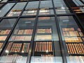
 British Library atrium - panoramio.jpg 3,264 × 2,448; 3.69 MB
-

-
 Bromesberrow Church - geograph.org.uk - 753577.jpg 426 × 640; 77 KB
-
 Bromesberrow Church - geograph.org.uk - 753588.jpg 640 × 426; 74 KB
-
 Bromesberrow Church - geograph.org.uk - 754704.jpg 426 × 640; 79 KB
-
 Bromesberrow church tower - geograph.org.uk - 754604.jpg 426 × 640; 67 KB
-
 Bromesberrow Court - geograph.org.uk - 754737.jpg 640 × 426; 85 KB
-
 Bromesberrow Heath Post Office - geograph.org.uk - 754818.jpg 640 × 426; 75 KB
-
 Building site, off Gardeners Crescent - geograph.org.uk - 1342463.jpg 640 × 437; 101 KB
-
 Burbage Brook and Packhorse Bridge - geograph.org.uk - 750373.jpg 640 × 480; 100 KB
-
 Burbage Brook and Packhorse Bridge.jpg 640 × 480; 96 KB
-
 Burbage Brook View - geograph.org.uk - 750464.jpg 640 × 480; 107 KB
-

-
 Burbage Rocks seen from Green Drive - geograph.org.uk - 750386.jpg 640 × 480; 91 KB
-
 Bus Shelter, Cockenzie - geograph.org.uk - 751620.jpg 640 × 480; 57 KB
-
 By Mount Pleasant - geograph.org.uk - 750750.jpg 640 × 426; 96 KB
-
 Cae Gaer 750952.jpg 640 × 480; 211 KB
-
 Campbelltown Mote - geograph.org.uk - 750110.jpg 640 × 480; 70 KB
-
 Canal Boat - geograph.org.uk - 749849.jpg 640 × 426; 99 KB
-
 Car Wash - geograph.org.uk - 750874.jpg 640 × 465; 69 KB
-

-
 Carving in Bromesberrow Church - geograph.org.uk - 754712.jpg 426 × 640; 47 KB
-
 Carving on Dymock lych gate - geograph.org.uk - 751644.jpg 426 × 640; 83 KB
-
 Chapel Road, Goldcliff - geograph.org.uk - 751685.jpg 640 × 479; 144 KB
-
 Chesham Bois Common - geograph.org.uk - 751163.jpg 640 × 480; 96 KB
-
 Chesham Bois Pond - geograph.org.uk - 751149.jpg 640 × 480; 95 KB
-

-
 Churchyard Cross, Goldcliff - geograph.org.uk - 754605.jpg 640 × 480; 182 KB
-

-
 Clearly defined footpath - geograph.org.uk - 749910.jpg 640 × 480; 102 KB
-

-

-
 Cliff top above Porth Helaeth - geograph.org.uk - 754768.jpg 640 × 275; 39 KB
-
 Cliff top path - geograph.org.uk - 754959.jpg 640 × 354; 43 KB
-
 Clogged canal - geograph.org.uk - 1670941.jpg 640 × 480; 102 KB
-

-
 Clover Street, Chatham - geograph.org.uk - 847344.jpg 480 × 640; 94 KB
-

-
 Cock, Fitzrovia, W1 (2388671646).jpg 1,280 × 960; 288 KB
-

-
 Congestion free on the A846 - geograph.org.uk - 755322.jpg 640 × 480; 75 KB
-
 Corner of an orchard on the Daffodil Way - geograph.org.uk - 769174.jpg 640 × 480; 118 KB
-
 Cottage at Keils - geograph.org.uk - 755529.jpg 640 × 423; 129 KB
-
 Craig Eigiau - geograph.org.uk - 751150.jpg 640 × 480; 104 KB
-
 Craighouse church - geograph.org.uk - 755775.jpg 640 × 401; 61 KB
-
 Craighouse from the pier - geograph.org.uk - 755742.jpg 640 × 380; 54 KB
-
 Craighouse in 2008.jpg 640 × 480; 87 KB
-
 Crathes Catle facade.jpg 2,272 × 1,704; 1,003 KB
-
 Crathes grounds.jpg 2,272 × 1,704; 1.21 MB
-
 Cuckoo flowers on the Daffodil Way - geograph.org.uk - 768407.jpg 480 × 640; 130 KB
-
 Lock keeper's cottage - geograph.org.uk - 752146.jpg 640 × 480; 79 KB
-
 Culham Cut bridge - geograph.org.uk - 752129.jpg 640 × 480; 108 KB
-
 Culham Lock - geograph.org.uk - 752137.jpg 640 × 480; 95 KB
-
 Cwm Eigiau - geograph.org.uk - 750986.jpg 640 × 480; 94 KB
-

-

-
 Daffodil Way approaching Dymock - geograph.org.uk - 768732.jpg 640 × 480; 81 KB
-
 Daffodil Way at Dymock - geograph.org.uk - 768743.jpg 640 × 480; 99 KB
-
 Daffodil Way at Shakesfield - geograph.org.uk - 768852.jpg 640 × 480; 69 KB
-
 Daffodil Way at the edge of Allum's Grove - geograph.org.uk - 769234.jpg 640 × 480; 124 KB
-

-
 Daffodil Way heading for Shakesfield - geograph.org.uk - 769147.jpg 640 × 480; 54 KB
-
-
 Daffodil Way near Boyce Court - geograph.org.uk - 768432.jpg 640 × 480; 86 KB
-

-
 Daffodil Way sign at Shakesfield - geograph.org.uk - 768857.jpg 640 × 480; 93 KB
-
 Daffodil Way sign in Dymock Wood - geograph.org.uk - 768301.jpg 640 × 480; 93 KB
-
-
 Danger Weir - geograph.org.uk - 761277.jpg 480 × 640; 66 KB
-

-
 Demolished Torwoodlee Railway Bridge - geograph.org.uk - 750961.jpg 640 × 480; 109 KB
-

-
 Didcot Power Station in the mist - geograph.org.uk - 752157.jpg 640 × 480; 31 KB
-

-

-
 Dog walking in Kingsford Forest Park - geograph.org.uk - 886496.jpg 640 × 480; 144 KB
-
 Donnington Church - geograph.org.uk - 751719.jpg 640 × 426; 80 KB
-
 Donnington Church - geograph.org.uk - 751726.jpg 640 × 426; 75 KB
-
 Donnington churchyard - geograph.org.uk - 751753.jpg 640 × 426; 80 KB
-

-
 Drive to Lower Wood Farm - geograph.org.uk - 750713.jpg 640 × 480; 69 KB
-
 Dry Silo Mortar - geograph.org.uk - 758902.jpg 480 × 640; 146 KB
-
 Duck family Totton, near Southampton - geograph.org.uk - 750560.jpg 640 × 519; 158 KB
-
 Dymock Church - geograph.org.uk - 751627.jpg 426 × 640; 95 KB
-
 Dymock churchyard - geograph.org.uk - 768783.jpg 640 × 480; 116 KB
-
 East Catkill Farm - geograph.org.uk - 750403.jpg 640 × 480; 76 KB
-
 East Garston back road. - geograph.org.uk - 1354966.jpg 640 × 480; 61 KB
-
 Empty Factory - geograph.org.uk - 750291.jpg 453 × 640; 103 KB
-
 Entrance to Boyce Court - geograph.org.uk - 768489.jpg 640 × 480; 92 KB
-
 Entrance to Haffield, near Donnington - geograph.org.uk - 754852.jpg 426 × 640; 80 KB
-
 Evening train leaving Barmouth - geograph.org.uk - 752167.jpg 640 × 480; 65 KB
-
 Ewe posing near Slough in Devon - geograph.org.uk - 750646.jpg 522 × 640; 82 KB
-
 Fallen tree by the Quoile - geograph.org.uk - 750227.jpg 640 × 421; 137 KB
-

-
 Farm road, Mapledurham - geograph.org.uk - 756471.jpg 480 × 640; 158 KB
-
 Farm roads - geograph.org.uk - 750371.jpg 640 × 480; 69 KB
-
 Farm track level crossing - geograph.org.uk - 749803.jpg 640 × 480; 90 KB
-
 Farmland and grain store, Mapledurham - geograph.org.uk - 756476.jpg 640 × 480; 125 KB
-
 Farmland at Broom's Green - geograph.org.uk - 755126.jpg 640 × 426; 82 KB
-
 Farmland, Mapledurham - geograph.org.uk - 756422.jpg 640 × 480; 131 KB
-
 Farmland, Mapledurham - geograph.org.uk - 756440.jpg 640 × 480; 133 KB
-
 Farmland, Mapledurham - geograph.org.uk - 756448.jpg 640 × 480; 138 KB
-
 Farmland, Mapledurham - geograph.org.uk - 756457.jpg 480 × 640; 164 KB
-
 Farmland, Mapledurham - geograph.org.uk - 756466.jpg 640 × 480; 106 KB
-
 Farmland, Mapledurham - geograph.org.uk - 756479.jpg 640 × 480; 135 KB
-
 Field edge - geograph.org.uk - 750180.jpg 640 × 480; 82 KB
-

-
 Flood marker - geograph.org.uk - 752141.jpg 640 × 480; 106 KB
-

-

-
 Footbridge on the Daffodil Way - geograph.org.uk - 768718.jpg 640 × 480; 135 KB
-
 Footbridge Stile - geograph.org.uk - 752796.jpg 640 × 427; 318 KB
-
 Footpath Approach to Higger Tor - geograph.org.uk - 750412.jpg 640 × 480; 80 KB
-
 Footpath off Worrall Road, Wadsley - geograph.org.uk - 755424.jpg 640 × 426; 99 KB
-
 Footpath to the Pub - geograph.org.uk - 749854.jpg 426 × 640; 116 KB
-

-

-
 Ford Farm - geograph.org.uk - 754887.jpg 640 × 480; 119 KB
-
 Forest Road leading to Cefn Blaenmerin - geograph.org.uk - 914736.jpg 640 × 480; 187 KB
-
 Forestry operations in Dymock Wood - geograph.org.uk - 768286.jpg 640 × 480; 118 KB
-
 Forestry track at Rhos Pant-mawr - geograph.org.uk - 750873.jpg 640 × 480; 223 KB
-

-
 Former School, Bromesberrow Heath - geograph.org.uk - 754876.jpg 640 × 426; 62 KB
-
 Former Sea Cliffs - geograph.org.uk - 750271.jpg 479 × 640; 92 KB
-
 Frankley Services on the M5 - geograph.org.uk - 761905.jpg 640 × 480; 73 KB
-
 Fresh ploughing at Boyce Court - geograph.org.uk - 768449.jpg 640 × 480; 112 KB


.jpg)
.jpg)


_-_geograph.org.uk_-_751414.jpg)
_-_geograph.org.uk_-_751418.jpg)


.jpg)


_-_geograph.org.uk_-_754279.jpg)


