Category:United Kingdom photographs taken on 2007-12-28
Jump to navigation
Jump to search
Countries of Europe: Austria · Bulgaria · Czech Republic · Finland · France‡ · Germany · Hungary · Italy · Latvia · Netherlands‡ · Norway · Poland · Portugal‡ · Romania · Russia‡ · Spain‡ · Switzerland · Ukraine · United Kingdom
‡: partly located in Europe
‡: partly located in Europe
| ← | 28 December 2007 | → | ||
| ← | December 2007 | → | ||

United Kingdom photographs taken on 28 December 2007.
Image files should be categorized here automatically using {{taken on}} template. Direct categorisation is also possible, if automatic is impossible.
Subcategories
This category has the following 3 subcategories, out of 3 total.
Media in category "United Kingdom photographs taken on 2007-12-28"
The following 200 files are in this category, out of 487 total.
(previous page) (next page)-
 "Renaissance", Arbury Park - geograph.org.uk - 641921.jpg 640 × 480; 55 KB
-
 "Which one was built first" - geograph.org.uk - 642310.jpg 640 × 480; 43 KB
-
 313111 and 67005 at Euston.jpg 3,648 × 2,736; 4.36 MB
-
 321434 at Euston A.jpg 3,648 × 2,736; 4.07 MB
-
 321434 at Euston B.jpg 3,648 × 2,736; 4.19 MB
-
 508303 at Kilburn High Road.jpg 3,648 × 2,736; 4.16 MB
-
 A splendid panorama - geograph.org.uk - 643515.jpg 640 × 480; 67 KB
-
 A stand of cypress trees - geograph.org.uk - 641903.jpg 640 × 480; 103 KB
-
 A view to a kill - geograph.org.uk - 642032.jpg 480 × 640; 96 KB
-
 A1 Upper Street - geograph.org.uk - 653601.jpg 640 × 480; 60 KB
-
 A501 City Road, looking west - geograph.org.uk - 726185.jpg 640 × 480; 73 KB
-
 Aberdeen Harbour - geograph.org.uk - 650098.jpg 600 × 435; 61 KB
-

-
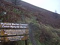 Access to Mynydd Machen Common - geograph.org.uk - 643549.jpg 640 × 477; 83 KB
-
 Access to Mynydd Machen Common - geograph.org.uk - 643561.jpg 640 × 472; 71 KB
-
 Access to Mynydd Machen Common - geograph.org.uk - 645388.jpg 640 × 477; 90 KB
-
 Alfreton High St 677145 11f1ca81.jpg 640 × 480; 77 KB
-
 Allotments - Bradford Road - geograph.org.uk - 643031.jpg 640 × 403; 110 KB
-
 Amazon warehouse - geograph.org.uk - 642218.jpg 640 × 480; 81 KB
-
 An ancient beech - geograph.org.uk - 642172.jpg 480 × 640; 126 KB
-
 An oasis of peace at St Mary's - geograph.org.uk - 642423.jpg 640 × 480; 82 KB
-
 Art-deco window, Lonsdale Cinema - geograph.org.uk - 650068.jpg 476 × 640; 273 KB
-
 Barbican Tandoori - geograph.org.uk - 643148.jpg 640 × 480; 79 KB
-
 Barclays Bank on Delf Street - geograph.org.uk - 647181.jpg 640 × 480; 152 KB
-
 Barclays Bank, City Rd - geograph.org.uk - 722870.jpg 480 × 640; 64 KB
-
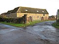
 Barn near Mariansleigh - geograph.org.uk - 642746.jpg 426 × 640; 79 KB
-
 Birch Hall Inn, Beck Hole - geograph.org.uk - 655654.jpg 640 × 430; 101 KB
-
 Black Horse Farm - geograph.org.uk - 642344.jpg 640 × 427; 76 KB
-
 Blisworth Mill and Boat Yard - geograph.org.uk - 642568.jpg 640 × 480; 61 KB
-
 Boundary Post by All Hallows Barking - geograph.org.uk - 642306.jpg 640 × 480; 70 KB
-
 Boundary Stones on Urra Moor - geograph.org.uk - 645566.jpg 480 × 608; 256 KB
-
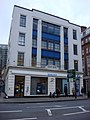
 Bournemouth, 80 Holdenhurst Road - geograph.org.uk - 644363.jpg 480 × 640; 52 KB
-
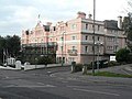 Bournemouth, Norfolk Royale Hotel - geograph.org.uk - 644344.jpg 640 × 480; 73 KB
-
 Bournemouth, Old Christchurch Lane - geograph.org.uk - 644357.jpg 640 × 480; 73 KB
-

-
 Bradford - Lister Park gates. - geograph.org.uk - 642203.jpg 640 × 480; 122 KB
-
 St Martin's Church - Haworth Road - geograph.org.uk - 642997.jpg 640 × 402; 77 KB
-
 Bridge 43 - geograph.org.uk - 644890.jpg 640 × 480; 97 KB
-
 Bugbrooke Mill and pond - geograph.org.uk - 644795.jpg 640 × 416; 132 KB
-
 Bugbrooke Mill from the south - geograph.org.uk - 644799.jpg 640 × 427; 82 KB
-
 Bugbrooke-Mill-from-the-East-by-Alan-Murray-Rust.jpg 640 × 427; 103 KB
-

-

-
 Cairn Guish summit - geograph.org.uk - 642050.jpg 640 × 480; 97 KB
-
 Carey Lane, EC2 - geograph.org.uk - 643864.jpg 640 × 480; 64 KB
-
 Caroline Street, Hull - geograph.org.uk - 642670.jpg 640 × 622; 86 KB
-
 Castleton, Derbyshire - geograph.org.uk - 681849.jpg 640 × 480; 111 KB
-
 Castleton, Derbyshire - geograph.org.uk - 682869.jpg 640 × 480; 88 KB
-
 Cattle grid on Mynydd Machen Common - geograph.org.uk - 646155.jpg 640 × 477; 72 KB
-
 Caundle Brook - geograph.org.uk - 642132.jpg 640 × 430; 158 KB
-
 Caundle Lane - geograph.org.uk - 642154.jpg 430 × 640; 57 KB
-
 Chantry Point - geograph.org.uk - 875081.jpg 640 × 480; 92 KB
-
 Chithurst Lane - geograph.org.uk - 643293.jpg 640 × 480; 126 KB
-
 Church of the Holy Cross, Crediton - geograph.org.uk - 917237.jpg 640 × 487; 56 KB
-
 Churchyard of St Anne and St Agnes - geograph.org.uk - 643325.jpg 640 × 480; 96 KB
-

-

-
 City of London Magistrates Court - geograph.org.uk - 643530.jpg 480 × 640; 55 KB
-
 City Spires - geograph.org.uk - 643594.jpg 640 × 480; 63 KB
-
 City Tavern, Trump Street - geograph.org.uk - 643681.jpg 640 × 480; 74 KB
-
 Civic Hall, Consett - geograph.org.uk - 643673.jpg 640 × 480; 86 KB
-
 Clock tower, Angel - geograph.org.uk - 726545.jpg 480 × 640; 62 KB
-
 Coal conveyor - geograph.org.uk - 642059.jpg 639 × 394; 70 KB
-

-
 Confluence of streets - geograph.org.uk - 647000.jpg 640 × 480; 149 KB
-

-
 Council House, Fountains and Ice Rink - geograph.org.uk - 642269.jpg 640 × 480; 59 KB
-

-

-
 Crown Post Office, Warwick road - geograph.org.uk - 650063.jpg 640 × 478; 316 KB
-
 Crumlin, Mural.jpg 640 × 477; 91 KB
-
 Cypress trees in Great Wood - geograph.org.uk - 641909.jpg 480 × 640; 114 KB
-
 Damp woodland at Westmuir - geograph.org.uk - 651730.jpg 426 × 640; 121 KB
-
 Delusions of Grandeur - geograph.org.uk - 642417.jpg 640 × 427; 70 KB
-
 Derelict farm building - geograph.org.uk - 642413.jpg 640 × 427; 56 KB
-
 Derwent River weir, Derbyshire - geograph.org.uk - 941733.jpg 640 × 480; 78 KB
-
 Devil's Punchbowl in Winter - geograph.org.uk - 1277102.jpg 640 × 480; 68 KB
-
 Disused quarry - geograph.org.uk - 644177.jpg 640 × 480; 58 KB
-
 Dresdner Kleinwort - geograph.org.uk - 643764.jpg 640 × 480; 82 KB
-
 Drinkall News and Delicatessen - geograph.org.uk - 642352.jpg 640 × 483; 108 KB
-
 Earl Street, Carlisle - geograph.org.uk - 750052.jpg 640 × 482; 331 KB
-

-
 Entrance to Chellow Dene - Haworth Road - geograph.org.uk - 642982.jpg 640 × 480; 164 KB
-

-
 Entrance to Nethersole Farm, Womenswold - geograph.org.uk - 644217.jpg 640 × 480; 278 KB
-
 Entrance to St Clement Eastcheap - geograph.org.uk - 642471.jpg 640 × 480; 51 KB
-
 Entrance to St Mary Aldermary - geograph.org.uk - 643606.jpg 640 × 480; 65 KB
-
 Equine patrol - geograph.org.uk - 643578.jpg 640 × 480; 80 KB
-
 Euston tube Northern Line City branch southbound.jpg 3,648 × 2,736; 4.01 MB
-
 Ex Hopper Lane Service Station - geograph.org.uk - 642225.jpg 640 × 480; 72 KB
-
 Farm road to Buckland Farm - geograph.org.uk - 641867.jpg 640 × 480; 233 KB
-
 Farmland to the north of Week - geograph.org.uk - 642806.jpg 640 × 426; 62 KB
-
 Fishing from Hythe Marina - geograph.org.uk - 646293.jpg 640 × 397; 26 KB
-
 Footbridge over the river Washburn - geograph.org.uk - 642216.jpg 640 × 480; 94 KB
-
 Footpath to Ashby Puerorum - geograph.org.uk - 642477.jpg 640 × 427; 86 KB
-
 Footpath to Smestow, Staffordshire - geograph.org.uk - 642446.jpg 518 × 640; 144 KB
-
 Footpath to Swindon, Staffordshire - geograph.org.uk - 642444.jpg 501 × 640; 138 KB
-
 Ford at the bottom of Buckham Hill - geograph.org.uk - 642775.jpg 640 × 426; 112 KB
-
 Ford near Odam Wood - geograph.org.uk - 642768.jpg 426 × 640; 115 KB
-
 Ford through the Washburn - geograph.org.uk - 642219.jpg 480 × 640; 110 KB
-
 Forest Track Through Greenhow Plantation - geograph.org.uk - 645550.jpg 640 × 427; 283 KB
-
 Forest Track Under Greenhow Bank - geograph.org.uk - 642345.jpg 427 × 640; 267 KB
-
 Former Site of St Gabriel Fenchurch - geograph.org.uk - 642382.jpg 640 × 480; 71 KB
-
 FP next to the Washburn - geograph.org.uk - 642181.jpg 480 × 640; 126 KB
-
 Getting the message across - geograph.org.uk - 663081.jpg 640 × 480; 105 KB
-
 Glentress Forest - geograph.org.uk - 725136.jpg 640 × 483; 56 KB
-
 Gnarly tree trunks - geograph.org.uk - 641907.jpg 480 × 640; 123 KB
-

-
 Goswell Road - geograph.org.uk - 726551.jpg 480 × 640; 65 KB
-
 Graveyard at St Nicholas Church - geograph.org.uk - 650093.jpg 600 × 450; 112 KB
-
 Grazing sheep - geograph.org.uk - 644270.jpg 640 × 480; 202 KB
-
 Great Chattenden Wood - geograph.org.uk - 641989.jpg 640 × 480; 169 KB
-
 Greenhow Botton - geograph.org.uk - 645561.jpg 427 × 640; 251 KB
-
 Greetham - geograph.org.uk - 642362.jpg 640 × 427; 78 KB
-
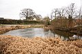
 Greetham pond - geograph.org.uk - 642357.jpg 640 × 427; 74 KB
-
 Greetham Pond - geograph.org.uk - 642359.jpg 640 × 427; 91 KB
-
 Greetham Pond - geograph.org.uk - 642360.jpg 640 × 427; 95 KB
-
 Gresham Street - geograph.org.uk - 643329.jpg 640 × 480; 82 KB
-
 Hanson Court - geograph.org.uk - 641910.jpg 640 × 480; 93 KB
-
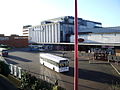 Harlow Bus Station.jpg 640 × 480; 75 KB
-
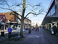 Harlow town centre -shops-28Dec2007.jpg 640 × 480; 106 KB
-
 Haworth Road Library - geograph.org.uk - 642998.jpg 640 × 449; 86 KB
-
 Haworth Road Methodist Church - geograph.org.uk - 643016.jpg 640 × 377; 63 KB
-
 High voltage power lines at Eastry, Kent - geograph.org.uk - 644201.jpg 640 × 480; 238 KB
-
 Highfield farm - geograph.org.uk - 642371.jpg 640 × 427; 67 KB
-
 Hop fields - geograph.org.uk - 644302.jpg 640 × 480; 286 KB
-
 Hope Brink to Lose Hill - geograph.org.uk - 642378.jpg 640 × 480; 63 KB
-
 Houses at Fernlea - geograph.org.uk - 643572.jpg 640 × 473; 55 KB
-
 Hythe Marina - geograph.org.uk - 646288.jpg 640 × 480; 71 KB
-
 Hythe Marina Lock - geograph.org.uk - 646263.jpg 640 × 480; 83 KB
-
 Hythe Pier - geograph.org.uk - 646283.jpg 640 × 480; 53 KB
-
 Impressive canopy in Guildhall Yard - geograph.org.uk - 643744.jpg 640 × 480; 65 KB
-
 Ingleby Incline (1) - geograph.org.uk - 642812.jpg 640 × 364; 201 KB
-
 Ingleby Incline (10) - geograph.org.uk - 643015.jpg 427 × 640; 266 KB
-
 Ingleby Incline (11) - geograph.org.uk - 643018.jpg 427 × 640; 259 KB
-
 Ingleby Incline (12) - geograph.org.uk - 643029.jpg 640 × 427; 256 KB
-
 Ingleby Incline (2) - geograph.org.uk - 642817.jpg 640 × 427; 269 KB
-
 Ingleby Incline (3) - geograph.org.uk - 642819.jpg 640 × 427; 278 KB
-
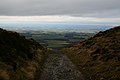 Ingleby Incline (4) - geograph.org.uk - 642832.jpg 640 × 427; 221 KB
-
 Ingleby Incline (5) - geograph.org.uk - 643003.jpg 427 × 640; 296 KB
-
 Ingleby Incline (6) - geograph.org.uk - 643005.jpg 640 × 392; 251 KB
-
 Ingleby Incline (7) - geograph.org.uk - 643006.jpg 427 × 640; 301 KB
-
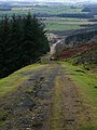 Ingleby Incline (8) - geograph.org.uk - 643011.jpg 482 × 640; 304 KB
-
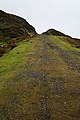 Ingleby Incline (9) - geograph.org.uk - 643013.jpg 427 × 640; 297 KB
-
 Interior of St Bartholomew the Less - geograph.org.uk - 643124.jpg 640 × 480; 73 KB
-
 Interior of the Skyline Pavilion - geograph.org.uk - 655651.jpg 640 × 480; 367 KB
-
 Kiddi Creche - Cottingley New Road - geograph.org.uk - 642913.jpg 640 × 417; 98 KB
-

-
 King's Street, Sandwich - geograph.org.uk - 646966.jpg 640 × 480; 165 KB
-
 Kissing gate on footpath to Bridge - geograph.org.uk - 644303.jpg 480 × 640; 386 KB
-
 Landscape with Bugbrooke Mill - geograph.org.uk - 644790.jpg 640 × 427; 88 KB
-
 Large barn - geograph.org.uk - 643140.jpg 640 × 480; 172 KB
-
 Lift at London Wall - geograph.org.uk - 643165.jpg 480 × 640; 100 KB
-

-
 Lloyds TSB in Gresham Street - geograph.org.uk - 643838.jpg 640 × 480; 97 KB
-
 Looking down towards St Mary-at-Hill - geograph.org.uk - 642412.jpg 640 × 480; 65 KB
-
 Looking down Tower Street - geograph.org.uk - 642403.jpg 640 × 480; 65 KB
-
 Looking down Watling Street - geograph.org.uk - 643633.jpg 640 × 480; 65 KB
-
 Looking eastwards down Gresham Street - geograph.org.uk - 643715.jpg 640 × 480; 76 KB
-

-
 Looking south east towards St Magnus - geograph.org.uk - 642441.jpg 640 × 480; 78 KB
-
 Looking towards Lag Buidhe - geograph.org.uk - 642308.jpg 640 × 480; 88 KB
-
 Looking westwards along Eastcheap - geograph.org.uk - 642405.jpg 640 × 480; 67 KB
-

-

-
 M1 Viaduct over the River Nene.jpg 640 × 480; 93 KB
-
 Mains of Abergeldie. - geograph.org.uk - 662151.jpg 640 × 290; 54 KB
-
 Mallyan Spout - geograph.org.uk - 1671886.jpg 480 × 640; 85 KB
-
 Mallyan Spout - geograph.org.uk - 655264.jpg 430 × 640; 115 KB
-
 Mallyan Spout - geograph.org.uk - 655268.jpg 430 × 640; 122 KB
-
 Manor Community College.jpg 640 × 480; 63 KB
-
 Market Street, Sandwich - geograph.org.uk - 647005.jpg 640 × 480; 171 KB
-
 Midnight Farm - geograph.org.uk - 645555.jpg 640 × 427; 246 KB
-
 Military Cemetery at Kilchoman - geograph.org.uk - 1062594.jpg 640 × 427; 93 KB
-
 Mill Race and FP - geograph.org.uk - 642191.jpg 480 × 640; 120 KB
-
 Mincing Lane - geograph.org.uk - 642377.jpg 640 × 480; 73 KB
-
 Mole hills - geograph.org.uk - 643182.jpg 640 × 480; 268 KB
-
 Monkwell Square - geograph.org.uk - 643311.jpg 480 × 640; 77 KB
-
 Moor Cottage - geograph.org.uk - 642087.jpg 640 × 480; 85 KB
-
 Moorland above Risca - geograph.org.uk - 645385.jpg 640 × 477; 74 KB
-
 Mount Lodge - geograph.org.uk - 641971.jpg 640 × 463; 152 KB
-
 Muddy gateway - geograph.org.uk - 644825.jpg 465 × 640; 138 KB
-

-

-
-
 Near Bugbrooke Mill - geograph.org.uk - 644847.jpg 640 × 480; 77 KB
-
 Near Bugbrooke Mill - geograph.org.uk - 644849.jpg 640 × 480; 79 KB
-
 Near the summit of Cairn Guish - geograph.org.uk - 642072.jpg 640 × 480; 79 KB
-
 New Development - Airedale Avenue - geograph.org.uk - 642929.jpg 640 × 411; 74 KB
-
 New Sheepfold Farm - geograph.org.uk - 645558.jpg 427 × 640; 285 KB
-
 Newbridge, Older housing.jpg 640 × 477; 61 KB
-

-
 Obelisk in Monkwell Square - geograph.org.uk - 643310.jpg 640 × 480; 94 KB
-
 Ochrelands Farm, Hexham - geograph.org.uk - 646732.jpg 480 × 640; 86 KB
-
 Old and new Crumlin - geograph.org.uk - 643600.jpg 640 × 477; 83 KB
-
 Old Mill in Crumlin - geograph.org.uk - 646173.jpg 640 × 477; 64 KB
-
 Old Road - geograph.org.uk - 642391.jpg 640 × 427; 69 KB
-
 Old road waymark - geograph.org.uk - 642384.jpg 640 × 427; 76 KB
-
 Old Sheepfold Farm - geograph.org.uk - 645546.jpg 640 × 427; 254 KB
-


_-_geograph.org.uk_-_644360.jpg)


_-_geograph.org.uk_-_642812.jpg)
_-_geograph.org.uk_-_643015.jpg)
_-_geograph.org.uk_-_643018.jpg)
_-_geograph.org.uk_-_643029.jpg)
_-_geograph.org.uk_-_642817.jpg)
_-_geograph.org.uk_-_642819.jpg)
_-_geograph.org.uk_-_642832.jpg)
_-_geograph.org.uk_-_643003.jpg)
_-_geograph.org.uk_-_643005.jpg)
_-_geograph.org.uk_-_643006.jpg)
_-_geograph.org.uk_-_643011.jpg)
_-_geograph.org.uk_-_643013.jpg)


