Category:United Kingdom photographs taken on 2007-11-17
Jump to navigation
Jump to search
Countries of Europe: Belgium · Bulgaria · Czech Republic · Finland · France‡ · Georgia‡ · Germany · Italy · Latvia · Monaco · Netherlands‡ · Norway · Poland · Portugal‡ · Russia‡ · Slovakia · Spain‡ · Sweden · Switzerland · Turkey‡ · Ukraine · United Kingdom
‡: partly located in Europe
‡: partly located in Europe
| ← | 17 November 2007 | → | ||
| ← | November 2007 | → | ||

United Kingdom photographs taken on 17 November 2007.
Image files should be categorized here automatically using {{taken on}} template. Direct categorisation is also possible, if automatic is impossible.
Subcategories
This category has the following 3 subcategories, out of 3 total.
Media in category "United Kingdom photographs taken on 2007-11-17"
The following 200 files are in this category, out of 368 total.
(previous page) (next page)-
 3D map of Helmsley Castle - geograph.org.uk - 615680.jpg 640 × 427; 94 KB
-
-
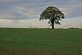
 A Venerable Oak, Duncombe Park - geograph.org.uk - 615990.jpg 640 × 427; 113 KB
-

-
 Alfred McAlpine Stand.png 991 × 692; 1.57 MB
-
 All Saints Church 01.jpg 427 × 640; 89 KB
-

-

-
 All Saints, Rockland All Saints, Norfolk - Font - geograph.org.uk - 1704763.jpg 706 × 1,000; 126 KB
-
 All Saints, Rockland All Saints, Norfolk - geograph.org.uk - 1704747.jpg 1,000 × 710; 166 KB
-
 All Saints, Rockland All Saints, Norfolk - geograph.org.uk - 1704759.jpg 1,000 × 749; 278 KB
-
 All Saints, Rockland All Saints, Norfolk - geograph.org.uk - 1704760.jpg 753 × 1,000; 176 KB
-

-
-
 All Saints, Rockland All Saints, Norfolk - Porch - geograph.org.uk - 1704748.jpg 1,000 × 739; 265 KB
-

-

-

-

-
 Approaching the Jubilee Tower - geograph.org.uk - 615030.jpg 640 × 480; 57 KB
-
-
 Ash tree, Risby, winter version - geograph.org.uk - 614490.jpg 640 × 513; 188 KB
-
 Autherd Garth, Walkington - geograph.org.uk - 614454.jpg 640 × 480; 179 KB
-
 Autumn on the Curly Wyrley - geograph.org.uk - 614723.jpg 640 × 480; 212 KB
-
 Bandstand near the 'Boatfloat' - geograph.org.uk - 932760.jpg 480 × 640; 68 KB
-
 Bayards Castle - geograph.org.uk - 932751.jpg 640 × 480; 70 KB
-
 Beeston Brook - geograph.org.uk - 653317.jpg 640 × 426; 312 KB
-
 Beverley 20 footpath near Walkington - geograph.org.uk - 614479.jpg 640 × 480; 199 KB
-
 Blanchland Abbey - geograph.org.uk - 615216.jpg 640 × 427; 62 KB
-
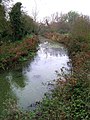 Blyth River at Halesworth - geograph.org.uk - 614546.jpg 480 × 640; 111 KB
-
 Boo^ - Easter Loch, Uyeasound - geograph.org.uk - 614474.jpg 640 × 426; 43 KB
-
 Bridge over the Mill Avon - geograph.org.uk - 614655.jpg 640 × 480; 113 KB
-
 Bridleway and Field, Wrickton, Shropshire - geograph.org.uk - 617663.jpg 640 × 440; 123 KB
-
 Bridleway to Cardwell's farm - geograph.org.uk - 653333.jpg 640 × 426; 237 KB
-
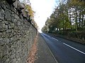
 Brighouse and Denholme Road - geograph.org.uk - 614630.jpg 640 × 380; 21 KB
-

-

-
 Broadway Road, Winchcombe - geograph.org.uk - 616944.jpg 640 × 480; 143 KB
-
 Calder Canal, Wakefield - geograph.org.uk - 926680.jpg 640 × 480; 70 KB
-
 Calder Canal, Wakefield - geograph.org.uk - 926686.jpg 640 × 480; 77 KB
-
 Caravan site at High Cross - geograph.org.uk - 616886.jpg 640 × 416; 84 KB
-
 Castle Street, Winchcombe - geograph.org.uk - 616945.jpg 640 × 480; 157 KB
-
 Cherry Orchard Farm, Barlby - geograph.org.uk - 615622.jpg 640 × 441; 77 KB
-
 Chimney at Glusburn mill - geograph.org.uk - 1250431.jpg 479 × 640; 47 KB
-
 Chimney at Glusburn mill - geograph.org.uk - 1250441.jpg 479 × 640; 47 KB
-
 Claybrooke Water Mill - geograph.org.uk - 616920.jpg 640 × 398; 77 KB
-
 Cleek Hall - geograph.org.uk - 615626.jpg 640 × 463; 59 KB
-
 Clifton Street - geograph.org.uk - 614841.jpg 640 × 480; 29 KB
-
 Coal-fired sunset - geograph.org.uk - 616311.jpg 640 × 437; 36 KB
-
 Cock Hill old Quarries - geograph.org.uk - 614968.jpg 640 × 480; 77 KB
-
 Coleshill Road - geograph.org.uk - 619977.jpg 640 × 480; 70 KB
-
 Coppleflat Lane in the gloaming - geograph.org.uk - 614544.jpg 640 × 490; 159 KB
-
-
 Cragg Lane - geograph.org.uk - 614624.jpg 640 × 420; 32 KB
-
 Crich Tram Museum, 17 November 2007 (1).jpg 2,048 × 1,536; 550 KB
-
 Crich Tram Museum, 17 November 2007 (2).jpg 1,763 × 2,048; 1.01 MB
-
 Crich Tram Museum, 17 November 2007 (3).jpg 2,048 × 1,536; 713 KB
-
 Crich Tram Museum, 17 November 2007 (4).jpg 2,048 × 1,915; 913 KB
-
 Crich Tram Museum, 17 November 2007 (5).jpg 2,048 × 1,536; 535 KB
-
 Crop of Maize, Near Griff - geograph.org.uk - 615899.jpg 640 × 427; 69 KB
-
 Crossing-Gate Keeper's Cottage - geograph.org.uk - 615350.jpg 640 × 480; 110 KB
-
 Culter House front entrance - geograph.org.uk - 615071.jpg 620 × 465; 244 KB
-
 Dead tree, Risby Park - geograph.org.uk - 614539.jpg 455 × 640; 151 KB
-

-
 Drax Power Station - geograph.org.uk - 615628.jpg 640 × 393; 34 KB
-
 Dunton Road in Leire, Leicestershire - geograph.org.uk - 617580.jpg 495 × 640; 92 KB
-

-
 Ei-max (2038683603).jpg 1,600 × 818; 1.04 MB
-
 Entrance to Claybrooke Lodge - geograph.org.uk - 616219.jpg 640 × 450; 69 KB
-
 Exeter, Cathedral Yard - geograph.org.uk - 614858.jpg 640 × 427; 178 KB
-
 Exeter, near Broadgate - geograph.org.uk - 614855.jpg 640 × 427; 171 KB
-
 Exeter, towards Cathedral Close - geograph.org.uk - 614860.jpg 640 × 427; 181 KB
-
 Expansion of Mochdre Business Park - geograph.org.uk - 614269.jpg 640 × 468; 102 KB
-
 Fair View - geograph.org.uk - 653326.jpg 640 × 430; 161 KB
-

-
 Farmland near Lower Faintree, Shropshire - geograph.org.uk - 617702.jpg 640 × 428; 122 KB
-
 Farmland near The Down, Shropshire - geograph.org.uk - 614418.jpg 640 × 431; 133 KB
-
 Fascination Place - Mill Lane - geograph.org.uk - 614819.jpg 640 × 409; 26 KB
-
 Ferry leaves for Kingswear - geograph.org.uk - 932753.jpg 640 × 480; 76 KB
-

-
 Fleetwood Hall farm - geograph.org.uk - 653327.jpg 640 × 426; 191 KB
-
 Footbridge, River Meig - geograph.org.uk - 623370.jpg 640 × 480; 115 KB
-
 Footpath across the meadow - geograph.org.uk - 653323.jpg 640 × 350; 169 KB
-
 Footpath Bridge - geograph.org.uk - 616047.jpg 640 × 480; 139 KB
-

-

-
 Forestry Track near Glen Buidhe - geograph.org.uk - 618539.jpg 640 × 427; 270 KB
-
 Former brewery, Tewkesbury - geograph.org.uk - 614657.jpg 640 × 480; 127 KB
-

-
-

-
 Frolesworth Road bridge - geograph.org.uk - 618533.jpg 640 × 480; 102 KB
-

-
 Frolesworth.jpg 640 × 397; 88 KB
-
 Gated entrance to West Lodge - geograph.org.uk - 615100.jpg 2,610 × 1,958; 6.63 MB
-
 George V Postbox, Malham - geograph.org.uk - 614990.jpg 683 × 1,024; 170 KB
-
 Glan Conwy Railway Station - geograph.org.uk - 614298.jpg 640 × 480; 53 KB
-
 Goodwin House - Minstrel Drive - geograph.org.uk - 614833.jpg 640 × 480; 36 KB
-
 Gorsedd stone circle, Tredegar House Park - geograph.org.uk - 616774.jpg 640 × 480; 165 KB
-
 Granite Sculpture. - geograph.org.uk - 614787.jpg 480 × 640; 129 KB
-
 Greenbelt under threat - geograph.org.uk - 619275.jpg 640 × 480; 84 KB
-
 St Mary's Church, Hemingbrough - geograph.org.uk - 616267.jpg 460 × 640; 70 KB
-
 Hemingbrough Water Tower - geograph.org.uk - 616275.jpg 640 × 479; 63 KB
-
 High Cross - geograph.org.uk - 616889.jpg 640 × 463; 82 KB
-
 High Street, Winchcombe - geograph.org.uk - 616946.jpg 640 × 480; 144 KB
-
 Hobson's Brook - geograph.org.uk - 619135.jpg 640 × 480; 149 KB
-
 Holy Trinity Church, Tewkesbury - geograph.org.uk - 614651.jpg 469 × 640; 107 KB
-
 Holy Trinity, Short Heath - geograph.org.uk - 614779.jpg 640 × 480; 357 KB
-
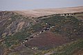
 Hope from Bolberry Down - geograph.org.uk - 932773.jpg 640 × 221; 21 KB
-
 Hougomont - off Low Lane - geograph.org.uk - 614648.jpg 640 × 495; 35 KB
-
 Houses on Swanland Road, Hessle - geograph.org.uk - 614865.jpg 640 × 472; 86 KB
-
 Jubilee Walk near Leire - geograph.org.uk - 617576.jpg 640 × 414; 103 KB
-
 Junction of Roach Road and Firwood Lane - geograph.org.uk - 653335.jpg 640 × 426; 240 KB
-
 Kearns Mill - geograph.org.uk - 614966.jpg 640 × 480; 97 KB
-
 Kippie Lodge Sports and Country Club - geograph.org.uk - 615113.jpg 620 × 465; 193 KB
-
 Larch tree by the Oxnam Water - geograph.org.uk - 615378.jpg 640 × 480; 171 KB
-
 Leire Road bridge - geograph.org.uk - 617574.jpg 640 × 486; 130 KB
-
 Leire Road towards Leire - geograph.org.uk - 617572.jpg 640 × 401; 81 KB
-
 Leverhulme Drive - geograph.org.uk - 1246916.jpg 640 × 429; 84 KB
-
 Looking south west from Top Lock - geograph.org.uk - 1094365.jpg 640 × 480; 51 KB
-
 Low Lane - off Pit Lane - geograph.org.uk - 614645.jpg 640 × 355; 19 KB
-
 Ludwig Wittgenstein, Storey's Way, Cambridge.jpg 523 × 419; 111 KB
-
 M42 bridge - geograph.org.uk - 614952.jpg 640 × 480; 67 KB
-
 Manor Road, Solihull - geograph.org.uk - 614619.jpg 640 × 429; 88 KB
-
 Meet me at St Pancras.JPG 620 × 1,188; 305 KB
-

-
 Moel y Gaer - geograph.org.uk - 615021.jpg 640 × 480; 49 KB
-
 Moor Street - geograph.org.uk - 614840.jpg 640 × 438; 33 KB
-
 Mossy Bank Close - geograph.org.uk - 614831.jpg 640 × 392; 24 KB
-

-
-
 Mute Swan, Ernesettle, Plymouth - geograph.org.uk - 1144021.jpg 640 × 432; 93 KB
-
 New Hall - geograph.org.uk - 614317.jpg 640 × 472; 92 KB
-
 Northgate, Walkington - geograph.org.uk - 614441.jpg 640 × 480; 173 KB
-
 Notice the interesting things - geograph.org.uk - 614423.jpg 640 × 480; 73 KB
-
 Nottingham Corner house - geograph.org.uk - 1311651.jpg 640 × 480; 60 KB
-
 Old Guy Road - geograph.org.uk - 614814.jpg 640 × 480; 24 KB
-
 Old road sign - geograph.org.uk - 653329.jpg 640 × 522; 319 KB
-
 Old School Gardens, Llanteg - geograph.org.uk - 1048955.jpg 640 × 434; 93 KB
-
 Old Weir on River Darwen - geograph.org.uk - 653311.jpg 640 × 426; 224 KB
-
 Open Barn, Middleton Scriven, Shropshire - geograph.org.uk - 617707.jpg 640 × 436; 124 KB
-
 Our Lady of Lourdes RC Church Hessle.jpg 640 × 527; 106 KB
-
-
 Park Buildings, Duncombe Park - geograph.org.uk - 615992.jpg 640 × 427; 84 KB
-
 Part of Brooklands motor circuit - geograph.org.uk - 614509.jpg 640 × 426; 78 KB
-
 Passenger Ferry Landing Stage - geograph.org.uk - 932757.jpg 640 × 375; 62 KB
-
 Pasture West of Helmsley - geograph.org.uk - 615684.jpg 640 × 427; 51 KB
-
 Pheasant Beware, Shropshire - geograph.org.uk - 615718.jpg 640 × 454; 139 KB
-

-
 Queensbury House - Nelson Street - geograph.org.uk - 614836.jpg 640 × 543; 29 KB
-
 Queensbury Music Centre - Albert Road - geograph.org.uk - 614835.jpg 640 × 455; 22 KB
-

-
 Red Rock arch - panoramio.jpg 2,048 × 1,536; 857 KB
-
 River Calder, Wakefield - geograph.org.uk - 926690.jpg 640 × 480; 42 KB
-
 River Darwen - geograph.org.uk - 653338.jpg 640 × 480; 246 KB
-
 River Derwent, South Duffield Ings - geograph.org.uk - 616303.jpg 640 × 448; 95 KB
-
 Road into Alvecote - geograph.org.uk - 614945.jpg 640 × 480; 68 KB
-

-

-

-
-
 Saturday market, Tewkesbury - geograph.org.uk - 614649.jpg 640 × 480; 112 KB
-
 Seven Star Road, Solihull - geograph.org.uk - 614615.jpg 640 × 429; 79 KB
-
 Sharket Head Close - Albert Road - geograph.org.uk - 614843.jpg 640 × 391; 24 KB
-

-
 Short Heath Medical Centre - geograph.org.uk - 614758.jpg 640 × 480; 308 KB
-
 Shropshire Farmland by Middleton Scriven - geograph.org.uk - 615848.jpg 640 × 393; 102 KB
-

-

-
 St John's, Broughton.jpg 3,072 × 2,304; 2.38 MB
-
 Station Theatre - geograph.org.uk - 615346.jpg 640 × 480; 53 KB
-
 Swanland Road, Hessle - geograph.org.uk - 614304.jpg 640 × 480; 87 KB
-

-
 The Avenue - geograph.org.uk - 614328.jpg 640 × 480; 64 KB
-

-
 The Belfast Road, Newry - geograph.org.uk - 614414.jpg 640 × 385; 80 KB
-
 The Chapel of St Nicholas, Langstone - geograph.org.uk - 615355.jpg 640 × 480; 60 KB
-
 The Dog and Duck Walkington.jpg 640 × 480; 159 KB
-
 The Higher Ferry - geograph.org.uk - 932765.jpg 640 × 480; 62 KB
-
 The Holly Bush, Ashby Parva - geograph.org.uk - 618521.jpg 640 × 427; 47 KB
-
 The Library, Tewkesbury - geograph.org.uk - 614647.jpg 640 × 480; 88 KB
-
 The Lodge - Mill Lane - geograph.org.uk - 614822.jpg 640 × 452; 36 KB
-
 The new Newry bypass (10) - geograph.org.uk - 614427.jpg 640 × 428; 90 KB
-
 The new Newry bypass (9) - geograph.org.uk - 614421.jpg 640 × 428; 87 KB
-
 The Oxnam Water - geograph.org.uk - 615390.jpg 640 × 480; 144 KB
-
 The Sir Isaac Newton, Castle Street - geograph.org.uk - 614429.jpg 640 × 477; 73 KB
-
 The view north from Bream Cenotaph - geograph.org.uk - 768527.jpg 640 × 447; 23 KB
-
 The'Boatfloat' - geograph.org.uk - 932761.jpg 640 × 480; 87 KB
-
 Timber framed cottages, Tewkesbury - geograph.org.uk - 614633.jpg 640 × 480; 144 KB
-
 Towards Bolt Head from Bolberry Down - geograph.org.uk - 932770.jpg 640 × 480; 57 KB
-
 Tredegar House2.jpg 640 × 480; 153 KB
-
 Tredegar Park.jpg 640 × 480; 98 KB
-
 Trees in a Cropfield, Shropshire - geograph.org.uk - 617703.jpg 640 × 480; 122 KB
-

-
 Turkeys for christmas - geograph.org.uk - 618547.jpg 608 × 640; 100 KB
-
 View of lake from road - geograph.org.uk - 618572.jpg 640 × 533; 91 KB
-
 All Hallows Church, Walkington - geograph.org.uk - 614424.jpg 492 × 640; 186 KB
-
 Walkington hens - geograph.org.uk - 614446.jpg 455 × 640; 186 KB
-
 Waterfall on River Darwen - geograph.org.uk - 653307.jpg 640 × 426; 258 KB
-
 Welcome to Leire - geograph.org.uk - 617582.jpg 640 × 412; 83 KB


.jpg)
.jpg)
.jpg)
.jpg)
.jpg)


.jpg)


_-_geograph.org.uk_-_614427.jpg)
_-_geograph.org.uk_-_614421.jpg)


