Category:United Kingdom photographs taken on 2007-10-12
Jump to navigation
Jump to search
Countries of Europe: Belgium · Bosnia and Herzegovina · Bulgaria · Denmark · France‡ · Germany · Greece · Hungary · Republic of Ireland · Italy · Netherlands‡ · Norway · Portugal‡ · Romania · Russia‡ · Slovakia · Spain‡ · Sweden · Switzerland · Turkey‡ · Ukraine · United Kingdom
‡: partly located in Europe
‡: partly located in Europe
| ← | 12 October 2007 | → | ||
| ← | October 2007 | → | ||

United Kingdom photographs taken on 12 October 2007.
Image files should be categorized here automatically using {{taken on}} template. Direct categorisation is also possible, if automatic is impossible.
Subcategories
This category has the following 3 subcategories, out of 3 total.
L
Media in category "United Kingdom photographs taken on 2007-10-12"
The following 200 files are in this category, out of 509 total.
(previous page) (next page)-
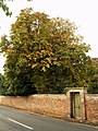 A Hedon Horse Chestnut Tree - geograph.org.uk - 582559.jpg 480 × 640; 138 KB
-

-

-
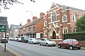
 Aldi Supermarket, Garth Road - geograph.org.uk - 585034.jpg 640 × 480; 77 KB
-
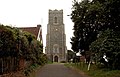
 All Saints Church Market Weighton.jpg 640 × 480; 88 KB
-

-
-
 Almshouses, Bedworth - geograph.org.uk - 583156.jpg 640 × 427; 155 KB
-
 Almshouses, Bedworth - geograph.org.uk - 583160.jpg 640 × 427; 147 KB
-
 Almshouses, Bedworth.jpg 640 × 427; 335 KB
-
 Alnwick Garden - geograph.org.uk - 989384.jpg 640 × 480; 140 KB
-
 An antique crane at Porth Penrhyn - geograph.org.uk - 583671.jpg 640 × 395; 51 KB
-

-
 Assize Court buildings at Lincoln Castle.jpg 3,443 × 2,292; 6.93 MB
-

-
-
 Barclays Bank, Baker Street - geograph.org.uk - 583642.jpg 640 × 480; 94 KB
-
 Remember Them - geograph.org.uk - 743225.jpg 1,744 × 1,308; 2.14 MB
-
 Remember Them - geograph.org.uk - 743252.jpg 640 × 480; 94 KB
-
 Royal Air Force - geograph.org.uk - 743289.jpg 640 × 480; 156 KB
-
 Royal Australian Air Force - geograph.org.uk - 743282.jpg 640 × 480; 136 KB
-
 Royal Canadian Air Force - geograph.org.uk - 743271.jpg 640 × 480; 117 KB
-
 Royal New Zealand Air Force - geograph.org.uk - 743301.jpg 640 × 480; 135 KB
-
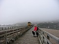 Barmouth Bridge - geograph.org.uk - 1300696.jpg 640 × 480; 45 KB
-
 Bascule Bridge, Shadwell - geograph.org.uk - 583352.jpg 640 × 480; 87 KB
-
 Bay head east of Porth Penrhyn - geograph.org.uk - 584269.jpg 640 × 480; 79 KB
-
 Bedworth Civic Hall - geograph.org.uk - 583144.jpg 640 × 427; 83 KB
-
 Bedworth Co-Op Buildings - geograph.org.uk - 583147.jpg 640 × 381; 80 KB
-
 Bedworth Cricket Club - geograph.org.uk - 583125.jpg 640 × 427; 67 KB
-
 Bedworth Rail Station - geograph.org.uk - 583090.jpg 640 × 427; 122 KB
-
 Bedworth Town Centre - geograph.org.uk - 583196.jpg 640 × 427; 108 KB
-

-
 BedworthOval.jpg 640 × 427; 86 KB
-
 Beech trees near Banstead Wood - geograph.org.uk - 583966.jpg 480 × 640; 132 KB
-
 Beeches on edge of Banstead Wood - geograph.org.uk - 583794.jpg 640 × 480; 141 KB
-

-
 Bentley Brook 583793 b2b4aa67.jpg 3,445 × 1,935; 1.8 MB
-
 Berrybrook Meadow, Exminster - geograph.org.uk - 949559.jpg 640 × 480; 80 KB
-

-
 Blandford Street - geograph.org.uk - 585108.jpg 640 × 480; 95 KB
-
 Booths Bridge and Glovers Court - geograph.org.uk - 583480.jpg 640 × 480; 221 KB
-
 Bournemouth , Ensbury Park - geograph.org.uk - 1119505.jpg 640 × 480; 57 KB
-
 Brent Tor across the Fields - geograph.org.uk - 932032.jpg 640 × 480; 47 KB
-
 Brentor Church from below - geograph.org.uk - 932035.jpg 640 × 480; 43 KB
-
 Bressay Memorial Cairn.jpg 408 × 618; 84 KB
-
 Bressay Taing of Ham.jpg 640 × 429; 70 KB
-

-
 Bridge Street, Chester - geograph.org.uk - 1082658.jpg 640 × 481; 130 KB
-
 Bridge, Central Six Retail Park - geograph.org.uk - 583354.jpg 640 × 427; 87 KB
-
 Broomfleet Hope - geograph.org.uk - 584767.jpg 467 × 640; 93 KB
-
 Broomfleet Island - geograph.org.uk - 584769.jpg 640 × 479; 82 KB
-
 Broomfleet Island - geograph.org.uk - 584771.jpg 640 × 480; 100 KB
-
 Bryanston Street - geograph.org.uk - 585085.jpg 640 × 480; 108 KB
-
 Building site, Wester Cowden - geograph.org.uk - 582468.jpg 640 × 480; 72 KB
-
 Bulkington Road, Bedworth - geograph.org.uk - 583093.jpg 640 × 427; 79 KB
-
 Burial Ground, Killundine River - geograph.org.uk - 879994.jpg 640 × 427; 116 KB
-
 Butley - Butley Abbey.jpg 640 × 480; 94 KB
-
 Campsie Road, Omagh - geograph.org.uk - 582995.jpg 640 × 267; 35 KB
-
 Catesby Road, Radford, Coventry - geograph.org.uk - 583249.jpg 640 × 427; 81 KB
-
 Caulfield's shop - geograph.org.uk - 582540.jpg 640 × 480; 53 KB
-
 Cemetery, Coventry Road, Bedworth - geograph.org.uk - 583140.jpg 640 × 427; 166 KB
-
 Centary Methodist Church, Scunthorpe - geograph.org.uk - 586050.jpg 640 × 441; 92 KB
-
 Central Six Retail Park, Coventry - geograph.org.uk - 583360.jpg 640 × 427; 94 KB
-

-
 Centre Court Shopping Centre, Wimbledon - geograph.org.uk - 583554.jpg 480 × 640; 101 KB
-

-
 Chapel Lane - geograph.org.uk - 582527.jpg 640 × 480; 78 KB
-
 Cherry Burton Post Office - geograph.org.uk - 590220.jpg 640 × 480; 124 KB
-

-
 Chester Weir - geograph.org.uk - 833241.jpg 640 × 481; 99 KB
-
 Chilbolton - Fungi - geograph.org.uk - 608104.jpg 640 × 480; 116 KB
-
 Chilbolton - Tree and Dish - geograph.org.uk - 608099.jpg 640 × 480; 92 KB
-
 Chipstead Station Parade - geograph.org.uk - 583754.jpg 640 × 406; 102 KB
-
 Christ Church, Cubitt Town - geograph.org.uk - 583408.jpg 640 × 480; 94 KB
-

-

-

-

-

-
 Cleveland Road - geograph.org.uk - 583042.jpg 640 × 480; 82 KB
-
 Coal tax post - geograph.org.uk - 583991.jpg 480 × 640; 128 KB
-
 Coal tax post - geograph.org.uk - 584125.jpg 480 × 640; 98 KB
-
 Coventry Building Society - geograph.org.uk - 583431.jpg 640 × 427; 79 KB
-
 Crabley Creek, Broomfleet Island - geograph.org.uk - 584776.jpg 640 × 453; 56 KB
-
-
 Cream Telephone Box, Molescroft - geograph.org.uk - 590763.jpg 480 × 640; 148 KB
-
 Crich Penfold.JPG 1,944 × 2,592; 1.97 MB
-
 Crick-Grand Union Canal - geograph.org.uk - 583831.jpg 640 × 480; 145 KB
-
 Crick-United Reformed Church - geograph.org.uk - 582669.jpg 640 × 480; 93 KB
-
 Culbin Bar - geograph.org.uk - 617281.jpg 640 × 480; 58 KB
-
 Dale Street, Scunthorpe - geograph.org.uk - 586096.jpg 640 × 426; 106 KB
-
 Dalkeith.jpg 620 × 407; 72 KB
-
 St. Barnabas Centre, Danesmoor - geograph.org.uk - 583319.jpg 640 × 360; 65 KB
-
 Dartmouth Castle - geograph.org.uk - 1092704.jpg 640 × 480; 64 KB
-
 Date detail, Moseley Avenue - geograph.org.uk - 583345.jpg 640 × 427; 73 KB
-
 Deadmans Cove from Blackstone Point - geograph.org.uk - 1092708.jpg 640 × 480; 68 KB
-
 Devonshire Arms, Duke Street - geograph.org.uk - 583613.jpg 480 × 640; 119 KB
-
 Dickies Yacht Brokers, Beach Road - geograph.org.uk - 584957.jpg 640 × 480; 60 KB
-
 Disused Factory Units, Cannon Park - geograph.org.uk - 586084.jpg 640 × 384; 55 KB
-
 Door, St Mary's Church, Brandesburton - geograph.org.uk - 591142.jpg 480 × 640; 74 KB
-
 Doorway of Brentor Church - geograph.org.uk - 932043.jpg 480 × 640; 91 KB
-
 Doorway, St Mary's Church, Brandesburton - geograph.org.uk - 591117.jpg 480 × 640; 135 KB
-
 Dorcan Stream in Covingham, Swindon - geograph.org.uk - 583846.jpg 640 × 480; 136 KB
-
 Dorset Street - geograph.org.uk - 585092.jpg 640 × 480; 111 KB
-
 Down-platform at Stonehaven Station. - geograph.org.uk - 582484.jpg 640 × 480; 80 KB
-
 Dumpers again - geograph.org.uk - 582536.jpg 640 × 480; 98 KB
-
 Eastgate Street - geograph.org.uk - 1082626.jpg 640 × 627; 136 KB
-
 Eastgate Street - geograph.org.uk - 1082634.jpg 640 × 530; 153 KB
-
 Engleton Road from Radford Common - geograph.org.uk - 583305.jpg 640 × 427; 113 KB
-

-
 Exminster village - east end. - geograph.org.uk - 949554.jpg 640 × 480; 72 KB
-
 Farm track 2 Km west of Red House Farm - geograph.org.uk - 583639.jpg 640 × 480; 142 KB
-
 Farmland at Easter Langlee, Galashiels - geograph.org.uk - 1561640.jpg 640 × 480; 148 KB
-
 Fish and Chip Shop, Brandesburton - geograph.org.uk - 591038.jpg 640 × 480; 109 KB
-
 Fishing boats at Porth Penrhyn - geograph.org.uk - 583124.jpg 640 × 480; 55 KB
-
 Floral Water Jug, Bedworth Town Centre - geograph.org.uk - 583169.jpg 640 × 427; 152 KB
-

-
 Footpath crossroads - geograph.org.uk - 583745.jpg 640 × 480; 155 KB
-
 Former hospital - geograph.org.uk - 582480.jpg 640 × 480; 85 KB
-
 Former Topshops, Bedworth - geograph.org.uk - 583132.jpg 640 × 427; 114 KB
-
 Fox and Coney, South Cave - geograph.org.uk - 590042.jpg 640 × 480; 115 KB
-
 Frodingham Motor Spares, Scunthorpe - geograph.org.uk - 585378.jpg 640 × 385; 89 KB
-
 Front Street Court - geograph.org.uk - 582532.jpg 640 × 408; 62 KB
-
 Front Street, Middleton-on-the-Wolds - geograph.org.uk - 582510.jpg 640 × 480; 78 KB
-
 Galls on Meadowsweet - geograph.org.uk - 928368.jpg 640 × 480; 82 KB
-
 George Street - geograph.org.uk - 583663.jpg 640 × 480; 89 KB
-
 George Street, looking west - geograph.org.uk - 585100.jpg 640 × 480; 91 KB
-
 GNER direct service to Kings Cross - geograph.org.uk - 582489.jpg 640 × 480; 94 KB
-

-
 Gowkshill - geograph.org.uk - 582539.jpg 640 × 480; 60 KB
-
 Grand Cascade, Alnwick Garden - geograph.org.uk - 989393.jpg 640 × 480; 62 KB
-
 Grey Heron on the Trent and Mersey Canal - geograph.org.uk - 600888.jpg 640 × 640; 160 KB
-
 Grosvenor Park - geograph.org.uk - 833267.jpg 640 × 481; 155 KB
-
 Guest Houses in Garth Road - geograph.org.uk - 585054.jpg 640 × 372; 75 KB
-
 Guru Nanak Sikh Temple - geograph.org.uk - 585394.jpg 640 × 536; 105 KB
-
 Hambro Post Office - geograph.org.uk - 582326.jpg 640 × 440; 188 KB
-

-

-
 Holbrook Buildings - geograph.org.uk - 583435.jpg 640 × 440; 82 KB
-
 Holbrooks Evangelical Church - geograph.org.uk - 583450.jpg 640 × 427; 68 KB
-
 Horse Chestnut Trees on Magdalen Lane - geograph.org.uk - 582554.jpg 640 × 480; 142 KB
-
 Hospital plaque - geograph.org.uk - 582485.jpg 499 × 640; 128 KB
-
 Houses on Church Hill - geograph.org.uk - 582520.jpg 640 × 480; 84 KB
-
 Houses on Ferry Road, Scunthorpe - geograph.org.uk - 582623.jpg 640 × 465; 142 KB
-

-

-

-
-

-

-
 Jubilee Crescent, Radford, Coventry - geograph.org.uk - 583239.jpg 640 × 427; 159 KB
-

-
 K1 Crich.JPG 1,944 × 2,592; 3.37 MB
-
 K1 Interior.JPG 1,944 × 2,592; 1.47 MB
-
 Killundine river - geograph.org.uk - 880055.jpg 640 × 427; 49 KB
-
 Kilsby-Rugby Road - geograph.org.uk - 583840.jpg 640 × 480; 107 KB
-
 Kilsby-The Post Office - geograph.org.uk - 583835.jpg 640 × 480; 96 KB
-
 King Edward VII Memorial Park, Shadwell - geograph.org.uk - 583271.jpg 640 × 480; 131 KB
-
-

-
 Lake Vyrnwy - geograph.org.uk - 780216.jpg 640 × 480; 68 KB
-

-
 Lay-by on the A15 west of Hibaldstow - geograph.org.uk - 583632.jpg 640 × 480; 180 KB
-
 LloydsTSB, Radford Branch - geograph.org.uk - 583350.jpg 640 × 427; 103 KB
-

-

-

-
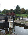
 Lock and School, Stone, Staffordshire - geograph.org.uk - 604354.jpg 640 × 480; 133 KB
-

-
-
 Lombardy Poplar - geograph.org.uk - 586088.jpg 637 × 640; 152 KB
-
-
 London tram leaving the depot.JPG 1,944 × 2,592; 4.71 MB
-

-
 Looking north from Central Six - geograph.org.uk - 583356.jpg 640 × 427; 99 KB
-
 Looking south down Moseley Avenue - geograph.org.uk - 583324.jpg 640 × 427; 96 KB
-
 Love Lane, Hedon - geograph.org.uk - 582557.jpg 640 × 480; 113 KB
-

-

-

-
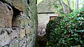
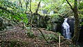
 Lumsdale Valley Industrial Archaeological Site - geograph.org.uk - 582610.jpg 3,503 × 1,972; 2 MB
-
 Lumsdale Valley Industrial Archaeological Site - geograph.org.uk - 582616.jpg 3,461 × 1,948; 2.18 MB
-

-
 Lumsdale Valley Industrial Archaeological Site - geograph.org.uk - 582626.jpg 3,503 × 1,972; 2.07 MB
-
 Lumsdale Valley Industrial Archaeological Site - geograph.org.uk - 582641.jpg 3,503 × 1,972; 2.13 MB
-

-
 Lumsdale Valley Industrial Archaeological Site - geograph.org.uk - 582870.jpg 3,503 × 1,972; 1.73 MB
-
 Lumsdale Valley Industrial Archaeological Site - geograph.org.uk - 582873.jpg 3,503 × 1,972; 2.3 MB
-
 Lumsdale Valley Industrial Archaeological Site - geograph.org.uk - 582876.jpg 3,503 × 1,972; 2.42 MB
-
 Lumsdale Valley Industrial Archaeological Site - geograph.org.uk - 582882.jpg 3,503 × 1,972; 2.22 MB
-
 Lumsdale Valley Industrial Archaeological Site - geograph.org.uk - 582970.jpg 3,503 × 1,972; 2.54 MB
-
 Lumsdale Valley Industrial Archaeological Site - geograph.org.uk - 582986.jpg 3,503 × 1,972; 2.34 MB
-
 Lumsdale Valley Industrial Archaeological Site - geograph.org.uk - 583040.jpg 3,503 × 1,972; 2.35 MB
-
 Lumsdale Valley Industrial Archaeological Site - geograph.org.uk - 583076.jpg 3,503 × 1,972; 2.12 MB
-
 Lumsdale Valley Industrial Archaeological Site - geograph.org.uk - 583101.jpg 3,503 × 1,972; 2.19 MB
-
 Lumsdale Valley Industrial Archaeological Site - geograph.org.uk - 583122.jpg 3,503 × 1,972; 2.2 MB
-
 Lumsdale Valley Industrial Archaeological Site - geograph.org.uk - 583134.jpg 3,503 × 1,972; 2.25 MB
-
 Lumsdale Valley Industrial Archaeological Site - geograph.org.uk - 583764.jpg 3,503 × 1,972; 2.12 MB
-
 Lumsdale Valley Industrial Archaeological Site - geograph.org.uk - 583768.jpg 3,455 × 1,945; 2.05 MB
-
 Lumsdale Valley Industrial Archaeological Site - geograph.org.uk - 583770.jpg 3,503 × 1,972; 2.23 MB


