Category:United Kingdom photographs taken on 2007-09-11
Jump to navigation
Jump to search
Countries of Europe: Austria · Belgium · Bulgaria · Croatia · Czech Republic · Denmark · Finland · France‡ · Germany · Greece · Hungary · Italy · Latvia · Netherlands‡ · Norway · Poland · Portugal‡ · Romania · Russia‡ · Spain‡ · Switzerland · Turkey‡ · Ukraine · United Kingdom
‡: partly located in Europe
‡: partly located in Europe
| ← | 11 September 2007 | → | ||
| ← | September 2007 | → | ||

United Kingdom photographs taken on 11 September 2007.
Image files should be categorized here automatically using {{taken on}} template. Direct categorisation is also possible, if automatic is impossible.
Subcategories
This category has the following 3 subcategories, out of 3 total.
Media in category "United Kingdom photographs taken on 2007-09-11"
The following 200 files are in this category, out of 663 total.
(previous page) (next page)-

-
 "Simon Jersey" - geograph.org.uk - 674739.jpg 628 × 470; 189 KB
-
 12th Century Norman Church - geograph.org.uk - 624826.jpg 640 × 480; 102 KB
-

-
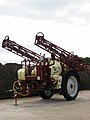 A crop sprayer - geograph.org.uk - 552516.jpg 480 × 640; 53 KB
-
 A sugar beet harvester - detail - geograph.org.uk - 552514.jpg 480 × 640; 81 KB
-
 A sugar beet harvester - geograph.org.uk - 552511.jpg 640 × 480; 53 KB
-
 A very ugly pylon - geograph.org.uk - 552666.jpg 640 × 480; 114 KB
-
 A view over the Taf estuary - geograph.org.uk - 1042228.jpg 640 × 320; 50 KB
-
 Across the Tyne - geograph.org.uk - 555894.jpg 640 × 425; 81 KB
-
 All Saints Church, Clayton-le-Moors - geograph.org.uk - 677036.jpg 640 × 480; 108 KB
-
 All Saints Church, Clayton-le-Moors - geograph.org.uk - 677039.jpg 640 × 480; 90 KB
-

-

-
 All that remains of Haveringland Hall - geograph.org.uk - 552590.jpg 640 × 480; 83 KB
-
 Almshouses - Wetherby Road, Roundhay - geograph.org.uk - 552584.jpg 640 × 403; 40 KB
-

-
 Asparagus plants - geograph.org.uk - 552470.jpg 480 × 640; 118 KB
-
 Banstead Church - geograph.org.uk - 1159947.jpg 640 × 480; 105 KB
-
 Barclay's Bank - Market Street - geograph.org.uk - 553353.jpg 640 × 387; 49 KB
-
 Barns Square Methodist Church - geograph.org.uk - 677027.jpg 640 × 480; 86 KB
-
 Beach at Mawgan Porth - geograph.org.uk - 562561.jpg 640 × 480; 134 KB
-
 Beach at Trevone - geograph.org.uk - 562596.jpg 640 × 480; 127 KB
-
 Beach news Goswick, Northumberland - geograph.org.uk - 1092612.jpg 640 × 480; 25 KB
-
 Bedruthan Steps - geograph.org.uk - 561882.jpg 628 × 466; 124 KB
-
 Bedruthan Steps - geograph.org.uk - 562571.jpg 623 × 458; 122 KB
-
 Bedruthan Steps - geograph.org.uk - 562577.jpg 627 × 467; 117 KB
-

-
 Bodha Ruadh - geograph.org.uk - 566087.jpg 640 × 480; 76 KB
-
 Bramley Cottage, Weston under Wetherley - geograph.org.uk - 554020.jpg 640 × 480; 125 KB
-
 Bridge repairs - geograph.org.uk - 555897.jpg 640 × 425; 117 KB
-
-

-

-
 Broadstone Road - geograph.org.uk - 553236.jpg 640 × 480; 100 KB
-

-
 Brunswick Court - geograph.org.uk - 553272.jpg 640 × 480; 52 KB
-
 Brunswick Court Blue Plaque - geograph.org.uk - 553273.jpg 640 × 579; 95 KB
-
 Buildings at Trevaylor - geograph.org.uk - 682694.jpg 640 × 480; 95 KB
-
 Bull near Carnewas Point - geograph.org.uk - 562569.jpg 640 × 480; 129 KB
-
 Bury Castle - geograph.org.uk - 560202.jpg 640 × 480; 58 KB
-
 Campsite in Haveringland Hall Park - geograph.org.uk - 552631.jpg 640 × 480; 61 KB
-
 Car park at Mawgan Porth - geograph.org.uk - 562560.jpg 640 × 480; 156 KB
-
 Cardinham Woods car park - geograph.org.uk - 560214.jpg 640 × 427; 95 KB
-
 Caterham Roadsport building - 137 - See-through Seven - Flickr - exfordy.jpg 1,927 × 1,706; 1.64 MB
-
 Caterham Roadsport building - 138 - Enjoyment of wide open spaces - Flickr - exfordy.jpg 2,336 × 3,504; 5.54 MB
-
 Caterham Roadsport building - 140 - Zoom zoom - Flickr - exfordy.jpg 3,504 × 2,336; 3.19 MB
-
 Chatterton Close Farm - geograph.org.uk - 553354.jpg 640 × 480; 96 KB
-

-
 Church of St Thomas, Wass - geograph.org.uk - 552685.jpg 640 × 480; 107 KB
-
 Class168mk0.jpg 768 × 576; 78 KB
-
 Clifftop at Carnewas Point - geograph.org.uk - 561883.jpg 640 × 480; 133 KB
-

-
 Coast path at Trenance Point - geograph.org.uk - 562554.jpg 640 × 480; 145 KB
-
 Coast path at Trenance Point - geograph.org.uk - 562564.jpg 640 × 480; 138 KB
-
 Coast path at Trenance Rock - geograph.org.uk - 562556.jpg 640 × 480; 149 KB
-
 Coast Road, Seaham - geograph.org.uk - 986403.jpg 640 × 480; 66 KB
-
 Coastal path, wall and pasture - geograph.org.uk - 556714.jpg 640 × 480; 183 KB
-
 Collywell Bay, Seaton Sluice - geograph.org.uk - 1121303.jpg 640 × 480; 60 KB
-
 Colours of the forest - geograph.org.uk - 552790.jpg 640 × 425; 200 KB
-
 Common Gorse (Ulex europaeus) - geograph.org.uk - 552485.jpg 480 × 640; 71 KB
-

-
 Cottage Near Chipstead - geograph.org.uk - 1162964.jpg 640 × 480; 109 KB
-
 Country Kitchen, Fintona - geograph.org.uk - 552356.jpg 480 × 640; 90 KB
-
 Couple Newbiggin Bay.JPG 2,510 × 1,587; 1.24 MB
-
 Cross Street - geograph.org.uk - 553275.jpg 640 × 434; 45 KB
-
 Crossroads near Cefn Coch Farm - geograph.org.uk - 552672.jpg 640 × 482; 105 KB
-
 Crown Inn - High Street - geograph.org.uk - 553266.jpg 640 × 501; 50 KB
-

-
 Disused railway bridge - geograph.org.uk - 559837.jpg 640 × 480; 57 KB
-
 Doric Pillars in Trevaylor - geograph.org.uk - 682691.jpg 640 × 480; 106 KB
-
 Drive to Fields Farm - geograph.org.uk - 552658.jpg 640 × 480; 125 KB
-
 Driveway to Wood Farm - geograph.org.uk - 552498.jpg 480 × 640; 101 KB
-
 Duart Bay - geograph.org.uk - 597144.jpg 640 × 449; 53 KB
-
 Dunnottar Castle - geograph.org.uk - 617079.jpg 640 × 480; 80 KB
-

-
 Eccles Arms, Main Street, Fintona - geograph.org.uk - 552346.jpg 640 × 480; 45 KB
-
 Eileann Chairminis, West Harris - geograph.org.uk - 559013.jpg 640 × 480; 104 KB
-
 Elmete Avenue - Roundhay - geograph.org.uk - 552603.jpg 640 × 379; 43 KB
-
 Elmete Drive - Roundhay - geograph.org.uk - 552599.jpg 640 × 348; 35 KB
-

-
 England expects (1388680346).jpg 1,371 × 2,048; 862 KB
-
 Entrance to Mercer Park, Clayton-le-Moors - geograph.org.uk - 677049.jpg 640 × 480; 124 KB
-
 Environment Agency G-MIND Cessna 404 Coventry(6) (32534148695).jpg 1,500 × 1,000; 452 KB
-
 Ever felt you were being watched^ - geograph.org.uk - 553240.jpg 640 × 480; 85 KB
-
 Farm access track near Nant-y-gollen - geograph.org.uk - 559327.jpg 600 × 450; 52 KB
-
 Farm Buildings in Stackyard Green - geograph.org.uk - 559535.jpg 640 × 480; 149 KB
-
 Farm Buildings, Stackyard Green - geograph.org.uk - 559528.jpg 640 × 480; 147 KB
-
 Farmland at Trevean Farm - geograph.org.uk - 797696.jpg 640 × 480; 125 KB
-
 Farmland beside the B5415 - geograph.org.uk - 552765.jpg 640 × 480; 97 KB
-
 Farmland near Chyandour Brook - geograph.org.uk - 797658.jpg 640 × 480; 115 KB
-
 Farmland near Tremayne - geograph.org.uk - 797736.jpg 640 × 480; 81 KB
-
 Farmland near Tremayne - geograph.org.uk - 797746.jpg 640 × 480; 102 KB
-
 Farmland near Tremayne - geograph.org.uk - 797751.jpg 640 × 480; 129 KB
-

-
 Field near Stableford - geograph.org.uk - 552996.jpg 640 × 480; 106 KB
-
 Findlater ruins - geograph.org.uk - 621436.jpg 640 × 480; 98 KB
-
 Fintona Credit Union - geograph.org.uk - 552338.jpg 640 × 480; 50 KB
-
 Fintona Medical Hall - geograph.org.uk - 552357.jpg 463 × 640; 77 KB
-
 Fintona Post Office - geograph.org.uk - 552330.jpg 640 × 480; 53 KB
-
 First view of Llanarth with sign - geograph.org.uk - 552683.jpg 640 × 482; 123 KB
-
 Arable farmland, Fishtoft - geograph.org.uk - 557679.jpg 640 × 480; 121 KB
-

-
 Footbridge at Huncoat Railway Station - geograph.org.uk - 674071.jpg 640 × 480; 107 KB
-
 Footbridge over Burtis Beck. - geograph.org.uk - 552437.jpg 480 × 640; 144 KB
-
 Footpath from Dunton Lodge to Dunton - geograph.org.uk - 554362.jpg 640 × 480; 109 KB
-
 Footpath through Haveringland Wood - geograph.org.uk - 552529.jpg 640 × 480; 112 KB
-
-
-
 Former Wesleyan Chapel, Fishtoft - geograph.org.uk - 557692.jpg 640 × 480; 68 KB
-
 Former Wesleyan Chapel, Fishtoft - geograph.org.uk - 557706.jpg 640 × 480; 80 KB
-

-
 From Quebec Farm to Buxton Road - geograph.org.uk - 552509.jpg 480 × 640; 50 KB
-
 Fryern Arcade, Chandler's Ford - geograph.org.uk - 555127.jpg 640 × 427; 111 KB
-

-
 Gashouse Lane plaque - geograph.org.uk - 553269.jpg 640 × 559; 74 KB
-
 George and Dragon - High Street - geograph.org.uk - 553265.jpg 640 × 477; 44 KB
-
 Glen Coishletter, West Harris - geograph.org.uk - 558993.jpg 640 × 480; 93 KB
-
 Grace Baptist Church - geograph.org.uk - 562481.jpg 640 × 480; 93 KB
-
 Grazing sheep - geograph.org.uk - 726211.jpg 640 × 480; 68 KB
-
 Guildford Cathedral - geograph.org.uk - 600434.jpg 640 × 485; 50 KB
-
 Halewood - Heyes Barn.jpg 640 × 480; 70 KB
-
 Hamleys London Regent.jpg 3,072 × 2,304; 1.83 MB
-
 Hare & Hounds, Clayton-le-Moors - geograph.org.uk - 675872.jpg 640 × 480; 82 KB
-

-
 Heavy Loam, The Carr - geograph.org.uk - 553724.jpg 640 × 480; 110 KB
-
-
 Hedges on Stipadon Farm - geograph.org.uk - 1100291.jpg 640 × 427; 72 KB
-
 Herring Gull on the roof - geograph.org.uk - 562580.jpg 640 × 480; 125 KB
-
 Hillmorton Top Locks in the mist - geograph.org.uk - 566454.jpg 640 × 425; 57 KB
-
 Hillside, fence and shore - geograph.org.uk - 566056.jpg 640 × 480; 98 KB
-
 Home Interiors, Fintona - geograph.org.uk - 552352.jpg 425 × 640; 68 KB
-
 Horsefair - geograph.org.uk - 553310.jpg 480 × 640; 36 KB
-
 Houlsyke - geograph.org.uk - 553250.jpg 640 × 468; 110 KB
-
 Howsham Mill Pond - geograph.org.uk - 553920.jpg 640 × 480; 116 KB
-
 Howsham Mill.jpg 640 × 480; 118 KB
-
 Howsham Weir, River Derwent - geograph.org.uk - 553892.jpg 640 × 480; 97 KB
-
 HSBC Bank - North Street - geograph.org.uk - 553340.jpg 640 × 480; 42 KB
-
 Huncoat Railway Station.jpg 640 × 480; 99 KB
-
 Imperial Hotel, Fintona - geograph.org.uk - 552349.jpg 640 × 520; 56 KB
-
 Inside Findlater Castle - geograph.org.uk - 621437.jpg 480 × 640; 81 KB
-
 Inveraray Bridge Loch Fyne.JPG 2,272 × 1,712; 1.51 MB
-
 Invergordon Welcome Sign - geograph.org.uk - 595909.jpg 640 × 480; 62 KB
-

-

-
 Kennett and Avon Canal, Newbury - geograph.org.uk - 552785.jpg 640 × 480; 111 KB
-
 Lamb Inn, Clayton-le-Moors - geograph.org.uk - 675878.jpg 640 × 480; 61 KB
-
 Lane junction - geograph.org.uk - 797722.jpg 640 × 480; 128 KB
-
 Lane near Trevean Farm - geograph.org.uk - 797670.jpg 640 × 480; 123 KB
-
 Lealholm Side - geograph.org.uk - 552747.jpg 640 × 480; 102 KB
-
 Lealholm village - geograph.org.uk - 552759.jpg 640 × 480; 118 KB
-
 Lear Investments N661GA GulfstreamV Coventry(6) (32413784962).jpg 2,893 × 1,800; 1.02 MB
-
 Level crossing at Huncoat - geograph.org.uk - 674063.jpg 640 × 480; 80 KB
-
 Library - Westgate - geograph.org.uk - 553325.jpg 640 × 407; 45 KB
-
 Llanarth Post Office - geograph.org.uk - 552729.jpg 640 × 482; 78 KB
-
 Llansantffraed Church - geograph.org.uk - 552705.jpg 640 × 482; 99 KB
-
 Llansantffraed Court Hotel - geograph.org.uk - 552697.jpg 640 × 482; 111 KB
-

-
 Lloyds TSB Bank, Sudbury - geograph.org.uk - 561398.jpg 640 × 480; 116 KB
-
 Loch Langavat, Harris - geograph.org.uk - 559026.jpg 640 × 480; 76 KB
-
 Looking east from Glendurgan beach - geograph.org.uk - 1026575.jpg 640 × 480; 146 KB
-
 Looking over Boskednan - geograph.org.uk - 682564.jpg 640 × 480; 114 KB
-

-
 Looking up stream - geograph.org.uk - 726143.jpg 640 × 425; 146 KB
-
 Low Pasture House - geograph.org.uk - 552890.jpg 640 × 480; 94 KB
-
 Manorbier Youth Hostel - geograph.org.uk - 553498.jpg 640 × 480; 41 KB
-
 Market Hall Sun Dial, Moreton-in-Marsh - geograph.org.uk - 894281.jpg 640 × 480; 115 KB
-
 Mawgan Porth beach and Berryl's Point - geograph.org.uk - 562562.jpg 640 × 480; 137 KB
-
 McGinn's - Hollywood, Fintona - geograph.org.uk - 552335.jpg 640 × 480; 51 KB
-

-

-
 Misty Morning near Hillmorton Locks - geograph.org.uk - 566376.jpg 640 × 425; 21 KB
-
 Moor Road - geograph.org.uk - 553470.jpg 640 × 480; 130 KB
-
 Moor Road Helmshore - geograph.org.uk - 554400.jpg 640 × 480; 122 KB
-
 Moorland Pools - geograph.org.uk - 558209.jpg 640 × 480; 92 KB
-
 Musselburgh Esk flower beds.jpg 640 × 480; 124 KB
-
 Musselburgh Museum - geograph.org.uk - 552497.jpg 640 × 480; 87 KB
-
 Nat West Bank - North Street - geograph.org.uk - 553312.jpg 640 × 465; 44 KB
-
 New Inn - Bank Street - geograph.org.uk - 553324.jpg 640 × 445; 50 KB
-

-
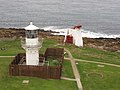 New lighthouse from old, Kinnaird Head - geograph.org.uk - 562661.jpg 640 × 480; 101 KB
-
 Newtrain Bay - geograph.org.uk - 562590.jpg 640 × 480; 132 KB
-
 Nissen Shed near Wrestlingworth - geograph.org.uk - 553214.jpg 640 × 480; 142 KB
-
 North Lodge, Wintershill - geograph.org.uk - 555155.jpg 640 × 424; 108 KB
-
 Not safe for public use (1387787363).jpg 1,371 × 2,048; 539 KB
-
 Oddfellows Arms, Clayton-le-Moors - geograph.org.uk - 675877.jpg 640 × 480; 73 KB
-
 Old Farmhouse in Stackyard Green - geograph.org.uk - 558007.jpg 640 × 480; 110 KB
-

-

-
 Overgrown track - geograph.org.uk - 552656.jpg 640 × 482; 158 KB
-
 Park Bank - geograph.org.uk - 553256.jpg 480 × 640; 93 KB
-
 Parterre4.JPG 2,848 × 2,136; 1.49 MB
-
-
 Pink Cottage in Stackyard Green - geograph.org.uk - 559439.jpg 480 × 640; 135 KB
-
 Private Road - geograph.org.uk - 553363.jpg 480 × 640; 128 KB
-
 Public footpath near Madron - geograph.org.uk - 797648.jpg 640 × 480; 136 KB
-
 Public Toilets, Fintona - geograph.org.uk - 552343.jpg 640 × 480; 43 KB
-

-
 Pylon north of Kimbers Copse - geograph.org.uk - 555163.jpg 640 × 415; 131 KB
-
 Red Lion - High Street - geograph.org.uk - 553264.jpg 640 × 409; 42 KB


_-_geograph.org.uk_-_552485.jpg)


.jpg)

_(32534148695).jpg)


_-_geograph.org.uk_-_677058.jpg)


_-_geograph.org.uk_-_555181.jpg)


_(32413784962).jpg)


.jpg)


