Category:United Kingdom photographs taken on 2007-07-11
Jump to navigation
Jump to search
Countries of Europe: Austria · Belgium · Czech Republic · Denmark · Estonia · Finland · France‡ · Georgia‡ · Germany · Greece · Hungary · Iceland · Republic of Ireland · Italy · Netherlands‡ · Norway · Poland · Romania · Russia‡ · Serbia · Spain‡ · Sweden · Turkey‡ · Ukraine · United Kingdom
‡: partly located in Europe
‡: partly located in Europe
| ← | 11 July 2007 | → | ||
| ← | July 2007 | → | ||

United Kingdom photographs taken on 11 July 2007.
Image files should be categorized here automatically using {{taken on}} template. Direct categorisation is also possible, if automatic is impossible.
Subcategories
This category has the following 2 subcategories, out of 2 total.
L
S
Media in category "United Kingdom photographs taken on 2007-07-11"
The following 200 files are in this category, out of 813 total.
(previous page) (next page)-
-
 "Mitchells of Lancaster" - geograph.org.uk - 495815.jpg 480 × 640; 175 KB
-
 "Mitchells of Lancaster" - geograph.org.uk - 495823.jpg 472 × 630; 193 KB
-
 "Mitchells of Lancaster" - geograph.org.uk - 495828.jpg 640 × 480; 147 KB
-
 'The Green Man' inn at Thriplow - geograph.org.uk - 492280.jpg 640 × 432; 66 KB
-
 10 Miles - geograph.org.uk - 516657.jpg 640 × 480; 46 KB
-
 104-108 South View Road - geograph.org.uk - 492305.jpg 640 × 488; 66 KB
-
 2 Chapel Lane - Birstall - geograph.org.uk - 491819.jpg 640 × 471; 54 KB
-
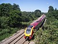
 360109 at Marks Tey.jpg 3,648 × 2,736; 4.45 MB
-
 A bit of beach at Staithes - geograph.org.uk - 519197.jpg 640 × 480; 67 KB
-
 A good drying day - geograph.org.uk - 492616.jpg 640 × 480; 140 KB
-
 A gruesome tally of exterminated moles. - geograph.org.uk - 497052.jpg 640 × 436; 130 KB
-
 A714 outside Kirkinner - geograph.org.uk - 492331.jpg 640 × 480; 120 KB
-
 Aberaeron harbour - geograph.org.uk - 497134.jpg 640 × 480; 360 KB
-
 Aberaeron harbour - geograph.org.uk - 497137.jpg 640 × 480; 444 KB
-
 Aberystwyth Promenade - geograph.org.uk - 658637.jpg 640 × 480; 58 KB
-
 Aberystwyth South Beach - geograph.org.uk - 658595.jpg 640 × 480; 75 KB
-
-
 Across the Harbour to Stanpit - geograph.org.uk - 493695.jpg 640 × 480; 94 KB
-
 Aghadowey River - geograph.org.uk - 492284.jpg 426 × 640; 189 KB
-
 Aigburth Methodist Church - geograph.org.uk - 492397.jpg 640 × 480; 97 KB
-

-

-

-
 Ancient lane - geograph.org.uk - 492641.jpg 640 × 480; 158 KB
-
 Anna Crags - geograph.org.uk - 493684.jpg 426 × 640; 98 KB
-
 Anyway up means the same - geograph.org.uk - 493302.jpg 640 × 480; 89 KB
-
 Approach to Naworth Castle - geograph.org.uk - 494069.jpg 640 × 480; 152 KB
-
 Argynnis paphia, Bentley Wood - geograph.org.uk - 491827.jpg 640 × 480; 91 KB
-
 Arriva buses in Aigburth Vale Bus Terminus, Liverpool 11 July 2007.jpg 640 × 480; 120 KB
-
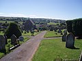
 Aughnahoy Church and Cemetery - geograph.org.uk - 491901.jpg 640 × 202; 83 KB
-
 Avenue at Kyre Park - geograph.org.uk - 493378.jpg 640 × 480; 126 KB
-
 Avenue of trees in St George's Park - geograph.org.uk - 492115.jpg 640 × 478; 136 KB
-
 Axminster, George Hotel - geograph.org.uk - 492937.jpg 640 × 427; 179 KB
-
 Axminster, South Street - geograph.org.uk - 492936.jpg 640 × 427; 180 KB
-
 Axminster, the town from the north west - geograph.org.uk - 492939.jpg 640 × 427; 204 KB
-
 Axminster, West Street and Castle Street - geograph.org.uk - 492935.jpg 427 × 640; 185 KB
-
 Ballycraigy Bonfire - geograph.org.uk - 491803.jpg 640 × 286; 86 KB
-
 Barn, Stockleigh Pomeroy - geograph.org.uk - 1403421.jpg 640 × 480; 82 KB
-
 Base of ancient preaching cross - geograph.org.uk - 1232822.jpg 640 × 480; 133 KB
-
 Batley Birstall CP School - Birstall - geograph.org.uk - 491809.jpg 640 × 397; 39 KB
-
 Bay of Linton, Shapinsay, Orkney Islands.jpg 640 × 398; 100 KB
-
 Bay to South East of Dinas Trefri - geograph.org.uk - 495035.jpg 640 × 480; 46 KB
-

-
 Beck running under Floreat Close - geograph.org.uk - 491790.jpg 516 × 640; 81 KB
-
 Below Blairdenon towards Bengengie - geograph.org.uk - 492411.jpg 640 × 480; 143 KB
-
 Ben Ever - geograph.org.uk - 492419.jpg 640 × 480; 143 KB
-
 Berriedale walk - geograph.org.uk - 727296.jpg 640 × 480; 155 KB
-
 Best's Farm, near Farley - geograph.org.uk - 491677.jpg 640 × 480; 152 KB
-

-
 Birstall Conservative Club - geograph.org.uk - 491821.jpg 640 × 482; 51 KB
-

-
-
-
 Black Bull Inn - Kirkgate, Birstall - geograph.org.uk - 491849.jpg 640 × 466; 55 KB
-

-
 Blue Agapanthus - geograph.org.uk - 492815.jpg 640 × 480; 131 KB
-
 Blue Reef Aquarium, Southsea - geograph.org.uk - 493088.jpg 640 × 427; 90 KB
-
 Boats at Runswick Bay - geograph.org.uk - 521530.jpg 640 × 480; 106 KB
-
 Bosent Cross.jpg 640 × 480; 90 KB
-
 Boulby Mine - geograph.org.uk - 518226.jpg 640 × 480; 72 KB
-
 Brick tunnel leading to Head Dike - geograph.org.uk - 492044.jpg 640 × 480; 140 KB
-
 Bridge Farm House - geograph.org.uk - 491946.jpg 640 × 480; 105 KB
-
 Bridge Gate, Hebden Bridge - geograph.org.uk - 492982.jpg 640 × 480; 99 KB
-
 Bridge Over Afon Dulas - geograph.org.uk - 492217.jpg 640 × 479; 80 KB
-
 Bridge over Kyme Eau - geograph.org.uk - 492176.jpg 640 × 480; 103 KB
-

-
 Bridgehouse Farm - geograph.org.uk - 492337.jpg 640 × 480; 99 KB
-
 Brockhampton Primary School - geograph.org.uk - 493387.jpg 640 × 480; 131 KB
-
 Bromyard from Bromyard Downs.jpg 640 × 480; 134 KB
-
 Bucholie Castle.jpg 640 × 480; 109 KB
-
 Bucklersbury House - geograph.org.uk - 604372.jpg 640 × 480; 70 KB
-
 Bus Shelter - South View Road - geograph.org.uk - 492307.jpg 640 × 494; 56 KB
-
 Bushcliff Wood Track - geograph.org.uk - 494130.jpg 640 × 480; 124 KB
-
 Byway beneath the A34, Shrill Down - geograph.org.uk - 496824.jpg 640 × 480; 171 KB
-
 Campbells Burn - geograph.org.uk - 492314.jpg 640 × 480; 170 KB
-
 Canal crossing the River Aire - geograph.org.uk - 491687.jpg 640 × 480; 71 KB
-
 Canal west of Gargrave - geograph.org.uk - 491959.jpg 640 × 480; 84 KB
-
 Castle Road - geograph.org.uk - 491916.jpg 640 × 475; 107 KB
-
 Cattle at Longwater Lawn, New Forest - geograph.org.uk - 493098.jpg 640 × 320; 72 KB
-

-
 Chadderton Police Station.jpg 640 × 480; 86 KB
-
 Chalk White Cliffs - geograph.org.uk - 1294174.jpg 640 × 480; 94 KB
-
 Chambered cairn at Reineabhal. - geograph.org.uk - 506049.jpg 640 × 480; 84 KB
-
 Charnock Richard Motorway Services M6.jpg 640 × 480; 165 KB
-

-
 Chepstow's captured gun - geograph.org.uk - 492883.jpg 640 × 480; 93 KB
-
 Chevet Lane at Monckton Manor - geograph.org.uk - 493304.jpg 640 × 480; 89 KB
-
-

-
 Church Street - geograph.org.uk - 493614.jpg 480 × 640; 79 KB
-
 Churchyard, St Andrew's, Maghull - geograph.org.uk - 1453697.jpg 640 × 426; 102 KB
-
 Cliff side houses in Staithes - geograph.org.uk - 519191.jpg 640 × 480; 82 KB
-

-

-
-
-

-
-

-

-
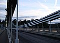
 Clifton suspension bridge cables - geograph.org.uk - 633811.jpg 640 × 480; 63 KB
-
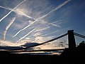
 Clifton Suspension bridge symmetry - geograph.org.uk - 633819.jpg 640 × 480; 68 KB
-
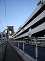
 Clifton Suspension Bridge Tower - geograph.org.uk - 633787.jpg 640 × 480; 62 KB
-
 Close Cross House - geograph.org.uk - 492658.jpg 640 × 480; 83 KB
-
 Clough Head - geograph.org.uk - 492549.jpg 640 × 480; 158 KB
-
 Cold Hiendley Common Lane Railway Bridge - geograph.org.uk - 493329.jpg 640 × 480; 103 KB
-
 Cold Hiendley Common Lane Railway Bridge - geograph.org.uk - 493336.jpg 640 × 480; 107 KB
-
 Cottage on the shore. - geograph.org.uk - 505792.jpg 640 × 359; 78 KB
-
 Cow Sculpture. - geograph.org.uk - 496085.jpg 640 × 480; 135 KB
-
 Crammel Linn on the River Irthing - geograph.org.uk - 492041.jpg 640 × 480; 132 KB
-
 Cricket field at St Bees - geograph.org.uk - 513196.jpg 640 × 426; 79 KB
-
 Crouch's Mill - geograph.org.uk - 492675.jpg 640 × 480; 110 KB
-

-
 Cullompton , Cullompton Cemetery - geograph.org.uk - 1217423.jpg 640 × 480; 71 KB
-
 Cullompton , Cullompton Cemetery - geograph.org.uk - 1217431.jpg 640 × 480; 71 KB
-
 Cullompton , Cullompton Cemetery - geograph.org.uk - 1217436.jpg 640 × 480; 93 KB
-
 Cullompton , Cullompton Cemetery - geograph.org.uk - 1217440.jpg 640 × 480; 62 KB
-
 Cullompton , Cullompton Cemetery - geograph.org.uk - 1217447.jpg 640 × 480; 66 KB
-
 Cullompton , Cullompton Cemetery - geograph.org.uk - 1217449.jpg 640 × 480; 89 KB
-
 Cullompton , Cullompton Fire Station - geograph.org.uk - 1217405.jpg 640 × 480; 59 KB
-

-
 Cullompton , Fore Street - geograph.org.uk - 1217392.jpg 640 × 480; 72 KB
-

-
 Cullompton , M5 Motorway - geograph.org.uk - 1216947.jpg 640 × 480; 64 KB
-
 Cullompton , Old Hill Road - geograph.org.uk - 1216955.jpg 640 × 480; 101 KB
-
 Cullompton , Old Hill Road - geograph.org.uk - 1216957.jpg 640 × 480; 105 KB
-
 Cullompton , Railway Track - geograph.org.uk - 1216934.jpg 640 × 480; 101 KB
-
 Cullompton , Railway Track - geograph.org.uk - 1216960.jpg 640 × 480; 63 KB
-
-
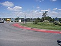 Cullompton , Station Road Roundabout - geograph.org.uk - 1216935.jpg 640 × 480; 64 KB
-
 Cullompton , The M5 Motorway - geograph.org.uk - 1216936.jpg 640 × 480; 63 KB
-
 Cullompton , The M5 Motorway - geograph.org.uk - 1216956.jpg 640 × 480; 66 KB
-
 Cullompton , The M5 Motorway - geograph.org.uk - 1216958.jpg 640 × 480; 69 KB
-

-
 Cullompton, Fore Street - geograph.org.uk - 1217368.jpg 640 × 480; 63 KB
-
 Cullompton, Fore Street - geograph.org.uk - 1217384.jpg 640 × 480; 73 KB
-
 Dead End, Lockton - geograph.org.uk - 1535468.jpg 457 × 640; 79 KB
-
 Dead tree at Underley Farm - geograph.org.uk - 492376 (cropped).jpg 511 × 428; 122 KB
-
 Dead tree at Underley Farm - geograph.org.uk - 492376.jpg 640 × 480; 156 KB
-
 Decisions - geograph.org.uk - 493316.jpg 480 × 640; 136 KB
-
-
 Dover Docks - geograph.org.uk - 1294185.jpg 640 × 480; 87 KB
-
 Dragonfly Sculpture. - geograph.org.uk - 496086.jpg 480 × 640; 102 KB
-
 Dumbarton Castle - geograph.org.uk - 501609.jpg 640 × 480; 84 KB
-
 Dungeness Old Lighthouse - geograph.org.uk - 1294203.jpg 640 × 480; 79 KB
-
-

-
 East from Moorber Lane Railway Bridge - geograph.org.uk - 491662.jpg 640 × 480; 79 KB
-
 East Lodge to the Boconnoc Estate - geograph.org.uk - 492432.jpg 640 × 480; 106 KB
-
 Edinburgh Castle, Edinburgh - geograph.org.uk - 505332.jpg 640 × 480; 99 KB
-
 Entrance to Kinver Edge - geograph.org.uk - 495766.jpg 640 × 498; 173 KB
-
 Entrance to the Innocent Railway Tunnel - geograph.org.uk - 530769.jpg 640 × 480; 141 KB
-
-
 Falls of Kirkaig - geograph.org.uk - 494762.jpg 640 × 427; 103 KB
-
 Family Portrait - geograph.org.uk - 518889.jpg 640 × 480; 99 KB
-
 Ferndale, Kidderminster - geograph.org.uk - 495822.jpg 640 × 480; 133 KB
-
 Ferriby Road, Hessle - geograph.org.uk - 491853.jpg 640 × 478; 198 KB
-
 Ferry at Largs - geograph.org.uk - 501142.jpg 640 × 480; 79 KB
-
 Ferry at Largs - geograph.org.uk - 501146.jpg 640 × 480; 64 KB
-
 Field boundary near Boulby Mine - geograph.org.uk - 518894.jpg 640 × 480; 82 KB
-
-
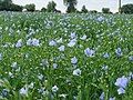 Flax Crop - geograph.org.uk - 492111.jpg 640 × 480; 138 KB
-
 Flower beds inside Aberystwyth castle - geograph.org.uk - 527491.jpg 640 × 480; 102 KB
-
 Footbridge at Head Dike - geograph.org.uk - 491979.jpg 640 × 480; 94 KB
-
 Footpath at Kinver Edge - geograph.org.uk - 495694.jpg 529 × 640; 173 KB
-

-

-
 Footpath to Lamyatt Lodge - geograph.org.uk - 492635.jpg 640 × 480; 110 KB
-
 Footpath to Notton Village. - geograph.org.uk - 493137.jpg 640 × 480; 123 KB
-
 Former egg packing premises, Palestine - geograph.org.uk - 491941.jpg 640 × 480; 127 KB
-
 Fountains. - geograph.org.uk - 496088.jpg 640 × 480; 115 KB
-

-
 FR Cob DLG 2.JPG 2,400 × 1,800; 1.78 MB
-
 Freathy Cliff - view westwards - geograph.org.uk - 492830.jpg 640 × 480; 85 KB
-
 Friendly Friesans at Underley Farm - geograph.org.uk - 492456.jpg 480 × 640; 140 KB
-
 Geo of Ork by C Michael Hogan.jpg 640 × 460; 93 KB
-
 Get your fortune told at Whitby - geograph.org.uk - 521678.jpg 640 × 480; 112 KB
-
 Glenamour Loch - geograph.org.uk - 492353.jpg 640 × 480; 85 KB
-
 Glenwinnel Burn - geograph.org.uk - 579534.jpg 640 × 480; 117 KB
-
 A house called The Gables - geograph.org.uk - 492227.jpg 640 × 474; 82 KB
-
 Gone Fishing^ - Kirkgate, Birstall - geograph.org.uk - 491843.jpg 640 × 326; 51 KB
-
 Grazing on Longwater Lawn, New Forest - geograph.org.uk - 492944.jpg 480 × 640; 108 KB
-
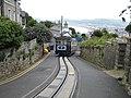
 Great Orme Tramway - geograph.org.uk - 553772.jpg 640 × 480; 62 KB
-
 Great Orme Tramway - geograph.org.uk - 553780.jpg 640 × 480; 73 KB
-
 Great Orme Tramway - geograph.org.uk - 553791.jpg 640 × 480; 70 KB
-

-
 Greaves Street. - geograph.org.uk - 493749.jpg 480 × 640; 86 KB
-
 Gualan Beach.jpg 640 × 359; 36 KB
-
 Hall Road, Maghull - geograph.org.uk - 1453690.jpg 640 × 426; 95 KB
-
 Harbour office and mooring - geograph.org.uk - 491681.jpg 640 × 480; 81 KB
-
 Harbour wall Staithes - geograph.org.uk - 517852.jpg 640 × 413; 45 KB
-
 Hay-making at Melling - geograph.org.uk - 491883.jpg 640 × 426; 71 KB
-
 Head Dike from footbridge - geograph.org.uk - 492072.jpg 640 × 480; 111 KB
-

-
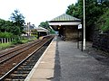 Hebden Bridge Railway Station - geograph.org.uk - 492952.jpg 640 × 480; 109 KB
-
 Hebden Bridge Railway Station - geograph.org.uk - 492954.jpg 640 × 480; 124 KB
-
 Hebden Bridge Railway Station - geograph.org.uk - 492962.jpg 640 × 480; 101 KB
-
 Hebden Bridge Signal Box - geograph.org.uk - 492966.jpg 640 × 480; 141 KB
-
 Hedge trimming - geograph.org.uk - 492678.jpg 640 × 480; 117 KB


.jpg)


_-_geograph.org.uk_-_921755.jpg)


