Category:United Kingdom photographs taken on 2007-05-27
Jump to navigation
Jump to search
Countries of Europe: Austria · Belgium · Cyprus‡ · Czech Republic · Denmark · Estonia · Finland · France‡ · Germany · Greece · Hungary · Republic of Ireland · Italy · Kazakhstan‡ · Latvia · Netherlands‡ · Norway · Poland · Portugal‡ · Romania · Russia‡ · Serbia · Slovakia · Spain‡ · Sweden · Switzerland · Ukraine · United Kingdom
Specific status: Isle of Man
‡: partly located in Europe
Specific status: Isle of Man
‡: partly located in Europe
| ← | 27 May 2007 | → | ||
| ← | May 2007 | → | ||

United Kingdom photographs taken on 27 May 2007.
Image files should be categorized here automatically using {{taken on}} template. Direct categorisation is also possible, if automatic is impossible.
Subcategories
This category has only the following subcategory.
Media in category "United Kingdom photographs taken on 2007-05-27"
The following 200 files are in this category, out of 561 total.
(previous page) (next page)-

-
-
 2007-05-27 Market Place, Great Yarmouth.jpg 640 × 480; 127 KB
-
 A lone Wild Garlic plant on Spey gravel. - geograph.org.uk - 446374.jpg 640 × 426; 112 KB
-

-
-
 A wet Sunday at St Mary's - geograph.org.uk - 447631.jpg 480 × 640; 112 KB
-
 Aberdeen Central Library.jpg 3,200 × 2,400; 1.8 MB
-
 Aberdeen Church ruin.jpg 2,125 × 3,188; 1.47 MB
-
 Aberdeen Gilcomston church tower.jpg 2,304 × 3,456; 1.74 MB
-
 Aberdeen Gilcomston church.jpg 2,132 × 3,198; 1.56 MB
-
 Aberdeen Marischal College.jpg 3,073 × 2,458; 1.69 MB
-
 Aberdeen Saint Mark.jpg 2,194 × 2,925; 1.34 MB
-
 Aberdeen St Nicholas Kirk.jpg 2,196 × 3,344; 3.61 MB
-
 Aberdeen town house.jpg 2,221 × 3,332; 1.69 MB
-
 Afon Colwyn and the Prince Llywelyn Hotel - geograph.org.uk - 446344.jpg 640 × 480; 145 KB
-
 Church Road, Alrewas - geograph.org.uk - 445804.jpg 640 × 480; 84 KB
-
 An arch of Pont Beddgelert - geograph.org.uk - 447616.jpg 640 × 480; 154 KB
-
 Ardlair - geograph.org.uk - 447745.jpg 640 × 480; 83 KB
-

-
 Ballynoe Stone Circle - geograph.org.uk - 539453.jpg 640 × 475; 79 KB
-
 Pizza Jim - geograph.org.uk - 456755.jpg 490 × 640; 161 KB
-
 Spencer Molloy, Electricals Shop - geograph.org.uk - 446248.jpg 640 × 477; 174 KB
-

-
 Beinn Shiantaidh (west side) - geograph.org.uk - 449062.jpg 640 × 480; 97 KB
-
 Beresford Building.jpg 640 × 427; 94 KB
-
 Beyond my PC screen - Flickr - krystina stimakovits.jpg 2,547 × 2,121; 942 KB
-
 Birthplace of Ivor Novello.jpg 480 × 640; 97 KB
-
 Black Water, Rogie - geograph.org.uk - 448832.jpg 640 × 480; 139 KB
-
 Blue Plaque on the Octagon - geograph.org.uk - 552537.jpg 480 × 640; 31 KB
-
 Bluebells - geograph.org.uk - 446316.jpg 640 × 436; 117 KB
-
 Bogbain - geograph.org.uk - 448857.jpg 639 × 419; 58 KB
-
 Boggy land, Daviot - geograph.org.uk - 449063.jpg 640 × 480; 90 KB
-
 Boulders - geograph.org.uk - 471118.jpg 640 × 408; 258 KB
-

-
 Bridleway near Easton Royal - geograph.org.uk - 446025.jpg 640 × 480; 148 KB
-
 Budleigh Salterton Museum - geograph.org.uk - 552526.jpg 640 × 480; 61 KB
-
 Bwthyn Llywelyn 446370.jpg 640 × 480; 159 KB
-
 Caledonian Canal at Dochgarroch - geograph.org.uk - 446642.jpg 640 × 425; 296 KB
-
 Camas nam Meanbh-chuileag - geograph.org.uk - 448914.jpg 640 × 480; 113 KB
-
 Caravan Site - geograph.org.uk - 470244.jpg 640 × 416; 215 KB
-
 Carrickarade Island - geograph.org.uk - 460295.jpg 640 × 427; 97 KB
-

-
 Chalk Rocks - geograph.org.uk - 471114.jpg 640 × 414; 285 KB
-
 Charing Cross Station - geograph.org.uk - 597290.jpg 552 × 640; 116 KB
-

-
 Chracaig Waterfall - geograph.org.uk - 961843.jpg 640 × 427; 120 KB
-

-
 Church of St Michael and St George - geograph.org.uk - 445848.jpg 640 × 427; 84 KB
-
 Church Street, Whitby - geograph.org.uk - 450360.jpg 640 × 428; 102 KB
-

-
 Churchyard Yews - Easton Royal - geograph.org.uk - 446140.jpg 640 × 480; 134 KB
-
 Clach Bheinn trig point S8824 - geograph.org.uk - 446597.jpg 640 × 480; 133 KB
-
 Cleddau Bridge from Hobbs Point - geograph.org.uk - 462763.jpg 640 × 480; 106 KB
-
 Coal Seam - geograph.org.uk - 470247.jpg 640 × 427; 277 KB
-
 Colliery Bay - geograph.org.uk - 454032.jpg 640 × 427; 101 KB
-
 Colliery Bay - geograph.org.uk - 454043.jpg 640 × 405; 94 KB
-
 Colliery Bay - geograph.org.uk - 470334.jpg 640 × 402; 233 KB
-
 Coolanlough - geograph.org.uk - 471142.jpg 640 × 330; 182 KB
-
 Coolanlough - geograph.org.uk - 471144.jpg 640 × 407; 254 KB
-
 Coolanlough - geograph.org.uk - 471146.jpg 640 × 416; 267 KB
-
 Coquetdale near Harbottle - geograph.org.uk - 457194.jpg 640 × 480; 145 KB
-
 Corran Lochan - geograph.org.uk - 446590.jpg 640 × 480; 147 KB
-
 Cottage Behind Farm at Tarbert - geograph.org.uk - 448091.jpg 640 × 480; 99 KB
-
 Cottage on Kirby Cane School Road - geograph.org.uk - 451070.jpg 640 × 480; 123 KB
-
 Cottages in Corran - geograph.org.uk - 457144.jpg 640 × 480; 108 KB
-
 Country Lane, Llanfabon - geograph.org.uk - 447156.jpg 640 × 480; 114 KB
-
 Cowbridge Road East - geograph.org.uk - 447054.jpg 640 × 480; 145 KB
-
 Crags above Stryd Gwynant - geograph.org.uk - 446800.jpg 640 × 480; 121 KB
-
 Cranny, Omagh - geograph.org.uk - 446008.jpg 640 × 480; 99 KB
-

-
 Crockanore - geograph.org.uk - 471422.jpg 640 × 427; 222 KB
-
 Cuillin Hills Hotel - geograph.org.uk - 961839.jpg 640 × 427; 97 KB
-
 Cushendun Hotel, Co Antrim - geograph.org.uk - 460284.jpg 640 × 427; 76 KB
-
 Cushendun, Co. Antrim, Harbour and bridge - geograph.org.uk - 1748011.jpg 2,496 × 1,664; 3.36 MB
-
 Dalradian Boulder - geograph.org.uk - 471483.jpg 640 × 427; 303 KB
-
 Deptford Green - geograph.org.uk - 462239.jpg 640 × 480; 97 KB
-
 Derelict church at Kildalton - geograph.org.uk - 469885.jpg 640 × 480; 99 KB
-
 Devorgilla Bridge - geograph.org.uk - 447602.jpg 640 × 427; 149 KB
-
 Devorgilla Bridge and Bridge House - geograph.org.uk - 448310.jpg 640 × 427; 99 KB
-
 Devorgilla Terrace - geograph.org.uk - 447638.jpg 640 × 427; 118 KB
-

-
 Distant Ben More - geograph.org.uk - 449126.jpg 640 × 480; 87 KB
-
 Distant Paps - geograph.org.uk - 448927.jpg 640 × 480; 85 KB
-
 Disused Mill off Barkerend Road - geograph.org.uk - 446180.jpg 640 × 563; 79 KB
-
 Dochgarroch - geograph.org.uk - 446656.jpg 640 × 426; 328 KB
-
 Downtown Nelson - geograph.org.uk - 447181.jpg 640 × 480; 84 KB
-
 Drochaid Ruaidh 456030.jpg 640 × 480; 98 KB
-
 Drumnakil Point - geograph.org.uk - 471168.jpg 640 × 412; 220 KB
-
 Duck pond - geograph.org.uk - 445602.jpg 640 × 512; 95 KB
-
 Dumfries - geograph.org.uk - 447572.jpg 409 × 640; 115 KB
-
 Dusk, Tayvallich - geograph.org.uk - 454655.jpg 640 × 427; 168 KB
-
 Easby Abbey from the South - geograph.org.uk - 447225.jpg 640 × 480; 45 KB
-
 Easton House, Easton Royal - geograph.org.uk - 446394.jpg 640 × 480; 131 KB
-
 Ecclesiastical Architecture, Llanfabon - geograph.org.uk - 447148.jpg 640 × 480; 101 KB
-
 Egton Railway Station.jpg 640 × 428; 107 KB
-
 Eilean Bàn Lighthouse - geograph.org.uk - 446614.jpg 640 × 426; 347 KB
-
 Elie Harbour - geograph.org.uk - 452610.jpg 640 × 480; 59 KB
-
 Escallonia - geograph.org.uk - 470249.jpg 640 × 427; 224 KB
-
 Exercise bars, Cranny, Omagh - geograph.org.uk - 446015.jpg 480 × 640; 192 KB
-
 Exercise bars, Cranny, Omagh - geograph.org.uk - 446026.jpg 480 × 640; 152 KB
-
 Exercise seat, Cranny, Omagh - geograph.org.uk - 446030.jpg 640 × 292; 49 KB
-
 Fair Head - geograph.org.uk - 471163.jpg 640 × 393; 243 KB
-
 Fair Head - geograph.org.uk - 471435.jpg 640 × 419; 249 KB
-
 Farewell Cardiff (516571977).jpg 800 × 533; 288 KB
-
 Farm road at Glanrafon - geograph.org.uk - 446288.jpg 640 × 480; 120 KB
-
 Farmhouse and orchard - geograph.org.uk - 445598.jpg 640 × 482; 87 KB
-
 Ffordd Gwynant Road - geograph.org.uk - 446385.jpg 640 × 480; 89 KB
-
 Fields by Lower Shorrock Hey Farm - geograph.org.uk - 471379.jpg 640 × 385; 266 KB
-
 Firth of Forth - geograph.org.uk - 563971.jpg 640 × 473; 75 KB
-
 Fishing Pond at Crimbles - geograph.org.uk - 448348.jpg 640 × 480; 95 KB
-
 Football - geograph.org.uk - 465377.jpg 640 × 480; 97 KB
-
 Footbridge over the River Ness - geograph.org.uk - 446664.jpg 640 × 425; 353 KB
-
 Footbridge, Harbottle - geograph.org.uk - 457180.jpg 480 × 640; 139 KB
-

-
 Forestry West of Ballochgair. - geograph.org.uk - 446803.jpg 640 × 427; 54 KB
-

-
 Former Lloyds Bank - geograph.org.uk - 450773.jpg 640 × 480; 83 KB
-

-

-
 Gardiesfauld, Uyeasound - geograph.org.uk - 446301.jpg 426 × 640; 76 KB
-
 Gated Road above Eskdale - geograph.org.uk - 451005.jpg 640 × 428; 108 KB
-
 Gillingham St. Mary's Church, Norfolk - geograph.org.uk - 448723.jpg 640 × 480; 99 KB
-
 Glamorgan University Campus - geograph.org.uk - 447086.jpg 480 × 640; 135 KB
-
 Glas Bheinn - geograph.org.uk - 448721.jpg 640 × 480; 59 KB
-
 Glen Barrisdale - geograph.org.uk - 457262.jpg 640 × 480; 95 KB
-
 Glendaruel - geograph.org.uk - 449902.jpg 640 × 427; 87 KB
-
 Gloucester Street, Belfast - geograph.org.uk - 446358.jpg 640 × 427; 92 KB
-
 Goathland - geograph.org.uk - 449381.jpg 640 × 428; 101 KB
-
 Goathland - geograph.org.uk - 451217.jpg 640 × 428; 84 KB
-
 Goathland Station - geograph.org.uk - 449368.jpg 428 × 640; 80 KB
-
 Guirdil Bothy - geograph.org.uk - 643000.jpg 640 × 360; 52 KB
-
 Haldon Belvedere - geograph.org.uk - 552525.jpg 480 × 640; 45 KB
-
 Hard Going - geograph.org.uk - 448946.jpg 640 × 480; 103 KB
-
 Harland statue, Belfast (1) - geograph.org.uk - 445889.jpg 640 × 427; 104 KB
-
 Harland statue, Belfast (2) - geograph.org.uk - 445900.jpg 640 × 427; 40 KB
-
 Heading out (516572007).jpg 794 × 526; 468 KB
-
 Heath Terrace - even numbers - geograph.org.uk - 446204.jpg 640 × 491; 102 KB
-
 Heath Terrace - odd numbers - geograph.org.uk - 446200.jpg 640 × 440; 92 KB
-
 Heathfield Railway Station.jpg 640 × 480; 44 KB
-
 High Street Court, Belfast - geograph.org.uk - 446083.jpg 640 × 427; 85 KB
-
 Highway to Health at Cranny, Omagh - geograph.org.uk - 446034.jpg 640 × 324; 51 KB
-
 Highway to Health, Cranny, Omagh - geograph.org.uk - 446052.jpg 640 × 480; 85 KB
-
 HMS Campbeltown in Kyle Akin - geograph.org.uk - 446635.jpg 640 × 425; 264 KB
-
 Holy Trinity Church, Easton Royal - geograph.org.uk - 446031.jpg 640 × 480; 103 KB
-
 Holy Trinity Church, Easton Royal - geograph.org.uk - 446039.jpg 640 × 480; 131 KB
-
 Holy Trinity Church, Easton Royal - geograph.org.uk - 446119.jpg 640 × 480; 128 KB
-
 Holy Trinity Church, Easton Royal - geograph.org.uk - 446147.jpg 640 × 480; 132 KB
-

-
 Horses' Tails in a Spey backwater. - geograph.org.uk - 446356.jpg 640 × 426; 190 KB
-
 Houses of Parliament - geograph.org.uk - 597297.jpg 640 × 471; 105 KB
-

-
 Kelly's Cellars, Belfast - geograph.org.uk - 445989.jpg 640 × 427; 89 KB
-
 Kitchener Road - geograph.org.uk - 447024.jpg 640 × 480; 107 KB
-
 Knock of Luce from Drumdow - geograph.org.uk - 445834.jpg 640 × 480; 75 KB
-
 Lambs, High Ashgill - geograph.org.uk - 449404.jpg 640 × 480; 181 KB
-
 Lanyon plaque, Wellington Place, Belfast - geograph.org.uk - 446401.jpg 640 × 427; 102 KB
-
 Levisham Station - geograph.org.uk - 449390.jpg 640 × 428; 123 KB
-
 Limekilns, Low Alwinton - geograph.org.uk - 455119.jpg 480 × 640; 140 KB
-
 Llandudno Lifeboat - geograph.org.uk - 1028700.jpg 640 × 427; 76 KB
-
 Llanfabon - geograph.org.uk - 446516.jpg 640 × 480; 146 KB
-
 Loch a'Bhealaich - geograph.org.uk - 469563.jpg 640 × 427; 42 KB
-
 Loch Buidhe from Stob a'Choire Odhair - geograph.org.uk - 750465.jpg 640 × 483; 35 KB
-
 Loch Mor, near Neist Point - geograph.org.uk - 447300.jpg 640 × 438; 78 KB
-
 Lochans on Cnuic Charrach - geograph.org.uk - 449149.jpg 640 × 480; 73 KB
-
 Looking North East up the River Swale - geograph.org.uk - 447224.jpg 450 × 600; 59 KB
-
 Lough na Cranagh - geograph.org.uk - 471158.jpg 640 × 406; 236 KB
-
 Lussagiven - geograph.org.uk - 448890.jpg 640 × 480; 104 KB
-
 Mallard on the Colwyn - geograph.org.uk - 446405.jpg 640 × 480; 92 KB
-
 Mark IIIA RFM Refresh.JPG 2,048 × 1,536; 977 KB
-
 Martello Tower (disused!) - geograph.org.uk - 462597.jpg 640 × 480; 83 KB
-
 Martello Tower (disused!) - geograph.org.uk - 462600.jpg 640 × 480; 91 KB
-
 Martello Tower - geograph.org.uk - 462604.jpg 640 × 480; 91 KB
-
 Mass-goers at St Mary's CoW Church - geograph.org.uk - 446441.jpg 480 × 640; 152 KB
-
 Mature trees, Cranny, Omagh - geograph.org.uk - 446033.jpg 640 × 480; 90 KB
-
 Mill Chimney - off Barkerend Road - geograph.org.uk - 446182.jpg 380 × 640; 34 KB
-
 Mine Entrance - geograph.org.uk - 471140.jpg 640 × 424; 273 KB
-
 Morvich Campsite - geograph.org.uk - 456036.jpg 640 × 480; 70 KB
-
 Mother and son - geograph.org.uk - 446409.jpg 640 × 480; 191 KB
-
 Mount Grace Priory - geograph.org.uk - 487929.jpg 640 × 360; 47 KB
-
 Murlough Bay - geograph.org.uk - 471413.jpg 640 × 422; 264 KB
-
 Murlough Bay - geograph.org.uk - 471447.jpg 640 × 410; 243 KB
-
 Murlough Bay - geograph.org.uk - 471452.jpg 640 × 427; 291 KB
-
 Murlough Bay - geograph.org.uk - 471460.jpg 640 × 404; 259 KB
-
 Murlough Bay - geograph.org.uk - 471467.jpg 640 × 413; 257 KB
-
 Murlough Bay - geograph.org.uk - 471514.jpg 640 × 416; 262 KB
-
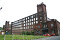
 Mutual Mill - No. 3 mill.jpg 640 × 427; 90 KB
-
 Mutual Mills - geograph.org.uk - 446525.jpg 427 × 640; 63 KB
-
 Mutual Mills - No. 2 engine house - geograph.org.uk - 446561.jpg 640 × 427; 90 KB
-
 Mutual Mills - No. 3 mill - geograph.org.uk - 446551.jpg 640 × 427; 121 KB
-
 Mutual Mills, Heywood - geograph.org.uk - 446542.jpg 640 × 427; 74 KB
-
 Mutual Mills, Heywood - geograph.org.uk - 751999.jpg 640 × 427; 95 KB
-

-
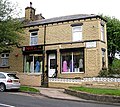 Naz Boutique - Thursby Street - geograph.org.uk - 446192.jpg 640 × 569; 122 KB
-
 Nether Gask - geograph.org.uk - 449208.jpg 640 × 480; 84 KB
-
 New Pier and Rocks, Loch Scresort - geograph.org.uk - 644036.jpg 640 × 360; 75 KB
-
 Ninian Park - geograph.org.uk - 446465.jpg 480 × 640; 60 KB
-
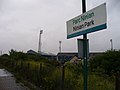 Ninian Park railway station.jpg 640 × 480; 80 KB
-
 NN2781 The A86 and The Roybridge Hotel.jpg 640 × 480; 44 KB
-
 North Star Dyke - geograph.org.uk - 471136.jpg 640 × 417; 262 KB

_-_geograph.org.uk_-_446297.jpg)


_-_geograph.org.uk_-_449062.jpg)


.jpg)


_(1)_-_geograph.org.uk_-_445966.jpg)
_(2)_-_geograph.org.uk_-_445974.jpg)


_-_geograph.org.uk_-_445889.jpg)
_-_geograph.org.uk_-_445900.jpg)
.jpg)


_-_geograph.org.uk_-_462597.jpg)
_-_geograph.org.uk_-_462600.jpg)


