Category:United Kingdom photographs taken on 2007-04-26
Jump to navigation
Jump to search
Countries of Europe: Austria · Belgium · Czech Republic · Finland · France‡ · Germany · Greece · Hungary · Italy · Latvia · Lithuania · Netherlands‡ · Poland · Romania · Russia‡ · Slovakia · Spain‡ · Sweden · Switzerland · Turkey‡ · Ukraine · United Kingdom
‡: partly located in Europe
‡: partly located in Europe
| ← | 26 April 2007 | → | ||
| ← | April 2007 | → | ||

United Kingdom photographs taken on 26 April 2007.
Image files should be categorized here automatically using {{taken on}} template. Direct categorisation is also possible, if automatic is impossible.
Subcategories
This category has the following 3 subcategories, out of 3 total.
L
Media in category "United Kingdom photographs taken on 2007-04-26"
The following 200 files are in this category, out of 1,049 total.
(previous page) (next page)-
 'Bede's Well' Jarrow - geograph.org.uk - 1386018.jpg 640 × 480; 123 KB
-
 'Bede's Well' Jarrow - geograph.org.uk - 1386019.jpg 640 × 480; 124 KB
-
 'Bede's Well' Jarrow - geograph.org.uk - 1386020.jpg 640 × 480; 113 KB
-
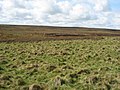 (Featureless) moorland - geograph.org.uk - 416583.jpg 640 × 480; 105 KB
-
 (Part of) Catton Moss - geograph.org.uk - 416575.jpg 640 × 480; 120 KB
-

-
 1 and 2 Claremont - Lowtown - geograph.org.uk - 413764.jpg 640 × 535; 85 KB
-
 100-mile tree - geograph.org.uk - 490154.jpg 640 × 477; 100 KB
-
 A busy transport intersection - geograph.org.uk - 490131.jpg 640 × 477; 126 KB
-
 A magical corner in Theberton Woods - geograph.org.uk - 722720.jpg 640 × 485; 140 KB
-

-
 A2 at Laraghaleas - geograph.org.uk - 414782.jpg 640 × 479; 63 KB
-
 A406 North Circular Road - geograph.org.uk - 416823.jpg 640 × 480; 83 KB
-
 A500 looking towards M6 J15 - geograph.org.uk - 414385.jpg 640 × 480; 30 KB
-
 Abandoned Bicycle - Tame Valley Canal - geograph.org.uk - 928969.jpg 480 × 640; 137 KB
-
 Across Windemere - geograph.org.uk - 732358.jpg 640 × 480; 27 KB
-
 Agden Dike - geograph.org.uk - 414650.jpg 640 × 480; 120 KB
-
 Agden Dike - geograph.org.uk - 430091.jpg 640 × 480; 122 KB
-
 Airfield relic. - geograph.org.uk - 416315.jpg 640 × 480; 109 KB
-
 Alien plants at Cranny, Omagh - geograph.org.uk - 415678.jpg 640 × 480; 77 KB
-
 All Saints church - view east - geograph.org.uk - 1549660.jpg 480 × 640; 85 KB
-
 All Saints church - view west - geograph.org.uk - 1549661.jpg 480 × 640; 82 KB
-
 All Saints church, Flore - geograph.org.uk - 489996.jpg 640 × 477; 116 KB
-
 All Saints church, Flore - geograph.org.uk - 490001.jpg 640 × 477; 124 KB
-
 All Saints. - geograph.org.uk - 414932.jpg 640 × 480; 92 KB
-
 Almshouse - geograph.org.uk - 414806.jpg 640 × 480; 229 KB
-
 Ancient Tree in Spearywell Wood - geograph.org.uk - 424276.jpg 480 × 640; 147 KB
-
 Ant 'farming' an aphid, Forest of Dean - geograph.org.uk - 1062305.jpg 640 × 405; 110 KB
-
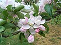 Apple blossom (2) - geograph.org.uk - 414428.jpg 640 × 480; 115 KB
-
 Approaching 'Treasure Trove' - geograph.org.uk - 413829.jpg 640 × 480; 94 KB
-
 Approaching Canons Ashby - geograph.org.uk - 493921.jpg 640 × 477; 91 KB
-

-
 Ardtornish House from Rannoch River - geograph.org.uk - 706976.jpg 427 × 640; 78 KB
-

-
 Atomfa Trawsfynydd Nuclear power station - geograph.org.uk - 414949.jpg 640 × 428; 149 KB
-
 Atomfa Trawsfynydd Nuclear power station - geograph.org.uk - 414958.jpg 640 × 428; 198 KB
-
 Auchenknight Farm - geograph.org.uk - 414133.jpg 640 × 480; 116 KB
-
 BA8894 Wick - Edinburgh - geograph.org.uk - 436980.jpg 640 × 480; 58 KB
-
 Baldersby St James Church - geograph.org.uk - 419322.jpg 480 × 640; 95 KB
-
 Balls Hill Bridge - Tame Valley Canal - geograph.org.uk - 902725.jpg 640 × 480; 56 KB
-
 Balmakin - geograph.org.uk - 414263.jpg 640 × 399; 59 KB
-
 Balniel - geograph.org.uk - 414187.jpg 640 × 382; 63 KB
-
 Bankhead - geograph.org.uk - 413841.jpg 640 × 427; 235 KB
-
 Barnes Meadow Bridge - Walsall Canal - geograph.org.uk - 902609.jpg 640 × 480; 97 KB
-
 Bell Bridge - Rushall Canal - geograph.org.uk - 902742.jpg 640 × 480; 105 KB
-
 Benwhat School - geograph.org.uk - 414495.jpg 614 × 461; 126 KB
-
 Biddlestone Bridge - Rushall Canal - geograph.org.uk - 902739.jpg 640 × 480; 103 KB
-
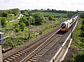
 Bingley Railway Station.jpg 640 × 480; 84 KB
-
 BJY Boundary Stone at Small Dale - geograph.org.uk - 430082.jpg 640 × 480; 123 KB
-
 Black Slug (Arion ater) - geograph.org.uk - 413741.jpg 640 × 480; 181 KB
-
 Bluebells in Clapgate Copse - geograph.org.uk - 424487.jpg 640 × 480; 153 KB
-
 Bluebells in Great Copse - geograph.org.uk - 424459.jpg 640 × 480; 159 KB
-
 Boats at Lydbrook Fisheries - geograph.org.uk - 418307.jpg 640 × 480; 124 KB
-
 Bod Owen - geograph.org.uk - 414042.jpg 640 × 428; 178 KB
-
 Bod Owen - geograph.org.uk - 414064.jpg 640 × 428; 172 KB
-
 Bracknell street - panoramio.jpg 640 × 480; 195 KB
-
 Brecon-Aberhonddu Cathedral - geograph.org.uk - 524362.jpg 640 × 427; 118 KB
-
 Brecon-Aberhonddu River Bridge - geograph.org.uk - 524379.jpg 640 × 427; 155 KB
-
 Bridge no more - Walsall Canal - geograph.org.uk - 902721.jpg 640 × 480; 108 KB
-

-
-
 Brown Cow. - geograph.org.uk - 414960.jpg 640 × 480; 70 KB
-

-
 Buddabrake peat track - geograph.org.uk - 413887.jpg 640 × 426; 66 KB
-
 Bull Lane Bridge - Walsall Canal - geograph.org.uk - 902713.jpg 640 × 480; 97 KB
-
 Buzzard over the Rheidol valley - geograph.org.uk - 656215.jpg 640 × 427; 38 KB
-
 By East Gilston - geograph.org.uk - 414117.jpg 640 × 424; 90 KB
-
 By West Gilston - geograph.org.uk - 414106.jpg 640 × 432; 73 KB
-

-
 Calstock, Cothele House - geograph.org.uk - 415331.jpg 640 × 427; 226 KB
-
 Campsey, Derry - Londonderry - geograph.org.uk - 414780.jpg 640 × 479; 70 KB
-
-
 Canons Ashby church - geograph.org.uk - 493931.jpg 477 × 640; 111 KB
-
 Canons Ashby House - geograph.org.uk - 493923.jpg 640 × 477; 138 KB
-
 Canons Ashby House 4.jpg 640 × 477; 123 KB
-
 Carnakilly - geograph.org.uk - 414789.jpg 640 × 314; 34 KB
-
 Carnakilly - geograph.org.uk - 414791.jpg 640 × 479; 44 KB
-
 Carnakilly Townland - geograph.org.uk - 414793.jpg 640 × 479; 66 KB
-
-
 Case tractor - panoramio.jpg 1,600 × 1,200; 687 KB
-
 Castle at Bamburgh - geograph.org.uk - 534631.jpg 480 × 640; 141 KB
-
 Cattle at Drodland - geograph.org.uk - 413861.jpg 640 × 427; 255 KB
-
 Cattle Grazing near Ackleton, Shropshire - geograph.org.uk - 415808.jpg 1,440 × 819; 1.06 MB
-
 Chalk cliffs - geograph.org.uk - 505630.jpg 640 × 480; 113 KB
-
 Christian Life Centre - geograph.org.uk - 414188.jpg 640 × 480; 108 KB
-
 Church Lane - geograph.org.uk - 413749.jpg 635 × 640; 62 KB
-
 St. Michael's, Church Stowe - geograph.org.uk - 490186.jpg 640 × 477; 104 KB
-
 Church Street Market, Lisson Grove - geograph.org.uk - 413862.jpg 640 × 480; 140 KB
-
 Clarks wood - geograph.org.uk - 458253.jpg 640 × 480; 136 KB
-
 Clifton Hill - Lowtown - geograph.org.uk - 413756.jpg 640 × 422; 71 KB
-
 Closed barbers shop - geograph.org.uk - 413943.jpg 640 × 480; 62 KB
-
 Closed shops in Queen Street - geograph.org.uk - 413986.jpg 640 × 480; 61 KB
-

-
 Cofeb Hedd Wyn Memorial - geograph.org.uk - 414624.jpg 640 × 428; 150 KB
-
 Cofgolofn - geograph.org.uk - 414143.jpg 640 × 480; 166 KB
-
 Common Dog Violet - geograph.org.uk - 417446.jpg 640 × 466; 263 KB
-
 Common land near Gowerton - geograph.org.uk - 429207.jpg 640 × 480; 64 KB
-
 Common Lane - geograph.org.uk - 414039.jpg 478 × 640; 89 KB
-
 Coolkeeragh - geograph.org.uk - 414766.jpg 640 × 300; 29 KB
-
 Coolkeeragh - geograph.org.uk - 414767.jpg 640 × 479; 67 KB
-
 Coolkeeragh - geograph.org.uk - 414769.jpg 640 × 301; 31 KB
-
 Coolkeeragh Power Station - geograph.org.uk - 414768.jpg 640 × 626; 58 KB
-
 Coombe Church - panoramio.jpg 3,072 × 2,304; 2.96 MB
-
 Coombe Gibbet - panoramio.jpg 2,304 × 3,072; 2.25 MB
-
 Coop for pheasant-rearing - geograph.org.uk - 414580.jpg 640 × 480; 139 KB
-
 Corbie Craigs - geograph.org.uk - 414487.jpg 614 × 461; 128 KB
-
 Corlett Street, Lisson Grove - geograph.org.uk - 414321.jpg 480 × 640; 125 KB
-
 Corlett Street, Lisson Grove - geograph.org.uk - 414337.jpg 639 × 480; 141 KB
-
 Cottages at Kersoe - geograph.org.uk - 414436.jpg 640 × 480; 124 KB
-
 Cows at Edenreagh - geograph.org.uk - 414896.jpg 640 × 479; 78 KB
-
 Craiglirian Craig - geograph.org.uk - 415264.jpg 640 × 480; 111 KB
-
 Craiglour Hawse - geograph.org.uk - 414471.jpg 640 × 480; 121 KB
-
 Cumber Church of Ireland - geograph.org.uk - 415655.jpg 640 × 479; 61 KB
-
 Curious lambs - geograph.org.uk - 413917.jpg 640 × 480; 101 KB
-
 Daisy Field - geograph.org.uk - 413837.jpg 640 × 427; 268 KB
-
 Darlaston Road Bridge - Walsall Canal - geograph.org.uk - 906335.jpg 640 × 480; 110 KB
-
 Daw End Bridge - Daw End Canal - geograph.org.uk - 902750.jpg 640 × 480; 102 KB
-
 Decoy Farm - geograph.org.uk - 414535.jpg 640 × 480; 131 KB
-
 Dee Sailing Club from Causeway - geograph.org.uk - 553155.jpg 640 × 480; 50 KB
-
 Deep in the forest something stirred - geograph.org.uk - 414476.jpg 640 × 480; 116 KB
-

-
 Derelict Cottage - geograph.org.uk - 413771.jpg 640 × 427; 287 KB
-
 Derelict Farm - geograph.org.uk - 413767.jpg 640 × 360; 178 KB
-
 Descending NW from Hill of Fare - geograph.org.uk - 414618.jpg 640 × 480; 86 KB
-
 Detail of bell at Snowshill Manor - geograph.org.uk - 467544.jpg 640 × 480; 150 KB
-
 Disused post box - geograph.org.uk - 414761.jpg 480 × 640; 270 KB
-
 Doe Bank Bridge - Walsall Canal - geograph.org.uk - 906342.jpg 640 × 480; 92 KB
-
 Drill Hall, Denne Road - geograph.org.uk - 414834.jpg 640 × 486; 57 KB
-
 Drodland - geograph.org.uk - 413804.jpg 640 × 427; 288 KB
-
 Drodland - geograph.org.uk - 413807.jpg 640 × 427; 277 KB
-
 Drumgrange Incline - geograph.org.uk - 414033.jpg 614 × 461; 120 KB
-
 Drumhill Wood - geograph.org.uk - 524809.jpg 480 × 640; 195 KB
-
 Dun Hallin - geograph.org.uk - 414645.jpg 640 × 427; 369 KB
-
 Dun Hallin - geograph.org.uk - 414646.jpg 640 × 425; 347 KB
-
 Dunbridge Village from Hatt Hill - geograph.org.uk - 422609.jpg 640 × 480; 69 KB
-
 Dunsop Bridge Village Hall - geograph.org.uk - 414218.jpg 640 × 480; 101 KB
-
 Edge of Turk Wood - geograph.org.uk - 413635.jpg 640 × 480; 122 KB
-
-
 End of the trail - geograph.org.uk - 413915.jpg 640 × 480; 85 KB
-
 Entrance to Catherston Manor - geograph.org.uk - 413754.jpg 640 × 480; 189 KB
-
 Ironstone houses in Eydon - geograph.org.uk - 494015.jpg 640 × 477; 87 KB
-
 Eydon village green - geograph.org.uk - 494013.jpg 640 × 477; 90 KB
-
 Farm Buildings Near Pontsticill - geograph.org.uk - 524288.jpg 640 × 427; 110 KB
-
 Farm track by Balmakin - geograph.org.uk - 414290.jpg 640 × 394; 85 KB
-

-
 Farmland at Bonemills Farm - geograph.org.uk - 414095.jpg 640 × 427; 101 KB
-
 Farmland near Shirrall Hall - geograph.org.uk - 415105.jpg 640 × 480; 63 KB
-
 Farmland near Snowshill Manor - geograph.org.uk - 467534.jpg 640 × 480; 152 KB
-
 Farmland, Nether Winchendon - geograph.org.uk - 414520.jpg 640 × 480; 157 KB
-
 Farmland, Waddesdon - geograph.org.uk - 414528.jpg 640 × 480; 101 KB
-
 Farmland, Westcott - geograph.org.uk - 414525.jpg 640 × 480; 157 KB
-

-
 Fertilising operations - geograph.org.uk - 493879.jpg 640 × 477; 63 KB
-
 Fertilising operations - geograph.org.uk - 493884.jpg 640 × 477; 76 KB
-
 Fertilising operations - geograph.org.uk - 493890.jpg 640 × 477; 84 KB
-
 Field Gate - geograph.org.uk - 414502.jpg 640 × 480; 102 KB
-
 Field of Rape Seed near Butt's Green - geograph.org.uk - 423345.jpg 640 × 480; 105 KB
-

-
 Fields near Cefn-bangor farm - geograph.org.uk - 656195.jpg 640 × 428; 52 KB
-
 Firebreak - geograph.org.uk - 415207.jpg 640 × 480; 114 KB
-
 Flamborough - geograph.org.uk - 505631.jpg 640 × 480; 84 KB
-
 Flamborough Head Lighthouse - geograph.org.uk - 505629.jpg 640 × 480; 42 KB
-
 Flooding The Lock - geograph.org.uk - 414091.jpg 476 × 640; 120 KB
-
 Flora of Clapgate Copse - geograph.org.uk - 424501.jpg 640 × 480; 120 KB
-
 Fog Horns and Radio signal station - geograph.org.uk - 505633.jpg 640 × 480; 94 KB
-

-
 Footbridge over the River Aline - geograph.org.uk - 1455019.jpg 640 × 427; 149 KB
-
 Ford Across the Milk Burn - geograph.org.uk - 413793.jpg 427 × 640; 257 KB
-
 Forestry at Gillen - geograph.org.uk - 414659.jpg 640 × 425; 376 KB
-
 Forestry Road, Lookout Post - geograph.org.uk - 413670.jpg 640 × 480; 137 KB
-
 Former Great Central railway line - geograph.org.uk - 493979.jpg 640 × 477; 111 KB
-
 Former railway bridge - geograph.org.uk - 493997.jpg 640 × 477; 150 KB
-
 Former Railway Line - off Lowtown - geograph.org.uk - 413778.jpg 640 × 343; 93 KB
-

-
-
-
 Garden pond at Snowshill Manor - geograph.org.uk - 467548.jpg 640 × 480; 150 KB
-
 Gate exit from Hill of Fare - geograph.org.uk - 414599.jpg 640 × 480; 89 KB
-
 Gates, Sculthorpe Airfield - geograph.org.uk - 449900.jpg 640 × 480; 98 KB
-
 Gateway to Bishop's Palace - geograph.org.uk - 415767.jpg 640 × 480; 90 KB
-

-
-
 Gorse in bloom - geograph.org.uk - 413687.jpg 640 × 480; 158 KB
-
 Gorse, gorse and more gorse. - geograph.org.uk - 417434.jpg 640 × 466; 164 KB
-
 Grange War Memorial - geograph.org.uk - 413779.jpg 640 × 407; 278 KB
-
 Grass track - geograph.org.uk - 414448.jpg 640 × 480; 108 KB
-
 Gravel works beyond - geograph.org.uk - 413964.jpg 640 × 480; 119 KB
-

-
 Grazing Cattle near Clapgate Copse - geograph.org.uk - 424496.jpg 640 × 480; 74 KB
-
 Great Bleaberry Gill - geograph.org.uk - 414104.jpg 427 × 640; 126 KB
-

-
 Greenridge Burn - geograph.org.uk - 416426.jpg 640 × 480; 127 KB
-
 Grouse droppings on the Hill of Fare - geograph.org.uk - 413753.jpg 640 × 480; 175 KB
-

-

-
 Guardian of the Bridge. - geograph.org.uk - 414105.jpg 640 × 480; 97 KB
-
 Gulworthy, waterwheel at Morwellham - geograph.org.uk - 415329.jpg 640 × 427; 228 KB
-

-
 Hattersley Crescent , Church Street - geograph.org.uk - 414748.jpg 640 × 480; 89 KB
-
 Headwaters of the Cherwell - geograph.org.uk - 494002.jpg 640 × 477; 146 KB


_moorland_-_geograph.org.uk_-_416583.jpg)
_Catton_Moss_-_geograph.org.uk_-_416575.jpg)
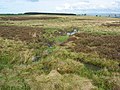
_cleugh_feeding_into_Anchey_Sike_-_geograph.org.uk_-_416528.jpg)


_-_geograph.org.uk_-_414428.jpg)


_-_geograph.org.uk_-_413741.jpg)


,_26_April_2007_cropped.jpg)
,_26_April_2007.jpg)


