Category:United Kingdom photographs taken on 2006-09-06
Jump to navigation
Jump to search
Countries of Europe: Austria · Belgium · Bosnia and Herzegovina · Bulgaria · Croatia · Cyprus‡ · Czech Republic · Finland · France‡ · Georgia‡ · Germany · Iceland · Republic of Ireland · Italy · Latvia · Netherlands‡ · Portugal‡ · Russia‡ · Slovakia · Spain‡ · Sweden · Switzerland · Turkey‡ · Ukraine · United Kingdom
‡: partly located in Europe
‡: partly located in Europe
| ← | 6 September 2006 | → | ||
| ← | September 2006 | → | ||

United Kingdom photographs taken on 6 September 2006.
Image files should be categorized here automatically using {{taken on}} template. Direct categorisation is also possible, if automatic is impossible.
Subcategories
This category has the following 2 subcategories, out of 2 total.
Media in category "United Kingdom photographs taken on 2006-09-06"
The following 200 files are in this category, out of 560 total.
(previous page) (next page)-
 'The Bull' inn, Bacton, Suffolk - geograph.org.uk - 235170.jpg 640 × 369; 53 KB
-
 'The Crown' inn, Stowupland, Suffolk - geograph.org.uk - 234648.jpg 640 × 480; 74 KB
-

-

-
 150019 and 158764 at Worcester Shrub Hill.jpg 1,600 × 1,200; 651 KB
-

-
 66119 & 185121 at York.jpg 2,160 × 1,424; 1.15 MB
-
 66119 at York - 5508971442.jpg 1,280 × 777; 306 KB
-
 66119 at York.jpg 1,280 × 769; 309 KB
-
 A15 near Scawby - geograph.org.uk - 234368.jpg 640 × 427; 95 KB
-
 Afon Fyllin - geograph.org.uk - 241798.jpg 640 × 451; 99 KB
-
 Afon Gain - geograph.org.uk - 241405.jpg 640 × 480; 92 KB
-
 Afon Wen - geograph.org.uk - 241455.jpg 640 × 480; 154 KB
-
 Afon Wen in the Coed y Brenin - geograph.org.uk - 241470.jpg 640 × 480; 158 KB
-
 All Saints Church, Weybourne - geograph.org.uk - 745439.jpg 640 × 480; 99 KB
-
 Ann Summers Shop - geograph.org.uk - 242230.jpg 640 × 482; 107 KB
-
 Anne Street - geograph.org.uk - 234212.jpg 640 × 495; 103 KB
-
 Arnos Park, Piccadilly Line viaduct - geograph.org.uk - 235787.jpg 640 × 480; 101 KB
-
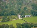
 Aultnancaber Shooting Lodge - geograph.org.uk - 234371.jpg 640 × 480; 92 KB
-
 B9052 road - geograph.org.uk - 234146.jpg 640 × 480; 75 KB
-
 B9052 road - geograph.org.uk - 234148.jpg 640 × 480; 73 KB
-
 Bamburgh Castle - geograph.org.uk - 254296.jpg 640 × 376; 47 KB
-
-
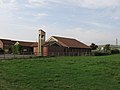
 Beilsbeck Farm - geograph.org.uk - 234316.jpg 640 × 426; 143 KB
-
 Beilsbeck Farm Near Market Weighton - geograph.org.uk - 234193.jpg 640 × 426; 142 KB
-
 Belfast - Dublin road near Newry (2) - geograph.org.uk - 234439.jpg 640 × 426; 120 KB
-
 Belfast-Dublin road near Mullan's Corner - geograph.org.uk - 234458.jpg 640 × 426; 130 KB
-
 Binks Car Park and The Cleveland Pub - geograph.org.uk - 274128.jpg 640 × 480; 50 KB
-
 Bishop Lane - geograph.org.uk - 235260.jpg 465 × 640; 130 KB
-
 Black Craig Observation Point - geograph.org.uk - 260060.jpg 640 × 480; 63 KB
-
 Blaen-rhiwarth farm - geograph.org.uk - 241741.jpg 640 × 480; 112 KB
-
 Boer War Memorial, Highbury Fields - geograph.org.uk - 235070.jpg 480 × 640; 149 KB
-
 Bordon , queue at the lights - geograph.org.uk - 234560.jpg 640 × 480; 127 KB
-
 Boundary Farm, near Cotton, Suffolk - geograph.org.uk - 235146.jpg 640 × 480; 67 KB
-
 BP Filling Station - geograph.org.uk - 235526.jpg 640 × 480; 106 KB
-

-
 Brearton, North Yorkshire.jpg 640 × 479; 107 KB
-
 Bridge over Afon Tanat - geograph.org.uk - 241755.jpg 640 × 480; 98 KB
-
 Bridge over Dollis Brook - geograph.org.uk - 234681.jpg 640 × 480; 211 KB
-

-
 Bridlepath from Occaney - geograph.org.uk - 234249.jpg 640 × 479; 109 KB
-
 Bridleway to Scotter - geograph.org.uk - 234390.jpg 640 × 427; 65 KB
-
 Bungalow East Common, Market Weighton - geograph.org.uk - 234347.jpg 640 × 426; 138 KB
-
 Burghead pier.jpg 640 × 482; 106 KB
-
 Burn of Graemeshall road bridge - geograph.org.uk - 234151.jpg 640 × 480; 73 KB
-
 Bust of Mahatma Gandhi - geograph.org.uk - 235438.jpg 467 × 631; 506 KB
-
 Caledonian Pine Tree, Bark - geograph.org.uk - 602967.jpg 480 × 640; 163 KB
-
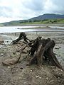 Capel Celyn exposed tree stumps.jpg 1,944 × 2,592; 1.4 MB
-
 Cared Fawr near Llanfachreth - geograph.org.uk - 241661.jpg 640 × 480; 109 KB
-
 Castle Cary catch points - 01.jpg 1,600 × 1,200; 888 KB
-
 Castle Cary catch points - 02.jpg 1,600 × 1,200; 884 KB
-
 Chapel at Penygarnedd - geograph.org.uk - 241771.jpg 640 × 480; 125 KB
-
 Chastleton House - geograph.org.uk - 895673.jpg 640 × 480; 119 KB
-
 Chater Street, Moulton - geograph.org.uk - 234958.jpg 640 × 502; 118 KB
-
 Cheapest petrol in Britain? - geograph.org.uk - 235551.jpg 640 × 480; 86 KB
-
 Church at Bursea.jpg 640 × 426; 120 KB
-
 Church of All Saints, Rempstone - geograph.org.uk - 235542.jpg 640 × 480; 64 KB
-
 Church Street, Sheringham - geograph.org.uk - 246595.jpg 640 × 480; 138 KB
-
 Coarse fishing water at Burton - geograph.org.uk - 481208.jpg 640 × 480; 60 KB
-

-
 Coed y Brenin - geograph.org.uk - 241440.jpg 640 × 480; 101 KB
-
 Coed y Brenin - geograph.org.uk - 241447.jpg 640 × 480; 101 KB
-
 Colorado Way - geograph.org.uk - 237339.jpg 640 × 428; 45 KB
-
 Conifers in West Walk, Forest of Bere - geograph.org.uk - 234484.jpg 427 × 640; 181 KB
-
 Convenience Store - geograph.org.uk - 234597.jpg 640 × 480; 99 KB
-
 Conwy station - geograph.org.uk - 238309.jpg 640 × 480; 74 KB
-
 Copse on South Cliffe Common - geograph.org.uk - 234194.jpg 640 × 426; 126 KB
-
 Cottage at Mendlesham Green, Suffolk - geograph.org.uk - 235123.jpg 640 × 480; 88 KB
-
 Cottage at Saxham Street, Suffolk - geograph.org.uk - 234650.jpg 640 × 480; 108 KB
-
 Cotton - Church of St Andrew.jpg 640 × 480; 101 KB
-

-
 Crags on the eastern slopes of Belig - geograph.org.uk - 236177.jpg 480 × 640; 80 KB
-

-
 Cuddington footpath 7 beside maize field - geograph.org.uk - 239338.jpg 640 × 480; 154 KB
-

-
 Drypool Bridge - geograph.org.uk - 235254.jpg 640 × 458; 112 KB
-
 Ducks on the Lake - geograph.org.uk - 234688.jpg 640 × 480; 167 KB
-
 Dunchurch - geograph.org.uk - 234684.jpg 640 × 480; 141 KB
-
 Dunchurch - geograph.org.uk - 234689.jpg 640 × 480; 113 KB
-
 Dunchurch - geograph.org.uk - 234693.jpg 640 × 480; 94 KB
-
 Dunkery Beacon - geograph.org.uk - 237582.jpg 640 × 480; 78 KB
-
 East Barnet, Parkside Gardens - geograph.org.uk - 235915.jpg 640 × 480; 92 KB
-
 Eastern end of Castle Cary railway station 03.jpg 1,600 × 1,200; 949 KB
-
 Eastern end of Castle Cary railway station 08.jpg 1,600 × 1,200; 858 KB
-
 Eastern end of Castle Cary railway station 09.jpg 1,600 × 1,200; 858 KB
-
 Eastern slopes of Glas Beinn Mhor - geograph.org.uk - 235687.jpg 640 × 480; 100 KB
-
 Emerald Airways G-AYIM 06-09-06 (21373697603).jpg 3,227 × 2,170; 954 KB
-
 Emerald Airways HS748 G-ORCP cvt 06-09-06 (21411761013).jpg 3,335 × 2,147; 913 KB
-
-
 Entrance to Lancaster market.jpg 480 × 640; 99 KB
-
 Farm at Bursea - geograph.org.uk - 234379.jpg 640 × 426; 135 KB
-
 Farm Silos - geograph.org.uk - 234344.jpg 640 × 426; 99 KB
-

-
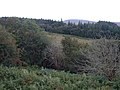
 Farmland - geograph.org.uk - 241761.jpg 640 × 480; 95 KB
-
 Farmland - geograph.org.uk - 241793.jpg 640 × 480; 83 KB
-
 Farmland in Cwm Rhiwarth - geograph.org.uk - 241751.jpg 640 × 480; 128 KB
-
 Farmland near Occaney - geograph.org.uk - 234248.jpg 640 × 479; 101 KB
-
 Farmland off Ferrensby Bridleway - geograph.org.uk - 234246.jpg 640 × 479; 116 KB
-
 Farnham Church - geograph.org.uk - 234226.jpg 640 × 479; 97 KB
-
 Farnham Lake - geograph.org.uk - 234228.jpg 640 × 479; 88 KB
-
 Farnham, North Yorkshire.jpg 640 × 479; 104 KB
-
 Field at Arglam - geograph.org.uk - 234180.jpg 426 × 640; 117 KB
-
 Field at North Carr Farm - geograph.org.uk - 234310.jpg 640 × 426; 117 KB
-
 Field at South Cliffe Common - geograph.org.uk - 234189.jpg 640 × 426; 126 KB
-
 Field Near East Common - geograph.org.uk - 234188.jpg 640 × 426; 144 KB
-
 Field opposite Squires Cafe - geograph.org.uk - 241457.jpg 640 × 480; 47 KB
-
 Field, Newthorpe - geograph.org.uk - 241448.jpg 640 × 480; 48 KB
-
 Fields to NW of A614 Portington Junction - geograph.org.uk - 234396.jpg 640 × 426; 104 KB
-
 Fillingham Castle - geograph.org.uk - 234318.jpg 640 × 427; 71 KB
-
 Fintona Methodist Church - geograph.org.uk - 234096.jpg 640 × 479; 47 KB
-
 Fintona Presbyterian Church - geograph.org.uk - 234097.jpg 640 × 479; 59 KB
-
 Flatbed trolley at Castle Cary railway station.jpg 1,600 × 1,200; 912 KB
-
 Floating Harbour and Bristol city centre - geograph.org.uk - 491107.jpg 640 × 512; 116 KB
-
 Folkestone Harbour September 2006 - geograph.org.uk - 240420.jpg 640 × 480; 100 KB
-
 Footpath sign - geograph.org.uk - 235106.jpg 640 × 481; 158 KB
-
 Footpath Sign Near Dryham - geograph.org.uk - 234290.jpg 426 × 640; 134 KB
-
 Footpath to Sweet Hills - geograph.org.uk - 234404.jpg 640 × 427; 64 KB
-
 Forestry track - geograph.org.uk - 241787.jpg 640 × 480; 131 KB
-
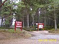
 Forestry Trail on Weybourne Heath - geograph.org.uk - 235457.jpg 640 × 480; 111 KB
-
 Fungi and Ivy - geograph.org.uk - 234679.jpg 480 × 640; 190 KB
-
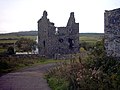 Galdenoch Castle (remains) - geograph.org.uk - 240913.jpg 640 × 480; 67 KB
-
 Gascoigne Wood Mine - geograph.org.uk - 235107.jpg 640 × 480; 128 KB
-
 Greetwell Crossroads - geograph.org.uk - 234361.jpg 640 × 427; 55 KB
-
 Greetwell Hall Farm - geograph.org.uk - 234387.jpg 640 × 427; 64 KB
-
 Gresham's School, Holt - geograph.org.uk - 235480.jpg 640 × 480; 106 KB
-
 Gun Inn at Keyhaven - geograph.org.uk - 333925.jpg 640 × 480; 108 KB
-
 Harvesting the Barley - geograph.org.uk - 243664.jpg 640 × 427; 86 KB
-
 Hasholme Hall - geograph.org.uk - 234372.jpg 640 × 426; 146 KB
-
 Hasholme Hall.jpg 640 × 426; 129 KB
-
 Hepworth's Arcade - Market Place Frontage - geograph.org.uk - 247675.jpg 522 × 640; 140 KB
-
 High Street Holt - geograph.org.uk - 860951.jpg 640 × 480; 172 KB
-
 High Street, Hull - geograph.org.uk - 1377802.jpg 582 × 640; 118 KB
-
 HMS Jackdaw II control tower - geograph.org.uk - 239569.jpg 640 × 480; 83 KB
-
 Holt Station, North Norfolk Railway - geograph.org.uk - 246508.jpg 640 × 480; 138 KB
-

-
 Holy Trinity Church, Hull (geograph 234700).jpg 640 × 502; 104 KB
-
 Horkstow Roman Mosaic - geograph.org.uk - 235236.jpg 640 × 519; 141 KB
-
 House at High Street Green, Suffolk - geograph.org.uk - 237280.jpg 640 × 480; 96 KB
-
 House at Hotham Carrs - geograph.org.uk - 234296.jpg 640 × 426; 142 KB
-
 House at Weighton common - geograph.org.uk - 234332.jpg 640 × 426; 111 KB
-
 House near Weighton Common - geograph.org.uk - 234186.jpg 640 × 426; 130 KB
-
 Hull and East Riding Museum - geograph.org.uk - 235231.jpg 640 × 480; 151 KB
-
 Hunstanton town sign.JPG 373 × 640; 37 KB
-
 Hurst Spit - geograph.org.uk - 333994.jpg 640 × 480; 126 KB
-

-
 Ice House - geograph.org.uk - 259860.jpg 640 × 480; 65 KB
-

-
 Inverkirchaig Loch - geograph.org.uk - 1652859.jpg 640 × 480; 76 KB
-
 Irwin's Hardware, Fintona - geograph.org.uk - 234092.jpg 640 × 479; 68 KB
-
 Keld to Muker - geograph.org.uk - 878112.jpg 640 × 424; 98 KB
-
 Kelso Abbey ruins and gardens - geograph.org.uk - 699916.jpg 640 × 440; 83 KB
-
 Keyhaven Harbour - geograph.org.uk - 333928.jpg 640 × 480; 84 KB
-
 Keyhaven Marshes - geograph.org.uk - 333952.jpg 640 × 471; 106 KB
-
 Trinity House Gateway - geograph.org.uk - 239167.jpg 640 × 472; 94 KB
-
 Knowstone, St Peter's church - geograph.org.uk - 234553.jpg 640 × 427; 138 KB
-
 Knowstone, The Mason's Arms - geograph.org.uk - 234558.jpg 640 × 427; 165 KB
-
 Lagoon and Pump - geograph.org.uk - 234550.jpg 640 × 426; 145 KB
-
 Lancaster museum - geograph.org.uk - 257021.jpg 480 × 640; 75 KB
-
 St John's Church, Lancaster.jpg 640 × 480; 53 KB
-

-
 Lane through the Ferry Wood near Omeath - geograph.org.uk - 234487.jpg 640 × 426; 149 KB
-
 Large Balestack - geograph.org.uk - 244348.jpg 640 × 427; 79 KB
-
 Lawrence Hill station.jpg 2,272 × 1,704; 1.6 MB
-
 Lendal Bridge ^ York Minster. Йорк - panoramio.jpg 1,005 × 1,006; 225 KB
-
 Lightning damaged chimney - geograph.org.uk - 234669.jpg 624 × 640; 99 KB
-
 St. Francis Church Littlemoor - geograph.org.uk - 394721.jpg 640 × 480; 69 KB
-
 Llanfachreth village - geograph.org.uk - 241655.jpg 640 × 480; 94 KB
-
 Loch Eilastar shoreline - geograph.org.uk - 733248.jpg 640 × 480; 46 KB
-
 Loch More, Galdenoch Estate - geograph.org.uk - 240920.jpg 640 × 480; 67 KB
-
 Loch na Sguabaidh - geograph.org.uk - 236180.jpg 640 × 480; 91 KB
-
 Looking down Cwm Rhiwarth - geograph.org.uk - 241747.jpg 640 × 480; 112 KB
-
 Looking south - geograph.org.uk - 1340848.jpg 640 × 480; 97 KB
-
 Looking up Cwm Rhiwarth - geograph.org.uk - 241744.jpg 640 × 480; 101 KB
-
 Looking West from Burland Hall Track - geograph.org.uk - 234389.jpg 640 × 426; 118 KB
-
 Manor Farm - geograph.org.uk - 234324.jpg 640 × 426; 136 KB
-
 Manor Farm, Weighton Common - geograph.org.uk - 234191.jpg 640 × 426; 111 KB
-
 Manor House, Bacton, Suffolk - geograph.org.uk - 235169.jpg 640 × 461; 94 KB
-
 Marketplace Post Office - geograph.org.uk - 234699.jpg 640 × 463; 133 KB
-
 Matfen High House, rear view - geograph.org.uk - 308074.jpg 640 × 427; 108 KB
-
 McGlinn's Bar, Fintona - geograph.org.uk - 234093.jpg 359 × 480; 29 KB
-

-
 Middle Park Way, Havant - geograph.org.uk - 234590.jpg 640 × 480; 86 KB
-
 Moor Farm - geograph.org.uk - 234376.jpg 640 × 427; 56 KB
-
 Moor Hall - geograph.org.uk - 234174.jpg 640 × 480; 169 KB
-
 Moorland and Coed y Brenin - geograph.org.uk - 241437.jpg 640 × 480; 80 KB
-
 Moorland near Loch Eilastar - geograph.org.uk - 733251.jpg 640 × 480; 47 KB
-
 Moormore Gate - geograph.org.uk - 234388.jpg 640 × 480; 137 KB
-
 Moulton College Land - geograph.org.uk - 237602.jpg 640 × 480; 101 KB
-
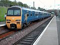 Musselburgh railway station 322484.jpg 2,304 × 1,728; 638 KB
-
 Musselburgh station.jpg 2,304 × 1,728; 641 KB
-
 Nant y Graean - geograph.org.uk - 241415.jpg 640 × 480; 92 KB
-
 National Westminster Bank - geograph.org.uk - 241319.jpg 640 × 595; 138 KB
-
 Near North Carr Farm - geograph.org.uk - 234314.jpg 640 × 426; 149 KB
-
 New Farm, Harleston, Suffolk - geograph.org.uk - 235620.jpg 640 × 480; 82 KB
-
 New Southgate, Piccadilly Line viaduct - geograph.org.uk - 235804.jpg 640 × 480; 108 KB
-
 Newthorpe - geograph.org.uk - 241465.jpg 640 × 480; 30 KB
-
 Nidd Village - geograph.org.uk - 234269.jpg 640 × 479; 108 KB
-
 Norfolk Coastal Path - geograph.org.uk - 240345.jpg 640 × 480; 158 KB
-
 Norfolk Shire Horse Centre, West Runton - geograph.org.uk - 240342.jpg 640 × 480; 159 KB
-
 North Carr Farm, Hotham - geograph.org.uk - 234196.jpg 640 × 426; 107 KB


_-_geograph.org.uk_-_234439.jpg)


.jpg)
.jpg)


_-_geograph.org.uk_-_240913.jpg)


.jpg)


