Category:United Kingdom photographs taken on 2005-12-08
Jump to navigation
Jump to search
Countries of Europe: Czech Republic · Germany · Italy · Netherlands‡ · Poland · Portugal‡ · Russia‡ · Spain‡ · United Kingdom
‡: partly located in Europe
‡: partly located in Europe
| ← | 8 December 2005 | → | ||
| ← | December 2005 | → | ||

United Kingdom photographs taken on 8 December 2005.
Image files should be categorized here automatically using {{taken on}} template. Direct categorisation is also possible, if automatic is impossible.
Subcategories
This category has only the following subcategory.
L
Media in category "United Kingdom photographs taken on 2005-12-08"
The following 188 files are in this category, out of 188 total.
-
 A high motorway junction. - geograph.org.uk - 88767.jpg 640 × 445; 71 KB
-
 A road maze. - geograph.org.uk - 88732.jpg 640 × 344; 45 KB
-
 A Straight Road. - geograph.org.uk - 88689.jpg 640 × 480; 79 KB
-
 A tall sign. - geograph.org.uk - 88697.jpg 640 × 515; 85 KB
-
 A146 passing The Gull - geograph.org.uk - 90309.jpg 640 × 480; 77 KB
-
 A429 - A3400 Roundabout. - geograph.org.uk - 88721.jpg 640 × 442; 62 KB
-
 A429 Sub Station. - geograph.org.uk - 88712.jpg 640 × 480; 74 KB
-
 A6 to Cliburn Junction. - geograph.org.uk - 88877.jpg 640 × 417; 60 KB
-

-
 Belshaw's Quarry - geograph.org.uk - 88503.jpg 640 × 480; 97 KB
-

-
 Blackstone Edge in Mist - geograph.org.uk - 595130.jpg 640 × 450; 18 KB
-
 Blackstone Edge. - geograph.org.uk - 88566.jpg 640 × 480; 46 KB
-
 Blackstone Edge. - geograph.org.uk - 88568.jpg 640 × 480; 33 KB
-
 Blebo Mains - geograph.org.uk - 88594.jpg 640 × 438; 112 KB
-

-
 Bridges. - geograph.org.uk - 88621.jpg 640 × 480; 82 KB
-

-

-
 Bruce Allen Geograph-1029766-by-Eric-Soons.jpg 640 × 480; 98 KB
-
 Bungalow - geograph.org.uk - 88511.jpg 640 × 480; 96 KB
-
 Camp site at Dowran - geograph.org.uk - 88486.jpg 640 × 480; 74 KB
-
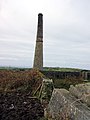 Chimney in the fields near Leswidden - geograph.org.uk - 88496.jpg 480 × 640; 103 KB
-
 Clovelly Surf Telecomm's Tower - geograph.org.uk - 89426.jpg 450 × 600; 90 KB
-

-

-
 Daventry - geograph.org.uk - 88550.jpg 640 × 480; 112 KB
-

-
 Derelict House - geograph.org.uk - 88498.jpg 640 × 480; 117 KB
-
 Disused Petrol Station and Grocery - geograph.org.uk - 88505.jpg 640 × 480; 82 KB
-

-
 Duisk River - geograph.org.uk - 89044.jpg 640 × 427; 122 KB
-
 Farmland by Pitscottie - geograph.org.uk - 88599.jpg 640 × 480; 158 KB
-
 Fedw Hir - geograph.org.uk - 88551.jpg 640 × 480; 226 KB
-
 Forest of Dean Geograph-1024117-by-Eric-Soons.jpg 480 × 640; 191 KB
-
 Four Shire Stone. - geograph.org.uk - 88659.jpg 640 × 480; 108 KB
-
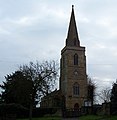
 Gartree Parish Church - geograph.org.uk - 88525.jpg 640 × 480; 98 KB
-
 Gatehouse - geograph.org.uk - 88527.jpg 640 × 480; 86 KB
-
 Great Wolford Church. - geograph.org.uk - 88684.jpg 625 × 640; 66 KB
-
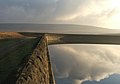 Green Withens Reservoir. - geograph.org.uk - 215449.jpg 640 × 449; 34 KB
-
 Green Withens Reservoir. - geograph.org.uk - 88583.jpg 640 × 480; 44 KB
-
 Green Withens Reservoir. - geograph.org.uk - 88630.jpg 640 × 480; 57 KB
-
 Hackthorpe Hall. - geograph.org.uk - 88870.jpg 640 × 480; 69 KB
-
 St Mary's Church Halford. - geograph.org.uk - 88723.jpg 640 × 480; 108 KB
-
 Handball Court in Nelson - geograph.org.uk - 88546.jpg 640 × 480; 133 KB
-
 Harmondsworth - geograph.org.uk - 88617.jpg 597 × 462; 116 KB
-
 Harmondsworth - geograph.org.uk - 88628.jpg 640 × 480; 86 KB
-
 Heathfield Farm - geograph.org.uk - 88618.jpg 640 × 480; 117 KB
-
 Holiday Homes, Ashworth Valley, Rochdale - geograph.org.uk - 88523.jpg 640 × 463; 141 KB
-
 Holverston Hall Barns - geograph.org.uk - 90323.jpg 640 × 480; 90 KB
-
 Humber - Hessle 811.jpg 1,600 × 1,200; 824 KB
-
 Inn "The Fox and Hounds" - geograph.org.uk - 88682.jpg 640 × 480; 66 KB
-
 Junction 22 M62 - geograph.org.uk - 88559.jpg 640 × 480; 74 KB
-
 Kemps Green stile - geograph.org.uk - 88584.jpg 640 × 480; 159 KB
-
 Church of St Mary Magdalene, Keyworth - geograph.org.uk - 88579.jpg 640 × 480; 84 KB
-
 Looking towards Corwar Mains - geograph.org.uk - 89042.jpg 640 × 427; 88 KB
-
 M6 under the A6. - geograph.org.uk - 88873.jpg 640 × 498; 74 KB
-
 M62 at Moss Moor. - geograph.org.uk - 88625.jpg 640 × 480; 76 KB
-

-
 Magheragall Methodist Church - geograph.org.uk - 88500.jpg 640 × 480; 64 KB
-
 Magheragall Orange Hall - geograph.org.uk - 88504.jpg 640 × 480; 68 KB
-
 Mainline approaching Sharnbrook - geograph.org.uk - 88692.jpg 640 × 366; 48 KB
-
 Milestone ^ - geograph.org.uk - 88528.jpg 640 × 476; 146 KB
-
 New Gates - geograph.org.uk - 88529.jpg 640 × 480; 87 KB
-
 Ochiltree trig - geograph.org.uk - 89036.jpg 640 × 427; 74 KB
-
 Pack Horse Inn, Birtle, Rochdale - geograph.org.uk - 88519.jpg 640 × 481; 185 KB
-
 Promenade and Sea Brows, Maryport - geograph.org.uk - 88552.jpg 640 × 427; 99 KB
-
 Railway Bridge, Crumlin.jpg 640 × 480; 99 KB
-
 Rishworth Drain. - geograph.org.uk - 88572.jpg 640 × 480; 87 KB
-
 River Colne - geograph.org.uk - 88631.jpg 640 × 480; 150 KB
-

-
 Shap Quarry Entrance. - geograph.org.uk - 88857.jpg 640 × 480; 110 KB
-
 St Andrew's Hospital. - geograph.org.uk - 91349.jpg 640 × 345; 72 KB
-
 St John the Baptist, Hellington - geograph.org.uk - 90327.jpg 640 × 480; 104 KB
-
 St. Luke's Catholic Church, Twinbrook - geograph.org.uk - 88495.jpg 640 × 480; 85 KB
-
 Church of All Saints, Stanton-on-the-Wolds - geograph.org.uk - 88575.jpg 640 × 480; 118 KB
-
 Sunrise to East of Back Lane Fangfoss - geograph.org.uk - 734652.jpg 640 × 426; 67 KB
-
 Tarmac Way - geograph.org.uk - 88626.jpg 640 × 480; 93 KB
-
 Terraced cottages, Jericho, Bury - geograph.org.uk - 88517.jpg 640 × 477; 129 KB
-
 The Aiggin Stone and Roman road. - geograph.org.uk - 88570.jpg 640 × 480; 68 KB
-
 The Ballance House - geograph.org.uk - 88510.jpg 640 × 480; 129 KB
-
 The County Boundary at Paddle Brook - geograph.org.uk - 88703.jpg 640 × 480; 52 KB
-
 The stone dust pile Gelligaer Quarry - geograph.org.uk - 88548.jpg 640 × 480; 159 KB
-
 The Street, Rockland St. Mary - geograph.org.uk - 90336.jpg 640 × 480; 90 KB
-
 Todenham Church Steeple. - geograph.org.uk - 88694.jpg 502 × 640; 55 KB
-
 Train arriving at Hockley railway station.jpg 1,280 × 960; 455 KB
-
 Turn left for Loxley. - geograph.org.uk - 88728.jpg 640 × 477; 60 KB
-
 Tyne from the Baltic - geograph.org.uk - 286680.jpg 640 × 480; 45 KB
-
 Umberslade Hall - geograph.org.uk - 88604.jpg 640 × 469; 104 KB
-
 Umberslade Hall driveway - geograph.org.uk - 88596.jpg 480 × 640; 156 KB
-
 Umberslade Hall driveway - geograph.org.uk - 88601.jpg 480 × 640; 147 KB
-
 Umberslade Hall driveway - geograph.org.uk - 88609.jpg 640 × 480; 94 KB
-
 Umberslade Hall driveway - geograph.org.uk - 88629.jpg 640 × 480; 168 KB
-
 Undercliff walk at Friars' Bay - geograph.org.uk - 1089972.jpg 640 × 480; 59 KB
-

-

-
 View across Blythburgh water - geograph.org.uk - 738521.jpg 640 × 480; 48 KB
-

-

-

-
 Welton - geograph.org.uk - 88884.jpg 640 × 480; 71 KB
-
 West of Harmondsworth - geograph.org.uk - 88623.jpg 640 × 480; 166 KB
-
 Whitestone BT-Tower - geograph.org.uk - 89423.jpg 450 × 600; 96 KB
-

-
 Yellow staghorn fungus, Forest of Dean - geograph.org.uk - 1062359.jpg 639 × 480; 117 KB
-
 An old burnt Tree Stump - geograph.org.uk - 88939.jpg 640 × 480; 110 KB
-
 Blackwell. - geograph.org.uk - 88716.jpg 640 × 480; 80 KB
-
 Brecon DVOR (aircraft navigation beacon) - geograph.org.uk - 88540.jpg 640 × 480; 129 KB
-
 Bridleway - geograph.org.uk - 88571.jpg 640 × 427; 100 KB
-
 British Geological Survey, Keyworth - geograph.org.uk - 88573.jpg 640 × 480; 61 KB
-
 Brown's Green Wood - geograph.org.uk - 88627.jpg 640 × 480; 61 KB
-
 Clay-pit lakes behind Radwell - geograph.org.uk - 88687.jpg 640 × 480; 66 KB
-
 Country House - geograph.org.uk - 88522.jpg 640 × 480; 80 KB
-
 Cowar Mains Hill trig - geograph.org.uk - 89041.jpg 640 × 427; 109 KB
-
 Daventry - geograph.org.uk - 88885.jpg 640 × 480; 125 KB
-
 Daventry - geograph.org.uk - 88892.jpg 640 × 480; 55 KB
-
 Dussindale Drive. - geograph.org.uk - 91354.jpg 640 × 482; 134 KB
-
 Electronic crossroads. - geograph.org.uk - 88711.jpg 640 × 480; 84 KB
-
 Exit through the puddles. - geograph.org.uk - 88707.jpg 640 × 480; 95 KB
-
 Farmstead - geograph.org.uk - 88531.jpg 640 × 480; 104 KB
-
 Fenwickfield near Simonburn - geograph.org.uk - 127968.jpg 640 × 210; 38 KB
-
 Fields west of Tissington Ford - geograph.org.uk - 91391.jpg 640 × 427; 53 KB
-
 Fire Service College. - geograph.org.uk - 88661.jpg 640 × 480; 60 KB
-
 Forkedbridge Water Treatment Works - geograph.org.uk - 88507.jpg 640 × 480; 49 KB
-
 Girlaverie trig - geograph.org.uk - 89046.jpg 640 × 427; 103 KB
-
 Granite Lodge - geograph.org.uk - 88514.jpg 640 × 480; 108 KB
-
 Green Withens Reservoir. - geograph.org.uk - 88588.jpg 640 × 480; 45 KB
-
 Heathfield Farm Stables - geograph.org.uk - 88620.jpg 640 × 470; 82 KB
-
 Heifer and hedge on No Go By hill - geograph.org.uk - 88493.jpg 640 × 480; 150 KB
-
 Kemps Green - geograph.org.uk - 88578.jpg 640 × 438; 88 KB
-
 Kemps Green - geograph.org.uk - 88580.jpg 640 × 480; 115 KB
-
 Looking south from East Street - geograph.org.uk - 88820.jpg 640 × 480; 97 KB
-
 Looking towards Bonar Bridge - geograph.org.uk - 88931.jpg 640 × 480; 118 KB
-
 Looking towards Garchew - geograph.org.uk - 89040.jpg 640 × 427; 104 KB
-
 Low road passing under the railway. - geograph.org.uk - 91351.jpg 640 × 482; 131 KB
-
 M6 Toll M6 Junction. - geograph.org.uk - 88762.jpg 640 × 426; 37 KB
-
 Maryport Golf Course - geograph.org.uk - 88562.jpg 640 × 427; 96 KB
-
 Middle Beck, Pallister - geograph.org.uk - 88739.jpg 360 × 480; 41 KB
-
 Moor end - geograph.org.uk - 88690.jpg 640 × 480; 82 KB
-
 Moorland near Loch Ochiltree - geograph.org.uk - 89039.jpg 640 × 427; 92 KB
-
 Motorway junction and deaf sheep^ - geograph.org.uk - 88615.jpg 640 × 480; 60 KB
-
 New Entrance to Development. - geograph.org.uk - 88869.jpg 640 × 480; 100 KB
-
 No Go By Hill - geograph.org.uk - 88586.jpg 480 × 640; 116 KB
-
 Norton - geograph.org.uk - 88900.jpg 640 × 480; 60 KB
-
 Oakham Farm. - geograph.org.uk - 88727.jpg 640 × 480; 102 KB
-
 Old Barn near Dairy House Farm - geograph.org.uk - 88624.jpg 640 × 480; 134 KB
-
 Old Lock Cottages - geograph.org.uk - 88683.jpg 640 × 480; 145 KB
-
 Old Sandstone Quarry, Maryport - geograph.org.uk - 101461.jpg 640 × 427; 117 KB
-
 Ormesby Road, Park End - geograph.org.uk - 88740.jpg 360 × 480; 36 KB
-
 Path to Netherhall School - geograph.org.uk - 88582.jpg 640 × 427; 122 KB
-
 Plough patterns Gar Knott - geograph.org.uk - 88553.jpg 640 × 427; 56 KB
-
 Railings at Green Withens Reservoir. - geograph.org.uk - 88598.jpg 640 × 480; 53 KB
-

-
 Ramshaw Mill and farmhouse, near Wark - geograph.org.uk - 127965.jpg 640 × 239; 68 KB
-
 Riding school in Radwell - geograph.org.uk - 88686.jpg 640 × 480; 95 KB
-
 Rishworth Drain. - geograph.org.uk - 88576.jpg 640 × 480; 87 KB
-
 Road Junction - geograph.org.uk - 88577.jpg 640 × 427; 71 KB
-
 Sandiford Farm, Ashworth Valley, Rochdale - geograph.org.uk - 88530.jpg 640 × 485; 166 KB
-
 Seashore North of Maryport - geograph.org.uk - 101457.jpg 640 × 427; 95 KB
-
 Sheep in a turnip field - geograph.org.uk - 89047.jpg 640 × 427; 83 KB
-
 Sign on Brecon DVOR - geograph.org.uk - 88542.jpg 640 × 480; 161 KB
-
 Slipping onto M6. - geograph.org.uk - 88763.jpg 640 × 374; 35 KB
-

-

-
 South Entrance to Wellesbourne. - geograph.org.uk - 88731.jpg 640 × 530; 73 KB
-
 South Lodge - geograph.org.uk - 88585.jpg 640 × 480; 176 KB
-
 Southern Upland Way signpost - geograph.org.uk - 89037.jpg 427 × 640; 100 KB
-
 Stones and cattle grid. - geograph.org.uk - 88766.jpg 640 × 480; 50 KB
-
 Stormer Hill. - geograph.org.uk - 88567.jpg 640 × 480; 55 KB
-
 Stream at Lower Bostraze - geograph.org.uk - 88490.jpg 640 × 480; 196 KB
-
 Sun End. - geograph.org.uk - 88564.jpg 640 × 480; 77 KB
-
 T Junction Nr Warbleton East Sussex - geograph.org.uk - 88563.jpg 640 × 480; 143 KB
-
 The busy A429. - geograph.org.uk - 88699.jpg 640 × 446; 67 KB
-
 The Crossroads Country Guest House - geograph.org.uk - 88520.jpg 640 × 480; 96 KB
-
 The footpath hole in the hedge. - geograph.org.uk - 88705.jpg 640 × 480; 88 KB
-
 Thrimby Cottages Underpass. - geograph.org.uk - 88864.jpg 640 × 480; 98 KB
-
 Track through Wolford Wood. - geograph.org.uk - 88676.jpg 640 × 480; 157 KB
-
 Transmitter Mast next to M62 Jnc.22. - geograph.org.uk - 88556.jpg 480 × 640; 58 KB
-
 Tree beside a bend in the road. - geograph.org.uk - 88509.jpg 640 × 480; 77 KB
-
 Umberslade Children's Farm - geograph.org.uk - 88589.jpg 640 × 475; 167 KB
-
 Umberslade Children's Farm - geograph.org.uk - 88633.jpg 640 × 480; 69 KB
-
 Umberslade Road - geograph.org.uk - 88613.jpg 480 × 640; 163 KB
-

-
 Varndean College - geograph.org.uk - 291583.jpg 640 × 480; 233 KB
-
 View north from A146 - geograph.org.uk - 90318.jpg 640 × 480; 58 KB
-
 Wasperton no through road. - geograph.org.uk - 88734.jpg 640 × 480; 132 KB
-
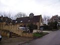
 Welton - geograph.org.uk - 88543.jpg 640 × 480; 140 KB
-
 Welton - geograph.org.uk - 88544.jpg 640 × 480; 99 KB


_-_geograph.org.uk_-_88540.jpg)