Category:United Kingdom photographs taken on 2005-11-21
Jump to navigation
Jump to search
Countries of Europe: Belgium · Denmark · Finland · France‡ · Germany · Greece · Republic of Ireland · Italy · Malta · Russia‡ · United Kingdom
‡: partly located in Europe
‡: partly located in Europe
| ← | 21 November 2005 | → | ||
| ← | November 2005 | → | ||

United Kingdom photographs taken on 21 November 2005.
Image files should be categorized here automatically using {{taken on}} template. Direct categorisation is also possible, if automatic is impossible.
Media in category "United Kingdom photographs taken on 2005-11-21"
The following 200 files are in this category, out of 327 total.
(previous page) (next page)-
 143620 on a foggy night at Bristol Temple Meads.jpg 1,600 × 1,200; 897 KB
-

-
-
 A' Ghlas-bheinn (918m) - geograph.org.uk - 123674.jpg 640 × 480; 71 KB
-
 A30 Overbridge, Pocombe Bridge, Exeter - geograph.org.uk - 82418.jpg 640 × 427; 272 KB
-
 Afon Cadair valley below Cadair Idris - geograph.org.uk - 147548.jpg 640 × 480; 78 KB
-
 Afon Clywedog - geograph.org.uk - 82531.jpg 640 × 480; 276 KB
-

-
 All Saints Church, Cuddesdon - geograph.org.uk - 82893.jpg 640 × 481; 46 KB
-
 Anick Grange (and beyond), from Anick - geograph.org.uk - 89068.jpg 640 × 480; 68 KB
-
 Armada Way, Plymouth - geograph.org.uk - 83458.jpg 640 × 427; 117 KB
-
 Autumn Leaves - geograph.org.uk - 82906.jpg 640 × 481; 59 KB
-
 Autumnal Bridleway in Holme Wood - geograph.org.uk - 1179124.jpg 640 × 426; 193 KB
-
 Avenue Farm - geograph.org.uk - 82390.jpg 640 × 480; 51 KB
-
 Bailbrook Bridge - geograph.org.uk - 82350.jpg 640 × 480; 76 KB
-
 Ballymacarrett Leisure Centre - geograph.org.uk - 82346.jpg 640 × 480; 123 KB
-
 Ballyowan House - geograph.org.uk - 82391.jpg 640 × 480; 145 KB
-
 Bank Farm, Oldcastle - geograph.org.uk - 125038.jpg 640 × 484; 81 KB
-
 Bank Hall Park - geograph.org.uk - 679384.jpg 640 × 427; 92 KB
-
 Barton Aqueduct on a foggy day - geograph.org.uk - 84910.jpg 640 × 480; 79 KB
-
 Beaufront Castle Gatehouse - geograph.org.uk - 82739.jpg 640 × 444; 93 KB
-
 Belfast Indoor Tennis Arena - geograph.org.uk - 82338.jpg 640 × 480; 80 KB
-
 Blackbird with berry, Omagh - geograph.org.uk - 276585.jpg 640 × 490; 57 KB
-
 Boat on Grazing Land - geograph.org.uk - 1179135.jpg 640 × 426; 53 KB
-
 Bridleway, Oakridge Cleave - geograph.org.uk - 82469.jpg 480 × 640; 59 KB
-
 Bus Museum. - geograph.org.uk - 82573.jpg 640 × 480; 101 KB
-
 Buses. - geograph.org.uk - 82596.jpg 640 × 429; 112 KB
-
 Bushcomb Wood, Nottingham Hill - geograph.org.uk - 82459.jpg 640 × 479; 88 KB
-
 By the sea at Plymouth - geograph.org.uk - 83453.jpg 640 × 427; 119 KB
-
 Bywell Home Farm - geograph.org.uk - 83161.jpg 640 × 499; 65 KB
-
 Carreg Y Gath - geograph.org.uk - 82504.jpg 640 × 480; 117 KB
-
 Castle Farm - geograph.org.uk - 82373.jpg 640 × 480; 53 KB
-
-
 Cattle Grid by Rabbit Warren Hill - geograph.org.uk - 82499.jpg 640 × 480; 179 KB
-
 Chandelier - Flickr - Nanimo.jpg 800 × 600; 79 KB
-
 Chapel at Saron. - geograph.org.uk - 82710.jpg 640 × 480; 149 KB
-
 Cherryville Clinic - geograph.org.uk - 82340.jpg 640 × 480; 93 KB
-

-
 Cleave Wood - geograph.org.uk - 82463.jpg 480 × 640; 57 KB
-
 Close the gate behind you^ - geograph.org.uk - 82332.jpg 640 × 480; 122 KB
-
 Cold Ashton Roundabout - geograph.org.uk - 82347.jpg 640 × 480; 82 KB
-

-
 Craig Fell near New Luce, Wigtownshire - geograph.org.uk - 83242.jpg 640 × 480; 112 KB
-
 Creech Grange near Wareham, Dorset - geograph.org.uk - 82426.jpg 640 × 427; 129 KB
-
 Dean Terrace, Walbottle - geograph.org.uk - 82712.jpg 640 × 506; 69 KB
-
 Denton House seen from Denton Lane - geograph.org.uk - 82895.jpg 640 × 481; 46 KB
-
 Disused Chapel at Soar - geograph.org.uk - 82983.jpg 640 × 480; 219 KB
-
 Emersons Green - geograph.org.uk - 82359.jpg 640 × 480; 92 KB
-
 Entrance to Lily Farm,off the A58 - geograph.org.uk - 1568955.jpg 640 × 426; 44 KB
-
 The Shepherd's Hut Public House - geograph.org.uk - 82836.jpg 640 × 481; 49 KB
-
 Ewelme Watercress Beds - geograph.org.uk - 82834.jpg 640 × 481; 66 KB
-
 Farm Pipe Dream - geograph.org.uk - 1179143.jpg 622 × 600; 94 KB
-
 Farm Road. - geograph.org.uk - 82405.jpg 640 × 480; 147 KB
-
 Farmland - geograph.org.uk - 82385.jpg 640 × 480; 105 KB
-
 Farmland above Hole Farm - geograph.org.uk - 82744.jpg 640 × 480; 12 KB
-
 Farmland above West Haggington Farm - geograph.org.uk - 82743.jpg 640 × 480; 20 KB
-
 Farmland near Ettiford Farm - geograph.org.uk - 82732.jpg 640 × 480; 22 KB
-
 Farmland near Francis Farm - geograph.org.uk - 82723.jpg 640 × 480; 19 KB
-

-
 Footpath through wood - geograph.org.uk - 92746.jpg 640 × 480; 173 KB
-
 Footpath to Houghton Hall - geograph.org.uk - 82356.jpg 640 × 480; 142 KB
-
 Friarmere St. Thomas.jpg 640 × 480; 72 KB
-
 Garsington Church - geograph.org.uk - 82898.jpg 640 × 481; 61 KB
-
 Gaskie Hill - geograph.org.uk - 82397.jpg 640 × 480; 98 KB
-
 Get Off My Bridleway - geograph.org.uk - 1179153.jpg 640 × 426; 70 KB
-
 Gilnahirk Presbyterian Church - geograph.org.uk - 82375.jpg 640 × 480; 84 KB
-
 Gleann Chòinneachain - geograph.org.uk - 123671.jpg 640 × 480; 70 KB
-
 Glen Ogle Emergency Services Mast - geograph.org.uk - 82388.jpg 480 × 640; 47 KB
-

-
 Granshaw Presbyterian Church - geograph.org.uk - 82378.jpg 480 × 640; 103 KB
-
 Hadrian's Wall, Heddon-on-the Wall - geograph.org.uk - 82724.jpg 480 × 640; 64 KB
-
 Hartland Moor NNR, Dorset - geograph.org.uk - 82501.jpg 640 × 425; 142 KB
-
 Hartland Moor NNR, Dorset - geograph.org.uk - 82518.jpg 640 × 425; 97 KB
-
 Heasandford near Walshaw Clough - geograph.org.uk - 695538.jpg 640 × 427; 78 KB
-
 Highholm Farm. - geograph.org.uk - 82407.jpg 640 × 480; 119 KB
-
 Hill Top Farm - geograph.org.uk - 82376.jpg 640 × 480; 53 KB
-
 Church, Coney Green - geograph.org.uk - 82513.jpg 640 × 480; 133 KB
-
 Hillsborough from Beara Farm - geograph.org.uk - 82746.jpg 480 × 640; 11 KB
-
 Hordle Cliff, Hampshire - geograph.org.uk - 82425.jpg 640 × 481; 152 KB
-
 Hore Down Gate - geograph.org.uk - 82729.jpg 640 × 480; 34 KB
-
 Houghton Hall - geograph.org.uk - 82366.jpg 640 × 480; 80 KB
-
 House and Barn at Rhewl - geograph.org.uk - 82704.jpg 640 × 480; 157 KB
-
 Hunnyhill - geograph.org.uk - 88743.jpg 640 × 480; 138 KB
-
 Imogen Heap Bush Hall 2005.jpg 2,560 × 1,920; 2.95 MB
-

-
-
 Keypitts Farm from Oxenpark Lane - geograph.org.uk - 82734.jpg 640 × 480; 22 KB
-
 Knock Methodist Church - geograph.org.uk - 82367.jpg 480 × 640; 81 KB
-
 Knock Presbyterian Church - geograph.org.uk - 82370.jpg 640 × 480; 79 KB
-
 Le Manoir aux Quatre Saisons - geograph.org.uk - 82877.jpg 640 × 481; 61 KB
-
 Little Gringley Nr Retford - geograph.org.uk - 82274.jpg 640 × 482; 115 KB
-
 Llewesog Hall - geograph.org.uk - 82692.jpg 640 × 480; 158 KB
-
 Loch Fitty - geograph.org.uk - 82410.jpg 640 × 480; 103 KB
-
 Loch Restil, by Rest and be Thankful. - geograph.org.uk - 83566.jpg 640 × 480; 59 KB
-

-
 Looking East over Shillingford Bridge - geograph.org.uk - 82849.jpg 640 × 481; 26 KB
-
 Looking West over Shillingford Bridge - geograph.org.uk - 82848.jpg 640 × 481; 34 KB
-
 Lymington - Keyhaven Nature Reserve - geograph.org.uk - 82436.jpg 640 × 481; 141 KB
-
 M90 Commerce Park - geograph.org.uk - 82402.jpg 640 × 480; 92 KB
-
 Manor House Farm - geograph.org.uk - 82384.jpg 640 × 480; 134 KB
-
 Mealough Orange Hall - geograph.org.uk - 82386.jpg 640 × 480; 74 KB
-
 Mealough Reservoir - geograph.org.uk - 82381.jpg 640 × 480; 43 KB
-
 Milestone at Jockey House,Nr Retford Notts - geograph.org.uk - 82261.jpg 482 × 640; 222 KB
-
 Mountpottinger Baptist Church - geograph.org.uk - 82341.jpg 480 × 640; 111 KB
-
 Musty Haulgh - geograph.org.uk - 1233678.jpg 640 × 427; 87 KB
-
 Nantglyn Quarries - geograph.org.uk - 82960.jpg 640 × 480; 212 KB
-
 New Barn Under Construction at Hilton - geograph.org.uk - 82620.jpg 640 × 480; 34 KB
-
 New footbridge, Whipton, Exeter - geograph.org.uk - 82444.jpg 640 × 427; 206 KB
-
 New Houses - geograph.org.uk - 82387.jpg 640 × 480; 101 KB
-
 New sea defence at Bulverhythe East Sussex - geograph.org.uk - 82675.jpg 640 × 480; 142 KB
-
 Newington Church - geograph.org.uk - 82871.jpg 640 × 481; 57 KB
-
 Newington Mansion - geograph.org.uk - 82870.jpg 640 × 481; 78 KB
-
 North Farm, Houghton - geograph.org.uk - 82725.jpg 640 × 456; 65 KB
-
 Northwood Cemetery - geograph.org.uk - 82256.jpg 640 × 480; 154 KB
-
 Northwood Parish Church - geograph.org.uk - 82249.jpg 640 × 480; 156 KB
-
 Nuneham Courteney Arboretum - geograph.org.uk - 82905.jpg 640 × 481; 58 KB
-
 Oakridge Cleave from Oakridge Farm - geograph.org.uk - 82475.jpg 640 × 480; 24 KB
-
 Oakridge Farm - geograph.org.uk - 82460.jpg 640 × 480; 28 KB
-
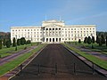 Parliament Buildings, Stormont - geograph.org.uk - 82357.jpg 640 × 480; 78 KB
-
 Penwhirn Reservoir near Stranraer - geograph.org.uk - 82701.jpg 640 × 480; 82 KB
-
 Pilot Boat - geograph.org.uk - 82254.jpg 640 × 480; 125 KB
-
 Plaque, Frenchman's Row (detail) - geograph.org.uk - 82720.jpg 482 × 640; 105 KB
-
 Plaque, Frenchman's Row, Throckley - geograph.org.uk - 82719.jpg 447 × 640; 89 KB
-
 Poultry Farm. - geograph.org.uk - 82371.jpg 640 × 480; 80 KB
-
 Prion Crossroads - geograph.org.uk - 82687.jpg 640 × 480; 177 KB
-
 Pylons at dusk - geograph.org.uk - 192837.jpg 640 × 480; 84 KB
-
 Railway Bridge, Creech Bottom, Dorset - geograph.org.uk - 82538.jpg 640 × 425; 147 KB
-
 Railway cottages - geograph.org.uk - 82570.jpg 640 × 480; 78 KB
-
 Railway Crossing, Creech Bottom, Dorset - geograph.org.uk - 82543.jpg 640 × 425; 138 KB
-
 Red Lion, Coney Green - geograph.org.uk - 82509.jpg 640 × 480; 118 KB
-
 Reflections - geograph.org.uk - 82337.jpg 640 × 480; 56 KB
-
 Remains of a Clamp - geograph.org.uk - 1179163.jpg 640 × 426; 45 KB
-
 River Don Heasandford - geograph.org.uk - 657347.jpg 640 × 427; 101 KB
-
 Road Junction - geograph.org.uk - 82395.jpg 640 × 480; 134 KB
-
 Royal Lane, Coney Green - geograph.org.uk - 82507.jpg 640 × 480; 89 KB
-
 Royal Train at Bristol Temple Meads - 67006 Royal Sovereign 02.jpg 1,600 × 1,200; 826 KB
-
 Royal Train at Bristol Temple Meads - 67006 Royal Sovereign 04.jpg 1,600 × 1,200; 661 KB
-
 Royal Train at Bristol Temple Meads - Royal coaches + Class 143.jpg 1,600 × 1,200; 878 KB
-
 Rushey Sidings Nr Retford Notts - geograph.org.uk - 82292.jpg 640 × 482; 107 KB
-
 Holy Cross Church, Ryton - geograph.org.uk - 83165.jpg 403 × 640; 63 KB
-
 Saltcoats3.jpg 480 × 640; 68 KB
-
 Severn Break-its-neck waterfall - geograph.org.uk - 347920.jpg 480 × 640; 118 KB
-
 Slew - geograph.org.uk - 82738.jpg 640 × 480; 25 KB
-
 Slew Hill - geograph.org.uk - 82740.jpg 640 × 480; 18 KB
-
 Slew Lane - geograph.org.uk - 82742.jpg 480 × 640; 20 KB
-
 South Crescent Road.jpg 640 × 480; 94 KB
-
 Spin Hill, Market Lavington - geograph.org.uk - 83115.jpg 600 × 450; 101 KB
-
 St Loyes public house, Exeter - geograph.org.uk - 82440.jpg 640 × 427; 205 KB
-
 St Mary's Church, Whicham - geograph.org.uk - 114994.jpg 640 × 480; 129 KB
-
 St Mary's Hospital - geograph.org.uk - 82246.jpg 640 × 480; 120 KB
-
 St. Clement's Parish Church - geograph.org.uk - 82342.jpg 640 × 480; 92 KB
-
 St. Patrick's Ballymacarrett - geograph.org.uk - 82345.jpg 640 × 480; 87 KB
-
 St.James Church, Prion - geograph.org.uk - 82681.jpg 640 × 480; 156 KB
-
 Steamy Sunset over Saltend - geograph.org.uk - 289275.jpg 640 × 480; 45 KB
-
 Stoborough Heath NNR, Dorset - geograph.org.uk - 82492.jpg 425 × 640; 126 KB
-
 Stormont Hotel - geograph.org.uk - 82363.jpg 640 × 480; 72 KB
-
 Stormont Presbyterian Church - geograph.org.uk - 82352.jpg 640 × 480; 84 KB
-
 Sunset on Thurlstone beach - geograph.org.uk - 532379.jpg 480 × 640; 42 KB
-

-
 Tanworth-in-Arden - geograph.org.uk - 247669.jpg 640 × 480; 435 KB
-
 Tanworth-in-Arden - geograph.org.uk - 247907.jpg 640 × 480; 282 KB
-
 Tesco Store, Exe Vale, Exeter - geograph.org.uk - 82443.jpg 640 × 427; 217 KB
-
 The Footpath to Cholsey - geograph.org.uk - 82833.jpg 640 × 481; 40 KB
-
 The Future 'Derwentthorpe' Site - geograph.org.uk - 82435.jpg 640 × 479; 98 KB
-
 The Halfway Inn, Norden, Dorset - geograph.org.uk - 82524.jpg 640 × 425; 137 KB
-
 The Plough, Garsington - geograph.org.uk - 82900.jpg 640 × 481; 67 KB
-
 The second Severn Bridge - geograph.org.uk - 1640117.jpg 640 × 343; 22 KB
-
 The Tyne at Howdene Bridge, west of Wylam - geograph.org.uk - 83164.jpg 640 × 480; 130 KB
-
 The Vine (left) - geograph.org.uk - 82514.jpg 640 × 480; 103 KB
-
 Time for Tea - geograph.org.uk - 82349.jpg 640 × 480; 37 KB
-
 The Mole Inn, Toot Baldon - geograph.org.uk - 82903.jpg 640 × 481; 47 KB
-
 TV Mast near Ettiford Farm - geograph.org.uk - 82731.jpg 480 × 640; 16 KB
-
 Two Pots - geograph.org.uk - 82726.jpg 640 × 480; 23 KB
-
 Uxbridge Road - geograph.org.uk - 82521.jpg 640 × 480; 93 KB
-
 Uxbridge Road - Long Lane junction - geograph.org.uk - 82519.jpg 640 × 480; 77 KB
-
 Vale of Tyn Y Twll - geograph.org.uk - 82713.jpg 640 × 480; 163 KB
-
 View of Exmoor from Slew - geograph.org.uk - 82737.jpg 640 × 480; 15 KB
-
 View of Francis Farm from Hore Down - geograph.org.uk - 82728.jpg 640 × 480; 29 KB
-

-
 View of Trayne Hills from Slew Hill - geograph.org.uk - 82741.jpg 640 × 480; 20 KB
-
 View towards Exmoor from Hore Down - geograph.org.uk - 82727.jpg 640 × 480; 24 KB
-

-
 Water Tower, Exeter - geograph.org.uk - 85504.jpg 640 × 427; 297 KB
-
 West Water dam. - geograph.org.uk - 82369.jpg 640 × 405; 45 KB
-
 West Water reservoir. - geograph.org.uk - 82421.jpg 640 × 446; 45 KB
-
 West Water. - geograph.org.uk - 82427.jpg 640 × 480; 70 KB
-
 West Water. - geograph.org.uk - 82429.jpg 640 × 480; 63 KB
-
 Westerleigh - geograph.org.uk - 82354.jpg 640 × 480; 95 KB
-
 Winsham Cleave - geograph.org.uk - 82453.jpg 480 × 640; 23 KB
-
 Woodland Scene in Shorne Country Park - geograph.org.uk - 85094.jpg 640 × 480; 192 KB
-
 Woodlands Farm - geograph.org.uk - 82393.jpg 640 × 480; 105 KB
-
 Worgret Manor Hotel, Wareham, Dorset - geograph.org.uk - 82437.jpg 640 × 427; 96 KB
-
 Ysgol Cyffylliog - geograph.org.uk - 82527.jpg 640 × 480; 159 KB
-
 Achinduich Lodge - geograph.org.uk - 83370.jpg 640 × 480; 120 KB
-

-
 Auchenharvie Academy, Saltcoats - geograph.org.uk - 82698.jpg 640 × 446; 44 KB
-
 Autumn Colours in Swanholme Lakes - geograph.org.uk - 622243.jpg 640 × 426; 102 KB
-
 Beaufront Castle, near Sandhoe - geograph.org.uk - 82736.jpg 640 × 475; 67 KB
-

-
 Bridge at Bontuchel - geograph.org.uk - 82466.jpg 640 × 480; 150 KB


_-_geograph.org.uk_-_123674.jpg)


,_from_Anick_-_geograph.org.uk_-_89068.jpg)


.jpg)


_-_geograph.org.uk_-_82720.jpg)


_-_geograph.org.uk_-_82514.jpg)


