Category:United Kingdom photographs taken on 2005-06-27
Jump to navigation
Jump to search
Countries of Europe: Austria · Belgium · Croatia · Czech Republic · France‡ · Germany · Hungary · Republic of Ireland · Italy · Malta · Netherlands‡ · Norway · Poland · Portugal‡ · Russia‡ · Sweden · Turkey‡ · Ukraine · United Kingdom
‡: partly located in Europe
‡: partly located in Europe
| ← | 27 June 2005 | → | ||
| ← | June 2005 | → | ||

United Kingdom photographs taken on 27 June 2005.
Image files should be categorized here automatically using {{taken on}} template. Direct categorisation is also possible, if automatic is impossible.
Subcategories
This category has only the following subcategory.
L
Media in category "United Kingdom photographs taken on 2005-06-27"
The following 200 files are in this category, out of 337 total.
(previous page) (next page)-
 -2005-06-27 Bay windows, Fawsley Hall, Northamptonshire.JPG 1,536 × 2,048; 776 KB
-
 -2005-06-27 Fawsley Hall, Northamptonshire.JPG 2,048 × 1,536; 788 KB
-
 -2005-06-27 Gothic doorway, Fawsley Hall, Northamptonshire.JPG 2,048 × 1,536; 760 KB
-
 -2005-06-27 Gothic Doorway, Fawsley Hall, Northamptonshire.JPG 1,536 × 2,048; 765 KB
-
 -2005-06-27 Sandstone mullion, Fawsley Hall, Northamptonshire (1).JPG 2,048 × 1,536; 791 KB
-
 -2005-06-27 Sandstone mullion, Fawsley Hall, Northamptonshire (2).JPG 1,536 × 2,048; 780 KB
-
 -2005-06-27 Sandstone mullion, Fawsley Hall, Northamptonshire (3).JPG 1,536 × 2,048; 784 KB
-
 -2005-06-27 Tudor archway head, Fawsley Hall, Northamptonshire.JPG 2,048 × 1,536; 770 KB
-
 2005-06-27 - United Kingdom - England - London - Industrial - Miscellenaeous 4887905196.jpg 2,592 × 1,944; 4.52 MB
-
 Abandoned Farm - geograph.org.uk - 28655.jpg 640 × 480; 104 KB
-

-
 Ancient Hinge - geograph.org.uk - 191162.jpg 480 × 640; 151 KB
-
 Aqueduct East Budleigh - geograph.org.uk - 23425.jpg 640 × 480; 129 KB
-
 Atlas Brewery and The Ice Factor - geograph.org.uk - 21963.jpg 640 × 389; 110 KB
-
 B863 - geograph.org.uk - 21935.jpg 640 × 455; 109 KB
-

-
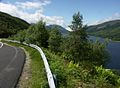
 B863 on North side of Loch Leven - geograph.org.uk - 21919.jpg 640 × 466; 115 KB
-
 B863 on North side of Loch Leven - geograph.org.uk - 21923.jpg 640 × 462; 126 KB
-
 B863 on North side of Loch Leven - geograph.org.uk - 21926.jpg 640 × 472; 126 KB
-
 B863 on North side of Loch Leven - geograph.org.uk - 21927.jpg 640 × 463; 118 KB
-
 B863 on North side of Loch Leven - geograph.org.uk - 21928.jpg 640 × 493; 108 KB
-

-
 B863 on South Side of Loch Leven - geograph.org.uk - 21968.jpg 640 × 459; 132 KB
-
 B863 on South Side of Loch Leven - geograph.org.uk - 21969.jpg 640 × 475; 144 KB
-
 B863 on South Side of Loch Leven - geograph.org.uk - 21970.jpg 640 × 478; 148 KB
-
 B863 on South Side of Loch Leven - geograph.org.uk - 21971.jpg 640 × 476; 136 KB
-
 B863 on South Side of Loch Leven - geograph.org.uk - 21972.jpg 640 × 467; 148 KB
-
 Balcombe Station - geograph.org.uk - 21837.jpg 640 × 480; 108 KB
-
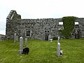 Baliasta Kirk South Wall - geograph.org.uk - 606862.jpg 640 × 480; 69 KB
-
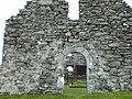 Baliasta Kirk West Door - geograph.org.uk - 606857.jpg 640 × 480; 118 KB
-
 Barratt Road allotments - geograph.org.uk - 21964.jpg 640 × 480; 146 KB
-
 Barrow Haven Timber Wharf - geograph.org.uk - 39748.jpg 640 × 480; 71 KB
-
 Beddington Sewage Treatment Works. - geograph.org.uk - 21882.jpg 640 × 474; 127 KB
-
 Beeston Bump 308479.jpg 640 × 480; 157 KB
-
 Bethel Methodist church, Boulder Clough - geograph.org.uk - 21764.jpg 800 × 600; 171 KB
-
 Birchwood - Railway Station.jpg 640 × 426; 103 KB
-
 Boat graveyard, Lake Lothing - geograph.org.uk - 1368195.jpg 640 × 411; 95 KB
-
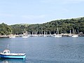 Boats on Pont Pill - geograph.org.uk - 30208.jpg 640 × 479; 135 KB
-
 Building houses, Luddendenfoot - geograph.org.uk - 21766.jpg 800 × 600; 192 KB
-
 Bullring Shopping Centre, Birmingham - geograph.org.uk - 33700.jpg 320 × 240; 19 KB
-
 Bury St Edmunds cemetery - geograph.org.uk - 21908.jpg 640 × 427; 77 KB
-
 Carnmore - geograph.org.uk - 1289717.jpg 640 × 480; 80 KB
-
 Carrick-a-rede Rope Bridge - geograph.org.uk - 405310.jpg 640 × 433; 71 KB
-
 China Clay Silos near Par - geograph.org.uk - 30198.jpg 640 × 393; 102 KB
-
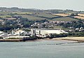 China Clay Storage near Par - geograph.org.uk - 30195.jpg 639 × 441; 106 KB
-
 Cirencester Parish church - geograph.org.uk - 324967.jpg 480 × 640; 89 KB
-
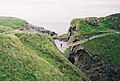
 Cliffs near Polridmouth - geograph.org.uk - 29716.jpg 640 × 480; 179 KB
-
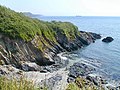
 Coast near Gribbin Head - geograph.org.uk - 29714.jpg 640 × 436; 101 KB
-
 Cove near Polkerris - geograph.org.uk - 30186.jpg 640 × 468; 172 KB
-
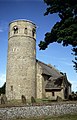
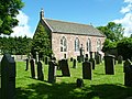
 Crathorne Parish Church - geograph.org.uk - 22886.jpg 640 × 480; 68 KB
-
 Crathorne Village Shop and Post Office - geograph.org.uk - 21960.jpg 640 × 480; 71 KB
-
 Croome Church - geograph.org.uk - 21897.jpg 640 × 479; 111 KB
-
 Crossing the burn from Srathan Buidhe - geograph.org.uk - 1289619.jpg 480 × 640; 119 KB
-
 Cubs Moor - geograph.org.uk - 21889.jpg 640 × 479; 82 KB
-
 Dangerous Bend, Green Street, Naunton - geograph.org.uk - 21883.jpg 640 × 479; 104 KB
-
 De Havilland Twin Otter - geograph.org.uk - 1469206.jpg 640 × 453; 57 KB
-
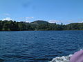
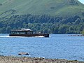 Derwent Water MMB 17.jpg 1,600 × 1,200; 796 KB
-
 Derwent Water MMB 18.jpg 1,600 × 1,200; 780 KB
-
 Derwent Water MMB 19.jpg 1,600 × 1,200; 792 KB
-
 Derwent Water MMB 20.jpg 1,600 × 1,200; 793 KB
-
 Derwent Water MMB 21.jpg 1,600 × 1,200; 778 KB
-
 Derwent Water MMB 22.jpg 1,600 × 1,200; 780 KB
-
 Derwent Water MMB 23.jpg 1,600 × 1,200; 790 KB
-
 Derwent Water MMB 24.jpg 1,600 × 1,200; 767 KB
-
 Derwent Water MMB 25.jpg 1,600 × 1,200; 785 KB
-
 Derwent Water MMB 26.jpg 1,600 × 1,200; 779 KB
-
 Derwent Water MMB 27.jpg 1,600 × 1,200; 784 KB
-
 Derwent Water MMB 28.jpg 1,600 × 1,200; 763 KB
-
 Derwent Water MMB 29.jpg 1,600 × 1,200; 780 KB
-
 Derwent Water MMB 30.jpg 1,600 × 1,200; 803 KB
-
 Derwent Water MMB 31.jpg 1,600 × 1,200; 786 KB
-
 Derwent Water MMB 32.jpg 1,600 × 1,200; 778 KB
-
 Derwent Water MMB 33.jpg 1,600 × 1,200; 781 KB
-
 Derwent Water MMB 34.jpg 1,600 × 1,200; 787 KB
-
 Derwent Water MMB 35.jpg 1,600 × 1,200; 785 KB
-
 Derwent Water MMB 36.jpg 1,600 × 1,200; 786 KB
-
 Derwent Water MMB 37.jpg 1,600 × 1,200; 774 KB
-
 Derwent Water MMB 38.jpg 1,600 × 1,200; 764 KB
-
 Derwent Water MMB 39.jpg 1,600 × 1,200; 778 KB
-
 Derwent Water MMB 40.jpg 1,600 × 1,200; 770 KB
-
 Devon Cliffs Holiday Park - geograph.org.uk - 23404.jpg 640 × 480; 64 KB
-
 Drum Castle - geograph.org.uk - 617537.jpg 609 × 450; 150 KB
-
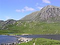
 Dubh Loch with A'Mhaighdean - geograph.org.uk - 1289709.jpg 640 × 480; 80 KB
-
 Duck Bay Marina - geograph.org.uk - 309271.jpg 640 × 425; 50 KB
-
 Top Church. - geograph.org.uk - 27946.jpg 640 × 628; 82 KB
-
 East of Gathurst - geograph.org.uk - 22108.jpg 640 × 480; 105 KB
-
 Edinburgh from Silver Sands, Aberdour - geograph.org.uk - 47062.jpg 640 × 480; 86 KB
-
 Encounter - geograph.org.uk - 26529.jpg 426 × 640; 71 KB
-
 Fenny Drayton from the East - geograph.org.uk - 863054.jpg 640 × 425; 88 KB
-
 Fenny Drayton from the West - geograph.org.uk - 863057.jpg 640 × 437; 52 KB
-
 Fields by Ilam Church and Thorpe Cloud - geograph.org.uk - 24525.jpg 640 × 480; 87 KB
-
 ForthRailwayBridge 27-06-2005 2150 TakenByEuchiasmus.JPG 1,536 × 2,048; 1.43 MB
-
-
-
 Gatehouse to Menabilly - geograph.org.uk - 30203.jpg 640 × 480; 154 KB
-
 Grassy slopes to Fionn Loch - geograph.org.uk - 1289696.jpg 640 × 480; 62 KB
-
 Great Yarmouth Windfarm - geograph.org.uk - 157787.jpg 640 × 480; 48 KB
-
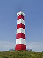 Gribbin Daymark, Gribbin Head - geograph.org.uk - 29711.jpg 480 × 640; 95 KB
-
 H J Heinz - geograph.org.uk - 21933.jpg 640 × 480; 90 KB
-
 Harthill Castle - geograph.org.uk - 28666.jpg 640 × 480; 144 KB
-
 Haskeir Eagach from Haskeir Lighthouse. - geograph.org.uk - 734187.jpg 480 × 640; 268 KB
-
 Haskeir Lighthouse - geograph.org.uk - 733685.jpg 640 × 480; 355 KB
-
 Hawstead Church - geograph.org.uk - 21940.jpg 456 × 640; 97 KB
-

-
 Herringfleet church - geograph.org.uk - 129432.jpg 411 × 640; 80 KB
-
 Herringfleet Marsh Mill - geograph.org.uk - 1368929.jpg 640 × 411; 47 KB
-
 Herringfleet Marsh Mill - geograph.org.uk - 1368979.jpg 640 × 411; 51 KB
-
 High Wood from Greenway Court Farm - geograph.org.uk - 22316.jpg 640 × 480; 72 KB
-
 Holcombe 'Old' Church - geograph.org.uk - 1466361.jpg 640 × 480; 110 KB
-
 Hollingbourne Primary School - geograph.org.uk - 22314.jpg 640 × 480; 103 KB
-
 Hollingbourne Recreation Ground - geograph.org.uk - 22313.jpg 640 × 480; 115 KB
-
 Holy Trinity Church - Cuckfield - geograph.org.uk - 21841.jpg 640 × 480; 94 KB
-
 Horringer Church - geograph.org.uk - 21912.jpg 640 × 403; 83 KB
-
 House of Monymusk.jpg 640 × 480; 130 KB
-
 Hutton Rudby Cricket Club Pavilion - geograph.org.uk - 22007.jpg 640 × 480; 55 KB
-
 Hutton Rudby Village Green - geograph.org.uk - 22884.jpg 640 × 480; 80 KB
-
 Ilam CE Primary School - geograph.org.uk - 26468.jpg 640 × 480; 100 KB
-
 Jumbles Reservoir - geograph.org.uk - 653031.jpg 640 × 480; 122 KB
-
 June Border at Crathes Castle Gardens - geograph.org.uk - 94037.jpg 640 × 480; 167 KB
-
 Kinnersley Village Centre - geograph.org.uk - 21887.jpg 640 × 479; 110 KB
-
 Knockendoch - geograph.org.uk - 689487.jpg 640 × 480; 52 KB
-
 Laggan Locks from Kilfinnan - geograph.org.uk - 23831.jpg 640 × 480; 89 KB
-
 Largie Community Centre - geograph.org.uk - 28656.jpg 640 × 480; 142 KB
-
 Littlecote House 02.jpg 640 × 480; 63 KB
-
 Littleham Cove - geograph.org.uk - 23403.jpg 640 × 480; 88 KB
-

-
 Loch an Doire Crionaich - geograph.org.uk - 1289593.jpg 640 × 480; 83 KB
-
 Loch Leven from near Craigrannoch - geograph.org.uk - 21976.jpg 640 × 457; 141 KB
-
 Loch Leven from near Craigrannoch - geograph.org.uk - 21977.jpg 640 × 474; 147 KB
-
 Lochan Beannach Beag and Fionn Loch - geograph.org.uk - 1289682.jpg 640 × 480; 58 KB
-
 Logie-Elphinstone Castle - geograph.org.uk - 28869.jpg 640 × 480; 128 KB
-
 Long Wood - geograph.org.uk - 21934.jpg 640 × 427; 83 KB
-
 Lower Speyside - geograph.org.uk - 930724.jpg 640 × 402; 50 KB
-
 Lowestoft Yacht Services - geograph.org.uk - 1368174.jpg 640 × 411; 81 KB
-
 M5 - geograph.org.uk - 21895.jpg 640 × 479; 88 KB
-
 Maidstone Hospital - geograph.org.uk - 22310.jpg 640 × 480; 73 KB
-

-
 Mereworth Church - geograph.org.uk - 22033.jpg 480 × 640; 116 KB
-
-
 North to Skirts of Foundland - geograph.org.uk - 28654.jpg 640 × 480; 95 KB
-
-
 Nowton Church - geograph.org.uk - 21942.jpg 640 × 427; 77 KB
-
 Nowton Park - geograph.org.uk - 21945.jpg 640 × 427; 136 KB
-
 Nurses Home, Barming - geograph.org.uk - 22309.jpg 640 × 480; 81 KB
-
 Occident vs. Orient^ - geograph.org.uk - 21890.jpg 640 × 480; 113 KB
-
 Old Dorney Bay - geograph.org.uk - 57934.jpg 480 × 640; 190 KB
-
 Old Portsmouth seafront - geograph.org.uk - 354779.jpg 640 × 480; 58 KB
-
 On the Carnmore track - geograph.org.uk - 1289673.jpg 640 × 480; 63 KB
-
 Otter Estuary Nature Reserve - geograph.org.uk - 23423.jpg 640 × 480; 91 KB
-
 Par Harbour - geograph.org.uk - 30196.jpg 639 × 441; 106 KB
-
 Par Sands and Booley Beach - geograph.org.uk - 30202.jpg 640 × 356; 96 KB
-
 Parish Church of Rudby - geograph.org.uk - 21966.jpg 640 × 480; 103 KB
-
 Path to Carnmore - geograph.org.uk - 1289585.jpg 640 × 432; 60 KB
-
 PenalltOldChurch(LynHarper)Apr2006.jpg 480 × 640; 119 KB
-
 Pinford End - geograph.org.uk - 21936.jpg 640 × 427; 121 KB
-

-
 Polkerris Beach - geograph.org.uk - 30187 (cropped).jpg 640 × 360; 141 KB
-
 Polkerris Beach - geograph.org.uk - 30187.jpg 640 × 480; 154 KB
-
 Polridmouth Cottage - geograph.org.uk - 29709.jpg 640 × 403; 142 KB
-
 Polridmouth West Beach - geograph.org.uk - 29710.jpg 640 × 480; 128 KB
-
 Polruan - geograph.org.uk - 30206.jpg 640 × 480; 147 KB
-
 Pond Farm,Herringfleet - geograph.org.uk - 1368998.jpg 640 × 411; 71 KB
-
 Railway Bridge at Carluke - geograph.org.uk - 128613.jpg 640 × 480; 81 KB
-
 Rise to cross the M5 - geograph.org.uk - 21891.jpg 640 × 479; 96 KB
-
 River Calder, Brearley - geograph.org.uk - 21758.jpg 800 × 600; 123 KB
-
 River Linnet in Bury St Edmunds - geograph.org.uk - 21910.jpg 427 × 640; 120 KB
-
 Road down from Mamore Lodge Hotel - geograph.org.uk - 21954.jpg 640 × 479; 150 KB
-
 Road down from Mamore Lodge Hotel - geograph.org.uk - 21957.jpg 640 × 487; 141 KB
-
 Road down from Mamore Lodge Hotel - geograph.org.uk - 21958.jpg 640 × 480; 159 KB
-

-
 Roses in the walled garden at Drum Castle - geograph.org.uk - 617527.jpg 600 × 450; 126 KB
-
 Roses in the walled garden at Drum Castle - geograph.org.uk - 617531.jpg 600 × 450; 137 KB
-

-
 Rural phone box, leaning phone pole - geograph.org.uk - 153922.jpg 640 × 480; 102 KB
-
 Ryarsh Parish Church - geograph.org.uk - 22018.jpg 640 × 480; 120 KB
-
 Scotstown Farm - geograph.org.uk - 28658.jpg 640 × 480; 96 KB
-
 Seafront at Southwold - geograph.org.uk - 1415733.jpg 640 × 411; 56 KB
-
 Severn Stoke - geograph.org.uk - 22118.jpg 640 × 479; 88 KB
-
 Skelwith Bridge Slate Works - geograph.org.uk - 65250.jpg 640 × 480; 132 KB
-

-
 Spinnaker Tower from Gosport - geograph.org.uk - 78579.jpg 640 × 480; 72 KB
-
 Spit Sand from RH Haslar sea wall - geograph.org.uk - 923494.jpg 640 × 384; 35 KB
-
 St Kilda-2.jpg 640 × 480; 261 KB
-
 St Leonard's Tower, West Malling - geograph.org.uk - 22019.jpg 640 × 480; 174 KB
-
 St Peter's Church, Sowerby - geograph.org.uk - 21765.jpg 450 × 600; 108 KB
-
 St. Peter's church, Pirton - geograph.org.uk - 21900.jpg 640 × 479; 127 KB
-

-
 Stokes Bay during T200 celebrations - geograph.org.uk - 923450.jpg 640 × 403; 32 KB
-
 Sunset over Lee-on-the-Solent - geograph.org.uk - 43420.jpg 640 × 480; 92 KB
-
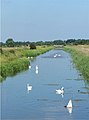 Swans on the Great Eau at Rimac - geograph.org.uk - 1030100.jpg 474 × 640; 48 KB
-
 The Beehive, Horringer - geograph.org.uk - 21911.jpg 640 × 427; 110 KB
-
-
 The Chapel of The Garioch Parish Church - geograph.org.uk - 28688.jpg 640 × 480; 132 KB
-
 The Coastal path Budleigh Salterton - geograph.org.uk - 23410.jpg 640 × 480; 95 KB
-
 The Floors - geograph.org.uk - 23406.jpg 640 × 480; 81 KB
-
 The former chapel at Brook Street - geograph.org.uk - 21839.jpg 640 × 480; 115 KB
-
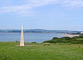 The Geoneedle at Orcombe Point Exmouth - geograph.org.uk - 23385.jpg 640 × 461; 60 KB
-
 The Haberden, Bury St Edmunds - geograph.org.uk - 21903.jpg 640 × 427; 66 KB
-
 The Hare and Hounds, Simmondley - geograph.org.uk - 22736.jpg 640 × 481; 108 KB
-
 The main road in Kilnsea - geograph.org.uk - 21892.jpg 640 × 480; 100 KB


.JPG)
.JPG)
.JPG)


_-_geograph.org.uk_-_693905.jpg)


Apr2006.jpg)


.jpg)


_end_-_geograph.org.uk_-_1021619.jpg)


