Category:United Kingdom photographs taken on 2004-08-29
Jump to navigation
Jump to search
Countries of Europe: Austria · Czech Republic · France‡ · Germany · Greece · Italy · Netherlands‡ · Poland · Portugal‡ · Russia‡ · Slovakia · Spain‡ · Switzerland · Ukraine · United Kingdom
‡: partly located in Europe
‡: partly located in Europe
| ← | 29 August 2004 | → | ||
| ← | August 2004 | → | ||

United Kingdom photographs taken on 29 August 2004.
Image files should be categorized here automatically using {{taken on}} template. Direct categorisation is also possible, if automatic is impossible.
Subcategories
This category has only the following subcategory.
Media in category "United Kingdom photographs taken on 2004-08-29"
The following 82 files are in this category, out of 82 total.
-
 Avebury Down - geograph.org.uk - 44039.jpg 640 × 427; 61 KB
-
 Aysgarth Falls - geograph.org.uk - 962872.jpg 640 × 480; 107 KB
-

-
 Believe it or not^ - geograph.org.uk - 46633.jpg 640 × 427; 113 KB
-
 Black Dog Halt, near Calne, Wilts - geograph.org.uk - 40305.jpg 640 × 427; 131 KB
-

-
 Bridge over the River Avon, Chippenham - geograph.org.uk - 44056.jpg 640 × 427; 132 KB
-
 Budleigh Farm campsite - geograph.org.uk - 1188805.jpg 640 × 264; 73 KB
-
 Cairn Gorm Ski Centre. - geograph.org.uk - 420774.jpg 640 × 427; 99 KB
-
 Cairn Gorm Ski Centre. - geograph.org.uk - 420777.jpg 640 × 427; 84 KB
-
 Calne, Wiltshire - geograph.org.uk - 44030.jpg 640 × 427; 65 KB
-
 Calvary at Mount St Bernard Abbey - geograph.org.uk - 369795.jpg 480 × 640; 92 KB
-
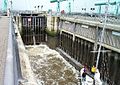
 Cardiff Bay Barrage lock - geograph.org.uk - 15862.jpg 640 × 425; 162 KB
-
 Cardiff Bay Barrage lock.jpg 571 × 403; 100 KB
-
 Cherhill village - geograph.org.uk - 46640.jpg 640 × 427; 101 KB
-
 Chinook - Flickr - Elsie esq..jpg 1,280 × 960; 442 KB
-
 Clachan Bridge - geograph.org.uk - 1127873.jpg 640 × 480; 71 KB
-

-
 Cliffs at east end of Marloes beach - geograph.org.uk - 96067.jpg 480 × 640; 118 KB
-
 Forest track heading for Glen Einich. - geograph.org.uk - 419734.jpg 640 × 427; 76 KB
-
 Foster Beck Mill - geograph.org.uk - 1127232.jpg 640 × 403; 82 KB
-
 Gayle Mill - geograph.org.uk - 1127273.jpg 640 × 418; 74 KB
-
 Glasshouses Mill - geograph.org.uk - 1127402.jpg 640 × 420; 61 KB
-
 Glenmore Caravan and Camping Site. - geograph.org.uk - 420567.jpg 640 × 427; 110 KB
-
 Glenmore. - geograph.org.uk - 420565.jpg 640 × 427; 103 KB
-
 Haddo House and Gardens - geograph.org.uk - 94846.jpg 640 × 480; 110 KB
-
 Huddersfield Canal, Slaithwaite - geograph.org.uk - 90454.jpg 640 × 480; 126 KB
-

-
 Inner Loch Tarbert, Isle of Jura - geograph.org.uk - 42436.jpg 640 × 480; 47 KB
-
 Knights Hill - geograph.org.uk - 502278.jpg 640 × 364; 34 KB
-
 Lagavulin from the anchorage - geograph.org.uk - 1127938.jpg 640 × 480; 61 KB
-

-

-
 Limehouse Reach, Rochester - geograph.org.uk - 683647.jpg 640 × 480; 50 KB
-
 Loch An Eilein. - geograph.org.uk - 419727.jpg 640 × 427; 100 KB
-

-
 Mount Caburn, East Sussex.jpg 2,022 × 1,504; 541 KB
-
 Mounts Bay Lugger - geograph.org.uk - 44656.jpg 640 × 429; 41 KB
-
 Pontypool Park - geograph.org.uk - 258629.jpg 640 × 480; 136 KB
-
 Pontypool Park - the pond - geograph.org.uk - 258634.jpg 640 × 480; 152 KB
-

-
 River Thame, Waterperry - geograph.org.uk - 31198.jpg 640 × 480; 147 KB
-
 Savernake Forest - geograph.org.uk - 44010.jpg 640 × 427; 119 KB
-
 Shop in the Causeway, Chippenham - geograph.org.uk - 450328.jpg 640 × 566; 118 KB
-

-

-
 Summit , Beinn Tharsuinn. - geograph.org.uk - 9596.jpg 640 × 442; 72 KB
-
 Tayvallich from the pontoon - geograph.org.uk - 1127885.jpg 640 × 480; 80 KB
-

-

-
 The beach at Morecambe - geograph.org.uk - 1502596.jpg 640 × 432; 61 KB
-
 The old ski road from Glen More - geograph.org.uk - 381879.jpg 640 × 427; 121 KB
-
-

-
 Upton House, Warwickshire. - geograph.org.uk - 308644.jpg 640 × 361; 85 KB
-
 Usk Castle - geograph.org.uk - 199435.jpg 640 × 427; 98 KB
-
 Usk Castle - geograph.org.uk - 199438.jpg 640 × 427; 114 KB
-
 View from Usk Castle - geograph.org.uk - 199442.jpg 640 × 427; 96 KB
-
 Welsh hills - geograph.org.uk - 32656.jpg 640 × 480; 73 KB
-
 Welshpool Bound - geograph.org.uk - 96808.jpg 640 × 426; 142 KB
-
 Yore Mill, Aysgarth - geograph.org.uk - 1656089.jpg 640 × 419; 91 KB
-
 Backhill of Bush - geograph.org.uk - 14237.jpg 600 × 450; 35 KB
-
 Barton Down, north of Marlborough - geograph.org.uk - 44038.jpg 640 × 427; 44 KB
-
 Cairn on Tair Carn Isaf - geograph.org.uk - 19075.jpg 640 × 353; 48 KB
-
 Cat and Fiddle - geograph.org.uk - 59833.jpg 640 × 480; 81 KB
-
 Clatford Down - geograph.org.uk - 44046.jpg 640 × 427; 60 KB
-
 Cliff Top View - geograph.org.uk - 76595.jpg 640 × 480; 89 KB
-

-
 Fyfield Down - geograph.org.uk - 44043.jpg 640 × 427; 68 KB
-
 Kettlehole - geograph.org.uk - 8643.jpg 640 × 480; 98 KB
-
 Kingussie - Croila Road - geograph.org.uk - 364048.jpg 640 × 427; 94 KB
-

-
 Marlborough, Wilts - geograph.org.uk - 44036.jpg 640 × 427; 82 KB
-
 Mixed rocks at the Bay of Stoer - geograph.org.uk - 61676.jpg 640 × 480; 70 KB
-
 Nearly at the top^ - geograph.org.uk - 60728.jpg 640 × 480; 82 KB
-
 Norfolk Groyne - geograph.org.uk - 74784.jpg 640 × 480; 109 KB
-

-
 Rivar Down - geograph.org.uk - 44015.jpg 640 × 427; 45 KB
-
 Savernake Forest - geograph.org.uk - 44006.jpg 640 × 427; 127 KB
-
 Sutton Scarsdale - View to Bolsover - geograph.org.uk - 597133.jpg 640 × 480; 60 KB
-
 Trig point on Tair Carn Isaf - geograph.org.uk - 19077.jpg 640 × 480; 60 KB
-
 Watermill near Leatheringham, Suffolk. - geograph.org.uk - 23039.jpg 640 × 413; 250 KB


