Category:United Kingdom photographs taken on 2004-07-26
Jump to navigation
Jump to search
Countries of Europe: Austria · Belgium · Czech Republic · Republic of Ireland · Italy · Netherlands‡ · Norway · Russia‡ · Spain‡ · Switzerland · United Kingdom
‡: partly located in Europe
‡: partly located in Europe
| ← | 26 July 2004 | → | ||
| ← | July 2004 | → | ||

United Kingdom photographs taken on 26 July 2004.
Image files should be categorized here automatically using {{taken on}} template. Direct categorisation is also possible, if automatic is impossible.
Subcategories
This category has only the following subcategory.
Media in category "United Kingdom photographs taken on 2004-07-26"
The following 52 files are in this category, out of 52 total.
-
 Achnachroish, Lismore - geograph.org.uk - 93925.jpg 640 × 480; 101 KB
-
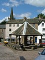 Alston Market Cross - geograph.org.uk - 1745507.jpg 480 × 640; 88 KB
-
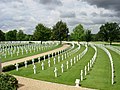 American War cemetery at Madingley - geograph.org.uk - 7250.jpg 640 × 480; 135 KB
-
 Another boundary, another summit - geograph.org.uk - 1745533.jpg 640 × 480; 72 KB
-
 Bar Point, St. Mary's - geograph.org.uk - 15840.jpg 640 × 480; 68 KB
-
 Brodick Bay - geograph.org.uk - 567.jpg 640 × 480; 36 KB
-
 C2C summit - geograph.org.uk - 1745515.jpg 640 × 480; 77 KB
-
 C2C summit - geograph.org.uk - 1745520.jpg 640 × 480; 76 KB
-

-
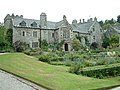 Cotehele House - geograph.org.uk - 65836.jpg 640 × 481; 125 KB
-
 Darlington - geograph.org.uk - 52377.jpg 640 × 480; 124 KB
-
 Golspie - geograph.org.uk - 9671.jpg 640 × 480; 68 KB
-
-
 Hartside summit - geograph.org.uk - 1745492.jpg 640 × 480; 82 KB
-
 Hartside viewpoint - geograph.org.uk - 1745481.jpg 640 × 480; 74 KB
-
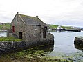
 Kirk Ness, Whalsay - geograph.org.uk - 100925.jpg 640 × 480; 85 KB
-
 Langwathby village green - geograph.org.uk - 1745471.jpg 640 × 480; 104 KB
-

-
 Llandudno Front viewed from the pier - geograph.org.uk - 500948.jpg 640 × 480; 62 KB
-
 Loch Fyne - geograph.org.uk - 1071776.jpg 640 × 480; 92 KB
-
 Perth Bridge - geograph.org.uk - 1711436.jpg 800 × 533; 351 KB
-
 Saltburn Cliff Lift - geograph.org.uk - 854800.jpg 640 × 480; 85 KB
-
 Saltburn Cliff Lift - geograph.org.uk - 854805.jpg 640 × 480; 138 KB
-
 Saltburn Cliff Lift and Pier - geograph.org.uk - 854779.jpg 640 × 480; 129 KB
-
 Saltburn Pier - geograph.org.uk - 854790.jpg 640 × 480; 80 KB
-
 Sun Inn - geograph.org.uk - 75852.jpg 640 × 369; 46 KB
-

-

-
 The view down from Goatfell - geograph.org.uk - 566.jpg 640 × 480; 58 KB
-
 The White Lion, Patterdale - geograph.org.uk - 771378.jpg 640 × 480; 64 KB
-
 Urvaig, Tiree - geograph.org.uk - 7998.jpg 640 × 480; 178 KB
-
 View from Tinker Hill - geograph.org.uk - 95449.jpg 640 × 483; 96 KB
-
 Watching for sharks off the Sound Of Gunna - geograph.org.uk - 8000.jpg 640 × 480; 149 KB
-
 West Beach, Whitby - geograph.org.uk - 854769.jpg 640 × 483; 101 KB
-
 Whalsay Ferry at Symbister - geograph.org.uk - 99987.jpg 640 × 480; 63 KB
-
 Whalsay road from Symbister to Isbister.jpg 640 × 480; 80 KB
-
 Alwen Reservoir at the far end - geograph.org.uk - 10490.jpg 640 × 480; 98 KB
-
 Bog track - geograph.org.uk - 9675.jpg 640 × 480; 72 KB
-
 Bruichglas - geograph.org.uk - 9665.jpg 640 × 480; 110 KB
-
 Cattle, Achnaluachrach - geograph.org.uk - 9673.jpg 640 × 422; 91 KB
-
 Craighead - geograph.org.uk - 9666.jpg 640 × 406; 43 KB
-
 Creag Dubh - geograph.org.uk - 9681.jpg 640 × 480; 72 KB
-
 Dunrobin Glen - geograph.org.uk - 9668.jpg 640 × 457; 66 KB
-
 Dunrobin Glen - geograph.org.uk - 9670.jpg 640 × 480; 74 KB
-
 Farm gate, Achnaluachrach - geograph.org.uk - 9677.jpg 640 × 435; 76 KB
-
 Old Water Bridge - geograph.org.uk - 5416.jpg 640 × 480; 98 KB
-
 Reeth town centre - geograph.org.uk - 31237.jpg 640 × 127; 25 KB
-
 Summit, Meall a'Chaise - geograph.org.uk - 9683.jpg 640 × 426; 36 KB
-
 The saddle - geograph.org.uk - 564.jpg 480 × 640; 57 KB
-
 Time For a Rest - geograph.org.uk - 565635.jpg 480 × 640; 90 KB
-
 Trig on Meall a'Chaise - geograph.org.uk - 9686.jpg 640 × 397; 37 KB
-
 Westburn of Fiddie - geograph.org.uk - 116063.jpg 640 × 480; 84 KB


