Category:United Kingdom photographs taken on 2004-05-22
Jump to navigation
Jump to search
Countries of Europe: Andorra · Austria · Finland · Georgia‡ · Germany · Hungary · Iceland · Republic of Ireland · Italy · Norway · Poland · Russia‡ · Spain‡ · Sweden · Switzerland · Ukraine · United Kingdom
Specific status: Isle of Man
‡: partly located in Europe
Specific status: Isle of Man
‡: partly located in Europe
| ← | 22 May 2004 | → | ||
| ← | May 2004 | → | ||

United Kingdom photographs taken on 22 May 2004.
Image files should be categorized here automatically using {{taken on}} template. Direct categorisation is also possible, if automatic is impossible.
Media in category "United Kingdom photographs taken on 2004-05-22"
The following 124 files are in this category, out of 124 total.
-
 "Boy Matthew", Coleraine - geograph.org.uk - 1708135.jpg 640 × 479; 63 KB
-
 A house in Little Gaddesden - geograph.org.uk - 67411.jpg 640 × 480; 143 KB
-
 A pair of Guillemots - geograph.org.uk - 772390.jpg 517 × 640; 139 KB
-
 Alexandra Palace from the north - geograph.org.uk - 50980.jpg 640 × 480; 90 KB
-
 Alexandra Palace station - geograph.org.uk - 50976.jpg 640 × 480; 53 KB
-
 APOLLO FOX in Ridham Dock - geograph.org.uk - 764510.jpg 640 × 482; 309 KB
-
 Aqueduct from Loch Katrine to Glasgow - geograph.org.uk - 944281.jpg 640 × 480; 116 KB
-
 Arctic Tern - geograph.org.uk - 772393.jpg 480 × 640; 95 KB
-
 Arctic Tern on tourist's hat - geograph.org.uk - 772376.jpg 640 × 480; 32 KB
-
 Arriva Trains Northern 142094 at Lincoln 01.jpg 1,024 × 768; 216 KB
-
 Arriva Trains Northern 142094 at Lincoln 02.jpg 1,024 × 768; 225 KB
-
 Baconsthorpe Castle - geograph.org.uk - 150390.jpg 480 × 640; 104 KB
-
 Baconsthorpe Castle - geograph.org.uk - 150393.jpg 640 × 480; 108 KB
-
 Baconsthorpe Castle. - geograph.org.uk - 150399.jpg 640 × 480; 85 KB
-
 Bartholomew Street, Newbury - geograph.org.uk - 127824.jpg 418 × 640; 82 KB
-
 Bay - geograph.org.uk - 17608.jpg 640 × 480; 83 KB
-
 Beach, Bernera - geograph.org.uk - 913668.jpg 640 × 480; 60 KB
-
 Bee Boles, Heligan Gardens - geograph.org.uk - 412612.jpg 640 × 481; 130 KB
-
 Belfast Lough Ferry.jpg 640 × 426; 120 KB
-
 Ben MacDui , Munro No 2 - geograph.org.uk - 69852.jpg 640 × 534; 260 KB
-

-
 Big Pit Mining Museum - geograph.org.uk - 1177581.jpg 410 × 640; 87 KB
-
 Blaenavon Ironworks and Stack Square - geograph.org.uk - 1137018.jpg 640 × 419; 84 KB
-
 Braeside, Glen More - geograph.org.uk - 917272.jpg 640 × 480; 75 KB
-
 St Mary's Church, Breamore - geograph.org.uk - 436996.jpg 640 × 480; 202 KB
-
 Breamore House - geograph.org.uk - 436995.jpg 640 × 480; 200 KB
-
 Breamore House, clock tower - geograph.org.uk - 436993.jpg 640 × 480; 193 KB
-
 Bridge Street, Newbury - geograph.org.uk - 127796.jpg 418 × 640; 71 KB
-
 Bridgewater Monument, Ashridge - geograph.org.uk - 67394.jpg 480 × 640; 59 KB
-
 Bridgewater Monument, Ashridge - geograph.org.uk - 67395.jpg 640 × 480; 130 KB
-
 Brimham Rocks, Nidderdale - geograph.org.uk - 51391.jpg 640 × 480; 119 KB
-
 Buggy Kiting on Bamburgh Sands - geograph.org.uk - 774111.jpg 640 × 480; 30 KB
-
 Caisson No.2, East Float dock - geograph.org.uk - 291351.jpg 640 × 480; 48 KB
-
 Camas nan Geall, Ardnamurchan - geograph.org.uk - 4422.jpg 640 × 370; 160 KB
-
 Carn a' Mhaim , Munro No 95 - geograph.org.uk - 72944.jpg 640 × 480; 220 KB
-
 Chibburn Chapel - geograph.org.uk - 950803.jpg 567 × 299; 35 KB
-
 Chibburn Chapel Detail - geograph.org.uk - 958463.jpg 564 × 640; 147 KB
-
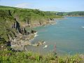 Combe Point - geograph.org.uk - 52962.jpg 640 × 480; 109 KB
-
 The Almshouses - geograph.org.uk - 528705.jpg 640 × 480; 72 KB
-
 Crarae Burn - geograph.org.uk - 965666.jpg 480 × 640; 166 KB
-
 Derry Cairngorm , Munro No 20 - geograph.org.uk - 69858.jpg 640 × 480; 204 KB
-
 Druridge Bay - geograph.org.uk - 958484.jpg 640 × 480; 39 KB
-
 Druridge Bay Nature Reserve - geograph.org.uk - 958476.jpg 640 × 462; 75 KB
-

-
 Fishing boats at Kyle of Lochalsh - geograph.org.uk - 1031631.jpg 640 × 480; 73 KB
-
 Glas Bheinn - geograph.org.uk - 913673.jpg 640 × 480; 69 KB
-
 Glas Bheinn - geograph.org.uk - 917262.jpg 640 × 480; 86 KB
-
 Glasshouse, Heligan Gardens - geograph.org.uk - 412636.jpg 640 × 481; 139 KB
-
 Glen Bernara - geograph.org.uk - 917270.jpg 640 × 480; 80 KB
-
 Hadlow Road Station, Willaston - geograph.org.uk - 36673.jpg 640 × 480; 60 KB
-
 Hadlow Road Station, Willaston. - geograph.org.uk - 36672.jpg 640 × 480; 60 KB
-
 St. John, Hammerwich - geograph.org.uk - 121217.jpg 640 × 427; 65 KB
-
 Harbottle Castle - geograph.org.uk - 950747.jpg 600 × 186; 19 KB
-
 Heligan apple arches.jpg 640 × 481; 136 KB
-
 Himalayan birch, Edinburgh Botanics - geograph.org.uk - 332908.jpg 570 × 422; 137 KB
-
 Information Board - geograph.org.uk - 958492.jpg 640 × 357; 63 KB
-
 Irvine Beach - panoramio.jpg 2,272 × 1,704; 1.08 MB
-
 Kirkham - Bridge over River Derwent - geograph.org.uk - 639542.jpg 640 × 480; 126 KB
-
 Kyle of Lochalsh quay - geograph.org.uk - 1031630.jpg 640 × 480; 66 KB
-
 LADY CLARA in Ridham Dock - geograph.org.uk - 764538.jpg 640 × 470; 322 KB
-
 Lagan Viking Irish Sea - geograph.org.uk - 339494.jpg 640 × 426; 105 KB
-
 Lincoln Central railway station from High Street level crossing.jpg 1,024 × 768; 248 KB
-
 Llech Idris - geograph.org.uk - 233598.jpg 322 × 397; 16 KB
-
 Loughisland and Slemish Mountain - geograph.org.uk - 775263.jpg 480 × 640; 68 KB
-
 Low Chibburn Information Board - geograph.org.uk - 958454.jpg 640 × 431; 80 KB
-
 Millennium Stadium, Cardiff - geograph.org.uk - 31653.jpg 640 × 480; 103 KB
-
 Moel Crynddyn in Cwm Glan-hafon - geograph.org.uk - 648566.jpg 640 × 480; 67 KB
-
 Nant Ddial in CwmGlan-hafon - geograph.org.uk - 648569.jpg 640 × 480; 67 KB
-
 Newbury Lock and Newbury Bridge - geograph.org.uk - 127766.jpg 418 × 640; 80 KB
-
 Newby Hall - geograph.org.uk - 114243.jpg 480 × 640; 92 KB
-
 Old Cottages, Willaston - geograph.org.uk - 36675.jpg 640 × 480; 61 KB
-
 On Glas Bheinn - geograph.org.uk - 913672.jpg 640 × 480; 66 KB
-

-
 Radar Tower near Hartland - geograph.org.uk - 17634.jpg 640 × 425; 33 KB
-
 Rear of Wharf Street, Newbury - geograph.org.uk - 127756.jpg 418 × 640; 74 KB
-
 Regional Railways-liveried Central Trains DMU 153356 at Lincoln 01.jpg 1,024 × 768; 239 KB
-
 Rhododendron in Crarae Gardens - geograph.org.uk - 1001821.jpg 640 × 480; 128 KB
-
 Rhododendrons and bamboo, Heligan Gardens - geograph.org.uk - 412656.jpg 640 × 481; 174 KB
-
 Ripon Canal - geograph.org.uk - 86772.jpg 640 × 480; 118 KB
-
 River Affric - geograph.org.uk - 135937.jpg 480 × 640; 80 KB
-
 Sad Castle Carving at Harbottle - geograph.org.uk - 950757.jpg 425 × 498; 40 KB
-
 Safely Ashore - geograph.org.uk - 267967.jpg 640 × 479; 101 KB
-
 Seagull Ardglass Harbour - geograph.org.uk - 339502.jpg 640 × 426; 75 KB
-
 Seaton - geograph.org.uk - 17607.jpg 640 × 480; 133 KB
-
 Shieldaig Lodge Hotel - geograph.org.uk - 278067.jpg 640 × 480; 75 KB
-
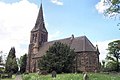
 St Nicholas Church, Ringwould.jpg 640 × 480; 108 KB
-
 St. John the Baptist, Knowle - geograph.org.uk - 119543.jpg 640 × 427; 87 KB
-
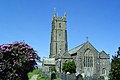
 St. Mary's church at Arlingham - geograph.org.uk - 109371.jpg 640 × 480; 129 KB
-
 St. Mary, Lapworth - geograph.org.uk - 119504.jpg 640 × 427; 84 KB
-
 St. Patrick, Salter Street - geograph.org.uk - 119531.jpg 324 × 486; 47 KB
-
 Steam Hammer, Blaenavon - geograph.org.uk - 290114.jpg 514 × 640; 116 KB
-
 Steep Hill, Lincoln - geograph.org.uk - 47251.jpg 400 × 600; 107 KB
-
 The Pond at Stixwould - geograph.org.uk - 46584.jpg 640 × 427; 141 KB
-
 Stnectan.jpg 640 × 425; 259 KB
-
 Stonehenge by Rob Stoeltje.jpg 3,264 × 2,176; 2.86 MB
-
 Swan family - geograph.org.uk - 1318178.jpg 640 × 361; 150 KB
-
 Swan with eight cygnets - geograph.org.uk - 1320790.jpg 640 × 479; 279 KB
-
 The allotments, Longworth - geograph.org.uk - 458992.jpg 640 × 427; 93 KB
-
-
 The Old Lifeboat House - geograph.org.uk - 515715.jpg 521 × 640; 274 KB
-
 The Ripon Canal - geograph.org.uk - 114472.jpg 480 × 640; 118 KB
-
 The summit of Post Gwyn - geograph.org.uk - 648504.jpg 640 × 480; 67 KB
-
 Toll bar - geograph.org.uk - 839190.jpg 640 × 480; 79 KB
-
 Trees in Crarae Forest Gardens - geograph.org.uk - 1001813.jpg 640 × 480; 157 KB
-

-

-
 Walled vegetable garden, Heligan Gardens - geograph.org.uk - 412621.jpg 640 × 481; 150 KB
-
 Wave at Hornsea. - geograph.org.uk - 529735.jpg 640 × 202; 29 KB
-
 Western side of Creag an Lochain - geograph.org.uk - 614567.jpg 800 × 600; 209 KB
-
 Windmill, Willaston - geograph.org.uk - 36681.jpg 480 × 640; 61 KB
-
 Arisaig - geograph.org.uk - 4260.jpg 451 × 640; 184 KB
-
 Biod Ban - geograph.org.uk - 8512.jpg 640 × 480; 93 KB
-
 Claerwen Reservoir - geograph.org.uk - 27272.jpg 640 × 481; 89 KB
-
 Deer Leap swimming pool, Ringshall - geograph.org.uk - 67404.jpg 640 × 480; 157 KB
-
 Deer Leap swimming pool, Ringshall - geograph.org.uk - 67406.jpg 640 × 480; 139 KB
-
 Glen More - geograph.org.uk - 8511.jpg 640 × 452; 60 KB
-
 Kennet and Avon Canal with boat and Nippa - geograph.org.uk - 315741.jpg 640 × 480; 144 KB
-

-
 May blossom at Ringwould allotments - geograph.org.uk - 318383.jpg 640 × 480; 163 KB
-
 Pier at Bogha Beag, Skye - geograph.org.uk - 25408.jpg 640 × 480; 51 KB
-
 Sign for the Pavilion Theatre - geograph.org.uk - 238758.jpg 640 × 463; 252 KB
-
 Slopes north of Meall nan Tarmachan - geograph.org.uk - 614577.jpg 800 × 569; 249 KB
-
 The Bridge Inn at Horton - geograph.org.uk - 315743.jpg 640 × 480; 117 KB
-
 The start of the Tarmachan ridge - geograph.org.uk - 614584.jpg 800 × 504; 202 KB


