Category:United Kingdom photographs taken on 2004-04-24
Jump to navigation
Jump to search
Countries of Europe: Belgium · Finland · Germany · Republic of Ireland · Netherlands‡ · Russia‡ · Spain‡ · Sweden · United Kingdom
‡: partly located in Europe
‡: partly located in Europe
| ← | 24 April 2004 | → | ||
| ← | April 2004 | → | ||

United Kingdom photographs taken on 24 April 2004.
Image files should be categorized here automatically using {{taken on}} template. Direct categorisation is also possible, if automatic is impossible.
Media in category "United Kingdom photographs taken on 2004-04-24"
The following 200 files are in this category, out of 215 total.
(previous page) (next page)-
 0037 "Aberddawan Aberthaw" at Peak Forest.jpg 1,280 × 768; 425 KB
-
 150104 approaches Stenson Junction on 24th April 2004.jpg 2,140 × 1,375; 1.39 MB
-
 170505 at North Stafford Junction - 5054685008.jpg 1,920 × 1,272; 656 KB
-
 170505 at North Stafford Junction - 5192804496.jpg 1,920 × 1,321; 1.19 MB
-
 170505 at North Stafford Junction - 5192804772.jpg 1,920 × 1,278; 998 KB
-
 170505 at North Stafford Junction.jpg 1,920 × 1,267; 1.14 MB
-
 Packhorse bridge in Marsden, West Yorkshire.jpg 429 × 643; 107 KB
-
 Peel Street, Marsden, West Yorkshire.jpg 965 × 643; 142 KB
-
 Standedge Tunnel End, Marsden, West Yorkshire.jpg 965 × 643; 144 KB
-
 Standedge Visitors Centre, Tunnel End, Marsden, West Yorkshire.jpg 965 × 643; 171 KB
-
 220001 at North Stafford Junction on 24th April 2004.jpg 1,700 × 1,247; 943 KB
-
 221101 at North Stafford Junction on 24th April 2004.jpg 2,000 × 1,356; 1.43 MB
-
 43155 at Tupton - 5528390903.jpg 1,280 × 818; 491 KB
-
 43155 at Tupton.jpg 1,280 × 824; 370 KB
-
 43157 at Clay Cross Junction 2.jpg 1,280 × 814; 488 KB
-
 43157 at Clay Cross Junction.jpg 1,280 × 826; 408 KB
-
 47854 at North Stafford Junction on 24th April 2004.jpg 2,160 × 1,440; 1.51 MB
-
 47854 at Stenson Junction on 24th April 2004.jpg 1,920 × 1,262; 1.06 MB
-
 60020 approaches Stenson Junction on 24th April 2004.jpg 1,720 × 1,156; 882 KB
-
 60020 passes North Stafford Junction on 24th April 2004.jpg 2,050 × 1,326; 1.28 MB
-
 60030 at North Stafford Junction on 24th April 2004.jpg 1,940 × 1,244; 909 KB
-
 60062 at Peak Forest.jpg 1,280 × 781; 401 KB
-
 66053 approaching Stenson Junction on 24th April 2004.jpg 2,160 × 1,370; 1.46 MB
-
 66053 at Stenson Junction on 24th April 2004.jpg 1,920 × 1,340; 1.29 MB
-
 66054 at North Stafford Junction - 5370754566.jpg 1,280 × 776; 492 KB
-
 66054 at North Stafford Junction.jpg 1,280 × 746; 409 KB
-
 66078 at North Stafford Junction.jpg 1,920 × 1,292; 1.12 MB
-
 66095 at Peak Forest.jpg 1,280 × 803; 477 KB
-
 66095, 60037 and 60062.jpg 1,280 × 809; 441 KB
-
 66562 at Clay Cross Junction - 5721866921.jpg 1,280 × 805; 444 KB
-
 66562 at Clay Cross Junction.jpg 1,280 × 831; 492 KB
-
 747 Taking Off - geograph.org.uk - 791090.jpg 640 × 512; 55 KB
-

-

-
 Adderbury Day of Dance.jpg 640 × 507; 123 KB
-
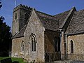 St.Mary Magdalene Adlestrop - geograph.org.uk - 108665.jpg 640 × 480; 150 KB
-
 Aircraft remains, Beinn a' Bhuird - geograph.org.uk - 203022.jpg 640 × 437; 71 KB
-
 Along the Hanson Way 1 - geograph.org.uk - 14511.jpg 422 × 640; 109 KB
-
 Along the Hanson Way 2 - geograph.org.uk - 14512.jpg 416 × 640; 76 KB
-
 Beach near Tal-y-bont looking South-East - geograph.org.uk - 144017.jpg 640 × 480; 102 KB
-
 Bledington - geograph.org.uk - 108670.jpg 640 × 480; 141 KB
-
 Bridge at Evesham - geograph.org.uk - 243210.jpg 640 × 478; 69 KB
-

-
 Cadair Berwyn New Top - geograph.org.uk - 648482.jpg 480 × 640; 91 KB
-
 Cairn on the path to Moel Sych - geograph.org.uk - 647918.jpg 640 × 480; 64 KB
-
 Cairnwell ski centre Glen Shee - geograph.org.uk - 7433.jpg 640 × 480; 173 KB
-
 Calke Abbey - panoramio - PJMarriott (1).jpg 2,048 × 1,536; 783 KB
-
 Calke Abbey - panoramio - PJMarriott (2).jpg 2,048 × 1,536; 774 KB
-
 Calke Abbey - panoramio - PJMarriott (3).jpg 2,048 × 1,536; 772 KB
-
 Calke Abbey - panoramio - PJMarriott.jpg 2,048 × 1,536; 767 KB
-
 Calke Abbey - panoramio.jpg 2,048 × 1,536; 740 KB
-
 St Paul's Church, Canonbury - geograph.org.uk - 347564.jpg 640 × 427; 129 KB
-

-
 Church of St Andrew, Heckington - geograph.org.uk - 474678.jpg 480 × 640; 70 KB
-

-

-
 Cnicht - geograph.org.uk - 107489.jpg 640 × 480; 80 KB
-
 St Michael and All Angels, Coningsby - geograph.org.uk - 430015.jpg 640 × 480; 105 KB
-
 St Michael and All Angels, Coningsby - geograph.org.uk - 430021.jpg 480 × 640; 145 KB
-
 Coningsby Baptist Church, Coningsby - geograph.org.uk - 429980.jpg 640 × 480; 94 KB
-
 Corfe Castle - geograph.org.uk - 1637661.jpg 480 × 640; 75 KB
-
 Craig Rossie from Aberuthven - geograph.org.uk - 868082.jpg 640 × 480; 107 KB
-
 Custom House Quay, Falmouth - geograph.org.uk - 102086.jpg 640 × 427; 97 KB
-
 Cwm Maen Gwynedd - geograph.org.uk - 648489.jpg 480 × 640; 82 KB
-

-
 Deer Park Mount Edgecombe - geograph.org.uk - 356093.jpg 640 × 480; 75 KB
-
 District Line carriage - internal - night - London - 240404.jpg 640 × 480; 37 KB
-
 Down it goes^ - geograph.org.uk - 1008309.jpg 640 × 475; 55 KB
-
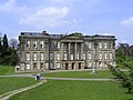
 Dunham Massey Hall - geograph.org.uk - 791116.jpg 640 × 512; 117 KB
-

-
 Ellins Tower - geograph.org.uk - 28214.jpg 640 × 480; 75 KB
-
 Evenly at Evenley - geograph.org.uk - 480390.jpg 640 × 399; 65 KB
-
 Falmouth Docks - geograph.org.uk - 102088.jpg 640 × 480; 60 KB
-
 Flats on Ironside Road - geograph.org.uk - 356556.jpg 640 × 480; 84 KB
-
 Rear of Church on Blackstock Road - geograph.org.uk - 356560.jpg 640 × 480; 96 KB
-
 Side of Church on Blackstock Road - geograph.org.uk - 356566.jpg 480 × 640; 69 KB
-
 Heckington Station 4.jpg 640 × 480; 90 KB
-
 Interior of St Andrew, Heckington - geograph.org.uk - 474824.jpg 480 × 640; 95 KB
-
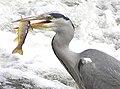
 Heron, Lover's Retreat (1) - geograph.org.uk - 1708155.jpg 640 × 479; 56 KB
-
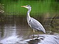 Heron, Lover's Retreat (2) - geograph.org.uk - 1708162.jpg 640 × 479; 56 KB
-
 Heron, Lover's Retreat (3) - geograph.org.uk - 1708168.jpg 640 × 479; 73 KB
-
 Heron, Lover's Retreat (4) - geograph.org.uk - 1708174.jpg 640 × 479; 60 KB
-
 Hill Houses from the reservoir road - geograph.org.uk - 380218.jpg 640 × 480; 160 KB
-
 Holy Trinity Church, Bramley - geograph.org.uk - 527355.jpg 480 × 640; 99 KB
-

-
 Knock of Crieff - geograph.org.uk - 868074.jpg 640 × 504; 117 KB
-
 Knock of Crieff - geograph.org.uk - 868078.jpg 480 × 640; 82 KB
-
 Knock of Crieff - geograph.org.uk - 868080.jpg 640 × 480; 67 KB
-
 Llyn Bochlwyd - geograph.org.uk - 90839.jpg 640 × 480; 116 KB
-
 Llyn Lluncaws from the Berwyn ridge - geograph.org.uk - 648477.jpg 640 × 480; 65 KB
-
 London Underground Interior Jubilee line.jpg 640 × 480; 38 KB
-
 Looking for lunch, Cranny - geograph.org.uk - 1008306.jpg 640 × 479; 72 KB
-
 Marsden station and canal.jpg 965 × 643; 140 KB
-
 MEA 391631.jpg 1,280 × 597; 265 KB
-
 MEA 391637.jpg 1,280 × 587; 252 KB
-
 MEA 391641.jpg 1,280 × 608; 270 KB
-
 MEA 391649.jpg 1,280 × 626; 267 KB
-
 MEA 391654.jpg 1,280 × 620; 269 KB
-
 MEA 391657.jpg 1,280 × 601; 255 KB
-
 Millbank Tower - Millbank - Westminster - London - 240404.jpg 540 × 869; 28 KB
-
 Millbank Tower Base - Millbank - Westminster - London - 240404.jpg 1,168 × 671; 118 KB
-
 Millbank Tower, Westminster, London, 24Apr04.jpg 960 × 1,258; 174 KB
-
 Moel Sych - geograph.org.uk - 647924.jpg 640 × 480; 85 KB
-
 Morden station - geograph.org.uk - 940380.jpg 640 × 482; 87 KB
-
 Naunton. St. Andrew's church - geograph.org.uk - 114741.jpg 640 × 480; 149 KB
-
 St Luke, North Kyme - geograph.org.uk - 105585.jpg 640 × 480; 77 KB
-
 North of Hexton (LCA 218) 2004 - geograph.org.uk - 426712.jpg 640 × 425; 56 KB
-
 North Watergate at low tide - geograph.org.uk - 626899.jpg 640 × 426; 83 KB
-

-
 Orangery Calke Abbey - panoramio.jpg 2,048 × 1,536; 852 KB
-
 Oxford Canal - geograph.org.uk - 1280146.jpg 640 × 457; 321 KB
-
 Oxford Canal - geograph.org.uk - 1338184.jpg 640 × 457; 315 KB
-
 Oxford Canal - geograph.org.uk - 1338197.jpg 640 × 457; 309 KB
-
 Oxford Canal - geograph.org.uk - 1338201.jpg 640 × 457; 308 KB
-
 Oxford Canal - geograph.org.uk - 1338206.jpg 640 × 457; 316 KB
-
 Oxford Canal - geograph.org.uk - 1338216.jpg 640 × 457; 324 KB
-
 Oxford Canal - geograph.org.uk - 1338223.jpg 640 × 457; 311 KB
-
 Oxford Canal - geograph.org.uk - 1338236.jpg 640 × 457; 353 KB
-
 Oxford Canal - geograph.org.uk - 1338247.jpg 640 × 457; 339 KB
-
 Oxford Canal - geograph.org.uk - 1338260.jpg 640 × 457; 274 KB
-
 Oxford Canal - geograph.org.uk - 1338264.jpg 640 × 457; 338 KB
-
 Oxford Canal - geograph.org.uk - 1338271.jpg 640 × 457; 368 KB
-
 Oxford Canal - geograph.org.uk - 1338275.jpg 640 × 457; 394 KB
-
 Oxford Canal - geograph.org.uk - 1338279.jpg 640 × 457; 333 KB
-
 Oxford Canal - geograph.org.uk - 1338282.jpg 640 × 457; 376 KB
-
 Oxford Canal - geograph.org.uk - 1338288.jpg 640 × 457; 422 KB
-
 Oxford Canal - geograph.org.uk - 1338295.jpg 640 × 457; 411 KB
-
 Oxford Canal - geograph.org.uk - 1338302.jpg 640 × 457; 372 KB
-
-

-

-

-
 Plas Mawr, Aberconwy - geograph.org.uk - 126681.jpg 480 × 640; 80 KB
-
 Plas Mawr, Aberconwy - geograph.org.uk - 218747.jpg 480 × 640; 58 KB
-
 Plas Mawr, Aberconwy - geograph.org.uk - 218748.jpg 480 × 640; 62 KB
-
 Plas Mawr, Conwy - geograph.org.uk - 1575761.jpg 640 × 480; 59 KB
-

-

-
 Road sign - geograph.org.uk - 1192194.jpg 640 × 480; 71 KB
-
 Roger Stevens Building - geograph.org.uk - 38635.jpg 640 × 476; 127 KB
-
 Rough open land on Knock of Crieff - geograph.org.uk - 868077.jpg 640 × 480; 63 KB
-
 Ruined Cottage near Harding Down - geograph.org.uk - 82850.jpg 640 × 480; 120 KB
-
 Salperton church. All saints - geograph.org.uk - 108700.jpg 640 × 480; 166 KB
-
 Ship at Falmouth Docks - geograph.org.uk - 308137.jpg 640 × 428; 75 KB
-
 Solva - geograph.org.uk - 242724.jpg 600 × 398; 84 KB
-
 Solva Harbour - geograph.org.uk - 239001.jpg 398 × 600; 100 KB
-
 Spring in Bury - geograph.org.uk - 1227873.jpg 480 × 640; 92 KB
-
 St Andrew, Ewerby - geograph.org.uk - 432329.jpg 640 × 480; 82 KB
-
 St Andrew, Heckington - geograph.org.uk - 474680.jpg 640 × 480; 116 KB
-
 St John's Gate 2004 3.jpg 1,896 × 2,553; 2.03 MB
-
 St Just in Roseland Church - geograph.org.uk - 308181.jpg 640 × 472; 125 KB
-
 St Mawes Castle - geograph.org.uk - 102097.jpg 640 × 433; 75 KB
-
 St Mawes Castle - geograph.org.uk - 308165.jpg 480 × 640; 53 KB
-
 St Mawes Quay - geograph.org.uk - 308155.jpg 640 × 428; 90 KB
-
 St Pancras railway station.jpg 640 × 408; 23 KB
-
 Steps leading down from Constable Road - geograph.org.uk - 356581.jpg 640 × 480; 118 KB
-
 Thatched Cottages, Milton Abbas - geograph.org.uk - 1595367.jpg 480 × 640; 70 KB
-
 The Dog Rock (detail) - geograph.org.uk - 380210.jpg 640 × 480; 97 KB
-
 The Dog Rock - geograph.org.uk - 380205.jpg 640 × 480; 162 KB
-
 The Harbourside at St Mawes - geograph.org.uk - 308153.jpg 640 × 516; 133 KB
-
 The Hornblower, Dogdyke - geograph.org.uk - 430484.jpg 640 × 480; 79 KB
-
 The Kings Head, Llangennith - geograph.org.uk - 82472.jpg 640 × 480; 60 KB
-
-
 The Millennium Garden - Micklefield Park - geograph.org.uk - 1640546.jpg 640 × 457; 107 KB
-
 The Old Oak Tree - geograph.org.uk - 903014.jpg 512 × 640; 90 KB
-
-

-
 The Three Bridges - geograph.org.uk - 39829.jpg 640 × 480; 141 KB
-
 The White Bull, Coningsby - geograph.org.uk - 429953.jpg 640 × 480; 63 KB
-
 Threave Castle, Castle Douglas - geograph.org.uk - 1581942.jpg 640 × 480; 57 KB
-
 Tiverton , Post Hill - geograph.org.uk - 1123952.jpg 640 × 512; 65 KB
-
 Under construction - geograph.org.uk - 1338091.jpg 640 × 457; 414 KB
-
 Under construction - geograph.org.uk - 1338111.jpg 640 × 457; 371 KB
-
 Under construction - geograph.org.uk - 1338174.jpg 640 × 457; 412 KB
-
 Victoria Line carriage - internal - night - London - 240404.jpg 1,251 × 924; 102 KB
-
 View From Banks Wood Park - geograph.org.uk - 559698.jpg 640 × 427; 66 KB
-
 Wesleyan Chapel, Mareham Le Fen - geograph.org.uk - 105525.jpg 640 × 480; 90 KB
-
 Whip Ridding Fields - geograph.org.uk - 36137.jpg 484 × 640; 96 KB
-
 Earlsgate Junction - geograph.org.uk - 10120.jpg 640 × 480; 93 KB
-
 Earlsgate Road - geograph.org.uk - 10927.jpg 640 × 480; 138 KB
-
 Woodland, Knock of Crieff - geograph.org.uk - 868081.jpg 640 × 480; 88 KB
-
 Above Talgarth's Well - geograph.org.uk - 82851.jpg 640 × 480; 58 KB
-
 Alnwick from the south - geograph.org.uk - 17596.jpg 640 × 480; 75 KB
-
 Bluebell woods at Winkworth - geograph.org.uk - 569902.jpg 640 × 480; 183 KB
-
 Bridge to Devils Cauldron Falls - geograph.org.uk - 39834.jpg 640 × 480; 132 KB
-
 Channel Street, Galashiels - geograph.org.uk - 65133.jpg 640 × 408; 81 KB
-
 Esker near Bridge of Cally - geograph.org.uk - 8376.jpg 640 × 480; 161 KB
-
 Farm and Caravan Site Drive - geograph.org.uk - 33979.jpg 640 × 480; 136 KB
-
 Gleann Beag - geograph.org.uk - 8546.jpg 640 × 480; 128 KB
-
 Houses on Ironside Road - geograph.org.uk - 356550.jpg 640 × 480; 83 KB
-
 Ironside Close - geograph.org.uk - 356529.jpg 640 × 480; 70 KB
-
 Ironside Close - geograph.org.uk - 356574.jpg 640 × 480; 71 KB
-
 Ironside Close Jnc Ironside Road - geograph.org.uk - 356526.jpg 640 × 480; 74 KB
-
 Knock of Crieff - geograph.org.uk - 12998.jpg 640 × 447; 81 KB
-

-
 OAP Flats Ironside Road - geograph.org.uk - 356568.jpg 640 × 480; 89 KB
-
 Out-Houses on Ironside Road - geograph.org.uk - 356571.jpg 640 × 480; 131 KB
-
 Padarn Country Park - geograph.org.uk - 90852.jpg 480 × 640; 178 KB
-

-


.jpg)
.jpg)
.jpg)


_-_geograph.org.uk_-_1708155.jpg)
_-_geograph.org.uk_-_1708162.jpg)
_-_geograph.org.uk_-_1708168.jpg)
_-_geograph.org.uk_-_1708174.jpg)


_2004_-_geograph.org.uk_-_426712.jpg)


_-_geograph.org.uk_-_380210.jpg)


_on_a_lovely_April_day._-_geograph.org.uk_-_64412.jpg)


