Category:United Kingdom photographs taken on 2004-02-15
Jump to navigation
Jump to search
Countries of Europe: Belarus · France‡ · Germany · Italy · Norway · Russia‡ · Spain‡ · United Kingdom
Specific status: Isle of Man
‡: partly located in Europe
Specific status: Isle of Man
‡: partly located in Europe
| ← | 15 February 2004 | → | ||
| ← | February 2004 | → | ||

United Kingdom photographs taken on 15 February 2004.
Image files should be categorized here automatically using {{taken on}} template. Direct categorisation is also possible, if automatic is impossible.
Media in category "United Kingdom photographs taken on 2004-02-15"
The following 49 files are in this category, out of 49 total.
-
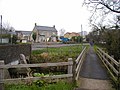
 All Saints Church Crudwell - geograph.org.uk - 1115503.jpg 640 × 435; 62 KB
-
 All Saints Church Crudwell - geograph.org.uk - 55197.jpg 512 × 384; 72 KB
-

-
 Bayview, Scousburgh - geograph.org.uk - 1780630.jpg 1,352 × 822; 269 KB
-
 Ben More and the Auchlyne West Burn - geograph.org.uk - 12282.jpg 640 × 432; 35 KB
-
 Cadair Idris seen from Carnedd Lŵyd - geograph.org.uk - 1631067.jpg 800 × 600; 666 KB
-
 Calver - geograph.org.uk - 67953.jpg 640 × 480; 102 KB
-
 Centre for Alternative Technology - geograph.org.uk - 1086207.jpg 640 × 404; 101 KB
-
 Centre for Alternative Technology - geograph.org.uk - 1093915.jpg 638 × 435; 193 KB
-
 Centre for Alternative Technology - geograph.org.uk - 1093924.jpg 425 × 638; 175 KB
-
 Crudwell - geograph.org.uk - 1115501.jpg 640 × 480; 61 KB
-
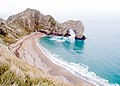 Durdle Door - panoramio (3).jpg 3,364 × 2,403; 5.47 MB
-

-
 Exmouth Beach - geograph.org.uk - 31201.jpg 640 × 480; 124 KB
-
 From Tegg's Nose looking towards Ridgegate Resr-Macc Forest - panoramio.jpg 1,000 × 667; 132 KB
-
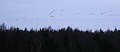 Geese in Flight - geograph.org.uk - 62265.jpg 640 × 276; 35 KB
-

-
 Interior, All Saints Church Crudwell - geograph.org.uk - 1114269.jpg 480 × 640; 90 KB
-
 Lochmaben - geograph.org.uk - 62253.jpg 640 × 272; 57 KB
-

-
 Pennard Castle Ruins - geograph.org.uk - 415060.jpg 640 × 480; 59 KB
-
 Penrhyn Castle - geograph.org.uk - 206536.jpg 480 × 640; 75 KB
-
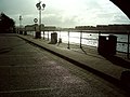 Preston Docks - geograph.org.uk - 179658.jpg 640 × 480; 90 KB
-
 Road at Crudwell - geograph.org.uk - 1115498.jpg 640 × 470; 45 KB
-
 Scotts Bay - geograph.org.uk - 1281757.jpg 500 × 375; 72 KB
-
 Shin Falls - geograph.org.uk - 1280.jpg 541 × 406; 72 KB
-
 Summit of Beinn Fhionnlaidh - geograph.org.uk - 221585.jpg 640 × 480; 51 KB
-
 Tetbury townhall - geograph.org.uk - 57008.jpg 512 × 384; 44 KB
-

-
 The Falkirk Wheel - geograph.org.uk - 6996.jpg 640 × 444; 143 KB
-
 The Plough Inn, Crudwell - geograph.org.uk - 55199.jpg 512 × 384; 61 KB
-
 The River Exe below Road Castle - geograph.org.uk - 92754.jpg 425 × 640; 91 KB
-
 The Snooty Fox, Tetbury - geograph.org.uk - 1114248.jpg 640 × 480; 81 KB
-
-
 Upper Park Street - geograph.org.uk - 308487.jpg 640 × 483; 68 KB
-
 Wall - geograph.org.uk - 44721.jpg 640 × 480; 74 KB
-
 Altanour Lodge Glen Ey near Braemar - geograph.org.uk - 9276.jpg 640 × 480; 156 KB
-
 Black Sail Hut and Great Gable - geograph.org.uk - 50851.jpg 640 × 480; 125 KB
-

-
 Cleared for Take Off - geograph.org.uk - 62263.jpg 640 × 399; 113 KB
-
 Climbing centre - geograph.org.uk - 75157.jpg 640 × 480; 142 KB
-
 Farmland above Auchlyne - geograph.org.uk - 340307.jpg 480 × 640; 67 KB
-
 Kiplin Hall - Front view - geograph.org.uk - 139245.jpg 640 × 480; 72 KB
-
 Lochan Coire Dubhclair - geograph.org.uk - 12288.jpg 640 × 419; 65 KB
-
 Sgiath Chùil and Meall a'Churain - geograph.org.uk - 12285.jpg 640 × 448; 60 KB
-
 Spot the phone mast^ - geograph.org.uk - 8366.jpg 640 × 480; 141 KB
-
 Survey pillar, Beinn Bhreac - geograph.org.uk - 12289.jpg 640 × 480; 65 KB
-
 Tetbury - geograph.org.uk - 57011.jpg 512 × 384; 46 KB
-
 Wellington's Monument - geograph.org.uk - 67948.jpg 480 × 640; 87 KB


.jpg)


