Category:United Kingdom photographs taken on 2002-05-10
Jump to navigation
Jump to search
Countries of Europe: Germany · United Kingdom
| ← | 10 May 2002 | → | ||
| ← | May 2002 | → | ||

United Kingdom photographs taken on 10 May 2002.
Image files should be categorized here automatically using {{taken on}} template. Direct categorisation is also possible, if automatic is impossible.
Subcategories
This category has only the following subcategory.
Media in category "United Kingdom photographs taken on 2002-05-10"
The following 72 files are in this category, out of 72 total.
-
 150001 & 150103 at Walsall.jpg 1,280 × 858; 287 KB
-
 150001 at Walsall - 5876615352.jpg 1,280 × 833; 277 KB
-
 150001 at Walsall on 10th May 2002.jpg 2,120 × 1,422; 838 KB
-
 150001 at Walsall.jpg 1,280 × 841; 300 KB
-
 150125 approaching Walsall on 10th May 2002.jpg 2,050 × 1,344; 769 KB
-
 150125 at Walsall 10th May 2002.jpg 2,120 × 1,418; 1.04 MB
-
 150125 at Walsall on 10th May 2002.jpg 2,060 × 1,400; 847 KB
-
 150125 enters Walsall on 10th May 2002.jpg 2,020 × 1,340; 744 KB
-
 37695 at Walsall.jpg 1,280 × 881; 381 KB
-
 60027 at Chapel-en-le-Frith.jpg 1,280 × 852; 433 KB
-
 60027 at Peak Forest - 5692801352.jpg 1,280 × 793; 394 KB
-
 60027 at Peak Forest - 5720835335.jpg 1,280 × 828; 445 KB
-
 60027 at Peak Forest 1.jpg 1,280 × 790; 377 KB
-
 60063, 60099 and 66055 at Peak Forest on 10th May 2002.jpg 2,130 × 1,430; 1.27 MB
-
 60076 at Peak Forest - 5468052904.jpg 1,280 × 780; 423 KB
-
 60076 at Peak Forest - 5525788038.jpg 1,280 × 845; 434 KB
-
 60076 at Peak Forest.jpg 1,280 × 834; 247 KB
-
 66055 & 60099 at Peak Forest.jpg 2,160 × 1,440; 1.33 MB
-
 66135 at Peak Forest.jpg 1,280 × 828; 441 KB
-
 66165 at Peak Forest 2.jpg 1,280 × 790; 367 KB
-
 66165 at Peak Forest on 10th May 2002.jpg 2,160 × 1,440; 1.31 MB
-
 66165 at Peak Forest.jpg 2,120 × 1,400; 1.07 MB
-
 66165 leaves Peak Forest on 10th May 2002.jpg 2,160 × 1,440; 1.3 MB
-
 Acairseid Mhòr - geograph.org.uk - 1292670.jpg 640 × 480; 54 KB
-
 An Teampull - geograph.org.uk - 1292808.jpg 640 × 480; 69 KB
-
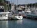 Brixham marina - geograph.org.uk - 3519.jpg 640 × 480; 68 KB
-
 Brochel Castle - geograph.org.uk - 1292558.jpg 573 × 640; 62 KB
-
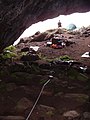 Church Cave on Rona - geograph.org.uk - 1292616.jpg 480 × 640; 77 KB
-
 Dry harbour - geograph.org.uk - 1292759.jpg 640 × 480; 85 KB
-
 East Riding Council Office Hedon.jpg 640 × 480; 78 KB
-
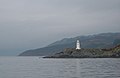 Eilean Mòr lighthouse - geograph.org.uk - 1293160.jpg 640 × 416; 33 KB
-
 Elsie Gate - geograph.org.uk - 278285.jpg 640 × 480; 169 KB
-
 Green Lane near Ketwell Lane - geograph.org.uk - 278284.jpg 640 × 480; 121 KB
-
 Hedon Beacon Market Hill.jpg 640 × 480; 80 KB
-
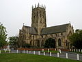 Hedon Church from Market Hill.jpg 640 × 480; 88 KB
-
 Hedon Market Place - geograph.org.uk - 278256.jpg 640 × 480; 81 KB
-
 Hedon Town Hall and Alexandra Hall - geograph.org.uk - 278281.jpg 640 × 480; 76 KB
-
 Ivy Lane - the road to Hedon Cemetery - geograph.org.uk - 278279.jpg 640 × 480; 140 KB
-
 JGA RMC 17222 at Peak Forest.jpg 1,280 × 706; 367 KB
-
 JGA RMC 17225 at Peak Forest.jpg 1,280 × 693; 321 KB
-
 JGA RMC 17230 at Peak Forest.jpg 1,280 × 709; 331 KB
-
 JGA RMC 17242 at Peak Forest.jpg 1,280 × 697; 295 KB
-
 Market Hill - geograph.org.uk - 278258.jpg 640 × 480; 61 KB
-
 Market Hill - geograph.org.uk - 278271.jpg 640 × 480; 88 KB
-
 MBA 500001 at Peak Forest - 6855817867.jpg 2,100 × 1,200; 1.06 MB
-
 MBA 500001 at Peak Forest - 6855818129.jpg 2,040 × 1,350; 982 KB
-
 MBA 500001 at Peak Forest.jpg 2,160 × 1,260; 1.1 MB
-
 MBA 500009 at Peak Forest.jpg 2,140 × 1,360; 1.09 MB
-
 MBA 500075 at Peak Forest on 10th May 2002.jpg 2,070 × 1,260; 1,008 KB
-
 MBA 500075 detail at Peak Forest on 10th May 2002.jpg 2,100 × 1,200; 846 KB
-
 MBA 500092 at Peak Forest on 10th May 2002.jpg 1,860 × 1,120; 842 KB
-
 MBA 500114 at Peak Forest on 10th May 2002.jpg 1,645 × 1,000; 682 KB
-
 Near Market Hill - geograph.org.uk - 137098.jpg 640 × 480; 139 KB
-
 Queen's Head - geograph.org.uk - 278277.jpg 640 × 480; 106 KB
-
 Rudd ZBA DB972627 - 5263382850.jpg 1,280 × 680; 383 KB
-
 Rudd ZBA DB972627.jpg 1,280 × 729; 395 KB
-
 Sea Urchin ZCA DC200698.jpg 1,280 × 721; 384 KB
-
 Sheriff Highway, Hedon - geograph.org.uk - 129017.jpg 640 × 480; 101 KB
-
 Sheriff Highway, Hedon - geograph.org.uk - 129120.jpg 640 × 480; 99 KB
-
 Souttergate Hedon.jpg 640 × 480; 83 KB
-
 St Augustines Gate Hedon.jpg 640 × 480; 97 KB
-
 The crossroads, Hedon - geograph.org.uk - 129123.jpg 640 × 480; 78 KB
-
 The road to Hedon Cemetery - geograph.org.uk - 278273.jpg 640 × 480; 104 KB
-
 The summit cairn on Carn Aosda - geograph.org.uk - 94246.jpg 640 × 466; 129 KB
-

-
 TTA TRL 51963.jpg 1,280 × 719; 268 KB
-
-
 War Memorial, West Hallam - geograph.org.uk - 14872.jpg 640 × 423; 114 KB
-
 YTX ADS56299.jpg 1,280 × 810; 389 KB
-
 Bluebells in wood - geograph.org.uk - 1422933.jpg 640 × 480; 156 KB
-
 Centenary Way, West Hallam - geograph.org.uk - 14867.jpg 640 × 423; 86 KB
-
 Porthmeor Beach - geograph.org.uk - 11559.jpg 640 × 480; 100 KB


