Category:Umschlagplatz
Jump to navigation
Jump to search
| Object location | | View all coordinates using: OpenStreetMap |
|---|
railway in the ghetto of Warsaw for deportation of Jews  | |||||
| Upload media | |||||
| Instance of | |||||
|---|---|---|---|---|---|
| Location | Śródmieście, Warsaw, Masovian Voivodeship, Poland | ||||
| Street address |
| ||||
| Has part(s) | |||||
| Heritage designation |
| ||||
 | |||||
Media in category "Umschlagplatz"
The following 61 files are in this category, out of 61 total.
-
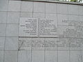
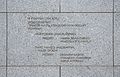
 2018 Warszawa Umschlagplatz, inskrypcja, 1.jpg 4,160 × 1,424; 3.76 MB
-
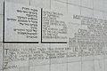
 2018 Warszawa Umschlagplatz, inskrypcja, 2.jpg 3,404 × 1,176; 2.61 MB
-
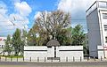
 2020 Warszawa Zespół Szkół Licealnych i Ekonomicznych nr 1, 4.jpg 5,362 × 3,575; 12.1 MB
-
 65th Anniversary of the Warsaw Ghetto Uprising (1).jpg 700 × 502; 144 KB
-
 Jews Umschlagplatz in Warsaw 1942.jpg 2,049 × 1,133; 543 KB
-
 Leśmian meadow.jpg 4,032 × 3,024; 14.02 MB
-
 Mur dawny Umschlagplatz ulica Stawki.JPG 4,862 × 3,101; 2.64 MB
-
 Museum of the History of Polish Jews Umschlagplatz 01.JPG 4,838 × 3,204; 2.5 MB
-
 Museum of the History of Polish Jews Umschlagplatz.JPG 4,915 × 3,255; 2.64 MB
-
 Ostbahn Krakau shuttle train Warschau-Treblinka.jpg 2,878 × 2,432; 2.5 MB
-
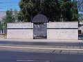
 Pomnik Umschlagplatz - panoramio.jpg 1,600 × 1,200; 382 KB
-
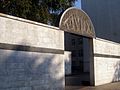
 Pomnik Umschlagplatz w Warszawie 2019a.jpg 7,360 × 4,912; 8.3 MB
-
 Pomnik Umschlagplatz w Warszawie 2019b.jpg 7,295 × 4,800; 7.94 MB
-
 Pomnik Umschlagplatz w Warszawie 2019d.jpg 6,781 × 4,413; 8.16 MB
-
 Pomnik Umschlagplatz w środku.jpg 4,016 × 3,008; 5.7 MB
-
 Stroop Collection - Jürgen Stroop and other officers - 06.jpg 800 × 526; 61 KB
-
 Stroop Report - Warsaw Ghetto Uprising - NARA04.jpg 1,642 × 1,186; 314 KB
-
 Słupek MSI al. Jana Pawła II róg Stawek.JPG 4,542 × 3,142; 1.78 MB
-
 Ulica Stawki przy Dzikiej 01.JPG 4,928 × 3,264; 2.86 MB
-
 Ulica Stawki w Warszawie dawny Umschlagplatz 011.JPG 2,942 × 1,885; 956 KB
-
 Umschlagplatz (1).JPG 4,608 × 3,456; 4.76 MB
-
 Umschlagplatz (2).JPG 4,608 × 3,456; 2.93 MB
-
 Umschlagplatz (3).JPG 4,608 × 3,456; 5.55 MB
-
 Umschlagplatz (4).JPG 4,608 × 3,456; 4.01 MB
-
 Umschlagplatz (5).JPG 4,608 × 3,456; 4.78 MB
-
 Umschlagplatz - panoramio - ekeidar.jpg 2,048 × 1,536; 386 KB
-
 Umschlagplatz - panoramio - geo573.jpg 2,048 × 1,536; 545 KB
-
 Umschlagplatz - panoramio - Tadeusz Dąbrowski.jpg 800 × 600; 96 KB
-
 Umschlagplatz - panoramio.jpg 2,048 × 1,536; 412 KB
-
 Umschlagplatz - The ghetto tram.jpg 1,023 × 746; 274 KB
-
 Umschlagplatz 1960.jpg 3,415 × 1,367; 1.91 MB
-
 Umschlagplatz dziedziniec szkoły 1942.jpg 3,477 × 2,264; 3.99 MB
-
 Umschlagplatz first commemoration.jpg 2,888 × 877; 741 KB
-
 Umschlagplatz in Warsaw August 1942.jpg 1,724 × 1,907; 898 KB
-
 Umschlagplatz In Warsaw ghetto.JPG 2,016 × 1,512; 729 KB
-
 Umschlagplatz loading (2).jpg 1,360 × 917; 973 KB
-
 Umschlagplatz loading.jpg 674 × 480; 173 KB
-
 Umschlagplatz Monument.jpg 800 × 600; 101 KB
-
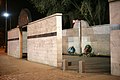 Umschlagplatz noc.JPG 2,000 × 1,333; 322 KB
-
 Umschlagplatz Warsaw 1.JPG 3,868 × 2,457; 2.11 MB
-
 Umschlagplatz Warsaw 2.JPG 4,563 × 3,094; 3.48 MB
-
 Umschlagplatz Warsaw 3.JPG 4,454 × 2,903; 3.03 MB
-
 Umschlagplatz Warsaw 4.JPG 4,438 × 2,966; 3.31 MB
-
 Umschlagplatz Warsaw 5.JPG 4,526 × 3,050; 2.29 MB
-
 Umschlagplatz Warsaw 6.JPG 4,660 × 2,971; 3.15 MB
-
 Umschlagplatz Warsaw 7.JPG 4,542 × 2,870; 2.48 MB
-
 Umschlagplatz Warsaw Ghetto 01.jpg 814 × 503; 234 KB
-
 Umschlagplatz Warsaw.JPG 4,645 × 2,940; 2.28 MB
-
 Umschlagplatz.JPG 2,592 × 1,944; 1.88 MB
-
 Umschlagplatzsign.jpg 1,024 × 768; 147 KB
-
 Umschlagpltaz Monument in Warsaw viewed from Dzika Street.JPG 4,787 × 3,100; 3.42 MB
-
 Umschlaplatz.jpg 3,120 × 4,160; 1.57 MB
-
 Umshlagplatz.jpg 3,648 × 2,736; 4.77 MB
-
 Warsaw Ghetto Uprising Umschlagplatz 1943 05.jpg 2,368 × 1,754; 1.35 MB
-
 Warsaw Uprising - Stawki magazine.jpg 640 × 373; 46 KB
-
 Warszawa Umschlagplatz pomnik 01.jpg 1,600 × 1,200; 443 KB
-
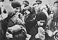 Żydzi którzy otrzymali chleb i marmoladę za dobrowolne stawienia się na Umschlagplatzu.jpg 2,045 × 1,399; 1.04 MB
-
 האומשלאגפלאץ, ורשה (1).jpg 5,152 × 3,864; 6.57 MB
-
 האומשלאגפלאץ, ורשה (2).jpg 3,864 × 5,152; 4.3 MB
-
 האומשלאגפלאץ, ורשה (3).jpg 5,152 × 3,864; 6.08 MB
-
 האומשלאגפלאץ, ורשה.jpg 4,000 × 3,000; 2.96 MB

.jpg)


.JPG)
.JPG)
.JPG)
.JPG)
.JPG)


.jpg)


.jpg)
.jpg)
.jpg)
