Category:Ulverston
Jump to navigation
Jump to search
town in Cumbria, England, United Kingdom  | |||||
| Upload media | |||||
| Instance of | |||||
|---|---|---|---|---|---|
| Location | Westmorland and Furness, Cumbria, North West England, England | ||||
| Said to be the same as | Ulverston (Wikimedia duplicated page, civil parish) | ||||
| official website | |||||
 | |||||
Subcategories
This category has the following 18 subcategories, out of 18 total.
C
- Canal Foot (4 F)
- Conishead Priory (6 F)
D
- Dragley Beck (3 F)
F
H
- Hartleys Brewery (5 F)
- Hoad Monument (35 F)
M
- St Mary's Church, Ulverston (4 F)
P
- Pubs in Ulverston (17 F)
R
- Rosside (2 F)
S
U
- Ulverston Canal (26 F)
- Ulverston railway station (49 F)
- Ulverston Town Hall (1 F)
- Ulverston War Memorial (3 F)
- Ulverston Workhouse (2 F)
Media in category "Ulverston"
The following 200 files are in this category, out of 435 total.
(previous page) (next page)-
 1 King Street (RF Oxley Plaque) - panoramio.jpg 1,728 × 3,072; 860 KB
-
 1 New Market Street - panoramio.jpg 3,072 × 1,728; 697 KB
-
 20 New Market Street - panoramio.jpg 1,220 × 3,072; 1.48 MB
-

-
 22 New Market Street - panoramio.jpg 1,174 × 3,072; 1.63 MB
-
 34 Market Street - panoramio.jpg 1,728 × 3,072; 708 KB
-
 39 Market Street - panoramio.jpg 1,357 × 3,072; 1.77 MB
-
 4 Market Street - panoramio.jpg 3,072 × 1,728; 861 KB
-
 64 Market Street (Gillams Cafe) - panoramio.jpg 1,728 × 3,072; 850 KB
-
 7 Theatre Street - panoramio.jpg 3,072 × 1,728; 969 KB
-
 A Blue House in Ulverston - geograph.org.uk - 1983061.jpg 800 × 600; 116 KB
-
 A view of Flan Hill - geograph.org.uk - 4518088.jpg 640 × 480; 74 KB
-
 A5087 Priory Road - geograph.org.uk - 5685651.jpg 640 × 481; 109 KB
-

-
 A5087 Priory Road, near Priory Park - geograph.org.uk - 5685646.jpg 640 × 481; 74 KB
-
 A590 nears Oubis Hill roundabout - geograph.org.uk - 5685636.jpg 640 × 478; 69 KB
-
 A590 through Ulverston.JPG 2,848 × 2,134; 1.23 MB
-
 A590 Ulverston.JPG 2,848 × 2,134; 1.21 MB
-
 Accumulator tower - panoramio (1).jpg 1,728 × 3,072; 1.75 MB
-
 Accumulator tower - panoramio.jpg 1,728 × 3,072; 2.06 MB
-
 Accumulator tower by the Ulverston Canal - geograph.org.uk - 3321579.jpg 480 × 649; 160 KB
-
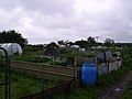 Allotments, Outcast. - geograph.org.uk - 188741.jpg 640 × 480; 76 KB
-
 Art Deco Roxy cinema, Brogden Street, Ulverston - geograph.org.uk - 2216216.jpg 1,618 × 1,150; 222 KB
-
 Artwork at start of Cumbria Way - panoramio.jpg 1,728 × 3,072; 638 KB
-
 Back drain - geograph.org.uk - 3884549.jpg 1,528 × 1,084; 1.68 MB
-
 Back Ford Park, Ulverston - geograph.org.uk - 3264367.jpg 1,024 × 768; 326 KB
-
 Bank Chambers - panoramio.jpg 2,836 × 1,728; 1.92 MB
-
 Barclays bank, Ulverston - geograph.org.uk - 1731557.jpg 640 × 480; 116 KB
-
 Barclays Bank, Ulverston, Cumbria.jpg 4,032 × 3,024; 3.49 MB
-
 Barn and Gate - geograph.org.uk - 135033.jpg 640 × 480; 125 KB
-

-
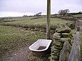 Bath Horace Hill - geograph.org.uk - 135018.jpg 640 × 480; 107 KB
-
 Bay Horse, Canal Foot - geograph.org.uk - 2191974.jpg 640 × 480; 170 KB
-
 Bench beside the Ulverston Canal - geograph.org.uk - 5771048.jpg 640 × 480; 371 KB
-
 Bench, Market Street, Ulverston - geograph.org.uk - 3264423.jpg 1,024 × 768; 368 KB
-
 Blue Plaque on Ellers Mill - geograph.org.uk - 6197813.jpg 1,944 × 2,592; 1.33 MB
-
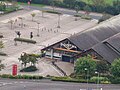
 Booth's Supermarket carpark - geograph.org.uk - 3368924.jpg 3,456 × 2,304; 2.97 MB
-
 Booths Car Park - geograph.org.uk - 1007195.jpg 640 × 480; 71 KB
-
 Booths car park, Ulverston - geograph.org.uk - 2488915.jpg 640 × 480; 124 KB
-
 Booths sharp.JPG 2,848 × 2,134; 1.11 MB
-
 Booths Supermarket, Ulverston - geograph.org.uk - 2192931.jpg 640 × 480; 248 KB
-
 Booths Ulverston - geograph.org.uk - 99261.jpg 640 × 480; 99 KB
-
 Braddylls Arms, Ulverston - geograph.org.uk - 2191960.jpg 480 × 640; 179 KB
-
 Brick wall with gateway - geograph.org.uk - 3736102.jpg 1,520 × 1,000; 1.24 MB
-
 Brogden Cottages - panoramio.jpg 2,888 × 1,728; 2.19 MB
-
 Buddhist Temple - geograph.org.uk - 3674304.jpg 2,442 × 1,596; 3.16 MB
-
 Buddhist Temple, Conishead Priory - geograph.org.uk - 5114991.jpg 640 × 425; 140 KB
-
 Building, Schooner Wharf - geograph.org.uk - 2191973.jpg 640 × 480; 230 KB
-
 Burlington Street, Ulverston - geograph.org.uk - 3264413.jpg 1,024 × 768; 236 KB
-
 Byron Street, Ulverston - geograph.org.uk - 1731396.jpg 640 × 480; 108 KB
-
 Canal Basin - geograph.org.uk - 1875026.jpg 2,560 × 1,456; 2.91 MB
-
 Canal Foot - geograph.org.uk - 1983071.jpg 800 × 600; 124 KB
-
 Canal Foot - geograph.org.uk - 2191978.jpg 640 × 480; 159 KB
-
 Canal Foot - geograph.org.uk - 2913637.jpg 640 × 425; 135 KB
-
 Canal Foot - geograph.org.uk - 2913642.jpg 640 × 425; 85 KB
-
 Canal Foot - geograph.org.uk - 2913644.jpg 640 × 425; 150 KB
-
 Canal Head, Ulverston - geograph.org.uk - 5265784.jpg 640 × 431; 188 KB
-
 Cartmel Sands Tidal Byway - geograph.org.uk - 4386862.jpg 3,872 × 2,592; 3.69 MB
-
 Central Drive at Croftlands in Ulverston - geograph.org.uk - 5961984.jpg 4,000 × 3,000; 2.48 MB
-
 Chapel Island - geograph.org.uk - 2191977.jpg 640 × 353; 23 KB
-
 Chapel Island from beach.JPG 3,072 × 2,304; 2.47 MB
-
 Chapel Island from Ulverston.JPG 2,848 × 2,134; 1.17 MB
-
 Chapel Island from Ulverston2.jpg 1,302 × 640; 197 KB
-
 Chapel Street, Ulverston - geograph.org.uk - 3827890.jpg 640 × 469; 74 KB
-
 Chippy Bank - panoramio.jpg 1,342 × 3,072; 1.6 MB
-
 Church for sale - geograph.org.uk - 2191983.jpg 640 × 480; 217 KB
-
 Church of Christ - panoramio.jpg 2,951 × 1,728; 2.09 MB
-
 Church Walk passing St Mary's - geograph.org.uk - 4462146.jpg 640 × 480; 83 KB
-
 Church Walk, mid-February 2015 - geograph.org.uk - 4460581.jpg 640 × 480; 54 KB
-
 Co-op New - panoramio.jpg 1,728 × 3,072; 862 KB
-
 Conishead Priory - geograph.org.uk - 3367805.jpg 3,456 × 2,304; 1.21 MB
-
 Conishead Priory - geograph.org.uk - 3676330.jpg 2,296 × 1,528; 2.69 MB
-
 Conishead Priory - geograph.org.uk - 3677845.jpg 2,250 × 1,500; 2.42 MB
-
 Conishead Priory - geograph.org.uk - 4232568.jpg 1,528 × 976; 1.18 MB
-
 Conishead Priory - geograph.org.uk - 4235630.jpg 1,512 × 984; 1.21 MB
-
 Conishead Priory - geograph.org.uk - 5113192.jpg 640 × 425; 137 KB
-
 Cormorant in the Ulverston Canal - geograph.org.uk - 3323548.jpg 480 × 640; 151 KB
-
 Coronation Hall, Ulverston - geograph.org.uk - 1731546.jpg 640 × 480; 116 KB
-
 Coronation Hall, Ulverston - geograph.org.uk - 4217087.jpg 3,776 × 2,520; 4.17 MB
-
 Creepy Ulverston.JPG 2,848 × 1,783; 654 KB
-
 Croft House - panoramio.jpg 2,913 × 1,728; 2.17 MB
-
 Croftlands Infant School.jpg 3,072 × 2,304; 2.28 MB
-
 Cumbria Way finger post and narrow gap stile - geograph.org.uk - 5453007.jpg 2,134 × 1,468; 1.01 MB
-
 Cumbria Way signs in Ulverston.JPG 3,072 × 2,304; 2.59 MB
-
 Cumbria Waymarker - geograph.org.uk - 986584.jpg 480 × 640; 106 KB
-
 Cumbria Waymarker. The Gill. Ulverston - geograph.org.uk - 5453004.jpg 1,728 × 2,304; 1.99 MB
-
 Decorative iron work at Canal Foot - geograph.org.uk - 5771089.jpg 640 × 480; 230 KB
-
 Derelict lock gates at Canal Foot - geograph.org.uk - 5771097.jpg 640 × 480; 242 KB
-

-
 Devonshire Arms pub, Ulverston - geograph.org.uk - 3265818.jpg 1,024 × 768; 310 KB
-
 Dog defecation.JPG 1,846 × 1,490; 586 KB
-
 Dog House - panoramio (1).jpg 3,072 × 1,728; 864 KB
-
 Doorway - geograph.org.uk - 1731473.jpg 481 × 640; 95 KB
-
 Effect of wind on trees.JPG 2,848 × 2,134; 1.34 MB
-
 Elegant Oxfam shop - geograph.org.uk - 1911319.jpg 1,597 × 2,140; 791 KB
-
 Ellers Mill - geograph.org.uk - 6197817.jpg 1,944 × 2,592; 1.12 MB
-
 Ellers Mill, Ulverston - geograph.org.uk - 5570787.jpg 640 × 480; 59 KB
-
 Emmanuel Christian Centre - panoramio.jpg 3,072 × 1,728; 777 KB
-
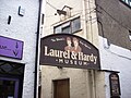
 Entrance to the Laurel ^ Hardy Museum - geograph.org.uk - 2191956.jpg 480 × 640; 228 KB
-

-
 Fell Barn, Swarthoor Hall - geograph.org.uk - 5770854.jpg 640 × 480; 272 KB
-
 Fell Street, Ulverston - geograph.org.uk - 6194347.jpg 2,592 × 1,944; 1.13 MB
-
 Footbridge at Canal Foot - geograph.org.uk - 5771095.jpg 640 × 480; 220 KB
-
 Footpath on Hoad Hill - geograph.org.uk - 3264381.jpg 1,024 × 768; 283 KB
-

-
 Former Hartleys Brewery - geograph.org.uk - 5265782.jpg 640 × 425; 153 KB
-
 Former Hartleys Brewery - geograph.org.uk - 5265783.jpg 512 × 640; 249 KB
-
 Fountain Street, Ulverston - geograph.org.uk - 1549966.jpg 640 × 480; 64 KB
-
 Free Grace Baptist Church - geograph.org.uk - 1731403.jpg 640 × 480; 117 KB
-
 Gateway to Hoad Hill - geograph.org.uk - 2066790.jpg 425 × 640; 421 KB
-
 Gill Cycles - panoramio.jpg 3,072 × 1,728; 756 KB
-
 Glaxo ulverston.JPG 2,848 × 921; 688 KB
-
 GlaxoSmithKline entrance Ulverston.JPG 2,848 × 2,134; 1.19 MB
-
 Grazing land near Ulverston - geograph.org.uk - 2913647.jpg 640 × 425; 177 KB
-
 Grazing near Next Ness - geograph.org.uk - 3827894.jpg 640 × 444; 50 KB
-
 Greatorex Shop, Ulverston - geograph.org.uk - 767197.jpg 457 × 640; 54 KB
-
 Habitat, Sculpture by Richard Caink - panoramio.jpg 1,172 × 840; 1.01 MB
-
 Happy graffitti.JPG 2,848 × 2,134; 1.14 MB
-
 Heading for Ulverston - geograph.org.uk - 5694643.jpg 640 × 433; 100 KB
-
 Heron Glass Factory Shop - geograph.org.uk - 1007191.jpg 640 × 480; 100 KB
-
 Heron, Dragley Beck, Ulverston - geograph.org.uk - 5570828.jpg 480 × 640; 117 KB
-
 Historical plaque in Church Walk - geograph.org.uk - 4460578.jpg 640 × 405; 44 KB
-
 Hoad Hill - geograph.org.uk - 2066798.jpg 425 × 640; 406 KB
-
 Hoad Hill - geograph.org.uk - 2066810.jpg 640 × 425; 289 KB
-
 Hoad Hill across the Leven estuary - geograph.org.uk - 3959549.jpg 800 × 600; 91 KB
-
 Hoad Monument - geograph.org.uk - 4518095.jpg 640 × 480; 44 KB
-
 Holy Trinity Church, Ulveston.jpg 1,944 × 2,592; 1.19 MB
-
 Holy Trinity Sunday School - panoramio.jpg 3,072 × 1,728; 712 KB
-
 Housing on Cross Lane - geograph.org.uk - 5694652.jpg 640 × 404; 78 KB
-
 Housing Ulverston.JPG 2,848 × 2,134; 1.32 MB
-
 Industry beside Ulverston Canal - geograph.org.uk - 5682099.jpg 1,600 × 1,297; 459 KB
-
 Industry by the Ulverston Canal - geograph.org.uk - 3321608.jpg 600 × 800; 146 KB
-

-
 Inside St Mary, Ulverston (i) - geograph.org.uk - 4463409.jpg 480 × 640; 47 KB
-
 Inside St Mary, Ulverston (ii) - geograph.org.uk - 4463499.jpg 640 × 480; 75 KB
-
 Inside St Mary, Ulverston (iii) - geograph.org.uk - 4463411.jpg 640 × 561; 79 KB
-
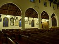 Inside St Mary, Ulverston (iv) - geograph.org.uk - 4463413.jpg 640 × 480; 65 KB
-
 Inside St Mary, Ulverston (iv) - geograph.org.uk - 4463444.jpg 640 × 480; 42 KB
-
 Inside St Mary, Ulverston (ix) - geograph.org.uk - 4463424.jpg 480 × 640; 43 KB
-
 Inside St Mary, Ulverston (v) - geograph.org.uk - 4463417.jpg 640 × 480; 63 KB
-
 Inside St Mary, Ulverston (vi) - geograph.org.uk - 4463419.jpg 640 × 480; 92 KB
-
 Inside St Mary, Ulverston (vii) - geograph.org.uk - 4463420.jpg 640 × 480; 64 KB
-
 Inside St Mary, Ulverston (viii) - geograph.org.uk - 4463423.jpg 640 × 474; 63 KB
-
 Inside St Mary, Ulverston (x) - geograph.org.uk - 4463426.jpg 640 × 465; 72 KB
-
 Inside St Mary, Ulverston (xi) - geograph.org.uk - 4463429.jpg 640 × 480; 77 KB
-
 Inside St Mary, Ulverston (xii) - geograph.org.uk - 4463431.jpg 640 × 480; 80 KB
-
 Inside St Mary, Ulverston (xiii) - geograph.org.uk - 4463441.jpg 459 × 640; 64 KB
-
 Inside St Mary, Ulverston (xix) - geograph.org.uk - 4463523.jpg 640 × 480; 59 KB
-
 Inside St Mary, Ulverston (xv) - geograph.org.uk - 4463459.jpg 640 × 480; 59 KB
-
 Inside St Mary, Ulverston (xvi) - geograph.org.uk - 4463511.jpg 480 × 640; 78 KB
-
 Inside St Mary, Ulverston (xvii) - geograph.org.uk - 4463516.jpg 480 × 640; 76 KB
-
 Inside St Mary, Ulverston (xviii) - geograph.org.uk - 4463517.jpg 480 × 640; 34 KB
-
 Inverness to Kyle Ulverston40XXX180778 (16927494962).jpg 2,344 × 2,560; 4.86 MB
-
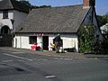 John Barrow Cottage.jpg 680 × 510; 85 KB
-
 John Morgan sign - panoramio.jpg 1,728 × 3,072; 1.73 MB
-
 Kadampa Buddhist Temple - geograph.org.uk - 5493976.jpg 640 × 480; 77 KB
-
 Kadampa Buddhist Temple - geograph.org.uk - 5775408.jpg 1,000 × 667; 145 KB
-
 King Street, Ulverston - geograph.org.uk - 5616692.jpg 4,794 × 3,111; 2.33 MB
-
 Kings Arms Inn, King Street - geograph.org.uk - 3368920.jpg 3,456 × 2,304; 1.74 MB
-
 Kings Arms Inn. Ulverston - geograph.org.uk - 5453000.jpg 2,282 × 1,698; 1.62 MB
-
 Kitchen garden at Swarthmoor Hall - geograph.org.uk - 5770846.jpg 640 × 480; 358 KB
-
 Lane and Pylons - geograph.org.uk - 189135.jpg 640 × 480; 88 KB
-
 Lantern House - panoramio.jpg 3,072 × 1,728; 820 KB
-
 Lanternhouse, Ulverston - geograph.org.uk - 5268777.jpg 640 × 512; 132 KB
-
 Lanternhouse, Ulverston - geograph.org.uk - 5268780.jpg 640 × 512; 110 KB
-
 Laurel and Hardy - geograph.org.uk - 2563723.jpg 4,029 × 3,240; 2.02 MB
-
 Laurel and hardy autocorrect.JPG 2,848 × 2,134; 1.1 MB
-
 Laurel and Hardy Museum - geograph.org.uk - 2563733.jpg 4,320 × 3,240; 2.92 MB
-

-
 Laurel and Hardy statues advertising a beer festival in Ulverston.jpg 3,024 × 4,032; 3.28 MB
-
 Laurel ^ Hardy Museum, Ulverston - geograph.org.uk - 4072610.jpg 4,000 × 2,666; 6.09 MB
-
 Laurel ^ Hardy, Ulverston - geograph.org.uk - 4062332.jpg 3,193 × 4,000; 6.19 MB
-
 Laurel ^ Hardy, Ulverston - geograph.org.uk - 4062347.jpg 2,666 × 4,000; 7.28 MB
-
 Laurel ^ Hardy, Ulverston - geograph.org.uk - 4062877.jpg 2,770 × 4,000; 7 MB
-
 Leven estuary from Canal Foot - geograph.org.uk - 2913640.jpg 640 × 425; 113 KB
-
 Leven Viaduct from Canal Foot - geograph.org.uk - 2191982.jpg 640 × 320; 33 KB
-
 Lightburn Road in May 2000 - geograph.org.uk - 3020039.jpg 1,024 × 684; 155 KB
-
 Lloyd TSB Bank, Ulverston - geograph.org.uk - 1731535.jpg 480 × 640; 65 KB
-
 Lloyd TSB Bank, Ulverston, Blue plaque - geograph.org.uk - 1731536.jpg 640 × 480; 172 KB
-
 Lock Gates - geograph.org.uk - 3515919.jpg 1,516 × 996; 1.29 MB
-
 Looking across Urswick Road, Ulverston (1) - geograph.org.uk - 5998712.jpg 1,024 × 576; 114 KB
-
 Looking across Urswick Road, Ulverston (2) - geograph.org.uk - 5998717.jpg 1,024 × 576; 103 KB
-
 Looking across Urswick Road, Ulverston (3) - geograph.org.uk - 5998726.jpg 1,024 × 576; 105 KB
-
 Looking down Market Street Ulverston - geograph.org.uk - 5452997.jpg 1,686 × 1,301; 918 KB
-
 Looking down The Weint, Ulverston - geograph.org.uk - 3264417.jpg 768 × 1,024; 240 KB
-
 Looking south from Hoad Hill - geograph.org.uk - 3264404.jpg 1,024 × 768; 200 KB
-

-
 Lyndhurst - panoramio.jpg 3,072 × 1,728; 789 KB
-
 Market day - Ulverston - geograph.org.uk - 218842.jpg 640 × 479; 136 KB
-
 Market Hall Entrance - panoramio.jpg 1,728 × 3,072; 984 KB
-
 Market in Ulverston town centre. - geograph.org.uk - 4708104.jpg 640 × 480; 61 KB
-
 Market Street at Ulverston - geograph.org.uk - 1513692.jpg 515 × 640; 131 KB
-
 Market Street at Ulverston - geograph.org.uk - 1513721.jpg 480 × 640; 138 KB
-
 Market Street at Ulverston - geograph.org.uk - 1513725.jpg 480 × 640; 110 KB
-
 Market Street at Ulverston - geograph.org.uk - 1513727.jpg 480 × 640; 112 KB
-
 Market Street in Ulverston - geograph.org.uk - 5961975.jpg 4,000 × 3,000; 2.81 MB
-
 Market Street top end - geograph.org.uk - 3368918.jpg 3,456 × 2,304; 2.01 MB
-
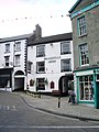
 Market Street, Ulverston - geograph.org.uk - 1731488.jpg 640 × 480; 123 KB
-
 Market Street, Ulverston - geograph.org.uk - 1983051.jpg 800 × 600; 154 KB
-
 Market Street, Ulverston - geograph.org.uk - 2191968.jpg 640 × 480; 188 KB
_-_panoramio.jpg)


_-_panoramio.jpg)


.jpg)


.jpg)


_-_geograph.org.uk_-_4463409.jpg)
_-_geograph.org.uk_-_4463499.jpg)
_-_geograph.org.uk_-_4463411.jpg)
_-_geograph.org.uk_-_4463413.jpg)
_-_geograph.org.uk_-_4463444.jpg)
_-_geograph.org.uk_-_4463424.jpg)
_-_geograph.org.uk_-_4463417.jpg)
_-_geograph.org.uk_-_4463419.jpg)
_-_geograph.org.uk_-_4463420.jpg)
_-_geograph.org.uk_-_4463423.jpg)
_-_geograph.org.uk_-_4463426.jpg)
_-_geograph.org.uk_-_4463429.jpg)
_-_geograph.org.uk_-_4463431.jpg)
_-_geograph.org.uk_-_4463441.jpg)
_-_geograph.org.uk_-_4463523.jpg)
_-_geograph.org.uk_-_4463459.jpg)
_-_geograph.org.uk_-_4463511.jpg)
_-_geograph.org.uk_-_4463516.jpg)
_-_geograph.org.uk_-_4463517.jpg)
.jpg)


_-_geograph.org.uk_-_5998712.jpg)
_-_geograph.org.uk_-_5998717.jpg)
_-_geograph.org.uk_-_5998726.jpg)


