Category:US National Archives series: Civil Works Map File, 1818 - 1947
Jump to navigation
Jump to search
Subcategories
This category has only the following subcategory.
Media in category "US National Archives series: Civil Works Map File, 1818 - 1947"
The following 114 files are in this category, out of 114 total.
-

-
 -Map of area in the vicinity of Berkeley Springs.- - NARA - 305611.jpg 1,200 × 734; 136 KB
-

-

-

-

-

-

-

-
-

-

-

-

-

-

-

-
 A Map of the State of New York - NARA - 102279782.jpg 8,674 × 7,171; 10.7 MB
-

-

-
 Bay of Presque Isle - NARA - 109186621.jpg 5,120 × 4,360; 1.6 MB
-
 Boundary Line Between the Counties of Nevada and Placer - NARA - 93193218.jpg 5,400 × 1,822; 474 KB
-
 Chart of San Francisco Bar Showing Location of the Steamer Escambia - NARA - 128215928.jpg 6,380 × 4,638; 1.33 MB
-
 Coast Survey Chart Trinidad Harbor California - NARA - 122206695.jpg 5,100 × 4,304; 1.09 MB
-

-

-
 Corrections from A.L. Bancroft's Map of California and Nevada - NARA - 122668483.jpg 6,336 × 5,086; 2.44 MB
-
 Corrections from Map of Sonoma and Chihuahua - NARA - 122668485.jpg 7,040 × 5,552; 3.51 MB
-

-

-

-

-
 Drawing of underwater boulder, Hell Gate, New York - NARA - 109186605.jpg 3,328 × 2,600; 596 KB
-
 Drawing showing dredging boat - NARA - 112061522.jpg 7,008 × 4,425; 1.79 MB
-
 Drawings of dredging mechanisms for removing snags - NARA - 112061524 (page 1).jpg 2,988 × 2,240; 751 KB
-
 Drawings of dredging mechanisms for removing snags - NARA - 112061524 (page 2).jpg 2,804 × 2,208; 214 KB
-
 Drawings of dredging mechanisms for removing snags - NARA - 112061524 (page 3).jpg 2,948 × 2,218; 296 KB
-
 Drawings of dredging mechanisms for removing snags - NARA - 112061524 (page 4).jpg 3,700 × 5,593; 718 KB
-
 Drawings of dredging mechanisms for removing snags - NARA - 112061524 (page 5).jpg 3,012 × 2,222; 224 KB
-
 Economic Features of Eastern California, Atlas Sheet 65(D) - NARA - 100306267.jpg 7,470 × 5,901; 7.33 MB
-
 Entrance to Humboldt Bay, Cal. - NARA - 100306357 (page 1).jpg 24,226 × 6,756; 32.23 MB
-
 Entrance to Humboldt Bay, Cal. - NARA - 100306357 (page 2).jpg 8,164 × 12,535; 4.92 MB
-
 From U.S. Coast Guard Chart No. 5 of the Gulf Coast - NARA - 122206743.jpg 6,972 × 3,503; 1.11 MB
-
 From U.S. Coast Guard Chart No. 601, San Francisco to San Diego - NARA - 122206747.jpg 6,184 × 6,123; 1.59 MB
-
 Jordan del Metro and Mimbres Range (Atlas 84) - DPLA - 45395717741c14d070d69ce0d42ccd05.jpg 9,448 × 7,960; 4.44 MB
-

-

-
 Kennebunk River. Maine. - DPLA - d3b1cc712f15455b8141e4684e6494be.jpg 12,207 × 8,232; 10.22 MB
-
 Land Classification Map of Part of North Central California - NARA - 135841466.jpg 7,468 × 5,966; 4.24 MB
-
 Land Classification Map of Part of Southern California - NARA - 135841472.jpg 7,492 × 5,949; 4.21 MB
-

-
-
 Map and Profile of the Tejon Pass - NARA - 100305651.jpg 11,678 × 7,916; 11.88 MB
-
 Map Comprising Parts of California, Oregon and Idaho - NARA - 93193179.jpg 10,800 × 10,451; 6.08 MB
-
 Map No. IV, West Half, Humboldt River - NARA - 93193121.jpg 7,040 × 9,618; 5.16 MB
-
 Map No. V, East Half, Humboldt River - NARA - 93193125.jpg 7,008 × 9,615; 5.57 MB
-

-
 Map of area near Los Angeles, California - NARA - 100305836.jpg 9,200 × 6,675; 3.18 MB
-
 Map of area of California - NARA - 100305838.jpg 9,216 × 6,105; 2.76 MB
-

-
 Map of California and Nevada - NARA - 93193070 (page 1).jpg 10,816 × 6,300; 8.05 MB
-
 Map of California and Nevada - NARA - 93193070 (page 2).jpg 10,816 × 6,584; 6.6 MB
-
 Map of Mendocino, California and Surrounding Area - NARA - 93193260.jpg 4,740 × 6,536; 1.23 MB
-
-
 Map of Nevada - NARA - 100305653.jpg 9,168 × 10,668; 5.59 MB
-
 Map of part of California, Nevada and Oregon - NARA - 93193280.jpg 10,380 × 10,381; 5.64 MB
-
 Map of Part of Fresno County, California - NARA - 100305689.jpg 9,232 × 12,289; 6.74 MB
-
 Map of Public Surveys in California - NARA - 139309196.jpg 9,964 × 11,858; 4.88 MB
-

-
 Map of San Francisco Bay and Country Adjacent East - NARA - 100305697 (page 1).jpg 8,136 × 14,228; 9.07 MB
-
 Map of San Francisco Bay and Country Adjacent East - NARA - 100305697 (page 2).jpg 8,240 × 13,484; 8.16 MB
-
 Map of San Francisco Bay and Country Adjacent East - NARA - 100305697 (page 3).jpg 8,372 × 14,142; 7.64 MB
-
 Map of San Francisco Bay and Country Adjacent East - NARA - 100305697 (page 4).jpg 8,228 × 14,220; 8.75 MB
-
 Map of Sierra Valley, California - NARA - 100305691.jpg 6,780 × 5,820; 1.92 MB
-
 Map of the Arcata Trail Between Redwood Creek and Camp Gaston - NARA - 109186405.jpg 5,504 × 7,115; 2.9 MB
-
 Map of the Battles of Bull Run Near Manassas (3678683445).jpg 3,150 × 2,334; 1.95 MB
-
-

-

-
-
 Map of the Military Department of California - NARA - 122206824.jpg 9,000 × 10,178; 7.1 MB
-
 Map of the Military Department of California - NARA - 23812143.jpg 9,024 × 10,222; 9.49 MB
-

-
-
 Map of the Road from Reno, Nevada to Camp Bidwell - NARA - 109186439.jpg 3,160 × 4,727; 1.07 MB
-
-
 Map of the Southern Part of California and adjoining country - NARA - 93193226.jpg 6,200 × 4,597; 1.98 MB
-
 Map of the State of California - NARA - 23812146.jpg 9,280 × 10,554; 7.86 MB
-
 Map of the Trail From Camp Gaston to Klamath Bluffs - NARA - 109186457.jpg 4,316 × 5,301; 917 KB
-

-
 Map of the United States (annotated) - NARA - 122668657 (page 1).jpg 8,812 × 6,279; 4.45 MB
-
 Map of the United States (annotated) - NARA - 122668657 (page 3).jpg 8,808 × 6,241; 3.93 MB
-
 Map of the United States - DPLA - 967ff34681448c6fc95a44bbcd79a7b9.jpg 16,896 × 11,894; 37.5 MB
-
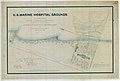 Map of United States Marine Hospital Grounds - NARA - 128215820.jpg 9,516 × 6,410; 3.02 MB
-
 Map showing area around Los Angeles, California - NARA - 100305840.jpg 7,928 × 10,372; 9.27 MB
-
 Map showing area between Honey Lake, California and Lake Tahoe - NARA - 100305718.jpg 3,944 × 6,166; 1.63 MB
-

-

-
 Mouth of Root River, Wisconsin - DPLA - 72e8574dadeb39c45da767efa0b33b24.jpg 7,108 × 5,656; 2.32 MB
-
 North America from Purchas 1692 - DPLA - 00aaa7f230918949d758b825c8e16f30.JPG 7,456 × 5,986; 2.02 MB
-

-
 Odometer Measurements - DPLA - fdfd84b17f6c7c7b7076f4040cfd06a1.jpg 3,600 × 4,682; 533 KB
-

-

-

-

-
 Picturesque View of the Building, and Grounds in front - NARA - 102279184.jpg 4,553 × 4,569; 1.56 MB
-
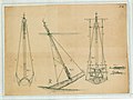
 Plan of One Tower for the East River Bridge - NARA - 594709.jpg 698 × 1,200; 90 KB
-
 Route from Great Salt Lake City to Cajon Pass - DPLA - a44a44fc37ada531e26b0b5a02312bbc.jpg 7,303 × 5,100; 4.53 MB
-

-

-

-

-

_Sketch_showing_New_Channel_Proposed_to_be_dredged_through_the_Bar_at_the_entrance_of_the_inner_harbor_of_Portland,_Maine_-_NARA_-_122668506.jpg)

.jpg)
.jpg)
_-_NARA_-_305574.jpg)

_-_NARA_-_305656.jpg)
_-_NARA_-_102279497_(page_10).jpg)
_-_NARA_-_102279497_(page_11).jpg)
_-_NARA_-_102279497_(page_12).jpg)
_-_NARA_-_102279497_(page_18).jpg)
_-_NARA_-_102279497_(page_19).jpg)
_-_NARA_-_102279497_(page_5).jpg)
_-_NARA_-_102279497_(page_6).jpg)
_-_NARA_-_102279497_(page_7).jpg)
_-_NARA_-_102279497_(page_8).jpg)
_-_NARA_-_102279497_(page_9).jpg)


.jpg)
.jpg)


.jpg)
.jpg)
.jpg)
.jpg)
.jpg)
_-_NARA_-_100306267.jpg)
.jpg)


_-_DPLA_-_45395717741c14d070d69ce0d42ccd05.jpg)


.jpg)


.jpg)
.jpg)


.jpg)
.jpg)
.jpg)
.jpg)


.jpg)


.jpg)


_-_NARA_-_122668657_(page_1).jpg)
_-_NARA_-_122668657_(page_3).jpg)


_-_DPLA_-_f69dc7c0317f3b8acd6a98d71d54815e.JPG)


_-_DPLA_-_65d8eeb7d8069a012be679aefa745ec4.jpg)

.jpg)
.jpg)


_-_NARA_-_102279776_(page_1).jpg)
_-_NARA_-_102279776_(page_2).jpg)

.jpg)