Category:USGS projections
Jump to navigation
Jump to search
English: Diagrams created by the United States Geological Survey (USGS) for illustration of various map projections.

|
All map images in this category could be re-created using vector graphics as SVG files. This has several advantages; see Commons:Media for cleanup for more information. If an SVG form of this image is available, please upload it and afterwards replace this template with
{{vector version available|new image name}}. |
Media in category "USGS projections"
The following 42 files are in this category, out of 42 total.
-
 Albers projection ar.png 1,288 × 749; 1.06 MB
-
 AnAlbumOfMapProjections.pdf 1,650 × 1,331, 260 pages; 7.53 MB
-
 Detail of geologic units on USGS Moon Geologic Map of the Maskelyne DA Region.jpg 6,016 × 4,016; 12.55 MB
-
 Detail of landing site on USGS Moon Geologic Map of the Maskelyne DA Region.jpg 6,016 × 4,016; 14.45 MB
-
 Detail of Maskelyne DA Crater on USGS Moon Geologic Map of the Maskelyne DA Region.jpg 6,016 × 4,016; 14.88 MB
-
 Detail of USGS Moon Geologic Map of the Maskelyne DA Region.jpg 6,016 × 4,016; 16.31 MB
-
 Flint River Elevation.png 800 × 450; 14 KB
-
 Lambert conformal conic.svg 1,008 × 429; 64 KB
-
 Map Depicting Susceptibility to Landslides Triggered by Intense Rainfall, Puerto Rico.jpg 11,051 × 7,585; 9.67 MB
-
 Mercator projection ar.png 1,500 × 656; 207 KB
-
 Mussel Rock landslide due to 1906 San Francisco Earthquake.jpg 4,408 × 2,462; 3.23 MB
-
 Photo of USGS Moon Geologic Map of the Maskelyne DA Region.jpg 6,010 × 4,012; 14.23 MB
-
 Projection UTM fr.svg 842 × 1,191; 828 KB
-
 Proyección robinson.PNG 484 × 179; 64 KB
-
 Space-oblique Mercator projection Ar.png 1,417 × 674; 784 KB
-
 Transverse Mercator projection AR.png 1,323 × 660; 248 KB
-
 USGS 1982-1983 El Nino San Mateo Coastal Reosion Diagram.jpg 721 × 961; 130 KB
-

-
 USGS map Albers conic tall.gif 335 × 195; 27 KB
-
 Usgs map albers equal area conic.PNG 402 × 170; 38 KB
-
 Usgs map azimuthal equidistant.PNG 487 × 162; 46 KB
-
 USGS map azimuthal tall.gif 290 × 335; 32 KB
-
 Usgs map bipolar oblique conic conformal.PNG 299 × 172; 30 KB
-
 Usgs map equidistant conic.PNG 412 × 185; 38 KB
-
 Usgs map gnomic.PNG 508 × 167; 41 KB
-
 Usgs map lambert azimuthal equal area.PNG 495 × 188; 46 KB
-
 Usgs map lambert conformal conic.PNG 424 × 183; 42 KB
-
 Usgs map mercator-ko.svg 413 × 181; 525 KB
-
 Usgs map mercator.svg 413 × 181; 525 KB
-
 USGS map Miller cylindrical tall.gif 325 × 180; 15 KB
-
 Usgs map miller cylindrical.PNG 395 × 168; 33 KB
-
 Usgs map oblique mercator.PNG 367 × 181; 32 KB
-
 Usgs map orthographic.PNG 501 × 183; 51 KB
-
 Usgs map polyconic.PNG 377 × 181; 31 KB
-
 Usgs map robinson.PNG 484 × 179; 41 KB
-
 Usgs map sinousidal equal area.PNG 570 × 213; 13 KB
-
 Usgs map space oblique mercator.PNG 368 × 175; 30 KB
-
 Usgs map stereographic.PNG 534 × 181; 49 KB
-
 Usgs map traverse mercator.PNG 479 × 239; 18 KB
-
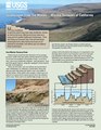 USGS Marine Terraces of California Fact Sheet.pdf 1,275 × 1,650, 4 pages; 4.05 MB
-
 USGSWaterWatch-01408500-Flow.png 700 × 500; 38 KB
-
 USGSWaterWatch-01408500-GageHeight.png 700 × 500; 34 KB


