Category:U.S. Route 66 in New Mexico
Jump to navigation
Jump to search
States of the United States: Arizona · California · Illinois · Kansas · Missouri · New Mexico · Oklahoma · Texas
section of historic former U.S. Numbered Highway in New Mexico, United States   | |||||
| Upload media | |||||
| Instance of | |||||
|---|---|---|---|---|---|
| Location | |||||
| Transport network | |||||
| Length |
| ||||
| Terminus | |||||
| |||||
English: Media related to U.S. Route 66 in New Mexico (US 66}, a 374-mile (602 km) section of a historic former U.S. Numbered Highway in New Mexico, United States, that connected US 66/U.S. Route 666 in Arizona with US 66 in Texas.
Subcategories
This category has the following 10 subcategories, out of 10 total.
Media in category "U.S. Route 66 in New Mexico"
The following 49 files are in this category, out of 49 total.
-
 US 66 (NM historic).svg 576 × 768; 19 KB
-
 2013, Route 66 - View E, San Fidel, NM - panoramio.jpg 6,000 × 4,000; 8.53 MB
-
 2013, Route 66, View W from San Fidel, NM - panoramio.jpg 6,000 × 4,000; 10.41 MB
-
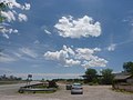
 2013, View E, Junction I-40 and Route 66 - panoramio.jpg 6,000 × 4,000; 7.19 MB
-
 2013, View NW, Old Route 66 - panoramio.jpg 6,000 × 4,000; 6.41 MB
-
 2013, View W to I-40 From Old Route 66, Owl (^) Rock - panoramio.jpg 6,000 × 4,000; 8.72 MB
-
 2013, West End, Central Avenue, Albuquerque, Route 66 - panoramio.jpg 6,000 × 4,000; 4.25 MB
-
 ABQ downtown skyline.JPG 3,456 × 2,304; 2.47 MB
-
 Charlie's Radiator Service, Grants, NM.jpg 3,648 × 2,736; 3.62 MB
-
 Clines Corners (4585423621).jpg 1,024 × 768; 402 KB
-
 Continental Divide, NM, View E on Old Route 66, 2010 - panoramio.jpg 3,648 × 2,736; 4.21 MB
-
 Continental Divide, NM, View N from Marker on Old Route 66, 2010 - panoramio.jpg 3,648 × 2,736; 4.99 MB
-
 Continental Divide, NM, View W from Marker on Old Route 66, 2010 - panoramio.jpg 3,648 × 2,736; 4.98 MB
-
 Deadman's Curve on Old Route 66, Tijeras Canyon NM.jpg 2,272 × 1,704; 1.26 MB
-
 Firestone Complete Auto Care, 701 Central Avenue NW, Albuquerque NM.jpg 3,264 × 2,448; 1.91 MB
-

-
 Genuine US66 Sign (33680936645).jpg 1,600 × 2,400; 1,003 KB
-
 Historic Route 66 - 2nd Street in Albuquerque - NARA - 7719409.jpg 729 × 482; 316 KB
-

-
 Historic Route 66 - An Abandoned Motel on Route 66 - NARA - 7719405.jpg 3,334 × 2,278; 453 KB
-
 Historic Route 66 - Aztec Motel - NARA - 7719423.jpg 750 × 502; 291 KB
-
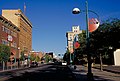 Historic Route 66 - Downtown Albuquerque - NARA - 7719406.jpg 723 × 488; 362 KB
-
 Historic Route 66 - Festival in Santa Fe Plaza - NARA - 7719474.jpg 490 × 723; 424 KB
-
-

-
 Historic Route 66 - Whiting Brothers Motel and Grocery Sign - NARA - 7719489.jpg 3,322 × 2,256; 308 KB
-
 HistoricRoute66Motel, TucumcariNM.jpg 2,304 × 1,728; 596 KB
-
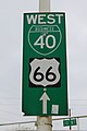
 Int25nRoadNM-Exit284-HistoricUS66sign (35942060964).jpg 2,400 × 1,600; 1.99 MB
-
 Macintosh FP-Desktop Folder-Writing desk-Pics USA-Reise-7-IMM027.JPG 693 × 462; 51 KB
-

-

-
-
-
 New Mexico State Road 124 approaching Budville.jpg 2,576 × 1,920; 691 KB
-
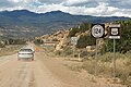 NM 124 and US 66 WB near Budville NM.jpg 2,511 × 1,668; 1.42 MB
-
 NM14nRoad-HistoricUS66signPre1937 (35942057854).jpg 2,400 × 1,600; 1.52 MB
-
 NM313sRoad-HistoricRouteUS66-Pre1937 (36379763360).jpg 2,400 × 1,600; 1.95 MB
-
 Old Mountain Lodge on Old Route 66, Carnuel NM.jpg 2,272 × 1,704; 1.38 MB
-
 Old US66 approaching New Mexico State Road 333.jpg 3,264 × 2,448; 2.03 MB
-
 Rio Grande Bridge Crossing.JPG 3,456 × 2,304; 2.19 MB
-
 Rock formations along Route 66.jpg 2,851 × 3,280; 1.5 MB
-
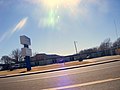
 Route 66 east of Albuquerque.JPG 3,456 × 2,304; 1.26 MB
-
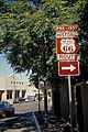
 Route66 sign.jpg 1,108 × 764; 44 KB
-
 Rt66newkirk.jpg 800 × 600; 173 KB
-
 Santa Ana Pueblo, NM, old Route 66, 2010 - panoramio.jpg 3,648 × 2,736; 5.83 MB
-
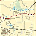
 US 66 New Mexico 1926.svg 1,485 × 1,440; 33 KB
-
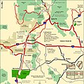
 US 66 New Mexico 1948.svg 1,485 × 1,440; 45 KB
-
 US 66 NM 122.jpg 3,072 × 2,304; 2.03 MB
-
 USA082.JPG 2,592 × 1,944; 1.1 MB
.svg)


_Rock_-_panoramio.jpg)


.jpg)


.jpg)


.jpg)

_-_NARA_-_68886928_(page_10).jpg)
_-_NARA_-_68886928_(page_8).jpg)
_-_NARA_-_68886928_(page_9).jpg)


.jpg)
.jpg)


_-_NARA_-_68886928_(page_15).gif)