Category:U.S. Route 17 in Georgia (U.S. state)
Jump to navigation
Jump to search
highway in Georgia | |||||
| Upload media | |||||
| Instance of | |||||
|---|---|---|---|---|---|
| Part of | |||||
| Location | Georgia | ||||
| Transport network | |||||
| Owned by | |||||
| Maintained by | |||||
| Inception |
| ||||
| Length |
| ||||
| |||||
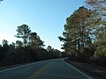
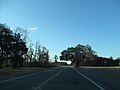
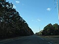
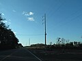
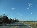
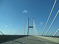
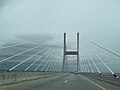
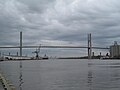
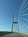
English: U.S. Route 17 in Georgia runs north–south near the Atlantic Ocean, serving Brunswick and Savannah on its path from Florida at the St. Marys River to South Carolina at the Savannah River. Except for part of the route in Savannah, which runs along State Route 404 (Interstate 16) and State Route 404 Spur to the Talmadge Memorial Bridge to Hutchinson Island, US 17 is also State Route 25. SR 25 uses an older western alignment of US 17 into South Carolina.
Subcategories
This category has the following 7 subcategories, out of 7 total.
*
Media in category "U.S. Route 17 in Georgia (U.S. state)"
The following 63 files are in this category, out of 63 total.
-
 Georgia state route 25 map.png 951 × 777; 129 KB
-
 US 17 Georgia 1926.svg 1,485 × 1,440; 30 KB
-
 US Highway 17 - Georgia - 8573590627.jpg 3,072 × 2,304; 366 KB
-
 US Highway 17 - Georgia - 8573592519.jpg 3,072 × 2,304; 846 KB
-
 US Highway 17 - Georgia - 8573593125.jpg 3,072 × 2,304; 730 KB
-
 US Highway 17 - Georgia - 8573593577.jpg 3,072 × 2,304; 831 KB
-
 US Highway 17 - Georgia - 8573594013.jpg 3,072 × 2,304; 957 KB
-
 US Highway 17 - Georgia - 8573594649.jpg 3,072 × 2,304; 580 KB
-
 US Highway 17 - Georgia - 8573595113.jpg 3,072 × 2,304; 810 KB
-
 US Highway 17 - Georgia - 8573595829.jpg 3,072 × 2,304; 1,015 KB
-
 US Highway 17 - Georgia - 8573596331.jpg 3,072 × 2,304; 998 KB
-
 US Highway 17 - Georgia - 8573596511.jpg 3,072 × 2,304; 643 KB
-
 US Highway 17 - Georgia - 8573597729.jpg 3,072 × 2,304; 724 KB
-
 US Highway 17 - Georgia - 8573597879.jpg 3,072 × 2,304; 572 KB
-
 US Highway 17 - Georgia - 8573598337.jpg 3,072 × 2,304; 431 KB
-
 US Highway 17 - Georgia - 8573598451.jpg 3,072 × 2,304; 523 KB
-
 US Highway 17 - Georgia - 8573599041.jpg 3,072 × 2,304; 889 KB
-
 US Highway 17 - Georgia - 8573601837.jpg 3,072 × 2,304; 938 KB
-
 US Highway 17 - Georgia - 8573602357.jpg 3,072 × 2,304; 373 KB
-
 US Highway 17 - Georgia - 8573603099.jpg 3,072 × 2,304; 497 KB
-
 US Highway 17 - Georgia - 8573603399.jpg 3,072 × 2,304; 549 KB
-
 US Highway 17 - Georgia - 8573603677.jpg 3,072 × 2,304; 832 KB
-
 US Highway 17 - Georgia - 8573604107.jpg 3,072 × 2,304; 577 KB
-
 US Highway 17 - Georgia - 8573604503.jpg 3,072 × 2,304; 518 KB
-
 US Highway 17 - Georgia - 8573604953.jpg 3,072 × 2,304; 381 KB
-
 US Highway 17 - Georgia - 8573605235.jpg 3,072 × 2,304; 502 KB
-
 US Highway 17 - Georgia - 8573605787.jpg 3,072 × 2,304; 466 KB
-
 US Highway 17 - Georgia - 8574682628.jpg 3,072 × 2,304; 362 KB
-
 US Highway 17 - Georgia - 8574682802.jpg 3,072 × 2,304; 493 KB
-
 US Highway 17 - Georgia - 8574682914.jpg 3,072 × 2,304; 421 KB
-
 US Highway 17 - Georgia - 8574684206.jpg 3,072 × 2,304; 381 KB
-
 US Highway 17 - Georgia - 8574684882.jpg 3,072 × 2,304; 401 KB
-
 US Highway 17 - Georgia - 8574685012.jpg 3,072 × 2,304; 395 KB
-
 US Highway 17 - Georgia - 8574685156.jpg 2,304 × 3,072; 491 KB
-
 US Highway 17 - Georgia - 8574685680.jpg 3,072 × 2,304; 1.19 MB
-
 US Highway 17 - Georgia - 8574686174.jpg 3,072 × 2,304; 445 KB
-
 US Highway 17 - Georgia - 8574686310.jpg 3,072 × 2,304; 530 KB
-
 US Highway 17 - Georgia - 8574686748.jpg 3,072 × 2,304; 1,001 KB
-
 US Highway 17 - Georgia - 8574687114.jpg 3,072 × 2,304; 409 KB
-
 US Highway 17 - Georgia - 8574687276.jpg 3,072 × 2,304; 549 KB
-
 US Highway 17 - Georgia - 8574687402.jpg 3,072 × 2,304; 567 KB
-
 US Highway 17 - Georgia - 8574687668.jpg 3,072 × 2,304; 342 KB
-
 US Highway 17 - Georgia - 8574687794.jpg 3,072 × 2,304; 404 KB
-
 US Highway 17 - Georgia - 8574688260.jpg 3,072 × 2,304; 681 KB
-
 US Highway 17 - Georgia - 8574688434.jpg 3,072 × 2,304; 593 KB
-
 US Highway 17 - Georgia - 8574688968.jpg 3,072 × 2,304; 1.14 MB
-
 US Highway 17 - Georgia - 8574690468.jpg 3,072 × 2,304; 1.09 MB
-
 US Highway 17 - Georgia - 8574690936.jpg 3,072 × 2,304; 702 KB
-
 US Highway 17 - Georgia - 8574691076.jpg 3,072 × 2,304; 562 KB
-
 US Highway 17 - Georgia - 8574691450.jpg 3,072 × 2,304; 614 KB
-
 US Highway 17 - Georgia - 8574692260.jpg 3,072 × 2,304; 1.11 MB
-
 US Highway 17 - Georgia - 8574692466.jpg 3,072 × 2,304; 642 KB
-
 US Highway 17 - Georgia - 8574692694.jpg 3,072 × 2,304; 750 KB
-
 US Highway 17 - Georgia - 8574694314.jpg 3,072 × 2,304; 850 KB
-
 US Highway 17 - Georgia - 8574695154.jpg 3,072 × 2,304; 424 KB
-
 US Highway 17 - Georgia - 8574695780.jpg 3,072 × 2,304; 563 KB
-
 US Highway 17 - Georgia - 8574695922.jpg 3,072 × 2,304; 594 KB
-
 US Highway 17 - Georgia - 8574697252.jpg 3,072 × 2,304; 504 KB
-
 US Highway 17 - Georgia - 8574697828.jpg 3,072 × 2,304; 331 KB
-
 US Highway 17 - Georgia - 8574698092.jpg 2,304 × 3,072; 501 KB
-
 US Highway 17 - Georgia - 8574698434.jpg 2,304 × 3,072; 571 KB
-
 US Highway 17 - Georgia - 8574698604.jpg 3,072 × 2,304; 596 KB
-
 US Highway 17 - Georgia - 8574698884.jpg 3,072 × 2,304; 393 KB


