Category:U-Bahnhof Rudolf-Oetker-Halle (Bielefeld)
Jump to navigation
Jump to search
| Object location | | View all coordinates using: OpenStreetMap |
|---|
| Upload media | |||||
| Instance of | |||||
|---|---|---|---|---|---|
| Location |
| ||||
| Transport network | |||||
| Connecting line |
| ||||
| Adjacent station |
| ||||
 | |||||
Media in category "U-Bahnhof Rudolf-Oetker-Halle (Bielefeld)"
The following 5 files are in this category, out of 5 total.
-
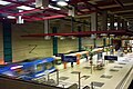 Bielefeld Stb-Oetkerhalle 2011.jpg 3,648 × 2,432; 3.65 MB
-
 Stadtbahn Bielefeld Graffiti-Kunst.jpg 3,648 × 2,432; 3.3 MB
-
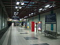 Stadtbahn-BI-oetkerhalle.jpg 2,592 × 1,944; 1.88 MB
-
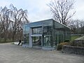 U-Bahnhof Rudolf-Oetker-Halle Bielefeld aussen.JPG 1,808 × 1,356; 353 KB
-
 Unterführung mit Airbrush-Grafittikunst - panoramio.jpg 3,648 × 2,736; 473 KB


