Category:Turnbull Building, Newcastle upon Tyne
Jump to navigation
Jump to search
This is a category about listed building number 1116103. |
This is a category about listed building number 1325543. |
warehouse in Newcastle upon Tyne, Tyne and Wear, UK .jpg) | |||||
| Upload media | |||||
| Instance of | |||||
|---|---|---|---|---|---|
| Location | Newcastle upon Tyne, Tyne and Wear, North East England, England | ||||
| Heritage designation |
| ||||
 | |||||
Media in category "Turnbull Building, Newcastle upon Tyne"
The following 14 files are in this category, out of 14 total.
-

-
 Clavering House by the East Coast Main Line (geograph 2426798).jpg 640 × 430; 57 KB
-
 Federation Brewery - geograph.org.uk - 309510.jpg 599 × 587; 180 KB
-
 Friar House, Clavering Place - geograph.org.uk - 1652809.jpg 640 × 480; 69 KB
-
 Javel Groupe, Newcastle Quayside (geograph 3397119).jpg 1,024 × 644; 205 KB
-
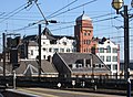 Newcastle - Turnbulls Warehouse from station (geograph 2653554).jpg 1,600 × 1,179; 592 KB
-
 Newcastle - View from the Quayside - geograph.org.uk - 771773.jpg 640 × 480; 88 KB
-
-
 Stella power station coal Newcastle.jpeg 640 × 430; 38 KB
-
 Stella power station coal newcastle.jpg 640 × 430; 37 KB
-
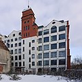
 Turnbull Building above new apartment block on Close (geograph 1828220).jpg 767 × 1,024; 237 KB
-

-
 Turnbulls Warehouse (geograph 2847823).jpg 995 × 746; 155 KB
-

_Turnbull%27s_Warehouse,_Queen%27s_Lane,_NE1_(geograph_5061442).jpg)
.jpg)


.jpg)
.jpg)


.jpg)

.jpg)