Category:Tuma Lunga
Jump to navigation
Jump to search
| Object location | | View all coordinates using: OpenStreetMap |
|---|
tuma at Domat/Ems, Graubünden, Switzerland | |||||
| Upload media | |||||
| Instance of | |||||
|---|---|---|---|---|---|
| Located in protected area |
| ||||
| Location | Domat/Ems, Grisons, Switzerland | ||||
| Area |
| ||||
| Elevation above sea level |
| ||||
 | |||||
Media in category "Tuma Lunga"
The following 7 files are in this category, out of 7 total.
-
 Domat-Ems Com FC09-7013-019.jpg 3,431 × 2,400; 7.55 MB
-
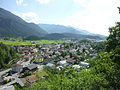 Domat-Ems Dorf West.jpg 4,000 × 3,000; 6.7 MB
-
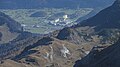 Ems-Chemie vom Ringelspitz.jpg 4,608 × 2,592; 2.02 MB
-
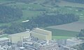
 Stallinger, Axpo, Emser Werke, Golfplatz.jpg 1,600 × 1,200; 953 KB
-
 Tuma Landschaft.jpg 4,608 × 3,456; 4.9 MB
-
 Tuma Lunga, Domat-Ems, 2013.jpg 483 × 291; 117 KB
-
 Tumalandschaft Domat-Ems, Tuma Tschelli im Zentrum, 1991 (Com FC09-7013-019).jpg 2,456 × 1,082; 2.58 MB


.jpg)