Category:Trinity Site Obelisk
Jump to navigation
Jump to search
| Object location | | View all coordinates using: OpenStreetMap |
|---|
site of the first detonation of a nuclear weapon  | |||||
| Upload media | |||||
| Instance of | |||||
|---|---|---|---|---|---|
| Location | Socorro County, New Mexico | ||||
| Heritage designation |
| ||||
 | |||||
Media in category "Trinity Site Obelisk"
The following 17 files are in this category, out of 17 total.
-
 1995 Trinity Site.jpg 1,190 × 789; 231 KB
-
 Closeup of Plaque on Monument at Trinity Site.jpg 1,500 × 2,030; 1.81 MB
-
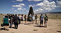 Crowds gathering around the Ground Zero Obelisk at Trinity Site.jpg 5,164 × 2,823; 8.63 MB
-
 LA-Trinity Marker (35463910982).jpg 2,232 × 2,822; 532 KB
-
 The Monument of the Trinity Site.jpg 2,448 × 3,264; 2.95 MB
-
 The remains of the race.jpg 2,448 × 3,264; 2.14 MB
-
 Tourist Standing Next to Trinity Site Monument or Obelisk.jpg 2,892 × 4,321; 8.59 MB
-
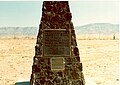
 Trinity Monument 2012.jpg 1,024 × 683; 327 KB
-
 Trinity monument.jpg 200 × 253; 18 KB
-
 Trinity Site cairn (1) (8060946495) (2).jpg 2,625 × 3,938; 3.3 MB
-
 Trinity Site cairn (8060945657).jpg 2,832 × 4,256; 2.88 MB
-
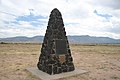
 Trinity Site Obelisk National Historic Landmark.jpg 2,300 × 2,300; 3.49 MB
-
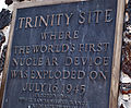 Trinity site plaque.jpg 2,379 × 1,960; 1.77 MB
-
 Trinity Site Plaque.jpg 2,340 × 4,160; 2.77 MB
-
 Trinity Site Up Close.jpg 2,448 × 3,264; 2.09 MB
-
 Trinity Site.jpg 1,964 × 2,988; 758 KB
-
 TRINITY.jpg 732 × 519; 84 KB


.jpg)


_(8060946495)_(2).jpg)
.jpg)


