Category:Tregony with Cuby
Jump to navigation
Jump to search
English: Tregony with Cuby is a civil parish in the Cornwall district, in the ceremonial county of Cornwall, England.
civil parish in Cornwall, England, UK | |||||
| Upload media | |||||
| Instance of | |||||
|---|---|---|---|---|---|
| Location | Cornwall, South West England, England | ||||
 | |||||
Subcategories
This category has the following 2 subcategories, out of 2 total.
Media in category "Tregony with Cuby"
The following 41 files are in this category, out of 41 total.
-
 A house, Tregoney - geograph.org.uk - 6133595.jpg 1,024 × 768; 241 KB
-
 A muddy National Cycle Route 3 - geograph.org.uk - 4241124.jpg 640 × 480; 122 KB
-
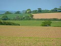 Farmland, Cuby - geograph.org.uk - 6133570.jpg 1,024 × 768; 199 KB
-
 Farmland, Cuby - geograph.org.uk - 6151165.jpg 1,024 × 768; 271 KB
-
 Farmland, Cuby - geograph.org.uk - 6151170.jpg 1,024 × 768; 245 KB
-
 Farmland, Cuby - geograph.org.uk - 6151177.jpg 1,024 × 768; 247 KB
-
 Farmland, Cuby - geograph.org.uk - 6151199.jpg 1,024 × 768; 211 KB
-
 Farmland, Cuby - geograph.org.uk - 6324803.jpg 1,024 × 683; 301 KB
-
 Farmland, Cuby - geograph.org.uk - 6324806.jpg 1,024 × 683; 256 KB
-
 Farmland, Cuby - geograph.org.uk - 6324809.jpg 1,024 × 683; 267 KB
-
 Farmland, Tregoney - geograph.org.uk - 6133598.jpg 1,024 × 768; 206 KB
-
 Farmland, Tregoney - geograph.org.uk - 6133599.jpg 1,024 × 768; 230 KB
-
 Farmland, Tregoney - geograph.org.uk - 6151242.jpg 1,024 × 768; 242 KB
-
-
 Fore Street and Clock Tower in Tregony - geograph.org.uk - 5392091.jpg 3,909 × 2,933; 2.04 MB
-
 Former Tollhouse by the B3287, Fair Cross, Creed - geograph.org.uk - 6095712.jpg 1,024 × 718; 313 KB
-
 Hilly grazing off National Cycle Route 3 - geograph.org.uk - 4241125.jpg 640 × 480; 125 KB
-
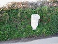
 Milestone - geograph.org.uk - 4308558.jpg 640 × 480; 56 KB
-
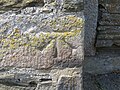
 Milestone with benchmark - geograph.org.uk - 4308555.jpg 640 × 480; 134 KB
-
-
-

-
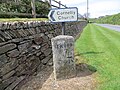
 Old milestone and modern sign, near Pittsdown - geograph.org.uk - 6003483.jpg 1,600 × 962; 762 KB
-
 Ordnance Survey Cut Mark - geograph.org.uk - 5439054.jpg 4,000 × 3,000; 5.01 MB
-
 Ordnance Survey Cut Mark - geograph.org.uk - 5439060.jpg 4,000 × 3,000; 4.17 MB
-
 Ordnance Survey Cut Mark - geograph.org.uk - 5439066.jpg 4,000 × 3,000; 4.53 MB
-
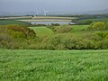
 Pasture, Cuby - geograph.org.uk - 6133573.jpg 1,024 × 768; 218 KB
-
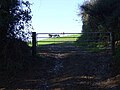
 Pasture, Tregoney - geograph.org.uk - 6133597.jpg 1,024 × 768; 218 KB
-
 Pasture, Tregoney - geograph.org.uk - 6324752.jpg 1,024 × 683; 278 KB
-
 Pasture, Tregoney - geograph.org.uk - 6324765.jpg 1,024 × 683; 182 KB
-
 Pasture, Tregoney - geograph.org.uk - 6324767.jpg 1,024 × 683; 170 KB
-
 Pasture, Tregoney - geograph.org.uk - 6324796.jpg 1,024 × 683; 270 KB
-
 Pasture, Tregoney - geograph.org.uk - 6324800.jpg 1,024 × 683; 298 KB
-
 The B3287 - geograph.org.uk - 4180287.jpg 4,000 × 2,664; 4.9 MB
-
 The B3287 - geograph.org.uk - 4180291.jpg 4,000 × 2,664; 4.69 MB
-
 The B3287 - geograph.org.uk - 4180293.jpg 4,000 × 2,664; 4.59 MB
-
 The B3287 - geograph.org.uk - 4180303.jpg 3,750 × 2,328; 3.87 MB
-
 The B3287 - geograph.org.uk - 4180310.jpg 4,000 × 2,664; 4.72 MB
-
 The Church of Cornelius at Cornelly - geograph.org.uk - 5392081.jpg 4,000 × 3,000; 4.11 MB
-
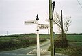
 Tregony - guide post at grid SW911456.jpg 1,496 × 2,500; 783 KB
-
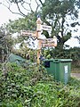
 Tregony - road signs at grid SW911456.jpg 1,316 × 1,343; 643 KB


