Category:Trees in Horkstow
Jump to navigation
Jump to search
Media in category "Trees in Horkstow"
The following 33 files are in this category, out of 33 total.
-
 Ash Tree near Turton's Covert - geograph.org.uk - 599563.jpg 640 × 463; 84 KB
-
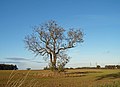
 Blasted Oak in Barley Field - geograph.org.uk - 1308582.jpg 640 × 480; 86 KB
-
 Bridge Lane, Horkstow - geograph.org.uk - 795041.jpg 456 × 640; 137 KB
-
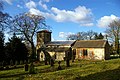
 Church of St. Maurice, Horkstow - geograph.org.uk - 1141446.jpg 640 × 427; 139 KB
-
 Church of St. Maurice, Horkstow - geograph.org.uk - 1266279.jpg 640 × 480; 111 KB
-
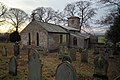
 Churchyard, St. Maurice, Horkstow - geograph.org.uk - 1141472.jpg 428 × 640; 137 KB
-
 East Drain - Summer - geograph.org.uk - 468775.jpg 425 × 640; 111 KB
-

-
 Field Gate on Bridge Lane - geograph.org.uk - 1137467.jpg 640 × 480; 126 KB
-
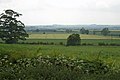
 Field near Hall Farm - geograph.org.uk - 282417.jpg 480 × 640; 160 KB
-
 Field with Blasted Oak - geograph.org.uk - 1441143.jpg 623 × 640; 157 KB
-
 Horkstow Carrs - geograph.org.uk - 823299.jpg 640 × 425; 68 KB
-
 Horkstow Church - geograph.org.uk - 10856.jpg 640 × 480; 121 KB
-
 Horkstow Church - geograph.org.uk - 125418.jpg 640 × 426; 149 KB
-
 Horkstow Church - geograph.org.uk - 43901.jpg 480 × 640; 162 KB
-
 Horkstow Church in December - geograph.org.uk - 640816.jpg 640 × 426; 93 KB
-
 Horkstow Church in December - geograph.org.uk - 640836.jpg 640 × 426; 99 KB
-
 Horkstow Hall seen from Middlegate - geograph.org.uk - 1321811.jpg 640 × 444; 151 KB
-
 Junction near Spot Height 98m - geograph.org.uk - 599578.jpg 640 × 433; 88 KB
-
 Junction on Middlegate - geograph.org.uk - 494334.jpg 640 × 551; 140 KB
-
 Lane down to Horkstow - geograph.org.uk - 1526212.jpg 640 × 480; 88 KB
-
 Middlegate near Saxby All Saints - geograph.org.uk - 1308630.jpg 640 × 606; 551 KB
-
 Middlegate near Saxby All Saints - geograph.org.uk - 1320251.jpg 500 × 565; 383 KB
-
 Near Horkstow - geograph.org.uk - 2082685.jpg 1,280 × 863; 1.09 MB
-
 Near Horkstow Hall - geograph.org.uk - 303248.jpg 640 × 398; 139 KB
-
 North Wold Farm - geograph.org.uk - 537722.jpg 640 × 480; 84 KB
-
 On the Viking Way - geograph.org.uk - 166793.jpg 640 × 426; 151 KB
-
 St.Maurice's church, Horkstow - geograph.org.uk - 67707.jpg 640 × 427; 110 KB
-
 The Road to Horkstow - geograph.org.uk - 668408.jpg 640 × 480; 94 KB
-
 The Road to Saxby All Saints - geograph.org.uk - 172147.jpg 640 × 480; 117 KB
-
 Tree on Saxby Hill - geograph.org.uk - 1526192.jpg 640 × 480; 115 KB
-
 The Road towards Barton Upon Humber - geograph.org.uk - 1557916.jpg 640 × 481; 319 KB
-
 Wold with Blasted Oak - geograph.org.uk - 1516170.jpg 640 × 475; 409 KB


