Category:Trawsgoed
Jump to navigation
Jump to search
hamlet and community in Ceredigion, Wales  | |||||
| Upload media | |||||
| Instance of | |||||
|---|---|---|---|---|---|
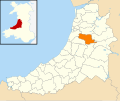
| Location | Ceredigion, Wales | ||||
| Population |
| ||||
| Area |
| ||||
 | |||||
Subcategories
This category has the following 7 subcategories, out of 7 total.
Media in category "Trawsgoed"
The following 180 files are in this category, out of 180 total.
-

-
 A view across Cwm Ystwyth - geograph.org.uk - 6242968.jpg 1,024 × 576; 442 KB
-
 A view over Cwm Ystwyth from Nant-y-Berws - geograph.org.uk - 6264119.jpg 1,024 × 576; 370 KB
-
 Afon Ystwyth - geograph.org.uk - 6242727.jpg 1,024 × 576; 553 KB
-
 Afon Ystwyth - geograph.org.uk - 6244384.jpg 1,024 × 768; 677 KB
-
 Afon Ystwyth - geograph.org.uk - 6244387.jpg 1,024 × 768; 822 KB
-
 Afon Ystwyth, Gelli Ddu - geograph.org.uk - 5765196.jpg 1,280 × 960; 682 KB
-
 Afon Ystwyth.jpg 5,456 × 3,632; 7.14 MB
-

-
 Beech grove in Coed Tynybedw - geograph.org.uk - 6252533.jpg 1,024 × 768; 624 KB
-
 Black Covert parking area - geograph.org.uk - 4516776.jpg 640 × 480; 133 KB
-
 Blaen y Waen - geograph.org.uk - 1224842.jpg 640 × 428; 107 KB
-
 Boggy patch, Gelli Ddu - geograph.org.uk - 5765342.jpg 1,280 × 960; 674 KB
-

-
 Bridle way near Disgwylfa - geograph.org.uk - 508817.jpg 480 × 640; 105 KB
-
 Brynafan - geograph.org.uk - 2469159.jpg 2,592 × 1,944; 1.11 MB
-
 Cattle-grid - geograph.org.uk - 3088331.jpg 4,320 × 3,240; 2.98 MB
-
 Close up of wheel - geograph.org.uk - 1447944.jpg 640 × 480; 99 KB
-
 Coed Maenarthur - geograph.org.uk - 5456028.jpg 640 × 467; 127 KB
-
 Coed Tynybedw - geograph.org.uk - 4517363.jpg 640 × 480; 129 KB
-

-
 Country road junction near New Cross - geograph.org.uk - 6242643.jpg 1,024 × 768; 580 KB
-
 Country road to Trawscoed - geograph.org.uk - 1588877.jpg 426 × 640; 69 KB
-
 Craig Goch - geograph.org.uk - 6252983.jpg 1,024 × 768; 416 KB
-
 Craig Goch mine building - geograph.org.uk - 6250567.jpg 768 × 1,024; 685 KB
-
 Craterium muscorum, Trawscoed, North Wales, Sept 2016 2 - Flickr - janetgraham84.jpg 3,000 × 2,229; 744 KB
-
 Crossing Pont-y-mwynwyr - geograph.org.uk - 6244392.jpg 1,024 × 768; 736 KB
-
 Crossroads by the bridge - geograph.org.uk - 972032.jpg 640 × 480; 148 KB
-
 Cwm Llechwedd - geograph.org.uk - 549371.jpg 640 × 480; 132 KB
-
 Cwm Newydion - geograph.org.uk - 1224728.jpg 640 × 442; 95 KB
-
 Cwmystwyth-by-Nigel-Brown.jpg 1,024 × 685; 928 KB
-
 Dead-end road past Gors-isaf - geograph.org.uk - 2538680.jpg 1,000 × 669; 454 KB
-
 Disused mine near Blaen-y-ddol - geograph.org.uk - 887877.jpg 640 × 480; 104 KB
-
 Diverging forestry roads - geograph.org.uk - 6242700.jpg 1,024 × 576; 245 KB
-
 Dyffryn Ystwyth - The Ystwyth Valley - geograph.org.uk - 5456033.jpg 640 × 484; 137 KB
-
 Eastern approach to Llanafan - geograph.org.uk - 1224833.jpg 640 × 428; 120 KB
-

-
 Fallen tree, Gelli Ddu-Black Covert - geograph.org.uk - 5765179.jpg 960 × 960; 628 KB
-
 Farm Lane at Penrallt Trawscoed - geograph.org.uk - 1313881.jpg 631 × 640; 202 KB
-
 Farmland at Eithyn Llwydion - geograph.org.uk - 2469153.jpg 2,592 × 1,944; 1.22 MB
-
 Farmland east of Tregaron, Ceredigion - geograph.org.uk - 1180587.jpg 640 × 444; 121 KB
-
 Fferm Trawscoed-Trawscoed Farm - geograph.org.uk - 4517376.jpg 640 × 480; 48 KB
-
 Field and woods near Trawscoed - geograph.org.uk - 503620.jpg 640 × 480; 85 KB
-
 Field beside Afon Ystwyth - geograph.org.uk - 972025.jpg 640 × 480; 135 KB
-
 Field near Penbanc - geograph.org.uk - 1091754.jpg 640 × 433; 95 KB
-
 Fields above Cnwch Coch - geograph.org.uk - 1806185.jpg 640 × 428; 94 KB
-
 Fields east of the B4340 - geograph.org.uk - 2150581.jpg 640 × 480; 124 KB
-
 Fields in Cwm Newydion - geograph.org.uk - 1224722.jpg 640 × 428; 103 KB
-
 Fields north west of New Cross - geograph.org.uk - 2538687.jpg 1,000 × 669; 301 KB
-
 Fields west of Cnwch Coch - geograph.org.uk - 2899257.jpg 640 × 480; 89 KB
-
 Footbridge over Afon Ystwyth - geograph.org.uk - 6250560.jpg 1,024 × 768; 668 KB
-
 Footbridge over the Afon Ystwyth - geograph.org.uk - 2145671.jpg 640 × 480; 202 KB
-
 Footpath and sign near Cefn Garreg - geograph.org.uk - 3088334.jpg 4,320 × 3,240; 2.96 MB
-
 Footpath climbing Craig Golomennod - geograph.org.uk - 6250541.jpg 1,024 × 768; 819 KB
-

-
 Footpath in Cwm Ystwyth - geograph.org.uk - 6250535.jpg 1,024 × 768; 854 KB
-
 Footpath through a garden^ - geograph.org.uk - 6250547.jpg 1,024 × 768; 775 KB
-
 Forestry entrance on Pant yr Hirian - geograph.org.uk - 5378142.jpg 640 × 427; 426 KB
-
 Forestry stand - Tan-geulan - geograph.org.uk - 6250578.jpg 1,024 × 768; 792 KB
-

-
 Graig Goch Mine - geograph.org.uk - 4416890.jpg 800 × 530; 516 KB
-
 Grogwynion lead mines - geograph.org.uk - 1082122.jpg 480 × 640; 155 KB
-
 Gwaith Goch - geograph.org.uk - 2798182.jpg 1,081 × 1,555; 524 KB
-
 House at Blaen-y-ddol - geograph.org.uk - 6250561.jpg 1,024 × 768; 635 KB
-
 Lane and pasture near Trawsgoed - geograph.org.uk - 284200.jpg 640 × 480; 227 KB
-
 Lane at Gwarcwm - geograph.org.uk - 937076.jpg 640 × 480; 290 KB
-
 Lane heading past Ty'n-y-berth - geograph.org.uk - 1771770.jpg 640 × 428; 140 KB
-
 Lane to Trawscoed Farm and Mansion - geograph.org.uk - 1224714.jpg 640 × 425; 98 KB
-

-
 Llanfihangel y Creuddyn - geograph.org.uk - 3887384.jpg 800 × 530; 339 KB
-
 Llanfihangel-y-Creuddyn - geograph.org.uk - 4517634.jpg 640 × 480; 57 KB
-
 Llanfihangel-y-Creuddyn - geograph.org.uk - 4517915.jpg 640 × 480; 76 KB
-
 Llwyn Gogau - geograph.org.uk - 1076303.jpg 640 × 480; 229 KB
-
 Llyn Rhos-Llwyd - geograph.org.uk - 1224825.jpg 640 × 423; 90 KB
-
 Lodge Fach, Trawsgoed.jpg 3,648 × 2,736; 2.68 MB
-
 Looking down on Llanfihangel-y-Creuddyn - geograph.org.uk - 3089637.jpg 4,320 × 3,240; 2.98 MB
-
 Mine workings in Cwm Newydion - geograph.org.uk - 1224749.jpg 640 × 428; 120 KB
-

-

-
 Minor road descending into Cnwch Coch - geograph.org.uk - 1806188.jpg 640 × 428; 119 KB
-

-
 Minor road near Ffosgoy farm - geograph.org.uk - 884573.jpg 640 × 428; 121 KB
-
 Misty forest above Ystwyth gorge - geograph.org.uk - 1082255.jpg 480 × 640; 190 KB
-
 Mucilago crustacea, Trawscoed, North Wales, Aug 2014 (16792726535).jpg 997 × 1,500; 526 KB
-
 Nant Newydion - geograph.org.uk - 4416925.jpg 800 × 530; 500 KB
-
 NCR 81-82 sign at Dolfor - geograph.org.uk - 972028.jpg 640 × 480; 139 KB
-
 New bungalow near Llanafan - geograph.org.uk - 2526976.jpg 640 × 480; 96 KB
-
 Old miners' track in Cwm Ystwyth - geograph.org.uk - 6250537.jpg 1,024 × 768; 815 KB
-
 Pasture in the Ystwyth valley - geograph.org.uk - 5765275.jpg 1,280 × 960; 557 KB
-
 Pasture in the Ystwyth valley, Gelli Ddu - geograph.org.uk - 5765329.jpg 1,280 × 960; 451 KB
-
 Pasture south of Llanfihangel-y-Creuddyn - geograph.org.uk - 3088337.jpg 4,320 × 3,240; 2.8 MB
-

-
 Path climbing through Coed Tynybedw - geograph.org.uk - 6252502.jpg 1,024 × 768; 569 KB
-
 Path leading from the "Miners' Bridge" - geograph.org.uk - 6250534.jpg 1,024 × 768; 814 KB
-
 Pen y Bryn and Cwm-pen-llydan farm - geograph.org.uk - 2469162.jpg 2,592 × 1,944; 1.18 MB
-

-
 Pentref Deublig Ddiolchgar - A Doubly Thankful Village - geograph.org.uk - 6054683.jpg 4,896 × 3,672; 6.92 MB
-
 Phonebox At Brynafan - geograph.org.uk - 1330658.jpg 640 × 426; 68 KB
-
 Pond near Carreg Gwylfihangel - geograph.org.uk - 3088332.jpg 4,320 × 3,240; 2.88 MB
-
 Pont-y-bont - geograph.org.uk - 972020.jpg 640 × 480; 172 KB
-

-
-
 Railway bridge at Trawsgoed - geograph.org.uk - 5764392.jpg 960 × 960; 551 KB
-
 Railway bridge north of Pen-rhiw - geograph.org.uk - 1771796.jpg 640 × 428; 191 KB
-
 Remains of Craig Goch Mine - geograph.org.uk - 6250562.jpg 1,024 × 768; 585 KB
-
 Remains of railway bridge near Trawscoed - geograph.org.uk - 1771723.jpg 640 × 428; 218 KB
-
 Road heading for Llanfihangel-y-Creuddyn - geograph.org.uk - 2150577.jpg 640 × 480; 165 KB
-
 Road heading up Cwm Newydion - geograph.org.uk - 1224761.jpg 640 × 428; 94 KB
-
 Road in Coed Maenarthur - geograph.org.uk - 6250552.jpg 768 × 1,024; 755 KB
-
 Road junction - Pennfford - geograph.org.uk - 6250580.jpg 1,024 × 768; 398 KB
-
 Road junction and bridge, Trawscoed - geograph.org.uk - 1771745.jpg 640 × 429; 172 KB
-
 Road on Banc Blaen Magwr - geograph.org.uk - 1091725.jpg 1,024 × 685; 953 KB
-
 Ruined building, Frongoch lead mine - geograph.org.uk - 3453461.jpg 1,152 × 768; 467 KB
-
 Sheep in the sun - geograph.org.uk - 5378119.jpg 640 × 427; 473 KB
-
 Sheep pasture at Cnwch Coch - geograph.org.uk - 3797669.jpg 640 × 480; 190 KB
-
 Snowy fields, Cnwch Coch - geograph.org.uk - 3300706.jpg 800 × 450; 64 KB
-
 Springtime in Cwm Newydion - geograph.org.uk - 5773561.jpg 640 × 426; 417 KB
-
 Steep hill northwest of Trawscoed - geograph.org.uk - 1224684.jpg 640 × 418; 158 KB
-
 Steep hill northwest of Trawscoed - geograph.org.uk - 1224694.jpg 640 × 428; 173 KB
-
 Tafarn y Gors-New Cross Inn - geograph.org.uk - 4517918.jpg 640 × 473; 55 KB
-
 Telephoto view of Craig Goch mine building - geograph.org.uk - 6250576.jpg 768 × 1,024; 615 KB
-
 The Afon Ystwyth above the footbridge - geograph.org.uk - 2145678.jpg 640 × 480; 188 KB
-
 The Afon Ystwyth at Trawscoed - geograph.org.uk - 1771755.jpg 640 × 428; 179 KB
-
 The Afon Ystwyth below the footbridge - geograph.org.uk - 2145675.jpg 640 × 480; 163 KB
-
 The B4340 west of Abermagwr - geograph.org.uk - 2145732.jpg 640 × 480; 135 KB
-
 The back road to Llanafan - geograph.org.uk - 5378097.jpg 640 × 427; 487 KB
-
 The Brynafan road leaving Llanafan - geograph.org.uk - 5378139.jpg 640 × 427; 469 KB
-
 The Brynafan road on Pant yr Hirian - geograph.org.uk - 5378148.jpg 640 × 427; 385 KB
-
 The cemetery, Cnwch Coch - geograph.org.uk - 3453457.jpg 1,152 × 768; 540 KB
-
 The head of Cwm Newydion - geograph.org.uk - 1224849.jpg 640 × 428; 89 KB
-

-
 The River Ystwyth at Trawscoed - geograph.org.uk - 4516764.jpg 640 × 480; 152 KB
-
 The road past Cynon-fawr farm - geograph.org.uk - 2305827.jpg 640 × 428; 119 KB
-
 The roads to New Cross and Llanfihangel-y-Creuddyn - geograph.org.uk - 3089739.jpg 4,320 × 3,240; 3.06 MB
-
 The school, Llanfihangel-y-Creuddyn - geograph.org.uk - 3089699.jpg 4,320 × 3,240; 2.78 MB
-
 The start of the lane to Tynfrondel, Llanfihangel-y-Creuddyn - geograph.org.uk - 3089157.jpg 4,320 × 3,240; 3.01 MB
-
 The track to Pen-y-banc - geograph.org.uk - 3088330.jpg 4,320 × 3,240; 2.92 MB
-
 The track to Sarnau Fawr - geograph.org.uk - 3089719.jpg 4,320 × 3,240; 3.03 MB
-
 The village centre, Llanfihangel-y-Creuddyn - geograph.org.uk - 3089709.jpg 4,128 × 2,952; 2.16 MB
-
 The White Gates, Trawsgoed J01.jpg 3,648 × 2,736; 3.66 MB
-
 The White Gates, Trawsgoed J02.jpg 3,648 × 2,736; 4.32 MB
-

-
 The Ystwyth Trail near Trawscoed - geograph.org.uk - 1771736.jpg 640 × 428; 175 KB
-
 Timber yard - geograph.org.uk - 972019.jpg 640 × 480; 92 KB
-
 Towards Ffosyfuwch - geograph.org.uk - 3887313.jpg 800 × 530; 373 KB
-
 Track in Cwm Ystwyth - geograph.org.uk - 6250554.jpg 768 × 1,024; 512 KB
-
 Track in Pen y Bryn-mawr wood - geograph.org.uk - 2469142.jpg 2,592 × 1,944; 2.11 MB
-
 Track in Pen y Bryn-mawr wood - geograph.org.uk - 2469151.jpg 2,592 × 1,944; 1.86 MB
-
 Track into forestry - geograph.org.uk - 1224784.jpg 640 × 436; 138 KB
-
 Track to Penrhiwfelin - geograph.org.uk - 5378107.jpg 640 × 427; 317 KB
-
 Trawscoed entrance.jpg 4,618 × 3,464; 3.5 MB
-
 Trawsgoed Station - geograph.org.uk - 257124.jpg 640 × 480; 81 KB
-
 Triangulation Pillar (S5446) - geograph.org.uk - 3815520.jpg 640 × 480; 53 KB
-
 Valley above Llanafan - geograph.org.uk - 5378134.jpg 640 × 427; 401 KB
-
 Very minor road west of Rhuddlan - geograph.org.uk - 2150572.jpg 640 × 480; 183 KB
-
 View down Cwm Newydion - geograph.org.uk - 3497018.jpg 640 × 480; 381 KB
-
 View from Penrallt Trawscoed Talog. - geograph.org.uk - 1313890.jpg 604 × 640; 178 KB
-
 View from the Brynafan road - geograph.org.uk - 5378166.jpg 640 × 427; 403 KB
-
 View west from Banc Blaen Magwr - geograph.org.uk - 1091736.jpg 640 × 428; 77 KB
-
 Wales Ceredigion Community Trawsgoed map.svg 512 × 428; 788 KB
-
 WalesrallyGB 07 Trawscoed Mid Stage - geograph.org.uk - 628273.jpg 640 × 480; 91 KB
-
 Walks in Coed Tynybedw - geograph.org.uk - 6252259.jpg 1,024 × 768; 523 KB
-
 Wayside chapel - geograph.org.uk - 4517386.jpg 640 × 480; 67 KB
-
 Western approach to Llanafan - geograph.org.uk - 2145718.jpg 640 × 480; 166 KB
-
 Windblown trees, Gelli Ddu - geograph.org.uk - 5765222.jpg 1,280 × 960; 671 KB
-
 Y Ffarmers - geograph.org.uk - 3887320.jpg 800 × 530; 366 KB
-
 Y Gors.jpg 4,000 × 3,000; 3.22 MB
-
 Yr Hen Efail - geograph.org.uk - 1447933.jpg 640 × 480; 92 KB
-
 Ystwyth gorge - geograph.org.uk - 2798938.jpg 480 × 640; 137 KB
-

-
 Ystwyth valley from Grogwynion - geograph.org.uk - 1171346.jpg 640 × 426; 81 KB
-
 Ystwyth valley upstream of Trawsgoed - geograph.org.uk - 5764747.jpg 1,280 × 960; 515 KB
-
 Allt Brynarth - geograph.org.uk - 547100.jpg 640 × 480; 60 KB
-
 Allt Fedw - geograph.org.uk - 556857.jpg 640 × 480; 131 KB
-

-
 Farm buildings at Talgarth - geograph.org.uk - 503640.jpg 640 × 480; 80 KB
-

-
 Fields near Trawscoed Mansion - geograph.org.uk - 503625.jpg 640 × 480; 74 KB
-
 Talgarth Farm - geograph.org.uk - 503636.jpg 640 × 480; 116 KB
-
 The lane to Trawscoed - geograph.org.uk - 378540.jpg 640 × 480; 91 KB


.jpg)


_-_geograph.org.uk_-_3815520.jpg)


