Category:Travel maps of Maryland
Jump to navigation
Jump to search
States of the United States: Alabama · Alaska · Arizona · Arkansas · California · Colorado · Delaware · Florida · Georgia · Hawaii · Idaho · Illinois · Indiana · Iowa · Kansas · Kentucky · Louisiana · Maine · Maryland · Massachusetts · Michigan · Minnesota · Mississippi · Missouri · Montana · Nebraska · Nevada · New Hampshire · New Jersey · New Mexico · New York · North Carolina · North Dakota · Ohio · Oklahoma · Oregon · Pennsylvania · Rhode Island · South Carolina · South Dakota · Tennessee · Texas · Utah · Virginia · Washington · Wisconsin · Wyoming – Washington, D.C.
American Samoa · Guam · Northern Mariana Islands · Puerto Rico
American Samoa · Guam · Northern Mariana Islands · Puerto Rico
Subcategories
This category has the following 4 subcategories, out of 4 total.
Media in category "Travel maps of Maryland"
The following 4 files are in this category, out of 4 total.
-
 Chesapeake and Ohio Canal park map.png 1,594 × 4,000; 1.72 MB
-
 Great Falls trails map.jpg 958 × 749; 69 KB
-
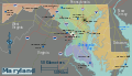
 Maryland regions map.png 3,008 × 1,728; 1.42 MB
-
 Maryland regions map.svg 928 × 533; 3.92 MB


