Category:Tower mills in South Yorkshire
Jump to navigation
Jump to search
Subcategories
This category has the following 2 subcategories, out of 2 total.
B
- The Round House, Barrow (6 F)
Media in category "Tower mills in South Yorkshire"
The following 18 files are in this category, out of 18 total.
-
 Branton Mill - seen across the M18 motorway (geograph 6823535).jpg 4,858 × 3,510; 3.33 MB
-
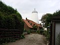
 Disused Lings windmill. - geograph.org.uk - 524115.jpg 640 × 480; 116 KB
-
 Disused windmill Mill House - geograph.org.uk - 2429279.jpg 1,200 × 1,600; 334 KB
-
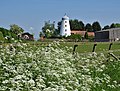
 Lings Windmill - geograph.org.uk - 146524.jpg 640 × 427; 94 KB
-
 Lings Windmill - geograph.org.uk - 2422223.jpg 1,600 × 1,200; 375 KB
-
 Lings windmill disused. - geograph.org.uk - 524107.jpg 640 × 371; 67 KB
-
 Motorway and Windmill - geograph.org.uk - 391244.jpg 640 × 480; 94 KB
-
 Norton Windmill.jpg 4,971 × 3,750; 5.89 MB
-

-
 Owston Ferry Mill.jpg 640 × 427; 86 KB
-
-
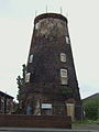 Thorne Mill.jpg 480 × 640; 63 KB
-
 Topham Mill - geograph.org.uk - 2593566.jpg 1,200 × 1,600; 565 KB
-
 West Nab Mill, Fishlake.jpg 640 × 480; 57 KB
-
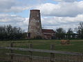
 Wrancarr Mill - geograph.org.uk - 262545.jpg 640 × 427; 56 KB
-
 Wrancarr Mill, Moss.jpg 640 × 480; 124 KB
-
 Wrancarr mill. - geograph.org.uk - 1716492.jpg 480 × 640; 123 KB
-
 Wrancarr Mill.jpg 3,782 × 5,087; 5.13 MB
.jpg)


