Category:Torre de senyals de Porto Pi
Jump to navigation
Jump to search
| Object location | | View all coordinates using: OpenStreetMap |
|---|
This is a category about a monument indexed in the Spanish heritage register of Bienes de Interés Cultural under the reference RI-51-0004926. |
Català: Torre de senyals de Porto Pi. Portopí (Palma). Senyals marítims.
English: Porto Pí Lighthouse
lighthouse in Spain  | |||||
| Upload media | |||||
| Instance of | |||||
|---|---|---|---|---|---|
| Location | Portopí, Ponent District, Palma, Mallorca, Mediterranean Sea | ||||
| Located in or next to body of water | |||||
| Maintained by |
| ||||
| Heritage designation |
| ||||
| Service entry |
| ||||
| Inception |
| ||||
| Source of energy | |||||
| Height |
| ||||
 | |||||
Media in category "Torre de senyals de Porto Pi"
The following 30 files are in this category, out of 30 total.
-
 1. Port de Palma (Mallorca).jpg 1,914 × 585; 854 KB
-
 2. Port de Palma (Mallorca).jpg 3,819 × 1,836; 2.51 MB
-
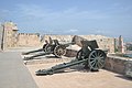 Castell de Sant Carles - Cannons.jpg 4,608 × 3,072; 5.27 MB
-
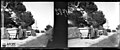 Dos cotxes i gent en una carretera a Portopí i al fons el far.jpeg 1,024 × 424; 75 KB
-
 El far de Portopí amb arbres i vegetació en primer terme.jpeg 1,024 × 429; 82 KB
-
 El far i el port de Portopí amb gent pescant i una barca al fons.jpeg 1,024 × 430; 42 KB
-
 El faro (34120556466).jpg 6,000 × 4,000; 17.21 MB
-
 Faro de Porto Pi Palma de Mallorca.jpg 4,871 × 3,247; 1.74 MB
-
 Faro de Porto Pi.jpg 4,272 × 2,848; 3.78 MB
-
 Faros de Mallorca.jpg 700 × 466; 75 KB
-
 La badia de Palma des de Porto-Pi.jpeg 1,024 × 747; 81 KB
-
 Mallorca Palma seaport asv2023-04 img2.jpg 4,118 × 6,177; 8.94 MB
-
 Mallorca Palma seaport asv2023-04 img3.jpg 6,935 × 3,901; 10.87 MB
-
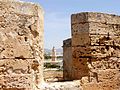
 Museu de Mallorca. Vista de la torre de Senyals i la torre de Paraires.jpg 2,888 × 2,596; 1.17 MB
-
 PALMA de MALLORCA, AB-285.jpg 5,152 × 3,146; 2.6 MB
-
 PALMA de MALLORCA, AB-289.jpg 5,152 × 3,152; 2.9 MB
-
 Port de Portopí (Restored).jpg 938 × 647; 104 KB
-
 Port de Portopí.jpeg 1,024 × 741; 105 KB
-
 Portopi sant carles.jpg 1,899 × 1,203; 88 KB
-
 Portopí.jpg 1,024 × 768; 335 KB
-
 Recuerdos y bellezas de España - Portopí. Torre del Señal (page 154 crop).jpg 2,771 × 1,922; 1.33 MB
-
 Torre de Paraires i torre de Portopí.JPG 5,184 × 3,456; 4.44 MB
-
 Torre de Porto Pi 2018.jpg 1,737 × 2,569; 1.1 MB
-
 Torre de Porto Pi i badia.jpeg 1,772 × 1,181; 207 KB
-
 Torre de Senyales - Porto Pi - Palma de Mallorca.jpg 5,596 × 8,395; 22.75 MB
-
 Torre de Senyals de Porto Pi (1).JPG 1,536 × 3,072; 1.57 MB
-
 Torre de Senyals de Porto Pi - RI-5I-0004926 (2).JPG 1,600 × 1,200; 442 KB
-
 Torre de Senyals de Porto Pi - RI-5I-0004926 -.JPG 1,166 × 732; 173 KB
-
 Torre de Senyals de Porto Pi.JPG 3,421 × 4,575; 2.45 MB
-
 Torre senyals portopi.jpg 828 × 684; 24 KB
.jpg)


.jpg)


.jpg)


.jpg)


.JPG)
.JPG)


.jpg)