Category:Topographische Karte über das Grossherzogthum Baden (Topographic map of the Grand Duchy of Baden)
Jump to navigation
Jump to search
 | |||||
| Upload media | |||||
| Instance of |
| ||||
|---|---|---|---|---|---|
| Location |
| ||||
| Start time |
| ||||
| End time |
| ||||
| |||||
Subcategories
This category has only the following subcategory.
Media in category "Topographische Karte über das Grossherzogthum Baden (Topographic map of the Grand Duchy of Baden)"
The following 10 files are in this category, out of 10 total.
-
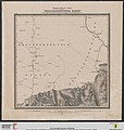
 Topographische Karte über das Grossherzogthum Baden 00 Blattschnitt.jpg 2,771 × 2,534; 978 KB
-
 Topographische Karte über das Grossherzogthum Baden 00 Einleitung.jpg 5,203 × 5,539; 4.6 MB
-
 Topographische Karte über das Grossherzogthum Baden Blatt 01a Mondfeld.jpg 2,871 × 3,051; 1.31 MB
-
 Topographische Karte über das Grossherzogthum Baden Blatt 01b Dertingen.jpg 3,032 × 3,222; 1.16 MB
-
 Topographische Karte über das Grossherzogthum Baden Blatt 02a Kirschgartshausen.jpg 2,596 × 2,759; 1.28 MB
-
 Topographische Karte über das Grossherzogthum Baden Blatt 03 Waldleiningen.jpg 2,768 × 2,924; 1.56 MB
-
 Topographische Karte über das Grossherzogthum Baden Blatt 04 Wertheim.jpg 2,283 × 2,613; 1.85 MB
-
 Topographische Karte über das Grossherzogthum Baden Blatt 05 Bischofsheim.jpg 2,620 × 2,819; 2.01 MB
-
 Topographische Karte über das Grossherzogthum Baden Blatt 08 Eberbach.jpg 2,654 × 3,024; 2.82 MB
-
 Topographische Karte über das Grossherzogthum Baden Blatt 09 Buchen.jpg 2,508 × 2,872; 2.56 MB


