Category:Topographical Collection of George III
Jump to navigation
Jump to search
English: The Topographical Collection of George III contains drawn and printed maps, views and atlases produced between 1500 and 1824.
Media in category "Topographical Collection of George III"
The following 17 files are in this category, out of 17 total.
-
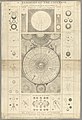 The BL King’s Topographical Collection - A Synopsis of the Universe.jpg 2,740 × 4,000; 1.98 MB
-
 The BL King’s Topographical Collection - Hemisphaerium Coeli Australe.jpg 4,000 × 3,355; 2.64 MB
-
 The BL King’s Topographical Collection - Hemisphaerium Coeli Boreale.jpg 4,000 × 3,372; 2.92 MB
-
 The BL King’s Topographical Collection - Introduction à la Géographie.jpg 4,000 × 2,870; 2.34 MB
-

-
 The BL King’s Topographical Collection - Near Plymouth - 50562484948.jpg 4,000 × 3,157; 1.35 MB
-
 The BL King’s Topographical Collection - Near Plymouth.jpg 4,000 × 3,390; 1.22 MB
-

-
 The BL King’s Topographical Collection - Systema Mundi Tychonicum.jpg 4,000 × 3,314; 2.18 MB
-
 The BL King’s Topographical Collection - Systema Solare et Planetarium.jpg 4,000 × 3,391; 3.03 MB
-
 The BL King’s Topographical Collection - Templa Diversa Romae - 51193105681.jpg 3,000 × 4,000; 1.94 MB
-
 The BL King’s Topographical Collection - Templa Diversa Romae.jpg 2,825 × 4,000; 2.51 MB
-
 The BL King’s Topographical Collection - The Astronomical Rotula.jpg 3,937 × 4,000; 2.28 MB
-
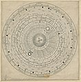
 The BL King’s Topographical Collection - The Planispherical Planetarium.jpg 3,423 × 4,000; 2.02 MB
-
 The BL King’s Topographical Collection - The Town and Cathedral of Carlisle.jpg 4,000 × 2,723; 1.34 MB
-
 The BL King’s Topographical Collection - View of Borrowdale.jpg 4,000 × 3,396; 1.6 MB
-


