Category:Topographic maps of Romania
Jump to navigation
Jump to search
Countries of Europe: Albania · Andorra · Armenia‡ · Austria · Azerbaijan‡ · Belarus · Belgium · Bosnia and Herzegovina · Bulgaria · Croatia · Cyprus‡ · Czech Republic · Denmark · Estonia · Finland · France‡ · Georgia‡ · Germany · Greece · Hungary · Iceland · Republic of Ireland · Italy · Kazakhstan‡ · Latvia · Liechtenstein · Lithuania · Luxembourg · Malta · Moldova · Monaco · Montenegro · Netherlands‡ · North Macedonia · Norway · Poland · Portugal‡ · Romania · Russia‡ · San Marino · Serbia · Slovakia · Slovenia · Spain‡ · Sweden · Switzerland · Turkey‡ · Ukraine · United Kingdom
Specific status: Faroe Islands · Isle of Man · Svalbard – Limited recognition: Kosovo
‡: partly located in Europe
Specific status: Faroe Islands · Isle of Man · Svalbard – Limited recognition: Kosovo
‡: partly located in Europe
Subcategories
This category has only the following subcategory.
S
- SVG topographic maps of Romania (13 F)
Media in category "Topographic maps of Romania"
The following 93 files are in this category, out of 93 total.
-
 Aruncuta 0 - Harta topografica.jpg 1,837 × 919; 472 KB
-
 AUB RANGE.jpg 5,939 × 4,076; 13.12 MB
-
 Baragan.jpg 1,006 × 714; 491 KB
-
 Brodina-Izvoarele Sucevei.png 1,024 × 738; 1.22 MB
-
 Campulung-Vatra Dornei.png 1,024 × 738; 1.22 MB
-
 Carpathian Mtns Romania 44to49N 22to27E Topo Rainbow Zebra 612.jpg 6,000 × 6,000; 24.84 MB
-
 Carpatii apuseni.png 1,006 × 714; 711 KB
-
 Carpatii Meridionali.png 1,006 × 714; 739 KB
-
 Carpatii occidentali.jpg 1,006 × 714; 143 KB
-
 Carpatii orientali.png 1,006 × 714; 746 KB
-
 Chernivtsi-Suceava.png 1,024 × 738; 1.21 MB
-
 Câmpia Transilvaniei.png 1,006 × 714; 960 KB
-
 Danube delta chart.png 1,000 × 540; 848 KB
-
 Darmanesti-Campulung.png 1,024 × 738; 1.22 MB
-
 Debrecen-Sighetu Marmatiei.png 1,024 × 738; 1.21 MB
-
 Depresiunea & Muntii Fagarasului - Harta topografica.jpg 1,657 × 3,610; 590 KB
-
 Dobrudscha2 Balkan topo de.jpg 620 × 620; 109 KB
-
 Fagaras-mountains-Ro.jpg 1,006 × 714; 516 KB
-
 Harta hipsometrica.jpg 816 × 1,056; 87 KB
-
 Harta hipsometrică a comunei Bîrseşti.tif 3,188 × 4,370; 39.89 MB
-
 Harta obiectivelor din zona Cheile Nerei.png 3,434 × 3,431; 8.69 MB
-
 Harta reliefului din Transilvana.jpg 1,783 × 1,298; 2.13 MB
-
 Ilva Mica-Floreni.png 1,024 × 738; 1.22 MB
-
 Iron Gates map.png 300 × 200; 100 KB
-
 Körös basin.png 400 × 300; 169 KB
-
 LageBaleasee.jpg 800 × 548; 122 KB
-
 LageVidraru.jpg 1,195 × 818; 220 KB
-
 Localitati si biserici sasesti din Transilvania.jpg 2,853 × 1,986; 5.07 MB
-
 Map of the Focșani Gate.png 670 × 570; 764 KB
-
 Muntele Mare.png 1,006 × 714; 968 KB
-
 Muntii Apuseni1.jpg 1,006 × 714; 666 KB
-
 Muntii Banatului.png 1,024 × 738; 1.2 MB
-
 Muntii Baraolt.jpg 1,006 × 714; 138 KB
-
 Muntii Bihorului.jpg 1,006 × 714; 138 KB
-
 Muntii Bucegi.jpg 1,006 × 714; 137 KB
-
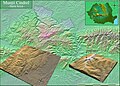 Muntii Cindrel - Harta fizica.jpg 3,019 × 2,156; 3.6 MB
-
 Muntii Cindrel.jpg 1,006 × 714; 138 KB
-
 Muntii Dobrogei.png 1,006 × 714; 732 KB
-
 Muntii Fagarasului - Panoramic Nordic.gif 652 × 241; 4.51 MB
-
 Muntii Giurgeu.png 1,006 × 714; 859 KB
-
 Muntii Gurghiu.png 1,006 × 714; 946 KB
-
 Muntii Harghita.png 1,006 × 714; 944 KB
-
 Muntii Lotrului - Harta fizica.jpg 2,507 × 2,011; 1.07 MB
-
 Muntii Metaliferi.JPG 1,006 × 714; 127 KB
-
 Muntii Persani.jpg 1,006 × 714; 138 KB
-
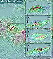 Muntii Piatra Craiului, Harta Topografica.jpg 2,424 × 2,702; 1.15 MB
-
 Muntii Piatra Craiului.jpg 1,006 × 714; 138 KB
-
 Muntii Retezat.jpg 1,006 × 714; 138 KB
-
 Muntii Rodnei.jpg 1,006 × 714; 137 KB
-
 Muntii Sureanu.png 1,006 × 714; 976 KB
-
 Muntii Trascaului.jpg 1,006 × 714; 138 KB
-
 Mureș basin.png 600 × 300; 301 KB
-
 Nordwestbulgarien.png 1,342 × 835; 2.01 MB
-
 Obcina Mare.jpg 1,006 × 714; 138 KB
-
 Oltul la intrarea in Defileu.jpg 2,257 × 5,449; 1.08 MB
-
 Panoramic desfasurat de pe Varful Steflesti - Muntii Lotrului.jpg 3,000 × 300; 220 KB
-
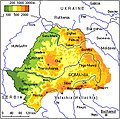
 Physical map of Moldova and Bukovina.JPG 519 × 346; 250 KB
-
 Physical map of Moldova.JPG 519 × 346; 297 KB
-
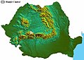
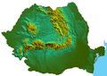
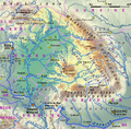
 Physical map of Romania.jpg 800 × 577; 365 KB
-
 Piatra Mare.jpg 1,006 × 714; 137 KB
-
 Podisul Hartibaciului.jpg 1,006 × 714; 138 KB
-
 Podisul Secaselor.png 1,006 × 714; 1,002 KB
-
 Podisul Transilvaniei.jpg 1,006 × 714; 134 KB
-
 Prelucrare 3D pentru Varful Cindrel din Muntii Cindrelului, Romania.gif 300 × 214; 7.72 MB
-
 Prelucrare 3D pentru Varful Steflesti din Muntii Lotrului, Romania.gif 300 × 214; 7.27 MB
-
 RacoviţaHartăToponimică.PNG 4,174 × 2,513; 2.56 MB
-
 Raul Buzau.png 800 × 547; 956 KB
-
 Raul Prahova.png 800 × 547; 956 KB
-
 Raul Sebes.png 800 × 547; 808 KB
-
 Raul Siret.png 800 × 547; 902 KB
-
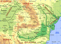
 Romania - Harta fizica, administrativa si politica.jpg 2,578 × 1,961; 1.71 MB
-
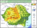
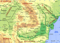
 ROMANIA Fizic.jpg 1,195 × 818; 760 KB
-
 Romania general map-en.png 1,789 × 1,266; 3.69 MB
-
 Romania general map-ro.png 1,789 × 1,266; 4.36 MB
-
 Romania location map Topographic portuguese.png 1,280 × 915; 2.29 MB
-
 Romania location map Topographic.png 1,822 × 1,303; 4.79 MB
-
 Romania Rivers.png 800 × 547; 917 KB
-
 Romania Topografie.jpg 2,985 × 2,258; 1.27 MB
-
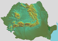
 Romania-relief.png 1,006 × 714; 799 KB
-
 Romania-topo.png 1,091 × 768; 671 KB
-
 Romania1939physical.jpg 600 × 452; 369 KB
-
 Rumania in 1967.JPG 7,009 × 5,478; 12.76 MB
-
 Sighetu Marmatiei-Iwano-Frankiwsk.png 1,024 × 738; 1.22 MB
-
 Slovakia topo.jpg 1,400 × 962; 582 KB
-
 Someș basin.png 400 × 300; 239 KB
-
 Suceava-Gura Humorului.png 1,024 × 738; 1.22 MB
-
 Targu Neamt area topographic map.png 2,890 × 1,999; 6.23 MB
-
 Tisza Karte.png 838 × 821; 1.2 MB
-

-
 TransylvaniaPhysical.jpg 329 × 327; 192 KB
-
 Valea Argeșului în cadrul treptelor de relief.jpg 1,227 × 968; 394 KB
-
 Valea Oltului.GIF 400 × 140; 2 MB
-
 Vatra Dornei-Prundu Bargaului.png 1,024 × 738; 1.22 MB


