Category:Topographic maps of Peru
Jump to navigation
Jump to search
Subcategories
This category has the following 15 subcategories, out of 15 total.
M
- Mapas topográficos de Cusco (1 F)
- Mapas topográficos de Ica (1 F)
- Mapas topográficos de Lima (1 F)
- Mapas topográficos de Piura (1 F)
- Mapas topográficos de Puno (1 F)
- Mapas topográficos de Tacna (2 F)
- Mapas topográficos de Tumbes (1 F)
- Mapas topográficos de Áncash (3 F)
S
- SVG topographic maps of Peru (7 F)
Media in category "Topographic maps of Peru"
The following 35 files are in this category, out of 35 total.
-
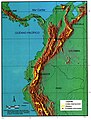
 Andes Peru 10to17S 69to77W Topo Rainbow Zebra 1938.jpg 9,600 × 8,400; 64.03 MB
-
 Cordillera Ampato.png 2,101 × 2,851; 3.32 MB
-
 Cordillera Negra.png 2,100 × 2,850; 3.28 MB
-
 Cotacajesrivermap.jpg 1,217 × 1,429; 751 KB
-
 Cotocajesrivermap.jpg 1,217 × 1,429; 750 KB
-

-
 Huaynaputina tephra fallout-topographic.svg 1,239 × 860; 8.39 MB
-
 Imagen satelital de Perú.jpg 1,966 × 2,834; 833 KB
-
 ImaV-CORBLA.gif 680 × 1,375; 179 KB
-
 Map of Peru Demis.png 840 × 1,191; 431 KB
-
 Mapa de localización Zona Reservada Cordillera Huayhuash.svg 512 × 495; 3.78 MB
-
 Mapa fisico Peru fondo transparente.png 681 × 975; 387 KB
-
 Mapa topografico del VRAEM.jpg 1,653 × 2,339; 757 KB
-
 Mapa topográfico del Perú.png 500 × 709; 428 KB
-
 Nasa anden altiplano.jpg 567 × 697; 443 KB
-
 Nevado Coropuna.png 679 × 492; 475 KB
-
 Paramos.JPG 698 × 918; 861 KB
-
 Peru Physiography.jpg 1,985 × 2,454; 1.26 MB
-
 Peru Topography.png 2,101 × 2,851; 3.36 MB
-
 Peró - Topografia.png 981 × 1,277; 553 KB
-
 Proechimys quadruplicatus distribution (colored).png 1,259 × 944; 1.91 MB
-
 Proechimys simonsi distribution (colored).png 1,259 × 944; 1.93 MB
-
 Proechimys simonsi distribution (gray).png 1,259 × 944; 1.24 MB
-
 Proechimys steerei distribution (colored).png 1,259 × 944; 1.85 MB
-
 Proechimys steerei distribution (gray).png 1,259 × 944; 1.21 MB
-
 Regiones naturales del Perú.png 1,806 × 2,317; 848 KB
-
 Reserva Nacional de Paracas topographic map-es.png 989 × 1,213; 595 KB
-
 Reserva Nacional de Paracas topographic map-fr.png 989 × 1,213; 595 KB
-
 S 10, W 81.5 - N 1.5, W 60 slope map.png 14,570 × 8,303; 61.09 MB
-
 S 20.1, W 78.4 - S 10, W 60 slope map.png 12,272 × 7,434; 47.98 MB
-
 Txu-oclc-224300691-se19-6 (cropped on Casiri).jpg 1,096 × 1,475; 1.42 MB
-
 Txu-oclc-224300691-se19-6.jpg 5,164 × 3,929; 10.27 MB
-
 Ubicación Loma Ochiputur.jpg 458 × 246; 123 KB
-
 Vampyrum spectrum distribution (colored).png 1,259 × 944; 2.09 MB
-
 Vampyrum spectrum distribution (gray).png 1,259 × 944; 1.03 MB


.png)
.png)
.png)
.png)
.png)


.jpg)


.png)
.png)