Category:Topographic maps of Colombia
Jump to navigation
Jump to search
Subcategories
This category has the following 4 subcategories, out of 4 total.
Media in category "Topographic maps of Colombia"
The following 54 files are in this category, out of 54 total.
-
 AGHRC (1890) - Carta XIV - Orografía e hidrografía de Colombia.jpg 4,259 × 3,477; 5.87 MB
-
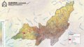 ALBANIA MAPA TOPOGRAFICO.png 3,840 × 2,160; 7.47 MB
-
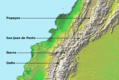
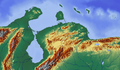
 BarreradeserCaribe.JPG 832 × 318; 50 KB
-
 Campagne de Pasto.png 831 × 557; 780 KB
-
 Campaña libertadora de la Nueva Granada (1819).png 897 × 880; 1.27 MB
-
 Carte Volcans Colombie.png 1,780 × 2,615; 10.55 MB
-
 Castellano Vallecaucano en el mapa de colombia.png 457 × 600; 328 KB
-
 Cerro tasajero Topo.png 391 × 803; 418 KB
-
 CIA map Central America & Caribbean.png 1,390 × 1,044; 1.6 MB
-
 Colombia continental relief location map.jpg 1,378 × 1,864; 653 KB
-
 Colombia Physiography.jpg 2,054 × 2,393; 1.7 MB
-
 Colombia rel 2001-2.png 1,059 × 1,258; 4.74 MB
-
 Colombia rel 2001.jpg 1,059 × 1,258; 275 KB
-
 Colombia relief demographic map-fr.png 1,082 × 1,394; 2.4 MB
-
 Colombia relief demographic map.png 1,082 × 1,394; 2.32 MB
-
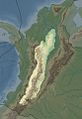
 Colombia relief location map Cauca dry forest.jpg 596 × 618; 467 KB
-
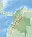 Colombia relief location map.jpg 2,028 × 2,294; 1.1 MB
-
 Colombia Rios Mapa.png 2,000 × 2,626; 1.8 MB
-
 Colombia Terrain and Transportation - btv1b53196922g.jpg 6,836 × 9,878; 7.23 MB
-
 Colombia Topography 2.png 1,839 × 2,399; 3.79 MB
-
 Colombia Topography uk.png 1,383 × 1,753; 2.03 MB
-
 Colombia Topography.png 1,839 × 2,399; 2.98 MB
-
 Cordillera Centrale de Colombia.jpg 660 × 960; 415 KB
-
 Cordillera Occidentale de Colombia.jpg 660 × 960; 412 KB
-
 Cordillera Orientale de Colombia.jpg 660 × 960; 425 KB
-
 Culture du café en Colombie (1997).png 2,000 × 2,687; 1.58 MB
-
 Dona juana volcano location map.jpg 559 × 743; 157 KB
-
 Karibik 16.png 1,353 × 785; 1.24 MB
-
 Karibik 17.png 1,349 × 784; 1.44 MB
-
 Kolumbien-reliev.jpg 278 × 323; 22 KB
-
 Map of Colombia Demis.png 646 × 774; 208 KB
-
 MiddleAmericaTrench.jpg 1,472 × 862; 351 KB
-
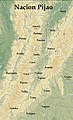 Nacion Pijao.JPG 1,063 × 1,742; 249 KB
-
 Paramos.JPG 698 × 918; 861 KB
-
 Proechimys quadruplicatus distribution (colored).png 1,259 × 944; 1.91 MB
-
 Proechimys semispinosus distribution (colored).png 1,259 × 944; 1.77 MB
-
 Proechimys semispinosus distribution (gray).png 1,259 × 944; 830 KB
-
 Proechimys simonsi distribution (colored).png 1,259 × 944; 1.93 MB
-
 Proechimys simonsi distribution (gray).png 1,259 × 944; 1.24 MB
-
 Proechimys steerei distribution (colored).png 1,259 × 944; 1.85 MB
-
 Proechimys steerei distribution (gray).png 1,259 × 944; 1.21 MB
-
 Region Montes de Maria.jpg 514 × 852; 107 KB
-
 Regiones naturales de Colombia.jpg 1,222 × 1,399; 1.12 MB
-
 Relieve colombia.png 1,200 × 863; 935 KB
-
 Santamartamys rufodorsalis distribution b.png 1,259 × 944; 839 KB
-
 Santamartamys rufodorsalis distribution c.png 1,259 × 944; 1.64 MB
-
 Santamartamys rufodorsalis distribution.png 1,259 × 944; 296 KB
-
 Sierra de Nevada.jpg 1,355 × 628; 165 KB
-
 Topographic Map of the Cesar-Ranchería Basin - Colombia.jpg 1,429 × 788; 821 KB
-
 Usgs-glaciers-colombia.png 414 × 597; 113 KB
-
 Vampyrum spectrum distribution (colored).png 1,259 × 944; 2.09 MB
-
 Vampyrum spectrum distribution (gray).png 1,259 × 944; 1.03 MB
-
 Vara-Metro.jpg 568 × 380; 129 KB
-
 Vuelta a Colombia 2012.png 668 × 756; 622 KB
_-_Carta_XIV_-_Orograf%C3%ADa_e_hidrograf%C3%ADa_de_Colombia.jpg)


.png)


.png)


.png)
.png)
.png)
.png)
.png)
.png)
.png)


.png)
.png)

