Category:Topographic maps of Andalusia
Jump to navigation
Jump to search
Media in category "Topographic maps of Andalusia"
The following 31 files are in this category, out of 31 total.
-
 Altimetria andalucia.png 1,610 × 1,011; 1.71 MB
-
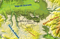
 Andalucía mapa físico.png 595 × 359; 429 KB
-
 Arco de Gibraltar.png 404 × 438; 340 KB
-
 Baetic System in Spanish - Cordilleras Béticas.png 592 × 381; 12 KB
-
 Baetic Systems.png 592 × 381; 13 KB
-
 Cordillera Antequerana.png 354 × 186; 144 KB
-
 El Temple (Granada, España).png 1,903 × 1,236; 698 KB
-
 Hoya de Málaga.png 118 × 117; 28 KB
-
 Lange diercke sachsen europaeische landschaften gibraltar.jpg 1,251 × 1,052; 664 KB
-
 Maps-for-free Sierra Nevada.png 497 × 399; 377 KB
-
 Montes de Málaga.png 269 × 148; 92 KB
-
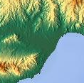
 Málaga topográfico.png 766 × 488; 746 KB
-
 Pegalajar (05-05-1892) plano topográfico, altimetría IGE 230425.png 7,266 × 5,371; 65.66 MB
-
 Pegalajar (1559) mapa del término municipal.png 1,743 × 980; 3.26 MB
-
 Pegalajar (28-11-1874) plano topográfico, planimetría IGE 230145.png 7,066 × 5,160; 65.36 MB
-
 Plano Sitio Histórico Alpujarra.jpg 535 × 430; 114 KB
-
 Plano Sitio Histórico.pdf 1,483 × 1,177; 129 KB
-
 Relief map of Spain Andalusia.png 4,064 × 2,713; 15.46 MB
-
 Reliefkarte Andalusien 2022.png 6,695 × 4,939; 33.45 MB
-
 Relieve almería.png 1,092 × 1,147; 1.14 MB
-
 Relieve andalucia.png 692 × 426; 407 KB
-
 Relieve Granada.png 1,030 × 574; 649 KB
-
 Relieve poniente.png 1,445 × 1,688; 1.54 MB
-
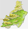
 Relieve Provincia de Jaen 200ppp.png 2,498 × 1,669; 2.43 MB
-
 RelieveGranada.png 2,123 × 1,148; 1.07 MB
-
 Relievehuelva.png 1,640 × 2,216; 1.59 MB
-
 Series 1404 sheet 347-C Sevilla, published 1965.jpg 7,162 × 5,386; 11.29 MB
-
 Slope andalucia.png 995 × 606; 68 KB
-
 Temple Localización.png 3,509 × 2,478; 2.77 MB
-
 Valle del Guadalhorce.png 304 × 249; 161 KB
-
 Ανδαλουσία ορογραφικός.png 1,610 × 1,011; 1.73 MB


.png)


_plano_topogr%C3%A1fico,_altimetr%C3%ADa_IGE_230425.png)
_mapa_del_t%C3%A9rmino_municipal.png)
_plano_topogr%C3%A1fico,_planimetr%C3%ADa_IGE_230145.png)


