Category:Topographic location maps of states of Mexico
Jump to navigation
Jump to search
Elevation legend[edit]
Applies to the series "File:Mexico [state name] topographic location map.png" (August 2023).
Land elevations (inside the state):
negative
0 to 50 m
50 to 100 m
100 to 200 m
200 to 400 m
400 to 700 m
700 to 1000 m
1000 to 1300 m
1300 to 1600 m
1600 to 1900 m
1900 to 2200 m
2200 to 2500 m
2500 to 2800 m
2800 to 3100 m
3100 to 3400 m
3400 to 3700 m
3700 to 4000 m
4000 to 4400 m
4400 to 4800 m
above 4800 m
Sea depths:
0 to 50 m
50 to 100 m
100 to 200 m
200 to 400 m
400 to 600 m
600 to 1000 m
1000 to 1500 m
1500 to 2500 m
2500 to 4000 m
below 4000 m
Media in category "Topographic location maps of states of Mexico"
The following 33 files are in this category, out of 33 total.
-
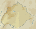 Mexico Aguascalientes topographic location map.png 383 × 310; 24 KB
-
 Mexico Baja California Sur topographic location map.png 892 × 913; 176 KB
-
 Mexico Baja California topographic location map.png 857 × 910; 198 KB
-
 Mexico Campeche topographic location map.png 691 × 630; 95 KB
-
 Mexico Chiapas topographic location map.png 734 × 675; 164 KB
-
 Mexico Chihuahua topographic location map.png 903 × 1,018; 238 KB
-
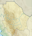
 Mexico Coahuila topographic location map.png 726 × 1,039; 172 KB
-
 Mexico Colima topographic location map.png 414 × 314; 57 KB
-
 Mexico Durango topographic location map.png 857 × 817; 217 KB
-
 Mexico Estado de Mexico topographic location map.png 524 × 523; 90 KB
-
 Mexico Federal District topographic location map.png 293 × 288; 16 KB
-
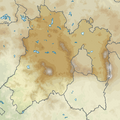
 Mexico Guanajuato topographic location map.png 563 × 467; 90 KB
-
 Mexico Guerrero topographic location map.png 744 × 468; 128 KB
-
 Mexico Hidalgo topographic location map.png 519 × 478; 137 KB
-
 Mexico Jalisco topographic location map.png 767 × 752; 225 KB
-
 Mexico Michoacan topographic location map.png 696 × 493; 140 KB
-
 Mexico Morelos topographic location map.png 338 × 331; 27 KB
-
 Mexico Nayarit topographic location map.png 553 × 667; 138 KB
-
 Mexico Nuevo Leon topographic location map.png 726 × 937; 151 KB
-
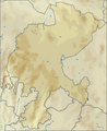
 Mexico Oaxaca topographic location map.png 779 × 513; 182 KB
-
 Mexico Puebla topographic location map.png 573 × 703; 156 KB
-
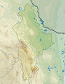
 Mexico Queretaro topographic location map.png 456 × 498; 67 KB
-
 Mexico Quintana Roo topographic location map.png 596 × 874; 89 KB
-
 Mexico San Luis Potosi topographic location map.png 711 × 645; 132 KB
-
 Mexico Sinaloa topographic location map.png 738 × 913; 218 KB
-
 Mexico Sonora topographic location map.png 990 × 967; 341 KB
-
 Mexico Tabasco topographic location map.png 673 × 401; 78 KB
-
 Mexico Tamaulipas topographic location map.png 742 × 1,091; 185 KB
-
 Mexico Tlaxcala topographic location map.png 399 × 259; 26 KB
-
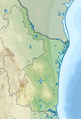
 Mexico Veracruz topographic location map.png 839 × 922; 241 KB
-
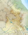
 Mexico Yucatan topographic location map.png 645 × 507; 43 KB
-
 Mexico Zacatecas topographic location map.png 674 × 823; 142 KB
-
 Yucatan topographic map.svg 2,815 × 2,211; 3.31 MB


