Category:Tivetshall St Margaret
Jump to navigation
Jump to search

village and former civil parish in Norfolk, UK  | |||||
| Upload media | |||||
| Instance of |
| ||||
|---|---|---|---|---|---|
| Location |
| ||||
| Area |
| ||||
 | |||||
English: Tivetshall St Margaret is a village and former civil parish in Norfolk, England. It covered an area of and had a population of 266 in 104 households as of the 2001 census.
Subcategories
This category has the following 11 subcategories, out of 11 total.
Media in category "Tivetshall St Margaret"
The following 41 files are in this category, out of 41 total.
-
-
 A crop of peas - geograph.org.uk - 1366630.jpg 640 × 480; 133 KB
-
 A long-distance view to Tivetshall - geograph.org.uk - 1596477.jpg 640 × 486; 92 KB
-
 A recently ploughed field - geograph.org.uk - 1596485.jpg 640 × 480; 129 KB
-
 A tree casting its shadow - geograph.org.uk - 1596467.jpg 640 × 446; 112 KB
-
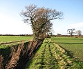
 A tree-hedge field boundary - geograph.org.uk - 1596460.jpg 640 × 480; 120 KB
-
 A tree-lined ditch beside footpath - geograph.org.uk - 1596445.jpg 640 × 535; 147 KB
-
 Approaching School Road - geograph.org.uk - 1596490.jpg 640 × 445; 146 KB
-

-

-
 Farm bridge over ditch beside footpath - geograph.org.uk - 1596435.jpg 640 × 449; 114 KB
-

-

-
 Ford - geograph.org.uk - 320549.jpg 640 × 480; 97 KB
-
 From farm track to footpath - geograph.org.uk - 1596463.jpg 640 × 480; 135 KB
-
 Path through a field of peas - geograph.org.uk - 1366622.jpg 640 × 480; 84 KB
-
 Path to the A140 (Norwich Road) - geograph.org.uk - 1596441.jpg 640 × 442; 146 KB
-
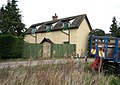
 Stoney Lane past sheds at Hall Farm - geograph.org.uk - 1366635.jpg 640 × 480; 99 KB
-
 Stunted tree beside the B1134 - geograph.org.uk - 1572599.jpg 554 × 640; 89 KB
-
 The Railway public house - geograph.org.uk - 1572367.jpg 640 × 455; 86 KB
-

-

-
-

-

-

-

-
-

-

-

-

-

-
-
 View across a ditch towards Rectory Wood - geograph.org.uk - 1596444.jpg 640 × 450; 103 KB
-
-
 View along a curving ditch - geograph.org.uk - 1596482.jpg 640 × 480; 164 KB
-

-
 Along the B1134 to Hales Street - geograph.org.uk - 357161.jpg 640 × 480; 69 KB
-
 Dwellings on B1134 - geograph.org.uk - 356660.jpg 640 × 480; 70 KB
-
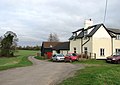
 Footpath Sign and Fernleigh Farm - geograph.org.uk - 356667.jpg 640 × 480; 87 KB


_-_geograph.org.uk_-_1596441.jpg)


_-_geograph.org.uk_-_1596425.jpg)

_-_geograph.org.uk_-_1596428.jpg)


