Category:Titchfield
Jump to navigation
Jump to search
village in United Kingdom  | |||||
| Upload media | |||||
| Instance of | |||||
|---|---|---|---|---|---|
| Location | Fareham, Hampshire, South East England, England | ||||
 | |||||
English: Titchfield is a village in southern Hampshire, by the River Meon. The village has a history stetching back to the 6th century. During the medieval period, the village operated a small port and market. Near to the village the ruins of Titchfield Abbey, a place with strong associations with Shakespeare, through his patron, the Earl of Southampton.
Español: Categoría:Localidades de Inglaterra
Subcategories
This category has the following 3 subcategories, out of 3 total.
P
- St Peter, Titchfield (31 F)
T
- Titchfield Abbey (26 F)
Media in category "Titchfield"
The following 138 files are in this category, out of 138 total.
-
 Abbey Garden Centre-Titchfield - geograph.org.uk - 728732.jpg 640 × 397; 83 KB
-
 Argos Extra - geograph.org.uk - 161001.jpg 640 × 480; 125 KB
-
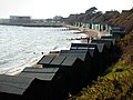
 Beach Huts -Hill Head - geograph.org.uk - 723761.jpg 640 × 396; 50 KB
-
 Beach huts at Hill Head - geograph.org.uk - 417585.jpg 640 × 480; 127 KB
-
 Beach Huts at Hill Head - geograph.org.uk - 452243.jpg 640 × 480; 99 KB
-
 Broad Beans - geograph.org.uk - 225774.jpg 640 × 480; 85 KB
-
 Car park near Hill Head - geograph.org.uk - 1145035.jpg 640 × 427; 62 KB
-
 Coach and Horses Pub-Titchfield - geograph.org.uk - 728742.jpg 640 × 401; 71 KB
-

-
 Fishermans Arms 2.jpg 4,032 × 3,024; 3.27 MB
-
 Fishermans Arms.jpg 4,032 × 3,024; 3.28 MB
-

-
 Footpath near Titchfield Haven - geograph.org.uk - 865911.jpg 640 × 480; 169 KB
-
 Foreshore near Solent Breezes - geograph.org.uk - 1147230.jpg 640 × 427; 70 KB
-
 High Street, Titchfield Village - geograph.org.uk - 464030.jpg 640 × 427; 139 KB
-

-
 Housing near Titchfield - geograph.org.uk - 157524.jpg 640 × 480; 145 KB
-
 It's horrible out here - geograph.org.uk - 1147400.jpg 640 × 427; 56 KB
-
 It's horrible out here - geograph.org.uk - 1147404.jpg 640 × 427; 54 KB
-
 Jack Snipe (Lymnocryptes minima) - geograph.org.uk - 604645.jpg 640 × 480; 61 KB
-

-
 Looking down Titchfield Hill - geograph.org.uk - 727879.jpg 640 × 398; 79 KB
-
 Main Road in Titchfield - geograph.org.uk - 422466.jpg 640 × 539; 103 KB
-

-
 More mud and water - geograph.org.uk - 1147385.jpg 640 × 427; 27 KB
-
 Muddy Paddock-Titchfield - geograph.org.uk - 727809.jpg 640 × 439; 93 KB
-
 Mystery Building-Titchfield - geograph.org.uk - 728108.jpg 640 × 411; 73 KB
-
 Old Brick Wall-Titchfield - geograph.org.uk - 729083.jpg 640 × 439; 84 KB
-
 Old Clarendon House, East Street, Titchfield (NHLE Code 1351246) (May 2019).JPG 2,500 × 1,900; 2.05 MB
-
 Place House Cottages 2.jpg 4,032 × 3,024; 3.72 MB
-
 Place House Cottages And Garden Boundary Wall Adjoining East.jpg 4,032 × 3,024; 3.6 MB
-
 Place House Cottages.jpg 4,032 × 3,024; 3.46 MB
-
 Promenade, Hillhead Harbour - geograph.org.uk - 1418102.jpg 640 × 426; 81 KB
-
 Pylons at Hookgate - geograph.org.uk - 536586.jpg 640 × 480; 86 KB
-
 Reed Beds at Titchfield Haven - geograph.org.uk - 729106.jpg 640 × 403; 62 KB
-
 Rhubarb - geograph.org.uk - 230633.jpg 640 × 480; 95 KB
-
 River Mouth-Tichfield Haven - geograph.org.uk - 723812.jpg 640 × 383; 57 KB
-
 Roundabout and housing at Titchfield Park - geograph.org.uk - 459745.jpg 640 × 427; 124 KB
-

-
 Sea defence at Titchfield Haven - geograph.org.uk - 1585165.jpg 640 × 480; 69 KB
-
 Sea House foreshore - geograph.org.uk - 1147375.jpg 640 × 427; 43 KB
-
 Sea wall at Titchfield Haven - geograph.org.uk - 1584973.jpg 640 × 480; 58 KB
-
 Steps to the Beach, Hill Head - geograph.org.uk - 1418123.jpg 640 × 426; 147 KB
-
 Stony Bridge 2.jpg 4,032 × 3,024; 4.66 MB
-
 Stony Bridge 3.jpg 4,032 × 3,024; 4.62 MB
-
 Stony Bridge 4.jpg 4,032 × 3,024; 4.51 MB
-
 Stony Bridge.jpg 3,024 × 4,032; 4.92 MB
-
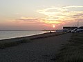 Sun set - panoramio (3).jpg 3,264 × 2,448; 1.7 MB
-
 Sunset on the Solent - panoramio.jpg 2,048 × 1,536; 671 KB
-
 The beach at Titchfield Haven - geograph.org.uk - 1418098.jpg 640 × 448; 124 KB
-
 The Bugle Hotel, The Square, Titchfield (NHLE Code 1230565) (May 2019).JPG 2,600 × 1,800; 1.68 MB
-
 The Queen's Head Hotel, High Street, Titchfield (NHLE Code 1230518) (May 2019).JPG 3,000 × 2,000; 2.22 MB
-
 The Vicarage, Church Street, Titchfield (NHLE Code 1094290) (May 2019).JPG 3,000 × 2,000; 2.8 MB
-
 Titchfield Common, the post office - geograph.org.uk - 625915.jpg 640 × 480; 76 KB
-
 Titchfield Haven - geograph.org.uk - 1418094.jpg 640 × 425; 130 KB
-
 Titchfield Haven - geograph.org.uk - 1418112.jpg 640 × 426; 112 KB
-
 Titchfield Haven Nature Reserve (1) - geograph.org.uk - 1497524.jpg 640 × 428; 60 KB
-
 Titchfield Haven Nature Reserve (2) - geograph.org.uk - 1497533.jpg 640 × 428; 79 KB
-
 Titchfield South Street.jpg 3,033 × 1,997; 493 KB
-
 Titchfield, UK - panoramio (1).jpg 3,264 × 2,448; 2.1 MB
-
 Titchfield, UK - panoramio (2).jpg 3,264 × 2,448; 3.08 MB
-
 Titchfield, UK - panoramio (3).jpg 3,264 × 2,448; 1.28 MB
-
 Titchfield, UK - panoramio (4).jpg 3,264 × 2,448; 3.35 MB
-
 Titchfield, UK - panoramio (5).jpg 3,264 × 2,448; 1.65 MB
-
 Titchfield, UK - panoramio.jpg 3,264 × 2,448; 2.22 MB
-
 TitchfieldMeon.jpg 1,600 × 1,200; 908 KB
-
 View along High Street, Titchfield (May 2019) (1).JPG 3,000 × 1,400; 1.44 MB
-
 View along High Street, Titchfield (May 2019) (2).JPG 2,800 × 1,600; 1.51 MB
-
 View along South Street, Titchfield (May 2019).JPG 3,000 × 2,000; 1.84 MB
-
 View along West Street, Titchfield (May 2019).JPG 2,800 × 2,000; 2.06 MB
-
 Viewing Area, Titchfield Haven - geograph.org.uk - 1418109.jpg 640 × 426; 146 KB
-

-
 Weald and Downland Museum - geograph.org.uk - 395441.jpg 640 × 480; 152 KB
-
 Windy day at Titchfield Haven - geograph.org.uk - 1418089.jpg 640 × 429; 92 KB
-
 Abbey Road - geograph.org.uk - 1453103.jpg 640 × 426; 104 KB
-
 Abbey Road - geograph.org.uk - 1453105.jpg 640 × 426; 112 KB
-
 Anjou Crescent - geograph.org.uk - 1452450.jpg 640 × 426; 132 KB
-
 Anjou Crescent - geograph.org.uk - 1452455.jpg 640 × 426; 103 KB
-
 Anjou Crescent - geograph.org.uk - 1453124.jpg 640 × 426; 110 KB
-
 Appleton Road - geograph.org.uk - 1452439.jpg 640 × 426; 89 KB
-
 Barnwood Road - geograph.org.uk - 1452444.jpg 640 × 426; 92 KB
-
 Barnwood Road - geograph.org.uk - 1452446.jpg 640 × 426; 91 KB
-
 Barry's Meadow Play Area-Titchfield - geograph.org.uk - 727873.jpg 640 × 390; 54 KB
-
 Beach at Hill Head - geograph.org.uk - 445273.jpg 640 × 480; 112 KB
-
 Beach Huts, Hill Head - geograph.org.uk - 1418114.jpg 640 × 426; 117 KB
-
 Blackbrook Park - geograph.org.uk - 1452482.jpg 640 × 426; 90 KB
-
 Blackbrook Park - geograph.org.uk - 1452487.jpg 640 × 426; 99 KB
-
 Blackbrook Park - geograph.org.uk - 1452494.jpg 640 × 426; 115 KB
-
 Blackbrook Park - geograph.org.uk - 1452500.jpg 640 × 426; 90 KB
-
 Blackbrook Park - geograph.org.uk - 1452502.jpg 640 × 426; 114 KB
-
 Blackbrook Road - geograph.org.uk - 1452505.jpg 640 × 426; 105 KB
-
 Blackbrook Road - geograph.org.uk - 1453138.jpg 640 × 426; 86 KB
-
 Blackbrook Road - geograph.org.uk - 1453146.jpg 640 × 426; 117 KB
-
 Blackbrook Road - geograph.org.uk - 1453151.jpg 640 × 426; 106 KB
-
 Boats and Houses, Hill Head - geograph.org.uk - 1418163.jpg 640 × 426; 121 KB
-

-
 Bridge over the Meon Valley Canal - geograph.org.uk - 514109.jpg 640 × 480; 111 KB
-
 Broad beans - geograph.org.uk - 225772.jpg 480 × 640; 68 KB
-
 BT telephone exchange-Fareham - geograph.org.uk - 701059.jpg 640 × 403; 64 KB
-
 Bus stop, Wild Ridings - Fareham - geograph.org.uk - 756861.jpg 640 × 480; 68 KB
-
 Catisfield Road - geograph.org.uk - 1452465.jpg 640 × 426; 96 KB
-
 Chatsworth Close - geograph.org.uk - 1452466.jpg 640 × 426; 85 KB
-
 Chatsworth Close - geograph.org.uk - 1452468.jpg 640 × 426; 88 KB
-
 Chatsworth Close - geograph.org.uk - 1452472.jpg 640 × 426; 108 KB
-
 Church Path-Titchfield - geograph.org.uk - 690850.jpg 640 × 402; 71 KB
-
 Cliff Road, Hill Head - geograph.org.uk - 1418118.jpg 640 × 426; 82 KB
-
 Cliff Road, Hill Head - geograph.org.uk - 1418122.jpg 640 × 426; 104 KB
-
 Clifftop, Hill Head - geograph.org.uk - 1418120.jpg 640 × 426; 122 KB
-
 Coach Hill-Titchfield - geograph.org.uk - 727852.jpg 640 × 494; 66 KB
-
 Cort Way-Fareham - geograph.org.uk - 733426.jpg 640 × 399; 80 KB
-
 Derelict House. Nashe Way-Fareham - geograph.org.uk - 733420.jpg 640 × 411; 92 KB
-

-
 Distribution and industrial park - geograph.org.uk - 230657.jpg 640 × 480; 36 KB
-
 Fallow field - geograph.org.uk - 77263.jpg 640 × 480; 150 KB
-
 Fishermans Rest - geograph.org.uk - 161816.jpg 640 × 480; 118 KB
-
 Floral Display-Southampton Hill - geograph.org.uk - 727867.jpg 640 × 407; 110 KB
-

-
 Footpath through farmland at Chilling - geograph.org.uk - 536600.jpg 480 × 640; 172 KB
-
 Highland Rd Shops and Remember - geograph.org.uk - 159899.jpg 640 × 480; 82 KB
-
 Hillhead Harbour - geograph.org.uk - 1418105.jpg 640 × 433; 100 KB
-
 Hollam House-Titchfield - geograph.org.uk - 690862.jpg 640 × 480; 70 KB
-

-
 House Protection-Titchfield - geograph.org.uk - 727903.jpg 640 × 413; 67 KB
-
 Irrigation pond, Hookgate Coppice - geograph.org.uk - 536553.jpg 640 × 480; 129 KB
-

-
 Looking West from Titchfield Haven - geograph.org.uk - 528884.jpg 640 × 468; 104 KB
-
 Market Gardening - geograph.org.uk - 225769.jpg 640 × 480; 64 KB
-

-
 Meon Valley Farmland - geograph.org.uk - 514111.jpg 640 × 473; 102 KB
-

-
 Office of National Statistics - geograph.org.uk - 160989.jpg 640 × 348; 53 KB
-
 Pumpkins^ - geograph.org.uk - 77273.jpg 640 × 480; 115 KB
-
 River Meon - geograph.org.uk - 230640.jpg 480 × 640; 65 KB
-
 Sea wall south of Titchfield Haven - geograph.org.uk - 527311.jpg 640 × 427; 104 KB
-
 Small scale industry - geograph.org.uk - 77253.jpg 640 × 480; 133 KB
-
 The Oast and Squire - geograph.org.uk - 159901.jpg 640 × 480; 131 KB
-
 Titchfield Village - geograph.org.uk - 77269.jpg 640 × 480; 113 KB
-
 West Street, Titchfield Village - geograph.org.uk - 464039.jpg 640 × 427; 129 KB


_-_geograph.org.uk_-_604645.jpg)


_(May_2019).JPG)


.jpg)


_(May_2019).JPG)
_(May_2019).JPG)
_(May_2019).JPG)


_-_geograph.org.uk_-_1497524.jpg)
_-_geograph.org.uk_-_1497533.jpg)

.jpg)
.jpg)
.jpg)
.jpg)
.jpg)


_(1).JPG)
_(2).JPG)
.JPG)
.JPG)


