Category:Tiree (civil parish)
Jump to navigation
Jump to search
Scottish parish in Argyll and Bute, Scotland, UK | |||||
| Upload media | |||||
| Instance of | |||||
|---|---|---|---|---|---|
| Named after | |||||
| Location |
| ||||
| Population |
| ||||
| Area |
| ||||
 | |||||
Media in category "Tiree (civil parish)"
The following 200 files are in this category, out of 652 total.
(previous page) (next page)-
 'An Turas', Scarinish, Tiree - geograph.org.uk - 5465771.jpg 1,024 × 768; 214 KB
-
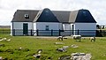
 'New' blackhouse at Vaul - geograph.org.uk - 4503663.jpg 3,264 × 2,448; 4.12 MB
-
 13thC Chapel at Kirkapol - geograph.org.uk - 4494546.jpg 3,264 × 2,448; 2.49 MB
-
 14thC Kirkapol Chapel - geograph.org.uk - 4494591.jpg 3,264 × 2,448; 3.91 MB
-
 A complicated road junction^ - geograph.org.uk - 5444788.jpg 1,600 × 900; 233 KB
-
 A Felt Roof House On Tiree - geograph.org.uk - 3980103.jpg 2,088 × 1,175; 1.02 MB
-
 A good drying day - geograph.org.uk - 4486985.jpg 4,000 × 2,000; 1.38 MB
-
 A house at Mannal - geograph.org.uk - 5442833.jpg 1,600 × 900; 164 KB
-
 A long straight road - geograph.org.uk - 4480597.jpg 4,320 × 3,240; 2.8 MB
-
 A misty day at Loch Bhasapoll - geograph.org.uk - 4501415.jpg 3,264 × 2,448; 4.5 MB
-
 A seat with a view - geograph.org.uk - 5442828.jpg 1,600 × 900; 254 KB
-
 A walk to Hynish, Tiree - geograph.org.uk - 6242911.jpg 1,600 × 1,346; 440 KB
-
 Across an azure sea - geograph.org.uk - 4480345.jpg 4,266 × 3,168; 1.83 MB
-
 Aeroplane above Traigh Bheag, Balephetrish - geograph.org.uk - 5467134.jpg 1,024 × 769; 98 KB
-
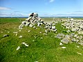
 Am Beannan Ruadh - geograph.org.uk - 5466780.jpg 1,024 × 768; 232 KB
-
 An Dùn, Balephetrish - geograph.org.uk - 5467023.jpg 1,024 × 768; 245 KB
-
 An Fhaodhail at Baugh - geograph.org.uk - 4499514.jpg 3,264 × 2,448; 4.74 MB
-
 An t-Àrd - geograph.org.uk - 4499501.jpg 3,264 × 2,448; 4.92 MB
-
 An Talla at Crossapol - geograph.org.uk - 4507917.jpg 3,264 × 2,448; 3.89 MB
-
 An Turas - geograph.org.uk - 3978203.jpg 3,015 × 2,000; 1.74 MB
-
 Approach to Scarinish - geograph.org.uk - 5442431.jpg 1,600 × 900; 340 KB
-
 Approaching Moss - geograph.org.uk - 5444622.jpg 1,600 × 900; 289 KB
-
 Approaching Sunnyville - geograph.org.uk - 5442402.jpg 1,600 × 900; 298 KB
-
 At Balevullin - geograph.org.uk - 5444612.jpg 1,600 × 900; 255 KB
-
 Balemartine - north end - geograph.org.uk - 4481695.jpg 4,000 × 3,000; 2.36 MB
-
 Balemartine from Soroby burial ground - geograph.org.uk - 4508301.jpg 3,264 × 2,448; 4.72 MB
-
 Balemartine, postbox № PA77 180 - geograph.org.uk - 4178299.jpg 478 × 640; 70 KB
-
 Balephetrish - geograph.org.uk - 5467143.jpg 1,024 × 768; 244 KB
-
 Balephetrish - geograph.org.uk - 5467154.jpg 1,024 × 768; 237 KB
-
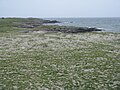
 Balephetrish beach - geograph.org.uk - 5441798.jpg 1,600 × 900; 190 KB
-
 Balephetrish Hill - geograph.org.uk - 5467160.jpg 1,024 × 768; 256 KB
-
 Balephetrish, postbox № PA77 140 - geograph.org.uk - 4178406.jpg 640 × 480; 73 KB
-
 Balephuil Bay - geograph.org.uk - 3978345.jpg 2,560 × 1,920; 1.94 MB
-
 Balephuil Bay and Beinn Ceann a' Mhara - geograph.org.uk - 5872316.jpg 1,024 × 751; 146 KB
-
 Balephuil Bay from Carnan Mor - geograph.org.uk - 2384121.jpg 2,816 × 2,112; 2.47 MB
-

-
 Balevullin, postbox № PA77 1 - geograph.org.uk - 4178364.jpg 480 × 640; 79 KB
-
 Balevullin, ripples in the sand - geograph.org.uk - 4131809.jpg 640 × 480; 48 KB
-
 Balevullin, the beach - geograph.org.uk - 4131765.jpg 640 × 480; 56 KB
-
 Beach at Sandaig - geograph.org.uk - 4499799.jpg 3,264 × 2,448; 4.7 MB
-
 Beach at Vaul - geograph.org.uk - 4491174.jpg 3,264 × 2,448; 4.55 MB
-
 Beach on north coast of Tiree - geograph.org.uk - 5466734.jpg 1,024 × 768; 223 KB
-
 Beinn Ceann a' Mhara - geograph.org.uk - 3978301.jpg 2,560 × 1,920; 2.52 MB
-
 Beinn Ghott - geograph.org.uk - 3968638.jpg 2,540 × 1,892; 1.62 MB
-
 Beinn Ghott, Tiree - geograph.org.uk - 5467439.jpg 1,024 × 768; 266 KB
-
 Beinn Hough Summit Rock - geograph.org.uk - 3978098.jpg 2,556 × 1,914; 2.64 MB
-

-
 Between two lochans - geograph.org.uk - 4487059.jpg 3,990 × 2,000; 1.83 MB
-
 Bird hide at Kilmoluaig - geograph.org.uk - 4501425.jpg 3,264 × 2,448; 3.88 MB
-
 Bird hide, by Loch a' Phuill - geograph.org.uk - 3964228.jpg 2,869 × 2,000; 2.1 MB
-
 Black house at Barrapol - geograph.org.uk - 4501529.jpg 3,264 × 2,448; 3.96 MB
-
 Black house chimney at Sandaig - geograph.org.uk - 4501205.jpg 2,448 × 3,264; 3.46 MB
-
 Black house roof at Sandaig - geograph.org.uk - 4501191.jpg 3,264 × 2,448; 4.95 MB
-
 Black houses at Sandaig - geograph.org.uk - 4501176.jpg 3,264 × 2,448; 4.16 MB
-
 Black houses at Sandaig - geograph.org.uk - 4501227.jpg 3,264 × 2,448; 4.22 MB
-
 Blackhouse at Millton - geograph.org.uk - 4498901.jpg 3,264 × 2,448; 4.2 MB
-
 Bladder campion above Traigh Bheag, Balephetrish - geograph.org.uk - 5467128.jpg 1,024 × 768; 268 KB
-
 Blow-out in the dunes - geograph.org.uk - 865860.jpg 640 × 480; 76 KB
-
 Blue Beyond art gallery - geograph.org.uk - 1974600.jpg 3,072 × 2,304; 2.92 MB
-
 Bog bean in Loch a' Mhuillin - geograph.org.uk - 4496505.jpg 3,264 × 2,448; 4.42 MB
-
 Bog Pimpernel (Anagallis tenella) near Dun Mor - geograph.org.uk - 5466499.jpg 766 × 1,024; 316 KB
-
 Boggy land east of Loch Aulaig - geograph.org.uk - 5466997.jpg 1,024 × 768; 239 KB
-
 Bridge at Baugh - geograph.org.uk - 4499509.jpg 3,264 × 2,448; 4.61 MB
-
 Bridge over An Fhaodhail - geograph.org.uk - 4499523.jpg 3,264 × 2,448; 4.42 MB
-
 Bridge south of Loch Aulaig - geograph.org.uk - 5467000.jpg 1,024 × 768; 253 KB
-
 Brock, towards Gott Bay - geograph.org.uk - 4484303.jpg 3,897 × 2,000; 974 KB
-
 Burn near Creagan Mora, Tiree - geograph.org.uk - 3657978.jpg 640 × 480; 71 KB
-
 Caibeal Chirceaboil-Kirkapol Chapel - geograph.org.uk - 4494564.jpg 2,448 × 3,264; 5.72 MB
-
 CalMac ferry terminal at Tiree - geograph.org.uk - 4498014.jpg 3,264 × 2,448; 3.2 MB
-
 Camp remains behind Tràigh Bhàgh - geograph.org.uk - 4499420.jpg 3,264 × 2,448; 4.93 MB
-
 Caolas, postbox № PA77 121 - geograph.org.uk - 4178436.jpg 640 × 480; 94 KB
-
 Caolas, the telephone box - geograph.org.uk - 4178442.jpg 640 × 481; 63 KB
-
 Carnan - geograph.org.uk - 4491139.jpg 3,264 × 2,448; 4.28 MB
-
 Carnan Mor - geograph.org.uk - 3978280.jpg 2,560 × 1,920; 1.55 MB
-
 Carved cross, St Patrick's Chapel - geograph.org.uk - 4485763.jpg 3,000 × 4,000; 2.78 MB
-
 Cattle by Tiree airfield - geograph.org.uk - 4499456.jpg 3,264 × 2,448; 4.46 MB
-
 Cattle grazing, by Balephuil - geograph.org.uk - 3964389.jpg 3,062 × 1,900; 2.04 MB
-
 Cattle grid at Kilkenneth - geograph.org.uk - 4501159.jpg 3,264 × 2,448; 4.56 MB
-
 Cattle grid on the B8068 - geograph.org.uk - 4493632.jpg 3,264 × 2,448; 3.39 MB
-
 Cattle holding pen and An Turas - geograph.org.uk - 4498025.jpg 3,264 × 2,448; 4.15 MB
-
 Cattle near the shore - geograph.org.uk - 4482689.jpg 4,000 × 3,000; 2.33 MB
-
 Ceann a' Mhara - geograph.org.uk - 3978325.jpg 2,560 × 1,920; 2.69 MB
-
 Chimney and thatch at Barrapol - geograph.org.uk - 4501516.jpg 3,264 × 2,448; 3.43 MB
-
 Chraiginis peninsula - geograph.org.uk - 1458868.jpg 640 × 480; 71 KB
-
 Church of Scotland at Heylipol - geograph.org.uk - 4501392.jpg 3,264 × 2,448; 3.85 MB
-
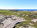
 Cladach a' Chrogain - geograph.org.uk - 3981100.jpg 3,300 × 1,954; 2.15 MB
-
 Cladh Sorobaidh, Tiree - geograph.org.uk - 4178315.jpg 4,320 × 3,240; 3.34 MB
-
 Cliff top view. - geograph.org.uk - 1472165.jpg 640 × 448; 97 KB
-
 Cloaked Urn at Cladh Sorobaidh - geograph.org.uk - 4491188.jpg 2,448 × 3,264; 4.03 MB
-
 Cnoc Ruaidh in empty landscape - geograph.org.uk - 5467431.jpg 1,024 × 768; 284 KB
-
 Coal Store at Hynish - geograph.org.uk - 4508030.jpg 3,264 × 2,448; 3.04 MB
-
 Coast at Port Fada - geograph.org.uk - 866394.jpg 640 × 480; 83 KB
-
 Coast at Port Fada - geograph.org.uk - 866595.jpg 640 × 480; 100 KB
-
 Coast walk at Carrastaoin - geograph.org.uk - 4480588.jpg 4,320 × 3,240; 3.39 MB
-
 Coastal colour below Ben Hynish - geograph.org.uk - 865831.jpg 640 × 474; 106 KB
-
 Coastal scene at Urvaig - geograph.org.uk - 4482936.jpg 4,000 × 3,000; 2.52 MB
-
 Coastline at Ceann a' Mhara - geograph.org.uk - 4485768.jpg 4,000 × 2,313; 2.03 MB
-
 Coastline at Dunbeg - geograph.org.uk - 4482948.jpg 4,000 × 3,000; 2.24 MB
-
 Coastline at Saltaig - geograph.org.uk - 4487044.jpg 4,000 × 3,000; 2.81 MB
-
 Coastline at Urvaig - geograph.org.uk - 4482706.jpg 4,000 × 3,000; 2.26 MB
-
 Coastline east of Milton - geograph.org.uk - 4480920.jpg 4,320 × 3,240; 3.19 MB
-
 Coastline near Aird - geograph.org.uk - 4480905.jpg 4,234 × 3,122; 2.82 MB
-
 Coastline near Port Mor - geograph.org.uk - 4480934.jpg 4,320 × 2,160; 2.16 MB
-
 Coll-View 1891 - geograph.org.uk - 4499152.jpg 3,264 × 2,448; 4.15 MB
-
 Commonwealth War Graves at Kirkapol - geograph.org.uk - 4494731.jpg 3,264 × 2,448; 4.97 MB
-
 Commonwealth war graves, Balemartine cemetery - geograph.org.uk - 4485959.jpg 4,000 × 3,000; 2.37 MB
-
 Conslum Island - geograph.org.uk - 1440075.jpg 640 × 480; 61 KB
-
 Contented cattle at Kilkenneth - geograph.org.uk - 4482645.jpg 4,000 × 2,000; 1.52 MB
-
 Cornaig, red telephone box - geograph.org.uk - 4178369.jpg 640 × 480; 95 KB
-
 Cornaigbeg - geograph.org.uk - 4484259.jpg 4,000 × 3,000; 1.98 MB
-
 Cornaigbeg, postbox № PA77 153 - geograph.org.uk - 4178380.jpg 480 × 640; 79 KB
-
 Cornaigmore High School - geograph.org.uk - 4501474.jpg 3,264 × 2,448; 4.01 MB
-
 Cottage at Balevullin - geograph.org.uk - 4480436.jpg 4,320 × 2,160; 1.92 MB
-
 Cottage at Barrapol - geograph.org.uk - 1459819.jpg 640 × 480; 108 KB
-
 Cottage at Milton - geograph.org.uk - 4480917.jpg 4,309 × 2,160; 1.52 MB
-
 Cottages at Brock - geograph.org.uk - 4484273.jpg 4,000 × 2,000; 1.11 MB
-
 Croft at Dun Beag - geograph.org.uk - 5466261.jpg 1,024 × 768; 175 KB
-
 Croft house at Kilkenneth - geograph.org.uk - 4480416.jpg 4,309 × 2,545; 1.67 MB
-
 Croft near Dun Beag - geograph.org.uk - 5466271.jpg 1,024 × 768; 244 KB
-
 Croftland at Caolas - geograph.org.uk - 4482968.jpg 4,000 × 2,000; 1.3 MB
-
 Crossapol Burn - geograph.org.uk - 4501540.jpg 3,264 × 2,448; 4.24 MB
-
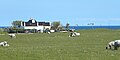
 Crossapol Farm - geograph.org.uk - 4487097.jpg 4,000 × 3,000; 2.59 MB
-
 Crossapol Farm and the B8065 - geograph.org.uk - 4501558.jpg 3,264 × 2,448; 3.91 MB
-

-
 Curious cattle at Caolas - geograph.org.uk - 4482962.jpg 3,788 × 2,183; 1.56 MB
-
 Deobeda, Scarinish, Tiree - geograph.org.uk - 5465775.jpg 1,024 × 768; 345 KB
-
 Departure from Tiree - geograph.org.uk - 4457807.jpg 750 × 500; 462 KB
-
 Dr Alexander Buchanan monument, Baugh, Tiree - geograph.org.uk - 3531946.jpg 4,320 × 3,240; 3.36 MB
-
 Drain with Irises and Kingcups - geograph.org.uk - 4501446.jpg 3,264 × 2,448; 4.98 MB
-
 Drainage ditch near Miodar - geograph.org.uk - 4482697.jpg 3,000 × 4,000; 2.81 MB
-
 Draining the moorland - geograph.org.uk - 5444793.jpg 1,600 × 900; 441 KB
-
 Dry dock at Hynish, Tiree - geograph.org.uk - 4068856.jpg 4,320 × 3,240; 4.47 MB
-
 Dry stone wall in rocky and rough moorland - geograph.org.uk - 4493641.jpg 3,264 × 2,448; 3.79 MB
-
 Dun Beag (Fort) - geograph.org.uk - 5466265.jpg 1,024 × 768; 305 KB
-
 Dun Mor broch - geograph.org.uk - 4487017.jpg 3,936 × 2,914; 2.3 MB
-
 Dun Mor broch - geograph.org.uk - 4487021.jpg 3,000 × 4,000; 2.45 MB
-
 Dun Mor Broch, Tiree - geograph.org.uk - 5466474.jpg 1,024 × 768; 355 KB
-
 Dun Mor Broch, Tiree - geograph.org.uk - 5466480.jpg 1,024 × 768; 299 KB
-
 Dun Mor Broch, Tiree - geograph.org.uk - 5466490.jpg 1,024 × 768; 309 KB
-
 Dun Mor from south-east - geograph.org.uk - 5466466.jpg 1,024 × 768; 213 KB
-
 Dun Mor from south-west - geograph.org.uk - 5466597.jpg 1,024 × 768; 246 KB
-
 Dune digger at rest - geograph.org.uk - 4480565.jpg 4,320 × 3,240; 3.04 MB
-
 Dunfoot ^ Park House, Balephetrish - geograph.org.uk - 5467406.jpg 1,024 × 768; 192 KB
-
 Dutchman’s Cap, a view from Tiree - geograph.org.uk - 4207971.jpg 640 × 480; 57 KB
-
 Dùn Mòr a' Chaolais - geograph.org.uk - 3968622.jpg 2,560 × 1,920; 2.88 MB
-
 Dùn Mòr a' Chaolais, Milton, Tiree - geograph.org.uk - 3659488.jpg 640 × 480; 41 KB
-
 Dùn Mòr Broch - geograph.org.uk - 4503465.jpg 3,264 × 2,448; 5.29 MB
-
 Dùn Mòr broch - geograph.org.uk - 4503528.jpg 3,264 × 2,448; 4.33 MB
-
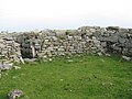
 Dùn Mòr broch - the way out - geograph.org.uk - 4503534.jpg 3,264 × 2,448; 5.02 MB
-
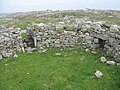 Dùn Mòr broch entrance - geograph.org.uk - 4503476.jpg 3,264 × 2,448; 5.4 MB
-
 Dùn Mòr broch entrance - geograph.org.uk - 4503506.jpg 3,264 × 2,448; 5.11 MB
-
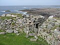
 Dùn Mòr Broch from the outside - geograph.org.uk - 4503518.jpg 3,264 × 2,448; 3.57 MB
-
 Dùn Mòr broch guard chamber - geograph.org.uk - 4503541.jpg 3,264 × 2,448; 4.85 MB
-
 Dùn Mòr broch security - geograph.org.uk - 4503610.jpg 3,264 × 2,448; 5.72 MB
-
 Dùn Mòr-Dun Mor information - geograph.org.uk - 4503376.jpg 2,582 × 2,284; 2.22 MB
-
 Edge of farmland at Ruaig - geograph.org.uk - 1461248.jpg 640 × 480; 92 KB
-
 Eilean Ghreasamuill - geograph.org.uk - 4501146.jpg 3,264 × 2,448; 3.35 MB
-
 Eilean nan Siolag - geograph.org.uk - 4499496.jpg 3,264 × 2,448; 4.86 MB
-
 Electricity supply line - geograph.org.uk - 4501589.jpg 3,264 × 2,448; 3.38 MB
-
 End of the tarmac - geograph.org.uk - 4480554.jpg 4,320 × 3,240; 3.6 MB
-
 Evening light on the beach - geograph.org.uk - 4482637.jpg 4,000 × 2,387; 1.83 MB
-
 Farm at Barrapol - geograph.org.uk - 4501613.jpg 3,264 × 2,448; 4.19 MB
-
 Farm at The Reef - geograph.org.uk - 4499776.jpg 3,264 × 2,448; 3.99 MB
-
 Farm at Vaul - geograph.org.uk - 4503354.jpg 3,264 × 2,448; 3.96 MB
-
 Farm buildings - geograph.org.uk - 5441792.jpg 1,600 × 900; 300 KB
-
 Farm buildings at Middleton - geograph.org.uk - 1459800.jpg 640 × 480; 103 KB
-
 Farm entrance road - geograph.org.uk - 5444229.jpg 1,600 × 900; 296 KB
-
 Farm track near Barrapol - geograph.org.uk - 5444232.jpg 1,600 × 900; 344 KB
-
 Fence across Loch Dearg - geograph.org.uk - 4499141.jpg 3,264 × 2,448; 5 MB
-
-
 Ferry at Scarinish Pier, Tiree - geograph.org.uk - 5465768.jpg 1,024 × 769; 232 KB
-
 Ferry Terminal at Scarinish - geograph.org.uk - 4498009.jpg 3,264 × 2,448; 3.5 MB
-
 Ferry Terminal at Scarinish - geograph.org.uk - 4498020.jpg 3,264 × 2,448; 3.3 MB
-
 Ferry terminal Tiree - geograph.org.uk - 3243431.jpg 2,421 × 1,713; 857 KB
-
 Field with en suite bath at Kilkenneth - geograph.org.uk - 4501163.jpg 3,264 × 2,448; 4.37 MB
-
 Flotsam or Jetsam, Tiree - geograph.org.uk - 5466606.jpg 1,024 × 768; 222 KB
-
 Flower-rich meadow at Gott - geograph.org.uk - 5467456.jpg 1,024 × 769; 396 KB
-
 Follow The Fence Towards Tràigh man Gilean - geograph.org.uk - 3978375.jpg 2,560 × 1,920; 2.67 MB
-
 Former lighthouse keepers cottages - geograph.org.uk - 4481666.jpg 4,000 × 2,000; 1.3 MB
-
 Foundations behind Tràigh Bhàgh - geograph.org.uk - 4499445.jpg 3,264 × 2,448; 5.22 MB
-
 From Crossapol to Scarinish - geograph.org.uk - 5445150.jpg 1,600 × 900; 377 KB
-
 From the Reef to Ruaig - geograph.org.uk - 5442678.jpg 1,600 × 900; 272 KB
-
 Gate leading to grazing land - geograph.org.uk - 5155125.jpg 3,264 × 2,448; 4.08 MB
-
 Gate to nowhere - geograph.org.uk - 849441.jpg 640 × 480; 59 KB
-
 Gateway to beach - geograph.org.uk - 1467145.jpg 640 × 480; 71 KB
-
 Glebe House at Scarinish - geograph.org.uk - 4493916.jpg 3,264 × 2,448; 4.44 MB
-
 Good cycling road^ - geograph.org.uk - 866893.jpg 640 × 480; 76 KB
-
 Gott Bay and Traigh Mhor - geograph.org.uk - 4484309.jpg 4,000 × 3,000; 2.05 MB
-
 Gott Bay from Beinn Ghott - geograph.org.uk - 5872289.jpg 1,024 × 720; 197 KB
-
 Gott post box - geograph.org.uk - 4487091.jpg 3,000 × 3,052; 1.73 MB
-
 Gott, postbox № PA77 137 - geograph.org.uk - 4178411.jpg 640 × 480; 81 KB
-
 Grass On Tiree - geograph.org.uk - 3988771.jpg 2,464 × 1,784; 1.52 MB
-
 Grassland below Beinn Hough - geograph.org.uk - 4480409.jpg 4,320 × 2,482; 1.93 MB
-
 Grassland near The Ringing Stone - geograph.org.uk - 5466988.jpg 1,024 × 768; 236 KB
-
 Graves at Soroby - geograph.org.uk - 4508293.jpg 3,264 × 2,448; 4.47 MB
-
 Gravestone, Kirkapol - geograph.org.uk - 4458224.jpg 500 × 750; 555 KB
-
 Gravestones old and new - geograph.org.uk - 4491119.jpg 3,264 × 2,448; 5.11 MB
-
 Graveyard at Kirkapol dedicated to St Oran - geograph.org.uk - 4494711.jpg 3,264 × 2,448; 4.53 MB
-
 Graveyard, Kirkapol - geograph.org.uk - 4462967.jpg 750 × 552; 599 KB
-
 Grazing at Kilkenneth - geograph.org.uk - 5444606.jpg 1,600 × 900; 205 KB


_near_Dun_Mor_-_geograph.org.uk_-_5466499.jpg)


_-_geograph.org.uk_-_5466265.jpg)


&filefrom=Grazing+land+at+Miodar+-+geograph.org.uk+-+4496388.jpg#mw-category-media)