Category:Tilted strata in the United Kingdom
Jump to navigation
Jump to search
Countries of Europe: Albania · Austria · Azerbaijan‡ · Belgium · Bulgaria · Croatia · Czech Republic · Denmark · Finland · France‡ · Georgia‡ · Germany · Greece · Hungary · Iceland · Italy · Montenegro · Norway · Poland · Portugal‡ · Romania · Russia‡ · Spain‡ · Sweden · Switzerland · United Kingdom
Specific status: Faroe Islands · Svalbard – Limited recognition: Kosovo
‡: partly located in Europe
Specific status: Faroe Islands · Svalbard – Limited recognition: Kosovo
‡: partly located in Europe
Subcategories
This category has the following 8 subcategories, out of 8 total.
Media in category "Tilted strata in the United Kingdom"
The following 120 files are in this category, out of 120 total.
-

-
 2010-11-16-Arish mell flowers barrow geol 1.JPG 967 × 263; 40 KB
-
 2010-11-16-Worbarrow geol jpg 1.JPG 967 × 263; 39 KB
-
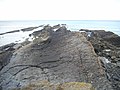
 A suite of falls - geograph.org.uk - 790898.jpg 480 × 640; 122 KB
-

-
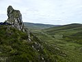
 A' Cheir Ghorm - geograph.org.uk - 14084.jpg 640 × 427; 67 KB
-
 Across Threlkeld to central Lakeland (6851835784).jpg 2,195 × 1,234; 863 KB
-
 Bermuda (UK) image number 235 view from bluff looking at Horseshoe Bay beach.jpg 2,001 × 1,218; 413 KB
-
 Bird Rock (Craig-y-Deryn) in Dysynni Valley (6802249457).jpg 1,600 × 1,200; 255 KB
-
 Black Cove - geograph.org.uk - 8700.jpg 640 × 480; 97 KB
-
 Bowfell's Great Slab (7088464943).jpg 2,610 × 1,468; 1.45 MB
-
 Brandungshöhle bei St. Davids, Pembrokeshire.jpg 2,448 × 3,264; 3.5 MB
-
 Brandungsplattform vor Aberystwyth.jpg 3,264 × 2,448; 3.44 MB
-
 Brass Point (Seven Sister) - geograph.org.uk - 1272964.jpg 640 × 480; 106 KB
-
 Bristol MMB R5 Avon Gorge.jpg 1,728 × 2,304; 1.6 MB
-
 Bristol MMB R6 Avon Gorge.jpg 2,304 × 1,728; 1.15 MB
-
 Carnedd y Filiast's Atlantic Cliff - geograph.org.uk - 219467.jpg 640 × 480; 94 KB
-
 Cave and cliffs, Ramsey Island - geograph.org.uk - 1501354.jpg 640 × 480; 125 KB
-
 Cave at Tràigh na h-Uamhag - geograph.org.uk - 822127.jpg 640 × 427; 274 KB
-
 Cliff Face East Quantoxhead - geograph.org.uk - 1003272.jpg 640 × 428; 116 KB
-
 Cliffs at Combe Martin - geograph.org.uk - 191016.jpg 640 × 426; 137 KB
-
 Cliffs at Porth Clais - geograph.org.uk - 479405.jpg 640 × 480; 126 KB
-
 Cliffs south of Fleswick - geograph.org.uk - 1195846.jpg 640 × 480; 77 KB
-
 Closeup of Gosker Rock - geograph.org.uk - 481544.jpg 640 × 480; 131 KB
-
 Cornakey Cliff - geograph.org.uk - 1567943.jpg 640 × 480; 72 KB
-
 Cornakey Cliff - geograph.org.uk - 1567945.jpg 480 × 640; 87 KB
-
 Detail mit Schiefer am Strand von Newport, Pembrokeshire.jpg 3,264 × 2,448; 3.65 MB
-
 Devil's Bridge - geograph.org.uk - 1420112.jpg 640 × 480; 95 KB
-
 Devonian Morte Slates - geograph.org.uk - 1327073.jpg 640 × 480; 126 KB
-
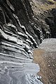
 Eroding bedding planes - geograph.org.uk - 814768.jpg 640 × 480; 95 KB
-
 Flute Casts - geograph.org.uk - 1383302.jpg 640 × 427; 276 KB
-
 Flute Casts in Cumbria - geograph 3239200.jpg 530 × 800; 118 KB
-
 Folded strata below Allt Wen - geograph.org.uk - 1750035.jpg 768 × 1,024; 538 KB
-
 Folded strata below Allt Wen - geograph.org.uk - 1750056.jpg 768 × 1,024; 454 KB
-
 Gosker Rock, Tenby - geograph.org.uk - 1016062.jpg 640 × 480; 47 KB
-
 Gypsum bands in marl escarpment - geograph.org.uk - 641319.jpg 640 × 435; 157 KB
-
 Gypsy point - geograph.org.uk - 343732.jpg 512 × 640; 220 KB
-
 Hanging valley and tilted strata - geograph.org.uk - 757261.jpg 480 × 640; 154 KB
-
-
 Inclined (25058359457).jpg 3,648 × 5,472; 4.91 MB
-
 Inclined igneous rock beds - geograph.org.uk - 95888.jpg 640 × 466; 115 KB
-
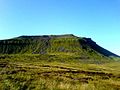
 Ingleborough - geograph.org.uk - 631729.jpg 640 × 429; 71 KB
-
 Ingleborough - geograph.org.uk - 631731.jpg 640 × 429; 86 KB
-
 Ingleborough - geograph.org.uk - 636379.jpg 597 × 400; 90 KB
-
 Ingleborough whole.JPG 640 × 480; 90 KB
-
 Kent East Sussex Downs.svg 625 × 312; 27 KB
-
 Kilve Beach Rock Formation - geograph.org.uk - 229528.jpg 640 × 480; 113 KB
-
 Kliff südlich von St. Davids mit steilen Schichten und Old Red Sandstone.jpg 1,536 × 2,048; 1.95 MB
-
 Logie Head - geograph.org.uk - 967108.jpg 640 × 416; 243 KB
-
 Looking over Loch Eishort (8016226661).jpg 4,752 × 3,168; 8.6 MB
-
 Lower Devonian sandstone & conglomerate Bealach Ard.JPG 3,648 × 2,736; 3.98 MB
-

-
 Muckle Rock - geograph.org.uk - 593932.jpg 640 × 235; 122 KB
-

-
 Near-vertical Rock Strata in Aberystwyth in Wales - geograph 4046963.jpg 1,024 × 768; 1.07 MB
-
 Near-vertical Rock Strata in Aberystwyth in Wales - geograph 4046977.jpg 1,024 × 768; 1.51 MB
-
 Outcrop - geograph.org.uk - 241982.jpg 640 × 480; 142 KB
-
 Pondfield cove cliffs dorset.jpg 2,816 × 2,112; 1.35 MB
-
 Port Logan rocks - geograph.org.uk - 1725964.jpg 640 × 480; 355 KB
-
 Ripple Marks in Cliff - Atlantic Slab - in Snowdonia in Wales - geograph 4470743.jpg 2,288 × 1,712; 857 KB
-
 Ripple-marked bedding - geograph.org.uk - 1356723.jpg 480 × 640; 93 KB
-
 Rock formation ,Cullernose - geograph.org.uk - 776287.jpg 640 × 480; 85 KB
-
 Rock Pool - geograph.org.uk - 224028.jpg 405 × 640; 286 KB
-
 Rock strata at Aberystwyth - geograph.org.uk - 744854.jpg 427 × 640; 115 KB
-
 Rock Strata near Aird - geograph.org.uk - 1274517.jpg 640 × 404; 260 KB
-
 Rock strata on Mouthmill Beach - geograph.org.uk - 420633.jpg 640 × 426; 123 KB
-

-
 Rocks at Blackaterry Point - geograph.org.uk - 886767.jpg 640 × 480; 97 KB
-
 Rocks at Hartland point.JPG 2,272 × 1,704; 872 KB
-
 Rocks near Lulworth Cove.JPG 1,668 × 2,077; 936 KB
-
 Rocks near The Delvers (2) - geograph.org.uk - 1513087.jpg 480 × 640; 84 KB
-
 Rocks near The Delvers - geograph.org.uk - 1513076.jpg 640 × 480; 103 KB
-
 Rocks on foreshore north of Wareham Point - geograph.org.uk - 309504.jpg 492 × 640; 127 KB
-
 Rocky coastline west of Pettico Wick - geograph.org.uk - 1078699.jpg 640 × 480; 79 KB
-
 Schiefer am Strand von Newport, Pembrokeshire.jpg 3,264 × 2,448; 3.44 MB
-
 Scord Quarry, Scalloway, Shetland - geograph.org.uk - 226223.jpg 640 × 480; 64 KB
-
 Scors of Blackwater - geograph.org.uk - 890046.jpg 640 × 480; 63 KB
-

-
 Silurian Proximal Turbidites New Quay Wales 22024839.jpg 1,600 × 1,200; 461 KB
-
 Silurian Proximal Turbidites New Quay Wales 22024869.jpg 1,600 × 1,200; 566 KB
-
 Slipped stone, Southwell Landslip - geograph.org.uk - 1030802.jpg 480 × 640; 107 KB
-
 Sloping rock face, Maer Cliff - geograph.org.uk - 411049.jpg 640 × 480; 220 KB
-

-
 St. David's Lifeboat Station, Old Red Sandstone.jpg 3,264 × 2,448; 3.64 MB
-
 Stair hole, Southern England.jpg 2,048 × 1,536; 275 KB
-
 Steil aufragende Schichten zwischen Porthclais Harbour und Porthlysgi Bay.jpg 2,048 × 1,536; 1.53 MB
-
 Steilküste bei Newport, Pembrokeshire, Wales.jpg 3,264 × 2,448; 3.66 MB
-
 Strand vor Tenby.jpg 3,264 × 2,448; 2.99 MB
-

-
 Tenby - Blick vom Castle Hill hinunter zum Castle Beach.jpg 2,048 × 1,536; 1.75 MB
-
 Tiefblick am Pembrokeshire Coast Path bei Fishguard.jpg 1,536 × 2,048; 1.88 MB
-
 Tiefblick an der St. Non's Bay.jpg 2,048 × 1,536; 1.85 MB
-

-
 Tilted Rock Layers - Ingleborough.jpg 2,560 × 1,920; 2.15 MB
-
 Tilted rock strata - geograph.org.uk - 744848.jpg 640 × 427; 94 KB
-
 Tilted strata - geograph.org.uk - 1612787.jpg 640 × 480; 96 KB
-
 Tilted Strata - geograph.org.uk - 224045.jpg 448 × 640; 270 KB
-
 Tilted strata - geograph.org.uk - 665605.jpg 480 × 640; 119 KB
-
-
 Tilted strata in the cliffs at Henborth - geograph.org.uk - 1443588.jpg 640 × 480; 102 KB
-
 Tilted strata near Friar's Point - geograph.org.uk - 982050.jpg 640 × 480; 80 KB
-
 Timley Knott - Dent Group mudstones.jpg 3,648 × 2,736; 2.67 MB
-
 Torridonian Sandstone - geograph.org.uk - 831693.jpg 640 × 404; 240 KB
-
 Trewent Point - geograph.org.uk - 1567377.jpg 640 × 421; 73 KB
-
 Triassic Sedimentary Strata Somerset 1.jpg 2,272 × 1,704; 1.35 MB
-
 Trwyn Grupyl - geograph.org.uk - 1259132.jpg 640 × 480; 100 KB
-
 Uamh nan Lasgairean - geograph.org.uk - 761482.jpg 480 × 640; 113 KB
-
 Uriconian Volcanics.jpg 2,048 × 1,536; 962 KB
-
 Vallisvale.jpg 640 × 432; 194 KB
-
 Vertical strata - geograph.org.uk - 1129262.jpg 640 × 640; 364 KB
-
 View from the clifftop - panoramio.jpg 2,375 × 3,191; 3.17 MB
-
 View north from Henna Cliff in Cornwall in England.jpg 1,306 × 979; 164 KB
-
 Vorgelagerter Felsen bei Newport, Pembrokeshire.jpg 3,264 × 2,448; 3.49 MB
-
 Waterloo - geograph.org.uk - 454845.jpg 640 × 490; 142 KB
-
 Wave-cut platform below Allt Wen - geograph.org.uk - 1751658.jpg 768 × 1,024; 474 KB
-
 Wave-cut platform below Allt Wen - geograph.org.uk - 1751689.jpg 1,024 × 768; 372 KB
-
 West of Chilton Chine - geograph.org.uk - 1378519.jpg 640 × 426; 206 KB
-
 Worbarrow and Gad Cliff - geograph.org.uk - 135609.jpg 640 × 398; 59 KB
-
 Worbarrow and Gad Cliff - geograph.org.uk - 135622.jpg 640 × 404; 50 KB
-
 Rock Strata - geograph.org.uk - 420447.jpg 600 × 450; 112 KB


.jpg)
_image_number_235_view_from_bluff_looking_at_Horseshoe_Bay_beach.jpg)
_in_Dysynni_Valley_(6802249457).jpg)

.jpg)


_-_geograph.org.uk_-_1272964.jpg)


.jpg)


.jpg)


_-_geograph.org.uk_-_1513087.jpg)


_Limestone,_Dudley,_Worcestershire_-_geograph.org.uk_-_636763.jpg)


