Category:Tilmanstone
Jump to navigation
Jump to search
English: Category:Villages in Kent
village in United Kingdom  | |||||
| Upload media | |||||
| Instance of | |||||
|---|---|---|---|---|---|
| Location | Dover, Kent, South East England, England | ||||
 | |||||
Subcategories
This category has the following 4 subcategories, out of 4 total.
Media in category "Tilmanstone"
The following 200 files are in this category, out of 221 total.
(previous page) (next page)-
 A bridge over the A256, Tilmanstone - geograph.org.uk - 1214698.jpg 640 × 480; 127 KB
-
 A field of beans - geograph.org.uk - 4024427.jpg 640 × 480; 144 KB
-
-
 A riot of spring blossom - geograph.org.uk - 4521391.jpg 3,264 × 2,448; 3.92 MB
-

-
 Arm of Poutty Wood from footpath - geograph.org.uk - 1590759.jpg 640 × 480; 172 KB
-
 Bluebells in Nine Acre Wood - geograph.org.uk - 1306692.jpg 640 × 480; 353 KB
-
 Bridge over the A256 at Tilmanstone - geograph.org.uk - 1214721.jpg 640 × 480; 164 KB
-
 Bridle gate near Thornton Wood - geograph.org.uk - 2220624.jpg 3,072 × 2,304; 1.99 MB
-
 Bridleway and footpath junction near Malmains Farm - geograph.org.uk - 2428361.jpg 3,072 × 2,304; 2.49 MB
-

-
 Bridleway junction beside the A256 Dover Road - geograph.org.uk - 2220536.jpg 3,072 × 2,304; 2.18 MB
-
 Bridleway junction near Lower Longlands Wood - geograph.org.uk - 2220078.jpg 3,072 × 2,304; 3.19 MB
-
 Bridleway near Thornton Wood - geograph.org.uk - 2594786.jpg 640 × 480; 175 KB
-
 Bridleway running through Thornton Farm - geograph.org.uk - 2594833.jpg 640 × 480; 176 KB
-
 Bridleway through Nightingale Woods - geograph.org.uk - 2594592.jpg 640 × 480; 274 KB
-
 Bridleway through Thornton Farm - geograph.org.uk - 2594827.jpg 640 × 480; 159 KB
-
 Bridleway through woods near Tilmanstone - geograph.org.uk - 2594579.jpg 640 × 480; 240 KB
-
 Bridleway to Barville Road - geograph.org.uk - 2219953.jpg 3,072 × 2,304; 2.8 MB
-
 Bridleway to Beeches Farm - geograph.org.uk - 2219933.jpg 3,072 × 2,304; 1.89 MB
-
 Bridleway to Betteshanger (2) - geograph.org.uk - 2220539.jpg 3,072 × 2,304; 3.62 MB
-
 Bridleway to Dane Court - geograph.org.uk - 2220630.jpg 3,072 × 2,304; 2.46 MB
-
 Bridleway to North Court - geograph.org.uk - 2594561.jpg 640 × 480; 168 KB
-
 Bridleway to Pike Road - geograph.org.uk - 2219970.jpg 3,072 × 2,304; 2.87 MB
-
 Bridleway to School Road, Tilmanstone - geograph.org.uk - 2594575.jpg 640 × 480; 269 KB
-
 Bridleway to Telegraph Farm - geograph.org.uk - 2220069.jpg 3,072 × 2,304; 2.54 MB
-
 Bridleway to Thornton Farm - geograph.org.uk - 2220618.jpg 3,072 × 2,304; 2.06 MB
-
 Bridleway to Tilmanstone - geograph.org.uk - 2220538.jpg 3,072 × 2,304; 2.3 MB
-
 Bridleway towards Venson Bottom - geograph.org.uk - 2594565.jpg 640 × 480; 173 KB
-
 Byway to Elvington - geograph.org.uk - 2220808.jpg 2,304 × 3,072; 2.89 MB
-
 Choice of footpaths, Tilmanstone - geograph.org.uk - 1214714.jpg 640 × 480; 175 KB
-
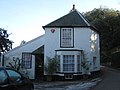
 Church House,Tilmanstone - geograph.org.uk - 2220046.jpg 3,072 × 2,304; 2.39 MB
-
 Churchyard of All Saints, Waldershare - geograph.org.uk - 6243722.jpg 3,776 × 2,520; 4.09 MB
-
 Commemorative sign for Miss Mary Hornsby - geograph.org.uk - 1597663.jpg 480 × 640; 147 KB
-
 Cropland at Beeches Farm - geograph.org.uk - 1970175.jpg 1,024 × 768; 267 KB
-
 Dane Court Lodge on School Road - geograph.org.uk - 2594612.jpg 640 × 480; 204 KB
-
 Dane Court Lodge, School Road - geograph.org.uk - 4521483.jpg 3,264 × 2,448; 3.24 MB
-
 Danefield House - geograph.org.uk - 4781899.jpg 3,264 × 2,448; 3.12 MB
-
 Danefield House, St Mary’s Grove - geograph.org.uk - 4781894.jpg 3,264 × 2,448; 3.91 MB
-
 Danefield House, St Mary’s Grove - geograph.org.uk - 4801505.jpg 3,264 × 2,448; 2.58 MB
-
 Danefield House, St Mary’s Grove - interior - geograph.org.uk - 5630024.jpg 2,448 × 3,264; 2.63 MB
-
 Danefield House, St Mary’s Grove - interior - geograph.org.uk - 5630032.jpg 2,448 × 3,264; 1.87 MB
-
 Danefield House, St Mary’s Grove – entrance to the interior - geograph.org.uk - 5630981.jpg 3,264 × 2,448; 2.65 MB
-
 Danefield House, St Mary’s Grove – from the front - geograph.org.uk - 5630992.jpg 3,264 × 2,448; 3.95 MB
-
 Dead end track, Waldershare - geograph.org.uk - 1597661.jpg 640 × 480; 168 KB
-
 Detail on village hall. - geograph.org.uk - 303720.jpg 609 × 456; 218 KB
-
 Eastling Down Farm Cottages - geograph.org.uk - 2143381.jpg 3,072 × 2,304; 2.02 MB
-

-
 Events at Barville Farm - geograph.org.uk - 1526990.jpg 640 × 480; 129 KB
-
 Farm road in Waldershare Park - geograph.org.uk - 2143222.jpg 3,072 × 2,304; 2.09 MB
-

-
 Farm track at Barville Farm - geograph.org.uk - 1526999.jpg 640 × 480; 120 KB
-
 Farm track through Thornton Farm - geograph.org.uk - 2594812.jpg 640 × 480; 223 KB
-
 Field boundary with Betteshanger woods - geograph.org.uk - 1306619.jpg 640 × 480; 169 KB
-

-
 Field of teasels near Thornton Farm - geograph.org.uk - 2594800.jpg 640 × 480; 178 KB
-
 Footpath in Craythorne Firs - geograph.org.uk - 2219994.jpg 2,304 × 3,072; 4.09 MB
-
 Footpath junction near All Saints Church - geograph.org.uk - 2143251.jpg 3,072 × 2,304; 1.86 MB
-
 Footpath junction near Tilmanstone - geograph.org.uk - 2220016.jpg 3,072 × 2,304; 3.85 MB
-
 Footpath running past Home Farm - geograph.org.uk - 4521381.jpg 3,264 × 2,448; 2.87 MB
-
 Footpath to Church Whitfield Road - geograph.org.uk - 2144022.jpg 2,304 × 3,072; 2.65 MB
-
 Footpath to Craythorne Firs - geograph.org.uk - 2219975.jpg 3,072 × 2,304; 1.97 MB
-
 Footpath to Craythorne Firs - geograph.org.uk - 2220010.jpg 3,072 × 2,304; 2.42 MB
-
 Footpath to Dane Court - geograph.org.uk - 2219982.jpg 3,072 × 2,304; 2.24 MB
-
 Footpath to Kelk Hill - geograph.org.uk - 2220751.jpg 3,072 × 1,728; 1.32 MB
-
 Footpath to Kettle Hill - geograph.org.uk - 2429730.jpg 3,072 × 2,304; 2.78 MB
-
 Footpath to Lower Street, Tilmanstone - geograph.org.uk - 2220008.jpg 3,072 × 2,304; 2.33 MB
-
 Footpath to Malmains Farm - geograph.org.uk - 2429738.jpg 3,072 × 2,304; 2.37 MB
-
 Footpath to Vicarage Lane - geograph.org.uk - 2220003.jpg 3,072 × 2,304; 1.96 MB
-
 Footpath towards Waldershare Park - geograph.org.uk - 2143366.jpg 3,072 × 2,304; 2.26 MB
-
 Home Farm on the Waldershare Estate - geograph.org.uk - 1597657.jpg 640 × 480; 145 KB
-
 Hornsby Groves Information Board - geograph.org.uk - 2143239.jpg 2,304 × 3,072; 2.12 MB
-
 House on Doves Corner - geograph.org.uk - 303706.jpg 640 × 480; 107 KB
-
 House with Dutch gable, Tilmanstone - geograph.org.uk - 5880470.jpg 4,320 × 3,240; 5.79 MB
-
 Houses on the Waldershare estate - geograph.org.uk - 1597637.jpg 640 × 480; 162 KB
-

-

-
 Kelk Hill Wood - geograph.org.uk - 2220735.jpg 3,072 × 1,728; 1.53 MB
-
 Lane at West Studdal - geograph.org.uk - 1846131.jpg 1,024 × 768; 223 KB
-

-

-
 Looking E from footpath at Barville Farm - geograph.org.uk - 1526994.jpg 640 × 480; 146 KB
-
 Looking NE across a field near Eythorne - geograph.org.uk - 983696.jpg 640 × 480; 203 KB
-

-
-

-

-
 Mailmains Farm from footpath - geograph.org.uk - 983632.jpg 640 × 480; 222 KB
-
 Malmain's Farm - geograph.org.uk - 1968513.jpg 1,024 × 369; 125 KB
-
 Malmains Farm - geograph.org.uk - 2428345.jpg 3,072 × 2,304; 1.87 MB
-
 New Purchase Farm Cottages - geograph.org.uk - 2428191.jpg 3,072 × 2,304; 1.96 MB
-
 North Downs Path towards Piddle Wood - geograph.org.uk - 2143236.jpg 3,072 × 2,304; 2.77 MB
-
 North Downs Way on Sandwich Road - geograph.org.uk - 2143256.jpg 3,072 × 2,304; 2.77 MB
-
 Old Farm House - geograph.org.uk - 2428177.jpg 3,072 × 2,304; 1.6 MB
-
 Paddocks and boot fair at Barville Farm - geograph.org.uk - 1526974.jpg 640 × 480; 120 KB
-
 Pike Road - geograph.org.uk - 6057889.jpg 3,264 × 2,448; 2.87 MB
-
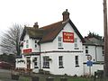 Plough & Harrow public house, Tilmanstone.jpg 640 × 480; 143 KB
-
 Plough and Harrow - geograph.org.uk - 2656560.jpg 640 × 480; 76 KB
-
 Plough and Harrow sign - geograph.org.uk - 2656564.jpg 480 × 640; 94 KB
-
 Poutty Woods from the Sandwich Road - geograph.org.uk - 949194.jpg 640 × 480; 147 KB
-
 Private road to Dane Court - geograph.org.uk - 2594606.jpg 640 × 480; 270 KB
-
 Pylons across farmland. - geograph.org.uk - 304717.jpg 640 × 480; 194 KB
-
 Road junction on Sandwich Road - geograph.org.uk - 2144009.jpg 3,072 × 2,304; 1.54 MB
-
 Road to Malmains Farm - geograph.org.uk - 4024413.jpg 640 × 480; 108 KB
-
 Roman road alongside Nine Acre Wood - geograph.org.uk - 1306703.jpg 640 × 480; 359 KB
-
 Route of Dismantled railway near Beeches Farm - geograph.org.uk - 2428171.jpg 3,072 × 2,304; 2.69 MB
-
 Sandwich Road Junction - geograph.org.uk - 1846157.jpg 1,024 × 768; 171 KB
-
 Sandwich Road to Whitfield - geograph.org.uk - 2144019.jpg 3,072 × 2,304; 1.58 MB
-
 Sandwich Road towards Poultry Wood - geograph.org.uk - 2143339.jpg 3,072 × 2,304; 1.94 MB
-
 Sheep grazing in front of Home Farm - geograph.org.uk - 1597643.jpg 640 × 480; 196 KB
-
 Sheep grazing near Home Farm - geograph.org.uk - 1597648.jpg 640 × 480; 152 KB
-
 Spring colours, Nine Acre Wood - geograph.org.uk - 1306712.jpg 480 × 640; 385 KB
-
 St. Mary's Grove Cottage - geograph.org.uk - 2220054.jpg 3,072 × 2,304; 1.69 MB
-
 The Old Bakery, Tilmanstone - geograph.org.uk - 2220030.jpg 3,072 × 2,304; 1.69 MB
-
 The Old Farmhouse ^ Pilgrims Cottage, Beeches Farm - geograph.org.uk - 6039706.jpg 3,264 × 2,448; 3.61 MB
-
 Thornton Farm house and stables - geograph.org.uk - 2594839.jpg 640 × 480; 160 KB
-
 Thornton Wood viewed from Pike Lane - geograph.org.uk - 1588356.jpg 640 × 480; 90 KB
-
 Three derelict Dutch barns - geograph.org.uk - 4519853.jpg 2,448 × 3,264; 3.15 MB
-

-

-
 Tilmanstone church - geograph.org.uk - 4024435.jpg 640 × 480; 161 KB
-
 Tilmanstone Village Hall - geograph.org.uk - 2220022.jpg 3,072 × 2,304; 2.24 MB
-
 Track in Waldershare Farm - geograph.org.uk - 2143199.jpg 3,072 × 2,304; 2.25 MB
-
 Track past Malmains Farm - geograph.org.uk - 4521428.jpg 3,264 × 2,448; 2.13 MB
-
 Track through Poutty Wood - geograph.org.uk - 4519884.jpg 3,264 × 2,448; 3.72 MB
-
 Track to Malmains Farm - geograph.org.uk - 1846148.jpg 1,024 × 768; 177 KB
-
 Track to Malmains Farm - geograph.org.uk - 2428333.jpg 3,072 × 2,304; 2.61 MB
-
 Track to Thornton Farm - geograph.org.uk - 4521518.jpg 3,264 × 2,448; 3.62 MB
-
 View across farmland towards North Court - geograph.org.uk - 2594892.jpg 640 × 480; 175 KB
-
 View across field to Poutty Wood - geograph.org.uk - 1590756.jpg 640 × 480; 151 KB
-
 View along bridleway to Pike Road - geograph.org.uk - 2594780.jpg 640 × 480; 203 KB
-
 View along field edge to Poutty Wood - geograph.org.uk - 1590762.jpg 640 × 480; 163 KB
-

-

-
 View N along Dover Road, Tilmanstone - geograph.org.uk - 1214732.jpg 640 × 480; 94 KB
-
 View N along the A256 towards Sandwich - geograph.org.uk - 1214703.jpg 640 × 480; 100 KB
-
 View NW from the Sandwich Road - geograph.org.uk - 949181.jpg 627 × 456; 220 KB
-
 View towards Barville Farm - geograph.org.uk - 4675670.jpg 640 × 480; 95 KB
-
 View towards Thornton Wood - geograph.org.uk - 1588376.jpg 640 × 480; 56 KB
-
 View towards Tilmanstone - geograph.org.uk - 1306615.jpg 640 × 480; 104 KB
-
 Waldershare Steam ^ Country Fair - 2007 - geograph.org.uk - 3533662.jpg 2,272 × 1,704; 1.09 MB
-
 Waldershare Steam ^ Country Fair - 2007 - geograph.org.uk - 3533667.jpg 2,272 × 1,704; 998 KB
-
 Waldershare Steam ^ Country Fair - 2007 - geograph.org.uk - 3533668.jpg 2,272 × 1,704; 1.04 MB
-
 Waldershare Steam ^ Country Fair - 2007 - geograph.org.uk - 3533673.jpg 2,272 × 1,704; 750 KB
-
 Waldershare Steam ^ Country Fair - 2007 - geograph.org.uk - 3533679.jpg 2,272 × 1,704; 958 KB
-
 Waldershare Steam ^ Country Fair - 2007 - geograph.org.uk - 3533708.jpg 2,272 × 1,704; 739 KB
-
 Waldershare Steam ^ Country Fair - 2007 - geograph.org.uk - 3533712.jpg 2,272 × 1,704; 787 KB
-
 Waldershare Steam ^ Country Fair - 2007 - geograph.org.uk - 3533717.jpg 2,272 × 1,704; 785 KB
-
 Waldershare Steam ^ Country Fair - geograph.org.uk - 2213154.jpg 2,272 × 1,704; 837 KB
-
 Waldershare Steam ^ Country Fair - geograph.org.uk - 2213158.jpg 2,272 × 1,704; 998 KB
-
 Waldershare Steam ^ Country Fair - geograph.org.uk - 2213164.jpg 2,272 × 1,704; 1.07 MB
-
 Waldershare Steam ^ Country Fair - geograph.org.uk - 2213181.jpg 1,704 × 2,272; 933 KB
-
 Waldershare Steam ^ Country Fair - geograph.org.uk - 2213187.jpg 2,272 × 1,704; 1.43 MB
-
 Waldershare Steam ^ Country Fair - geograph.org.uk - 2213193.jpg 1,704 × 2,272; 814 KB
-
 Waldershare Steam ^ Country Fair - geograph.org.uk - 2213820.jpg 2,272 × 1,704; 1.03 MB
-
 Waldershare Steam ^ Country Fair - geograph.org.uk - 2213827.jpg 2,272 × 1,704; 830 KB
-
 Waldershare Steam ^ Country Fair - geograph.org.uk - 2213834.jpg 2,272 × 1,704; 942 KB
-
 Waldershare Steam ^ Country Fair - geograph.org.uk - 2213863.jpg 2,272 × 1,704; 1,003 KB
-
 Wheat Field at Hangman's Carvett - geograph.org.uk - 1968503.jpg 1,024 × 768; 268 KB
-
 Wheat Field at Malmain's Farm - geograph.org.uk - 1968509.jpg 1,024 × 768; 288 KB
-
 Wheat Field on The Downs - geograph.org.uk - 1970094.jpg 1,024 × 768; 251 KB
-

-
 Barville farm. - geograph.org.uk - 303745.jpg 640 × 480; 133 KB
-
 Cleared woodland - geograph.org.uk - 591885.jpg 480 × 640; 71 KB
-
 Coal yard, off Pike lane. - geograph.org.uk - 303947.jpg 640 × 480; 118 KB
-
 Country lane near junction with Pike Road - geograph.org.uk - 649240.jpg 640 × 480; 245 KB
-
-

-
 Farmland viewed from Pike Road - geograph.org.uk - 675129.jpg 640 × 480; 274 KB
-

-
 Field boundary near Venson Bottom - geograph.org.uk - 649262.jpg 640 × 480; 211 KB
-

-

-

-
 Footpath along field boundary - geograph.org.uk - 591888.jpg 640 × 480; 214 KB
-
 Footpath from Pike Road - geograph.org.uk - 591889.jpg 640 × 480; 252 KB
-
 Footpath heading NW off Barville Road. - geograph.org.uk - 311194.jpg 640 × 480; 131 KB
-
 Footpath joining the old A256 - geograph.org.uk - 590056.jpg 640 × 480; 62 KB
-
 Footpath junction - geograph.org.uk - 659586.jpg 640 × 480; 200 KB
-
 Footpath leading to Telegraph Farm - geograph.org.uk - 331914.jpg 640 × 464; 183 KB
-

-
 Footpath through North Court - geograph.org.uk - 589920.jpg 640 × 480; 77 KB
-
 Footpath to Thorntonhill Cottages - geograph.org.uk - 675087.jpg 640 × 480; 220 KB
-
 Garden Wood from Pike Road. - geograph.org.uk - 315784.jpg 640 × 480; 334 KB
-
 Horse paddocks to the south of road - geograph.org.uk - 345809.jpg 640 × 480; 146 KB
-

-
-
 Junction of footpaths near Tilmanstone - geograph.org.uk - 589906.jpg 640 × 480; 241 KB
-

-
-

-

-

-
 Looking North East along Eastry by-pass. - geograph.org.uk - 303648.jpg 640 × 480; 120 KB
-
-

-
 Looking SW, in direction of Dover - geograph.org.uk - 423608.jpg 640 × 480; 42 KB
-
 Looking W across farmland - geograph.org.uk - 423923.jpg 640 × 480; 45 KB
-
 Nine Acre Wood in the spring - geograph.org.uk - 302911.jpg 640 × 480; 219 KB
-
 North Court house and gardens - geograph.org.uk - 591872.jpg 640 × 480; 233 KB


_-_geograph.org.uk_-_2220539.jpg)


