Category:Thursley
Jump to navigation
Jump to search
English: Thursley is a civil parish and a small village in Surrey. It lies just west of the A3 running between Milford and Hindhead. Neighbouring villages include Rushmoor, Witley and Brook. Thursley is in south-west Surrey, in south-east England. It is near Punch Bowl Farm and the Devil's Punch Bowl.
village in Surrey, England, UK  | |||||
| Upload media | |||||
| Instance of | |||||
|---|---|---|---|---|---|
| Location | Waverley, Surrey, South East England, England | ||||
| Area |
| ||||
 | |||||
Subcategories
This category has the following 9 subcategories, out of 9 total.
B
- Bowlhead Green (24 F)
C
- The Celtic Cross on Gibbet Hill (16 F)
E
- Emley Farm, Thursley (21 F)
H
K
S
- The Sailor's Stone (12 F)
T
Media in category "Thursley"
The following 200 files are in this category, out of 698 total.
(previous page) (next page)-

-
 2016, a year on Geograph (Day 352) - geograph.org.uk - 5231813.jpg 640 × 480; 78 KB
-
 A bench with a view overlooking Coombe Head - geograph.org.uk - 1841459.jpg 2,976 × 3,968; 3.11 MB
-
 A bench with a view, Gibbet Hill - geograph.org.uk - 2064290.jpg 640 × 430; 150 KB
-

-
 A mossy slope - geograph.org.uk - 4353260.jpg 640 × 480; 121 KB
-
 A muddy place by the stream - geograph.org.uk - 3926449.jpg 3,264 × 2,448; 3.49 MB
-
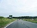
 A set of traffic cameras, A3 - geograph.org.uk - 4261429.jpg 640 × 403; 40 KB
-
 A temporary lake with ducks - geograph.org.uk - 3926454.jpg 3,264 × 2,448; 2.33 MB
-

-
 A3 at Boundless Copse - geograph.org.uk - 2284640.jpg 2,560 × 1,920; 1.83 MB
-
 A3 at start of new tunnel route - geograph.org.uk - 3125629.jpg 640 × 428; 71 KB
-
 A3 at the Devil's Punch Bowl - geograph.org.uk - 2285014.jpg 2,560 × 1,920; 1.69 MB
-
 A3 by road works depot - geograph.org.uk - 3038117.jpg 640 × 428; 60 KB
-
 A3 heading north - geograph.org.uk - 2795620.jpg 640 × 397; 56 KB
-
 A3 heading north from Hindhead Tunnel - geograph.org.uk - 5885420.jpg 4,000 × 3,000; 4.85 MB
-

-
 A3 northbound - geograph.org.uk - 3104003.jpg 640 × 480; 49 KB
-
 A3 northbound - geograph.org.uk - 3104007.jpg 640 × 455; 62 KB
-
 A3 Road Construction North of Hindhead - geograph.org.uk - 2284648.jpg 1,920 × 2,560; 1.83 MB
-
 A3 towards the tunnel - geograph.org.uk - 2211181.jpg 640 × 427; 170 KB
-
 A3, northbound - geograph.org.uk - 4261430.jpg 640 × 430; 37 KB
-
 A3, northbound - geograph.org.uk - 4261434.jpg 640 × 371; 29 KB
-
 A3, northbound - geograph.org.uk - 4261436.jpg 640 × 430; 38 KB
-
 A3, Thursley junction - geograph.org.uk - 2790.jpg 640 × 435; 41 KB
-
 A3, Thursley turning - geograph.org.uk - 4261435.jpg 640 × 393; 43 KB
-
 A3, turning for Thursley - geograph.org.uk - 2795624.jpg 640 × 384; 40 KB
-
 Alleged byway - geograph.org.uk - 1227765.jpg 640 × 360; 87 KB
-
 Along the Byway - geograph.org.uk - 2957990.jpg 3,300 × 2,200; 5.48 MB
-
 Along the old A3 - geograph.org.uk - 5671211.jpg 3,888 × 2,592; 2.78 MB
-
 An alleged bridleway - geograph.org.uk - 1227741.jpg 360 × 640; 120 KB
-
 An old reservoir - geograph.org.uk - 3926447.jpg 3,264 × 2,448; 3.74 MB
-
 Ancient Woodland in Devil's Punch Bowl - geograph.org.uk - 2284981.jpg 2,560 × 1,920; 1.69 MB
-
 Approaching Bowlhead Green - geograph.org.uk - 3801189.jpg 2,048 × 1,536; 869 KB
-
 Approaching Creedhole Farm - geograph.org.uk - 3926468.jpg 3,264 × 2,448; 2.71 MB
-
 Approaching Lower House Road from Heath Hall - geograph.org.uk - 3801184.jpg 2,048 × 1,536; 952 KB
-
 Army huts, Hankley Common - geograph.org.uk - 3958440.jpg 2,048 × 1,536; 1.08 MB
-
 Ascending the Devil's Punch Bowl - geograph.org.uk - 2284987.jpg 2,560 × 1,920; 1.67 MB
-
 Back on Tarmac - geograph.org.uk - 2963570.jpg 3,000 × 2,000; 6.68 MB
-
 Back to Nature - geograph.org.uk - 3077144.jpg 4,515 × 2,933; 5.29 MB
-
 Back to the Summit - geograph.org.uk - 3077138.jpg 4,592 × 3,056; 6.36 MB
-
 Badgers, Thursley - geograph.org.uk - 3936970.jpg 3,264 × 2,448; 2.43 MB
-
 Bales by French Lane - geograph.org.uk - 1172505.jpg 640 × 480; 111 KB
-
 Barn in Lower House Road - geograph.org.uk - 3801187.jpg 2,048 × 1,536; 530 KB
-
 Barrier on Byway 503 - geograph.org.uk - 2862870.jpg 4,000 × 3,000; 3.57 MB
-
 Beech Hedge by Highcomb Copse - geograph.org.uk - 2284956.jpg 2,560 × 1,920; 1.78 MB
-
 Bench in the Devil's Punch Bowl - geograph.org.uk - 2284713.jpg 2,560 × 1,920; 1.8 MB
-
 Bench with a view, Gibbet Hill - geograph.org.uk - 2064298.jpg 640 × 430; 160 KB
-
 Bend in Boundless Road outside Boundless Farm - geograph.org.uk - 2862872.jpg 4,000 × 3,000; 3.36 MB
-
 Bendy sign for a bendy path - geograph.org.uk - 1250167.jpg 360 × 640; 104 KB
-
 Birch Wood in Boundless Copse - geograph.org.uk - 2284594.jpg 2,560 × 1,920; 1.81 MB
-

-
 Boardwalk, Devil's Punch Bowl - geograph.org.uk - 4786172.jpg 1,600 × 1,200; 1.55 MB
-
 Boardwalk, Thursley Common - geograph.org.uk - 6144417.jpg 768 × 1,024; 281 KB
-
 Bog in Ockley Common - geograph.org.uk - 2251921.jpg 2,560 × 1,920; 1.81 MB
-
 Bog on Thursley Common - geograph.org.uk - 4728503.jpg 1,600 × 1,200; 559 KB
-

-
 Boggy descent into Keffolds Copse - geograph.org.uk - 2860900.jpg 4,000 × 3,000; 3.58 MB
-
 Boundless Road going under the A3 - geograph.org.uk - 5103163.jpg 2,304 × 1,728; 802 KB
-
 Boundless Road leading to Punch Bowl Lane - geograph.org.uk - 2865522.jpg 4,000 × 3,000; 3.56 MB
-
 Boundless Road near Hindhead - geograph.org.uk - 5103175.jpg 2,304 × 1,728; 825 KB
-
 Boundless Road near Hindhead - geograph.org.uk - 5103177.jpg 2,304 × 1,728; 857 KB
-
 Boundless Road near Hindhead - geograph.org.uk - 5103183.jpg 2,304 × 1,728; 1.52 MB
-
 Boundless Road near Hindhead - geograph.org.uk - 5103184.jpg 2,304 × 1,728; 818 KB
-
 Boundless Road with Boundless Copse on the right - geograph.org.uk - 2862880.jpg 4,000 × 3,000; 3.4 MB
-
 Bowlhead Green Farm - geograph.org.uk - 5094524.jpg 2,304 × 1,728; 813 KB
-
 Bowlhead Green, Surrey - geograph.org.uk - 5094434.jpg 2,304 × 1,728; 789 KB
-
 Branching Off at Hindhead - geograph.org.uk - 2284584.jpg 1,920 × 2,560; 1.71 MB
-
 Bridge on byway - geograph.org.uk - 1227714.jpg 640 × 360; 96 KB
-

-
 Bridleway 117 to Lake Cottages - geograph.org.uk - 2865646.jpg 4,000 × 3,000; 3.41 MB
-
 Bridleway above Highcombe Bottom - geograph.org.uk - 1871424.jpg 2,560 × 1,920; 1.79 MB
-
 Bridleway across heathland, Thursley Common - geograph.org.uk - 4943351.jpg 1,024 × 768; 212 KB
-
 Bridleway across heathland, Thursley Common - geograph.org.uk - 4943369.jpg 1,024 × 768; 234 KB
-
 Bridleway across Hindhead Common - geograph.org.uk - 2065896.jpg 640 × 430; 208 KB
-

-

-
 Bridleway at the Memorial, Beacon Hill - geograph.org.uk - 1871462.jpg 2,560 × 1,920; 1.76 MB
-
 Bridleway below Gibbet Hill - geograph.org.uk - 2064743.jpg 640 × 430; 122 KB
-
 Bridleway by Witley park boundary wall - geograph.org.uk - 2865652.jpg 4,000 × 3,000; 3.46 MB
-
 Bridleway enters National Trust land - geograph.org.uk - 1260544.jpg 360 × 640; 111 KB
-
 Bridleway in Highcomb Copse - geograph.org.uk - 1871455.jpg 2,560 × 1,920; 1.89 MB
-

-
 Bridleway onto Hindhead Common - geograph.org.uk - 2064071.jpg 640 × 430; 194 KB
-
 Bridleway or tank track^ - geograph.org.uk - 2065887.jpg 640 × 430; 196 KB
-

-
 Bridleway sign - geograph.org.uk - 1227728.jpg 640 × 360; 104 KB
-

-
 Bridleway to Highcombe - geograph.org.uk - 1871413.jpg 2,560 × 1,920; 1.75 MB
-
 Bridleways crossing at Truxford - geograph.org.uk - 1249895.jpg 640 × 360; 83 KB
-
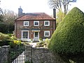
 Brook Cottage on Dye House Road - geograph.org.uk - 1250180.jpg 640 × 360; 68 KB
-
 Builders' Camp, North Portal, Hindhead - geograph.org.uk - 2284656.jpg 2,560 × 1,920; 1.65 MB
-
 Buildings in Warren Park - geograph.org.uk - 1802214.jpg 800 × 500; 98 KB
-
 Bulls in a field near to Hindhead Youth Hostel - geograph.org.uk - 1841517.jpg 3,968 × 2,976; 3.28 MB
-
 Busy Junction, Pitch Place - geograph.org.uk - 1871611.jpg 2,560 × 1,920; 1.81 MB
-
 By Heath Hall - geograph.org.uk - 1172534.jpg 640 × 480; 105 KB
-
 Byway 501 on Hindhead Common - geograph.org.uk - 3032375.jpg 640 × 480; 163 KB
-
 Byway around Devil's Punch Bowl - geograph.org.uk - 4785977.jpg 1,600 × 1,200; 1.15 MB
-
 Byway junction on the Greensand Way - geograph.org.uk - 1227800.jpg 640 × 360; 93 KB
-

-
 Byway just east of Gibbet Hill - geograph.org.uk - 2594751.jpg 768 × 1,024; 346 KB
-
 Byway near Ridgeway Farm - geograph.org.uk - 1227704.jpg 360 × 640; 93 KB
-
 Byway Near the Devil's Punch Bowl, Surrey - geograph.org.uk - 2963536.jpg 3,000 × 2,000; 6.32 MB
-
 Byway North of Hyde Lane - geograph.org.uk - 1871569.jpg 2,560 × 1,920; 1.73 MB
-
 Byway on the slope of Gibbet Hill - geograph.org.uk - 2862811.jpg 4,000 × 3,000; 3.57 MB
-
 Byway to Rutton Hill Road - geograph.org.uk - 2862851.jpg 4,000 × 3,000; 3.33 MB
-
 Byway to the Left - geograph.org.uk - 2957810.jpg 3,000 × 1,964; 6.25 MB
-
 Byway, Hankley Common - geograph.org.uk - 3958444.jpg 2,048 × 1,536; 1.23 MB
-
 Cattle Grid on the Greensand Way - geograph.org.uk - 2284694.jpg 2,560 × 1,920; 1.82 MB
-

-
 Change of direction for the Greensand Way - geograph.org.uk - 2864140.jpg 4,000 × 3,000; 3.89 MB
-
 Chinese-Canadian Soldiers-WW2.jpg 600 × 622; 93 KB
-
 Closed footpath 94 - geograph.org.uk - 2862939.jpg 4,000 × 3,000; 3.53 MB
-
 Clump of trees on Mount Pleasant - geograph.org.uk - 2864052.jpg 4,000 × 3,000; 3.56 MB
-
 Coat of arms on post by footpath 119 - geograph.org.uk - 2860751.jpg 4,000 × 3,000; 3.39 MB
-

-

-

-
 Coppice woodland - geograph.org.uk - 2862706.jpg 4,000 × 3,000; 3.51 MB
-

-
 Cosford Farm House - geograph.org.uk - 3801208.jpg 2,048 × 1,536; 785 KB
-
 Cosford Mill near Thursley - geograph.org.uk - 3801152.jpg 2,048 × 1,536; 743 KB
-
 Cottages by Thursley Church - geograph.org.uk - 3937023.jpg 2,178 × 1,632; 837 KB
-
 Cottages, 1-4 The Lane, Thursley.jpg 4,128 × 3,096; 6.19 MB
-
 Cows grazing by Rutton Hill Road - geograph.org.uk - 5103195.jpg 2,304 × 1,728; 918 KB
-
 Cows in field near Bowlhead Green - geograph.org.uk - 3801201.jpg 2,048 × 1,536; 776 KB
-

-
 Crossing of paths below Gibbet Hill - geograph.org.uk - 2080453.jpg 3,968 × 2,976; 2.8 MB
-
 Crossroads of paths on Hankley Common - geograph.org.uk - 4336011.jpg 4,608 × 3,456; 5.68 MB
-
 Dappled Sunlight - geograph.org.uk - 3077148.jpg 3,056 × 4,592; 7.36 MB
-
 Dappled sunlight near the top of Inval - geograph.org.uk - 2862690.jpg 4,000 × 3,000; 3.39 MB
-
 Descent to Highcomb Bottom - geograph.org.uk - 2284701.jpg 2,560 × 1,920; 1.79 MB
-
 Devil's Punch Bowl - geograph.org.uk - 2284507.jpg 2,560 × 1,920; 1.79 MB
-
 Devil's Punch Bowl - geograph.org.uk - 4786003.jpg 1,600 × 1,200; 1.06 MB
-
 Devil's Punch Bowl - geograph.org.uk - 4786019.jpg 1,600 × 1,200; 932 KB
-
 Devil's Punch Bowl - geograph.org.uk - 4786045.jpg 1,600 × 1,200; 897 KB
-
 Devil's Punch Bowl - geograph.org.uk - 4786049.jpg 1,600 × 1,200; 896 KB
-
 Devil's Punch Bowl - geograph.org.uk - 5261791.jpg 2,560 × 1,920; 2.92 MB
-
 Devil's Punch Bowl - Geology - geograph.org.uk - 2284993.jpg 2,560 × 1,920; 1.92 MB
-
 Devil's Punch Bowl Cafe - geograph.org.uk - 2451211.jpg 640 × 480; 117 KB
-
 Devil's Punch Bowl car park - geograph.org.uk - 4785961.jpg 1,600 × 1,200; 1.05 MB
-
 Devil's Punch Bowl from Hindhead Common - geograph.org.uk - 5349588.jpg 2,592 × 1,944; 1.38 MB
-
 Devil's Punch Bowl Slopes - geograph.org.uk - 2284998.jpg 1,920 × 2,560; 1.6 MB
-
 Devil's Punch Bowl, Hindhead - geograph.org.uk - 2451218.jpg 640 × 480; 91 KB
-
 Devil's Punch Bowl, Hindhead - geograph.org.uk - 2451225.jpg 640 × 480; 80 KB
-
 Devil's Punchbowl from the former A3 - geograph.org.uk - 3626774.jpg 1,600 × 1,064; 536 KB
-

-
 Devil's Punchbowl, former line of the A3 - geograph.org.uk - 3626772.jpg 1,600 × 1,064; 539 KB
-
 Devils Punch Bowl Hindhead - geograph.org.uk - 3362229.jpg 3,000 × 2,000; 1.82 MB
-
 Devil’s Punch Bowl from Highcombe Edge - geograph.org.uk - 4462743.jpg 4,608 × 3,456; 4.76 MB
-
 Devil’s Punch Bowl from Highcombe Edge - geograph.org.uk - 4462750.jpg 4,608 × 3,456; 4.65 MB
-
 Devil’s Punch Bowl from the west - geograph.org.uk - 4462727.jpg 4,608 × 3,456; 4.74 MB
-
 Devil’s Punch Bowl from the western rim - geograph.org.uk - 4462770.jpg 4,608 × 3,456; 3.99 MB
-
 Devil’s Punch Bowl near Hindhead in Surrey - geograph.org.uk - 4462725.jpg 4,608 × 3,456; 4.29 MB
-
 Door at Thursley Lodge - geograph.org.uk - 1536823.jpg 360 × 640; 46 KB
-
 Down the Track, Hindhead, Surrey - geograph.org.uk - 2957801.jpg 3,300 × 2,200; 5.67 MB
-
 Dry Valley above Glenhead Farm - geograph.org.uk - 1871519.jpg 2,560 × 1,920; 1.98 MB
-
 Ducks and geese by the westerly pond at Uplands Park - geograph.org.uk - 2859611.jpg 4,000 × 3,000; 3.58 MB
-
 Dugout with a view - geograph.org.uk - 4353281.jpg 640 × 480; 134 KB
-
 Dye House Aqueduct Bridge.jpg 5,580 × 3,713; 5.56 MB
-
 Dye House Road in Thursley - geograph.org.uk - 5295764.jpg 4,000 × 3,000; 4.14 MB
-
 Dyehouse Road, Thursley - geograph.org.uk - 1871740.jpg 1,920 × 2,560; 1.82 MB
-
 East of Highcomb Bottom - geograph.org.uk - 1871452.jpg 2,560 × 1,920; 1.71 MB
-
 Elementary, my dear Hindhead (23) - geograph.org.uk - 2997059.jpg 640 × 480; 140 KB
-
 Elementary, my dear Hindhead (24) - geograph.org.uk - 2997061.jpg 640 × 480; 149 KB
-
 Elementary, my dear Hindhead (25) - geograph.org.uk - 2997065.jpg 640 × 480; 57 KB
-
 Elementary, my dear Hindhead (26) - geograph.org.uk - 2997067.jpg 640 × 480; 58 KB
-
 Elementary, my dear Hindhead (27) - geograph.org.uk - 2997088.jpg 640 × 480; 85 KB
-
 Elementary, my dear Hindhead (28) - geograph.org.uk - 2997089.jpg 480 × 640; 126 KB
-
 Elementary, my dear Hindhead (29) - geograph.org.uk - 2997095.jpg 640 × 480; 142 KB
-
 Elementary, my dear Hindhead (30) - geograph.org.uk - 2997100.jpg 640 × 480; 128 KB
-
 Elementary, my dear Hindhead (31) - geograph.org.uk - 2997105.jpg 640 × 480; 125 KB
-
 Elementary, my dear Hindhead (32) - geograph.org.uk - 2997120.jpg 640 × 480; 131 KB
-
 Elementary, my dear Hindhead (33) - geograph.org.uk - 2997125.jpg 640 × 480; 125 KB
-
 Elementary, my dear Hindhead (34) - geograph.org.uk - 2997130.jpg 640 × 480; 147 KB
-
 Elementary, my dear Hindhead (35) - geograph.org.uk - 2997131.jpg 640 × 480; 129 KB
-
 Elementary, my dear Hindhead (36) - geograph.org.uk - 2997139.jpg 640 × 480; 103 KB
-
 Elstead Moat in December (2) - geograph.org.uk - 3258238.jpg 1,024 × 747; 171 KB
-
 Elstead Moat in December (3) - geograph.org.uk - 3258276.jpg 1,024 × 760; 107 KB
-
 Elstead Moat in December, partly frozen over - geograph.org.uk - 3253181.jpg 1,024 × 768; 81 KB
-
 Elstead Moat, on a November morning - geograph.org.uk - 2703014.jpg 1,024 × 768; 88 KB
-
 End of the road at Hindhead - geograph.org.uk - 3926405.jpg 3,264 × 2,448; 2.31 MB
-
 Entrance gate to Hankley common - geograph.org.uk - 4040316.jpg 2,048 × 1,536; 1.46 MB
-
 Entrance to Creedhole Farm - geograph.org.uk - 3926476.jpg 2,494 × 1,720; 1.51 MB
-
 Entrance to Quiet Lane off the busy Portsmouth Road - geograph.org.uk - 1841483.jpg 3,968 × 2,976; 2.73 MB
-

-
 Entrance to Uplands Park - geograph.org.uk - 1227583.jpg 640 × 360; 48 KB
-
 Entrance to Uplands Park, Brook, Surrey - geograph.org.uk - 2963642.jpg 3,600 × 2,400; 5.91 MB
-
 Estate bridge, Bowlhead Green Road - geograph.org.uk - 2971069.jpg 640 × 480; 149 KB
-
 Estate bridge, Bowlhead Green Road - geograph.org.uk - 5094415.jpg 2,304 × 1,728; 1.12 MB
-
 Exiting the Hindhead Tunnel - geograph.org.uk - 4260990.jpg 640 × 430; 44 KB
-
 Exmoor Pony, Hind Head - geograph.org.uk - 4785944.jpg 1,600 × 1,200; 1.4 MB
-
 Field by Dye House - geograph.org.uk - 1871617.jpg 2,560 × 1,920; 1.86 MB
-
 Field by Rutton Hill Road - geograph.org.uk - 5103194.jpg 2,304 × 1,728; 847 KB
-
 Field by Thursley Churchyard - geograph.org.uk - 1871969.jpg 2,560 × 1,920; 1.8 MB
-
 Fields behind Wheelers Farm, Thursley - geograph.org.uk - 3937027.jpg 3,264 × 2,448; 2.19 MB
-

-
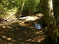
 Footbridge and ford, Highcomb Bottom - geograph.org.uk - 3032478.jpg 640 × 480; 182 KB
-
 Footbridge by Dye House - geograph.org.uk - 1871315.jpg 1,920 × 2,560; 1.9 MB
-
 Footbridge in Highcomb Bottom - geograph.org.uk - 1871432.jpg 2,560 × 1,920; 1.78 MB

_-_geograph.org.uk_-_5231813.jpg)


,_Thursley_Common_-_geograph.org.uk_-_5500985.jpg)


,_Thursley_Common_-_geograph.org.uk_-_5501121.jpg)
,_Thursley_Common_-_geograph.org.uk_-_5500914.jpg)
,_Thursley_Common_-_geograph.org.uk_-_5500943.jpg)


_-_geograph.org.uk_-_2997059.jpg)
_-_geograph.org.uk_-_2997061.jpg)
_-_geograph.org.uk_-_2997065.jpg)
_-_geograph.org.uk_-_2997067.jpg)
_-_geograph.org.uk_-_2997088.jpg)
_-_geograph.org.uk_-_2997089.jpg)
_-_geograph.org.uk_-_2997095.jpg)
_-_geograph.org.uk_-_2997100.jpg)
_-_geograph.org.uk_-_2997105.jpg)
_-_geograph.org.uk_-_2997120.jpg)
_-_geograph.org.uk_-_2997125.jpg)
_-_geograph.org.uk_-_2997130.jpg)
_-_geograph.org.uk_-_2997131.jpg)
_-_geograph.org.uk_-_2997139.jpg)
_-_geograph.org.uk_-_3258238.jpg)
_-_geograph.org.uk_-_3258276.jpg)


